6-11-17
Kim
was free for a hike and we
discussed possibilities. I suggested a trail neither of us had hiked.
Gary recently did a family hike on the trail and had many good things
to say about it. It looked to be a mostly overcast day so a low level
hike seemed fine. We met in Shoreline at 7:05 am and soon were heading
north. Up to Marblemount on Highway 20 then up to Newhalem (short stop)
and on to Diablo. At the turn off for the down of Diablo we stayed left
on Highway 20 for another 1.5 miles to the turn off for the Diablo Dam
Road and the North Cascades Environmental Learning Center. My first
time driving across the top of the dam. We reached the parking lot at
9:20 am. The lot was more than half full already. We were packed and on
the trail by 9:40 am.
Right by the start we went over to Sourdough Creek. Lots of water cascading down the hillside. Kim noticed Columbine blooming along the creek. The route starts by going around the edge of the Environmental Center. It comes to a road where a sign points downhill. Quickly the trail goes back into the forest and descends. A junction is quickly reached. It is signed right and left for the Sourdough Creek Trail and straight ahead for the Diablo Lake Trail. Another junction is just ahead. No signs but the main trail goes left and is the most obvious route. The rest of the way is very evident.
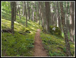
At first the trail is gentle as it crosses and recrosses Deer Creek. Then it begins to climb. The forest is very green. Lots of leafy deciduous trees down low. Thick green ground cover all over. Several rocky and sandy washouts are passed. No water even in the spring. It became humid along here but did not last long. We saw a number of other groups as we hiked in. There was plenty of solitude between sightings. We saw several varieties of wildflowers in bloom early on the trail. Starflowers and Nootka roses. We saw them along much of the route. Kim also noticed some dogwood trees in bloom off the trail. The trail is rocky in a few spots but mostly it is smooth and pretty soft. We came to one big boulder field. The trail is fine until near the end where some big rocks have fallen across the route. It was easy enough to scramble over them.
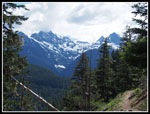
A little farther along an obvious trail turned off to the right. We hiked on up and came quickly came out in the cleared power line corridor. On a clear day the view of Colonial, Snowfield, and Pyramid Peaks. This morning we had a good view of the lower parts of the peaks while the summits were in the clouds. We did take advantage of the peek at Diablo Lake below and the partial mountains to sit on a bench and have part of our lunches. We arrived just before 11:00 am. We spent 20 minutes there and then headed on. The route soon comes out in the open and the peaks are back in sight without the power line poles and cables getting in the way of the view. The wildflower show also picked up markedly along here.
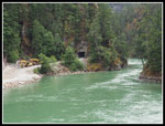
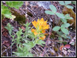
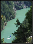
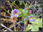
First we saw some small penstemon and then Indian paintbrush. Both were seen on and off for the rest of the way. Some small stonecrop were very photogenic. Kim spotted some very small and very colorful broomrape. We spent quite a bit of time taking photos along here. We saw one flower that looked like a very small beargrass. Spring beauty suddenly was all over the hillside. Strawberries were also in bloom. There was a much better flower show than we expected. The trail crosses the nose of a ridge. The hillside becomes very steep. The trail is wide enough but falling off would be very bad news. Hang on to kids hands if needed. The route went in and out of forest. After rounding the ridge the lake below becomes more of a river. A almost not moving river. The steep sides rise hundreds of feet up. We were looking hundreds of feet down to the very green water. Across the gorge we could see the North Cascades Highway.
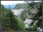
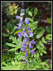
Soon the grade began to head down. Gently at first. Where we passed under the power lines for the second time we could see Ross Dam through the trees. We then went back into dark forest for the rest of the way. Dropping faster on smooth treat we worked our way down the hillside. Several creeks were still running. No creek crossings were difficult. Much more starflowers and roses in the forest. We also saw some lupine in bloom. At one creek crossing we saw columbine in bloom. After a long traverse down we came to a switchback. Straight ahead 150' was a viewpoint. We checked it out on the way back. Trees are starting to close out the view of Ross Dam and the powerhouse. Jack Mountain is behind the dam but this day it too was in the clouds.
Down we continued with another switchback until we reached the suspension bridge over the river. The sun was out and it was very pleasant. The powerhouse is right upstream from the bridge and the dam is right behind that. Nice views from the bridge. As with all the water seen this day, it was bright green. Across the dam is a grassy field. Several groups were there. A sign on the ground points to the ferry. While one can hike the 3.8 miles one way to this point one can also take a boat ride to the same spot. Another option is to hike one way and take the boat the other. Folks going to the resort on Ross Lake take the boat then a truck takes them up to the top of Ross Dam. For $10.00 each way anyone can ride the ferry. It docks about .25 miles from the trailhead at the Diablo Dam end.
Gary hike on to the ferry dock at the suspension bridge end and we chose to do so too. A rock slide took out the old dock and it looks like it was near the bridge. I may be wrong. The new dock is down the road a few tenths of a mile. Along the way it goes through a tunnel blasted out of the rock. We found a bigger dock for the ferry and a small park service one The big one had folks on it so we chose the smaller one. The river here is like a Norwegian fjord. Steep walls that appear to be nearly vertical. Just downstream is a very large waterfall dropping into the lake/river. Highway 20 crosses over the waterfall. I think it is John Pierce Falls. It is an interesting place. Deep green water, a deep gorge, and yet a major hydroelectric dam and an interstate highway both close by. Still, it is a neat spot.
We reached the bridge at 1:10 pm and the dock at 1:25 pm. We kicked back and laid in the sun until 2:00 pm. Another hour would have been even better. At 2:05 we headed back. From the bridge to the highpoint is about a 650' climb. Most trips are up on the way in and down coming out. This one has a good climb in both directions. The lighting was different and we had stopped for some though far fewer flower photos. We did see the ferry in the gorge making it's afternoon trip down the lake and back. At the power line viewpoint the summits were now mostly in the clear. We made it back to the trailhead at 5:00 pm. There is a beach next to the parking lot that has excellent views of Colonial, Snowfield, and Pyramid Peaks. A nice bonus after the hike.
I expected a moderate effort hike with some forest, views, and a few flowers. I found a great deal more. The forest was very green though this is in a mini rain shadow and we saw some flowers and trees more suited to drier climes. Pockets of many pine trees were unexpected. The green of the lake is very unusual too. The gorge is deep and the waterfalls high. At the end the dam, suspension bridge, and sitting on the dock in the gorge were all enjoyable. Going to the ferry dock and counting all the ups and downs this trip comes out at about 8 miles with almost 2000' of elevation gain. The tread is mostly smooth with virtually no steps. My kind of trail. All in all, Kim and I had a great day on the trail.
Trips - 2017
Home


