11-04-17
A
little snow in Seattle the day
before. A cold mostly dry day before more rain and possible lowland
snow was due. I chose a close in hike on the mountain bike side of
Tiger Mountain. I was slow to get going. It was 8:50 am by the time I
was on the road. It was the first day this season where I had to scrape
ice. I normally see very light traffic when I'm on the road by 7:30 am
for a weekend hike. This day it was getting heavy at 9:00 am. I headed
up I-90 then turned onto Highway 18. I arrived at Tiger Summit to find
the outer lot about 70% full. Still spaces for later arrivals. On my
one summer visit the inner parking lot was nearly full at 8:00 am. This
day it was mostly empty at 9:30 am. It was quite chilly, probably right
around 32 degrees. I packed up and was on the trail at 9:35 am.
Almost immediately five mountain bikers past me. They were the last bikes I would see for the next 1.5 hours. These trails were mostly built by and for mountain bikers. The other three sides of Tiger are hikers only. Most hikers avoid the Highway 18 side as you will be passed by a number of bikes. I cede the trail to bikes even when I have the right of way. They go by in seconds and are gone. I does not bother me. It does give me a lot of solitude. Especially in the seasons of cold, rain, and short days. The short connector trail took me to the main road/trail. Across the road I turned onto the Northwest Timber Trail. A short way along I turned again, this time onto the Master Link Trail.
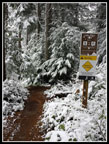
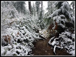
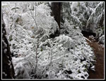
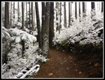
Not many years ago the roads were the way to get around near East Tiger Mountain. Now a series of bike trails have provided more scenic and softer tread routes. The Master Link is one way uphill for bikes. Hikers can go up or down. This means no fast bikes coming down towards hikers. The route is very easily graded. Long gentle switchbacks are not a fast way to climb but are very easy on the knees. By the time I had climbed a few hundred feet snow covered the underbrush. There was a little snow on trees at the trailhead but now it covered everything.
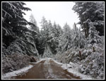
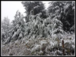
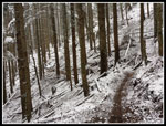
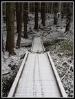
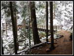
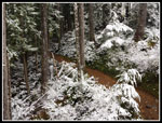
This is one of my favorite times of the year to hike. The first snow is very scenic. Travel is still easy. No snowshoes needed. The trail was sometimes snowy and sometimes bare as I continued to climb. I was surprised to pass two hikers coming down already. My progress was slowed by the snowy scenes. Most photos looked more like black and white than color. The white snow was very bright even without any sunshine. I passed the new Inside Passage trail and continued to the big bridge. The tree at the end of the bridge is huge. The trees became snowier but the trail was still mostly bare.
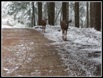
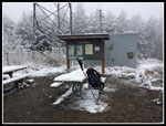
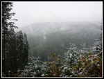
I reached the road and crossed over onto the Quick Link Trail. This is linger than just walking up the road but the tread is softer and the grade gentler. Near the top I saw two bikes below me. They passed me after I reached the road again. Now I just had a little under a mile of road to reach the summit of East Tiger Mountain. I took the summit road at the junction and then turned off to the lower viewpoint. Snow on the picnic tables and zero view. Back on the road I saw two folks walking down the road right towards me. Those "people" weren't people. Much to my surprise two deer were rapidly approaching me. I stood still and they stopped about 15 feet away. I took out my camera and took a few photos. Done posing, they walked off the edge of the road around me and kept walking down the road. Now that was a pleasant surprise.
I reached the summit to find the three bikers who had passed me. I arrived on top at 11:26 pm. 1:51 to hike 4 miles with 1650' of elevation gain. Not a great time but I did take a detour and a number of photos. It was a balmy 29 degrees on top but there was almost no wind. after those five bikers passed me near the start I saw only two hikers coming down and three bikes. Pretty good solitude. I had bit to eat then headed down. I did this trip in the spring for the first time. On that one I was a little short of time and walked the road down for several miles to where the Off the Grid Trail (OTG) crossed the road. This time I turned onto the OTG and followed it all the way to the road crossing. Another hour of solitude until three more bikers passed by just before reaching the road.
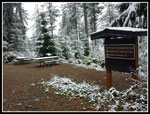
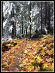
There is a big signboard and picnic table here. All the maps I saw were not updated. One at the trailhead and another at the summit. Evergreen Mountain Biking has a current map online that shows almost all the trails. The Inside Passage has yet to be added. I was now 6+ miles along with about 4 miles to go. The Joy Ridge Trail drops down to the Northwest Timber Trail. More gentle grade and a number of bridges. Some bridges are high above their creeks. The snow thinned as I descended though most brush was snowy white until most of the way down. I found the other end of the Inside Passage Trail after crossing a bridge. The trail angles in from above and is hard to see unless you are looking closely. A few more bikes passed me by but it was mostly lonely hiking. The 1.4 miles to the NW Timber trail seemed much longer. The NW Timber Trail seems more uphill than down though it is never steep.
As I neared the end I began to meet hikers. The day never did warm up. It was about 29-32 degrees all day. I passed the striped trees and knew I was almost back to the Master Link Trail junction. From there I quickly reached the main road and just had the last bit of the Connector Trail back to the parking lot. The last bit it began to snow. By the parking lot it was snowing pretty hard. A winter wonderland. I finished the hike at 2:09 pm. The lot was fuller though not full. Welcome to cold fall hiking.
This trip provided just what I was looking for. A full 10 miles with 1900' of elevation gain with an easy drive. No worries about driving home in the snow. Once the highway dropped down from Tiger Summit the snow turned to rain. For bike trails I had a lot of solitude. I saw over 20 folks but over 4.5 hours it left a lot of solitude. The scenery with fresh snow was the highlight of the day. I usually do not take many photos nor write a trip report for Tiger Mountain but this trip was a worthy exception.
Click on thumbnails to get
larger pictures.
Trips - 2017
Home
Almost immediately five mountain bikers past me. They were the last bikes I would see for the next 1.5 hours. These trails were mostly built by and for mountain bikers. The other three sides of Tiger are hikers only. Most hikers avoid the Highway 18 side as you will be passed by a number of bikes. I cede the trail to bikes even when I have the right of way. They go by in seconds and are gone. I does not bother me. It does give me a lot of solitude. Especially in the seasons of cold, rain, and short days. The short connector trail took me to the main road/trail. Across the road I turned onto the Northwest Timber Trail. A short way along I turned again, this time onto the Master Link Trail.
Not many years ago the roads were the way to get around near East Tiger Mountain. Now a series of bike trails have provided more scenic and softer tread routes. The Master Link is one way uphill for bikes. Hikers can go up or down. This means no fast bikes coming down towards hikers. The route is very easily graded. Long gentle switchbacks are not a fast way to climb but are very easy on the knees. By the time I had climbed a few hundred feet snow covered the underbrush. There was a little snow on trees at the trailhead but now it covered everything.
This is one of my favorite times of the year to hike. The first snow is very scenic. Travel is still easy. No snowshoes needed. The trail was sometimes snowy and sometimes bare as I continued to climb. I was surprised to pass two hikers coming down already. My progress was slowed by the snowy scenes. Most photos looked more like black and white than color. The white snow was very bright even without any sunshine. I passed the new Inside Passage trail and continued to the big bridge. The tree at the end of the bridge is huge. The trees became snowier but the trail was still mostly bare.
I reached the road and crossed over onto the Quick Link Trail. This is linger than just walking up the road but the tread is softer and the grade gentler. Near the top I saw two bikes below me. They passed me after I reached the road again. Now I just had a little under a mile of road to reach the summit of East Tiger Mountain. I took the summit road at the junction and then turned off to the lower viewpoint. Snow on the picnic tables and zero view. Back on the road I saw two folks walking down the road right towards me. Those "people" weren't people. Much to my surprise two deer were rapidly approaching me. I stood still and they stopped about 15 feet away. I took out my camera and took a few photos. Done posing, they walked off the edge of the road around me and kept walking down the road. Now that was a pleasant surprise.
I reached the summit to find the three bikers who had passed me. I arrived on top at 11:26 pm. 1:51 to hike 4 miles with 1650' of elevation gain. Not a great time but I did take a detour and a number of photos. It was a balmy 29 degrees on top but there was almost no wind. after those five bikers passed me near the start I saw only two hikers coming down and three bikes. Pretty good solitude. I had bit to eat then headed down. I did this trip in the spring for the first time. On that one I was a little short of time and walked the road down for several miles to where the Off the Grid Trail (OTG) crossed the road. This time I turned onto the OTG and followed it all the way to the road crossing. Another hour of solitude until three more bikers passed by just before reaching the road.
There is a big signboard and picnic table here. All the maps I saw were not updated. One at the trailhead and another at the summit. Evergreen Mountain Biking has a current map online that shows almost all the trails. The Inside Passage has yet to be added. I was now 6+ miles along with about 4 miles to go. The Joy Ridge Trail drops down to the Northwest Timber Trail. More gentle grade and a number of bridges. Some bridges are high above their creeks. The snow thinned as I descended though most brush was snowy white until most of the way down. I found the other end of the Inside Passage Trail after crossing a bridge. The trail angles in from above and is hard to see unless you are looking closely. A few more bikes passed me by but it was mostly lonely hiking. The 1.4 miles to the NW Timber trail seemed much longer. The NW Timber Trail seems more uphill than down though it is never steep.
As I neared the end I began to meet hikers. The day never did warm up. It was about 29-32 degrees all day. I passed the striped trees and knew I was almost back to the Master Link Trail junction. From there I quickly reached the main road and just had the last bit of the Connector Trail back to the parking lot. The last bit it began to snow. By the parking lot it was snowing pretty hard. A winter wonderland. I finished the hike at 2:09 pm. The lot was fuller though not full. Welcome to cold fall hiking.
This trip provided just what I was looking for. A full 10 miles with 1900' of elevation gain with an easy drive. No worries about driving home in the snow. Once the highway dropped down from Tiger Summit the snow turned to rain. For bike trails I had a lot of solitude. I saw over 20 folks but over 4.5 hours it left a lot of solitude. The scenery with fresh snow was the highlight of the day. I usually do not take many photos nor write a trip report for Tiger Mountain but this trip was a worthy exception.
 Rattlesnake Mountain |
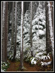 Snowy Trunks |
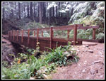 Falling Snow |
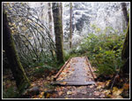 Leafy Bridge |
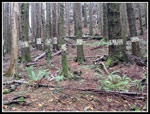 Tiger Stripes |
Trips - 2017
Home


