8-23-17
Gary
was free and we wanted to get up high for some views of peaks with some
recent snow. We considered Mt. David but snow conditions at over 7500'
were unknown. We chose a closer and lower summit in Mt. Dickerman. We
reached the trailhead parking lot at 8:20 pm. By 8:28 we were on our
way. There was a a big group of ten milling around that started just
after us. We took off at a good clip to get ahead. We passed two more
women farther up the trail. The first part is pretty flat until
reaching the junction with the old trail. Then it is up, up , and away.
The trail climbs at a steady rate gaining elevation pretty quickly. The
day was forecast to be partly sunny and we hoped to have some views at
the top. The cool morning was ideal for the uphill hike. I had on short
sleeves but kept on my long pants legs for the hike up.
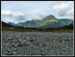
There are a few small creeks in the spring and bigger ones beyond the switchbacks in deep gullies on either side. There is no water at all now. The creek/waterfall passed beyond the two mile mark is bone dry. Not even a drop of water to be found. That is a bit unusual. Just after the last switchback starting a long traverse to the left is the old metal 2 mile marker. I seldom find it on the way up but did so this time. The big overhanging rock is just passed it. When we popped out of the forest we had a view across the valley to Big Four Mountain. There was a little snow on top but much less than I was expecting. The sky was mostly blue. Perhaps it would be clear on top?
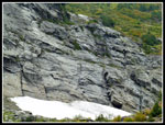
We reached the less steep gravel covered meadow to find some good fall color. Other than some quick photo stops we had no breaks on the hike up. Heading towards the meadows under the summit we reached the spot with views across Perry Creek to Stillaguamish Peak and Mt. Forgotten. Just a sprinkle of snow visible. I was surprised to see one waterfall flowing down the mountain. Some more good color higher up. We reached the spot under the summit where the final switchbacks begin to climb. We were hiking at a steady pace and were surprised that some fast hiker did not pass us. Other than a hiker or two descending we were alone. The last switchbacks went fast enough and soon we reached the top. It was about 10:43 am. We took about 2:15 to hike up.
In the meadows below we were happy to see so much blue sky. At the top is was much whiter. Many peaks were visible by most were to the south. To the north it was much cloudier. Glacier Peak, Mt. Pugh, and Sloan Peak were mostly lost in the clouds. No Three Fingers either. The Monte Cristo Peaks and Del Campo, Morningstar, Vesper, Sperry, Big Four, and Hall Peak were in the clear. Not great views but not a washout either. There was one group on top when we arrived. More began arriving soon after. Don't expect much solitude on Mt. Dickerman. We ate part of our lunch and took photos. It was so early that we had a lot of time to spend on the summit if we chose to.
At 11:17 we headed east to the next bump of a summit. I seldom go over there. We could look back to the crowd on the first summit. We also had a different view of the ridge leading out to Twin Peaks. We then dropped down the ridge a short way to the southeast. Gary looked down the slope to the east and saw a big black bear. It was munching on berries in the big meadow. For all the hiking I do I seldom see any bears. Even at a distance it was a treat. A little farther down we spooked some grouse. They stayed to posse for photos. That's more wildlife than I have ever seen on Dickerman.
Rather than climb back to the top we did a cross country traverse back to the trail, hitting it a few hundred feet below the top. We dropped down then began the traverse to our right. At the viewpoint down to Perry Creek a couple hikers were stopped. They pointed out five mountain goats across from us. So we had a bear, several grouse, and five goats on one trip. That was unusual and fun. We saw a steady stream of hikers coming up as we descended. Not like the Mt. Si trail but another group every so often. It would have been an uneventful descent except that I managed to run into a sharp branch end with my ear. It bled a lot more than I would have thought an ear could bleed before I managed to stop the flow. A few folks who saw me sitting on the side of the trail holding my ear with blood dripping from my fingers must have wondered what was going on.
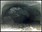
We reached the parking lot at 2:44 pm. It was still pretty early so we stopped at the Big Four Ice Caves trailhead. We had an easy hike up to the caves. They were much larger than I was expecting. Not really big but a solid roof at the end of a hot summer. We noticed that while ti was black looking into the tunnels from well in front, a our lenses grew lighter as we zoomed in. The interior became very visible in photos. We also saw a steady rain falling inside the caves. From the caves we could see north to Mt. Dickerman and even the summit was in sight. The trip down was easy and fast. We took the trail down to the old Big Four Lodge site. Just the chimney remains. A short walk along the old railroad grade brought us back to the car.
This turned out to be a very nice fall hike. The temperature was cool heading up but not cold. Perfect conditions. We some good mountain views from the top though many peaks were in the clouds. There was a little fresh snow highlighting the peaks though less than I was expecting. While we saw a number of other hikers it was never crowded. The short Ice Caves Trail was fun too. I seldom hike as it is a very short trail. Other than impaling by ear on a sharp branch it was an excellent day in the mountains. Mt. Dickerman is a lot closer to me than to Gary. Still, I was surprised to see that he has hiked it 5 times and this was my 21st trip. I knew I had hiked it often but that was even more often than I thought.
Trips - 2017
Home


