9-29-18
Gary
was free for a fall color hike. Last week I saw great colors at Green
Mountain but there was no sun. I wanted to see sun lit bright colors.
Unfortunately, much of the mountains would be under clouds. The North
Cascades have great color but the area would see little or no sunshine.
We hashed out ideas and settled on Alta Mountain. I really enjoy the
trip and hike it fairly often in summer and fall. Gary had not been
there in some time. Late the night before we had our destination. We
met at Eastgate at 7:00 am and headed east. Across Snoqualmie Pass and
off I-90 at the Lake Kachess exit. The last four miles are on gravel.
It was in the best shape in years. We arrived to find the first section
of the lot full. The second section had lots of space still. By 8:16 a,
we were at the 2770' trailhead. Two parties were filling out wilderness
permits. One party was Jenny and Pam. I hiked with them to Miller Peak
in late October 2016. I also hiked in a group including Pam this
summer. It is a small hiking world.
The trail begins with a short climb then the grade is pretty gentle heading down the valley. Forest gives way to small meadows then forest again. Where the trail reaches the creek at some big rock slabs we could see that there was not much flow. The meadows were brushed out and easy travel. The last one provides views straight up to Hibox Mountain. Back in forest again the boot path heading up Hibox is getting much more obvious. At 3400' after 2.5 miles the grade begins to steepen. The next mile gains 1260'. That would be steep but fine on a smooth trail. This is not a smooth trail. Rocks, roots, and creek beds. It has it all. It was chilly at the start but when we reached the creek we stopped and I zipped off pants legs and put on a short sleeve shirt. There was almost no water coming over the falls.
We continued up to a rocky spot where I stopped to take a photo down the valley. Except I did not have my camera. Oh crap!. It was back at the waterfall where I changed shirts and took off the case. Gary had a longer break while I hiked back down 160' vertical feet to find my camera. I have only done that a couple times in 36 years. A truly awful section of trail to have to hike twice. We arrived at Rachel Lake at 10:10 and took a ten minute break. The sky was still completely blue. Jenny and Pam arrived while we were there. They were backpacking and heading higher to camp.
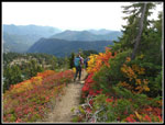
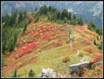
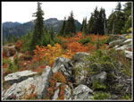
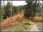
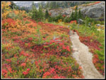
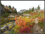
The section from the lake to the ridge top is well graded up the very steep slope. Lots of short switchbacks. A couple spots have good views down to Rachel Lake. Soon we are on the ridge top. For the first time I can recall, there is a trail sign there. Left goes to Rampart Lakes. Right goes to Alta Mountain and Lila Lakes. We headed right. So far we saw a number of folks heading up and down. It was never crowded. The ridge top route reaches the unsigned junction before long. This one has never had a sign. Straight ahead goes to Lila Lakes. We turned left. There was just a little leaf color up to the ridge top. Things improved fast. By the time we started up the steep trail on the ridge heading to Alta Mountain the berry bush leaves were thick and very red. Ahead of us the colors were muted. Looking back along the ridge the sunlight really made the colors "pop".
The first few hundred vertical feet were the steepest of the whole day. Then the ridge grade lessened. Views on the ridge top are outstanding. Peaks appeared in all directions. I really love this long ridge walk. Starting up the ridge the wind began to pick up. Now higher on the ridge top it was blowing hard. We had to stop to put on jackets but both of us had trouble getting our arms in them as the wind blew the jackets all around. The ridge has three false summits before the top. You can't see the real summit until reaching the third one. We slowed down for the really good leaf color sections. Higher on the ridge it is very narrow and there are no leaves. We went a little faster. There are great view out so that did slow us down a bit.
We finally reached the last false summit. The real summit was now not far away. One more descent to a saddle then up the sketchiest spot to the ridge top. A few minutes later we were on the summit. The views are almost 360 degrees. Only to the north are there peaks high enough to obstruct the view. Clouds were not starting to blow in. We arrived at the summit right at 12:00 pm. There were several other parties there. Higher on the ridge the wind lightened and it was very light on the summit. That was appreciated. We could see down Gold Creek to Hyak near Snoqualmie Pass. Across the valley was the Kendall Katwalk. Many miles of the Pacific Crest Trail are in sight. Half of Glacier Peak was seen. To the east was Hibox close by along with Three Queens. Mt. Stuart was in between in the distance. Mt. Daniel has little snow this late in the season. Below in Gold Creek Valley was more leaf colors.
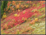
David Baxter showed up later. I have run into him several times over the years. He did a 19 mile trail run to Grand Ridge-Seven Lakes Basin in the Olympics the day before. Doing Alta the next day is crazy. David headed down first We hung around for over an hour. At 1:07 pm we started down. The cloud cover had thickened. We stopped lower down for more leaf photos but had much less sunshine to light them up. As we dropped down the wind picked up once again. We continued to see folks heading up and down.
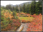
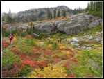
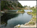
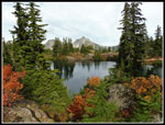
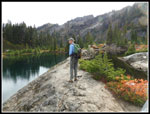
We reached the junction and headed straight ahead towards Rampart Lakes. It is only half a mile to the lakes. Lots of folks were coming out as we hiked in. There was some very good color on the trail to the lakes. We passed above one lake then crossed a creek and climbed up to one of the main lakes where we stopped. It was 3:01 pm. Time for another break. There were several tents around the lake but not as many as I expected. For 22 minutes we just sat and enjoyed the scene. We did a short loop trip around the lake basin. I had not previously seen that there are two lakes at different elevations that are separated by a narrow rock wall. That is pretty neat. At 3:53 pm we started back. More photos on the ridge then down to Rachel Lake. We did not stop here this time.
From Rachel Lake it was a non stop hike back to the trailhead. We were slow on the steep rocky and rooty section then picked up our pace when the grade flattened. We still saw folks with small day packs heading up who, if they went to the lake, would not make it back before darkness. We finally reached the parking lot at 6:16 pm. There were still quite a few cars there. Lots of backpackers. We took 1:47 to come down from Rachel Lake which was not too bad.
This turned out to be a great hike. Lakes, a high summit, and lots of fall colors. We had a lot more sunshine early than we would have had farther north. The wind was a pain on the ridge of Alta but almost came to a full stop on the summit. That was great. It was nice to see Jenny, Pam, and David on one trip. We spent quite a bit of time on the summit and at the lakes plus taking photos. The route was 12.2 miles with 4050' of elevation gain. Thanks to my lost camera I managed to get in 4200' of gain. We passed a lot of folks on this fine day but also had a fair bit of solitude. It was not like Mt. Si or Snow Lake. I've now had to very different fall color hikes with Green and then Alta Mountains. I hope to add a larch tree trip or two the next few weeks.
Click on thumbnails to get
larger pictures.
Trips - 2018
Home
The trail begins with a short climb then the grade is pretty gentle heading down the valley. Forest gives way to small meadows then forest again. Where the trail reaches the creek at some big rock slabs we could see that there was not much flow. The meadows were brushed out and easy travel. The last one provides views straight up to Hibox Mountain. Back in forest again the boot path heading up Hibox is getting much more obvious. At 3400' after 2.5 miles the grade begins to steepen. The next mile gains 1260'. That would be steep but fine on a smooth trail. This is not a smooth trail. Rocks, roots, and creek beds. It has it all. It was chilly at the start but when we reached the creek we stopped and I zipped off pants legs and put on a short sleeve shirt. There was almost no water coming over the falls.
We continued up to a rocky spot where I stopped to take a photo down the valley. Except I did not have my camera. Oh crap!. It was back at the waterfall where I changed shirts and took off the case. Gary had a longer break while I hiked back down 160' vertical feet to find my camera. I have only done that a couple times in 36 years. A truly awful section of trail to have to hike twice. We arrived at Rachel Lake at 10:10 and took a ten minute break. The sky was still completely blue. Jenny and Pam arrived while we were there. They were backpacking and heading higher to camp.
The section from the lake to the ridge top is well graded up the very steep slope. Lots of short switchbacks. A couple spots have good views down to Rachel Lake. Soon we are on the ridge top. For the first time I can recall, there is a trail sign there. Left goes to Rampart Lakes. Right goes to Alta Mountain and Lila Lakes. We headed right. So far we saw a number of folks heading up and down. It was never crowded. The ridge top route reaches the unsigned junction before long. This one has never had a sign. Straight ahead goes to Lila Lakes. We turned left. There was just a little leaf color up to the ridge top. Things improved fast. By the time we started up the steep trail on the ridge heading to Alta Mountain the berry bush leaves were thick and very red. Ahead of us the colors were muted. Looking back along the ridge the sunlight really made the colors "pop".
The first few hundred vertical feet were the steepest of the whole day. Then the ridge grade lessened. Views on the ridge top are outstanding. Peaks appeared in all directions. I really love this long ridge walk. Starting up the ridge the wind began to pick up. Now higher on the ridge top it was blowing hard. We had to stop to put on jackets but both of us had trouble getting our arms in them as the wind blew the jackets all around. The ridge has three false summits before the top. You can't see the real summit until reaching the third one. We slowed down for the really good leaf color sections. Higher on the ridge it is very narrow and there are no leaves. We went a little faster. There are great view out so that did slow us down a bit.
We finally reached the last false summit. The real summit was now not far away. One more descent to a saddle then up the sketchiest spot to the ridge top. A few minutes later we were on the summit. The views are almost 360 degrees. Only to the north are there peaks high enough to obstruct the view. Clouds were not starting to blow in. We arrived at the summit right at 12:00 pm. There were several other parties there. Higher on the ridge the wind lightened and it was very light on the summit. That was appreciated. We could see down Gold Creek to Hyak near Snoqualmie Pass. Across the valley was the Kendall Katwalk. Many miles of the Pacific Crest Trail are in sight. Half of Glacier Peak was seen. To the east was Hibox close by along with Three Queens. Mt. Stuart was in between in the distance. Mt. Daniel has little snow this late in the season. Below in Gold Creek Valley was more leaf colors.
David Baxter showed up later. I have run into him several times over the years. He did a 19 mile trail run to Grand Ridge-Seven Lakes Basin in the Olympics the day before. Doing Alta the next day is crazy. David headed down first We hung around for over an hour. At 1:07 pm we started down. The cloud cover had thickened. We stopped lower down for more leaf photos but had much less sunshine to light them up. As we dropped down the wind picked up once again. We continued to see folks heading up and down.
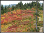
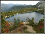
We reached the junction and headed straight ahead towards Rampart Lakes. It is only half a mile to the lakes. Lots of folks were coming out as we hiked in. There was some very good color on the trail to the lakes. We passed above one lake then crossed a creek and climbed up to one of the main lakes where we stopped. It was 3:01 pm. Time for another break. There were several tents around the lake but not as many as I expected. For 22 minutes we just sat and enjoyed the scene. We did a short loop trip around the lake basin. I had not previously seen that there are two lakes at different elevations that are separated by a narrow rock wall. That is pretty neat. At 3:53 pm we started back. More photos on the ridge then down to Rachel Lake. We did not stop here this time.
From Rachel Lake it was a non stop hike back to the trailhead. We were slow on the steep rocky and rooty section then picked up our pace when the grade flattened. We still saw folks with small day packs heading up who, if they went to the lake, would not make it back before darkness. We finally reached the parking lot at 6:16 pm. There were still quite a few cars there. Lots of backpackers. We took 1:47 to come down from Rachel Lake which was not too bad.
This turned out to be a great hike. Lakes, a high summit, and lots of fall colors. We had a lot more sunshine early than we would have had farther north. The wind was a pain on the ridge of Alta but almost came to a full stop on the summit. That was great. It was nice to see Jenny, Pam, and David on one trip. We spent quite a bit of time on the summit and at the lakes plus taking photos. The route was 12.2 miles with 4050' of elevation gain. Thanks to my lost camera I managed to get in 4200' of gain. We passed a lot of folks on this fine day but also had a fair bit of solitude. It was not like Mt. Si or Snow Lake. I've now had to very different fall color hikes with Green and then Alta Mountains. I hope to add a larch tree trip or two the next few weeks.
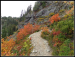 Heading To Rachel Lake |
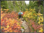 Last Fall Color Shot |
 Panorama Shot From The Summit Of Alta Mountain |
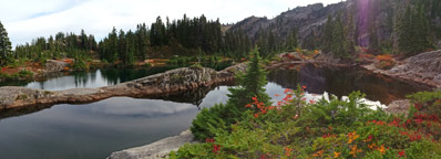 Two Of The Rampart Lakes |
Trips - 2018
Home


