8-26-18
The
wildfire smoke just keeps
coming. I took advantage of a one day break to get in a Thursday
afternoon/evening hike on Tiger Mountain. Saturday the smoke was back
and it was bad. No hiking at all. Sunday morning Seattle still had
unhealthy air and everything north and east was not much better. To the
south it was much better. Seattle had 8 times the air contamination
that nearby Kent showed. I was not excited about a long drive to
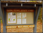
Capitol Forest and settled on Dash Point State Park. When I was a kid
Saltwater Park was where we went to be on Puget Sound. Occasionally we
would go farther south to Dash Point. I had not been there in close to
fifty years. At home I checked out the two turns to get from 320th
Street to Dash Point. Then I messed them up. After a couple mile detour
I made it to the part at the "early" hour of 10:40 am. One of the
latest morning starts I have had in years.
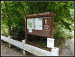
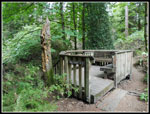
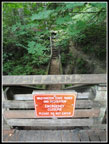
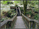
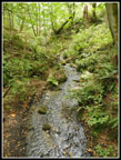
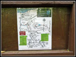
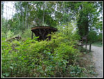
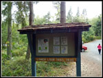
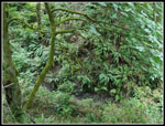
The parking lot was mostly empty. The park has a maze of trails. I printed out a paper map from the park's website. I also had a gps with a map that showed all the trails. I hoped I could get in 6 or seven miles if I hiked most of them. The trail starts out along Thames Creek. Not a lot of water this time of year but it was flowing. A short way up the trail is the first junction. Right is the Old Boundary Trail. It ends at a bird viewing platform. Right across the creek is another bird viewing platform. I wondered why there was no bridge or trail between them. The trail is among the steepest in the park. A good way to warm up fast. As with several trails there are short routes to houses. The park has a number of neighborhood trailheads as well as these boot paths to homes. I reached the platform and saw why there is a short gap between trails on the map. There is a bridge between the platforms and it is damaged. It is closed to hikers. A crude boot path cuts around, down, and back up to the other side. It is steep and loose. I could have taken it but the goal was to get in mileage and elevation gain. I went back the way I came.
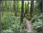
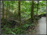
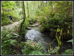
The main trail follows along Thames Creek.There are a number of stairways and bridges. They take the trail across and up as the creek goes into a steep and deep canyon. The trail starts just above sea level and the high point is at 430'. There are also a lot of short ups and downs. With a few wrong turns and climbs of a trail twice I managed to get in 1000' of elevation gain. I climbed to the southeast side and found a trailhead. Trails on the east end look to be mostly bike trails. They are fine for hikers too. I saw only two sets of two bikes all day. Heading north then west then north again. I found more neighborhood trailheads. I ended up at the north end of the park campgrounds. There are so many junctions that Loops and figure eights cam be made all over the park.
I finally made it back to the Thayer Creek Trail and dropped near the start. I went back up the Boundary Trail to round out 1000' of elevation gain. After the forest hiking I chose to take the short trail to the beach. A cool breeze was blowing and there was still no smoke. I had no desire to go back north. I walked around on the sand for quite a while. The tide was out and there was lots of sand to hike on. Eventually I headed back. I took the slow way home on back roads through the area where I grew up. A fun blast into my past.
The day turned out just about perfectly. I avoided the smoke. That was enough. I also had a change to visit the park for the first time in many decades. There are a lot of trails packed into a fairly small area. I was surprised to get in 8 miles. I did not think there would be 1000' of gain either. I'd rather be in the mountains in August but just getting in a hike without smoke was great.
Here is a link to a pdf map of the Dash Point State Park Trails: PDF Map
Click on thumbnails to get
larger pictures.
Trips - 2018
Home
The parking lot was mostly empty. The park has a maze of trails. I printed out a paper map from the park's website. I also had a gps with a map that showed all the trails. I hoped I could get in 6 or seven miles if I hiked most of them. The trail starts out along Thames Creek. Not a lot of water this time of year but it was flowing. A short way up the trail is the first junction. Right is the Old Boundary Trail. It ends at a bird viewing platform. Right across the creek is another bird viewing platform. I wondered why there was no bridge or trail between them. The trail is among the steepest in the park. A good way to warm up fast. As with several trails there are short routes to houses. The park has a number of neighborhood trailheads as well as these boot paths to homes. I reached the platform and saw why there is a short gap between trails on the map. There is a bridge between the platforms and it is damaged. It is closed to hikers. A crude boot path cuts around, down, and back up to the other side. It is steep and loose. I could have taken it but the goal was to get in mileage and elevation gain. I went back the way I came.
The main trail follows along Thames Creek.There are a number of stairways and bridges. They take the trail across and up as the creek goes into a steep and deep canyon. The trail starts just above sea level and the high point is at 430'. There are also a lot of short ups and downs. With a few wrong turns and climbs of a trail twice I managed to get in 1000' of elevation gain. I climbed to the southeast side and found a trailhead. Trails on the east end look to be mostly bike trails. They are fine for hikers too. I saw only two sets of two bikes all day. Heading north then west then north again. I found more neighborhood trailheads. I ended up at the north end of the park campgrounds. There are so many junctions that Loops and figure eights cam be made all over the park.
I finally made it back to the Thayer Creek Trail and dropped near the start. I went back up the Boundary Trail to round out 1000' of elevation gain. After the forest hiking I chose to take the short trail to the beach. A cool breeze was blowing and there was still no smoke. I had no desire to go back north. I walked around on the sand for quite a while. The tide was out and there was lots of sand to hike on. Eventually I headed back. I took the slow way home on back roads through the area where I grew up. A fun blast into my past.
The day turned out just about perfectly. I avoided the smoke. That was enough. I also had a change to visit the park for the first time in many decades. There are a lot of trails packed into a fairly small area. I was surprised to get in 8 miles. I did not think there would be 1000' of gain either. I'd rather be in the mountains in August but just getting in a hike without smoke was great.
Here is a link to a pdf map of the Dash Point State Park Trails: PDF Map
 Main Trailhead |
 Big Stump |
 Bird Viewing Deck |
 Bridge Is Broken |
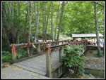
 Bridge Over Creek |
 Creek From Bridge |
 Other End Of Broke Span |
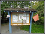
 Maps At Junctions |
 Contraption |
 Second Trailhead |
 Bike Trail |
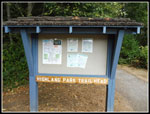 Third Trailhead |
 Fourth Trailhead |
 Ferns Line Gorge |
 Big Bridge |
 Along Creek |
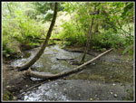 Thames Creek |
 Breach Trailhead |
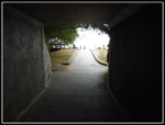 Tunnel To Beach |
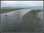
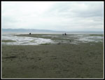 Sandy Beach |
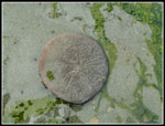 Sand Dollar |
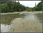
 Creek Outflow |
 Island In The Creek |
 Event |
Trips - 2018
Home