5-19-18
It
was Gwen's birthday and she
wanted to do a favorite hike up near Mt. Vernon. It is short so we
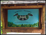
added a first visit for all of us to the Kukutali Preserve. The hikes
would be short so we did not get going until 9:00 am. Seattle traffic
is a mess again this weekend as two northbound lanes of I-5 were
closed. We headed north. We headed up to Highway 20 then west across
the Swinomish Slough and turned left on Reservation Road. Soon we
angled right on Snee-Oosh Road. A sign pointed out the turn into the
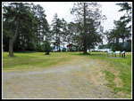
Kukutali Preserve. Parking for about 10 cars. The route begins heading
down a gated gravel road. The preserve sits on a peninsula east of
Deception Pass. Fidalgo Island is to the northwest. Whidbey Island is
to the southwest.
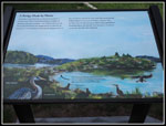
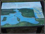
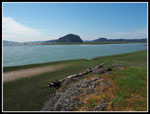
Kukutali was Swinomish Tribal land. In 1928 the land was purchased by a consortium for a a resort. The Great Depression ended that. In 1943 one of the consortium bought out the others and built a home. In 1969 Seattle City Light bought the land as the site for a nuclear power plant. That fell through. In 1982 the land changed hands again. Finally, in 2010 the Swinomish Tribe and Washington State Parks became co-owners and co- managers of the site. The park has been open to the public ever since. A Discover Pass is required. The gravel road crosses the peninsula to the old home site in one mile. North and south trails leave the road and come back in at the far end. Beyond the home site is Flagstaff Point which is off limits.
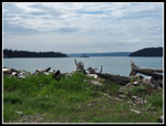
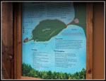
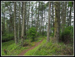
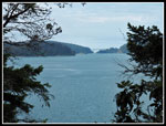
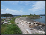
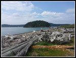
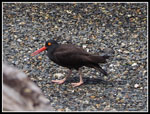
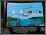
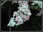
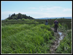
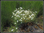
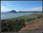
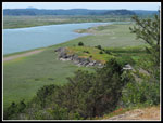
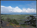
We took the north trail on the way in. Some big trees and some wildflowers along the way. Nicer than the road walk. The route gains a few hundred feet and gives it back again. We dropped to the grassy far end. I went farther through some trees and reached the spit between the main part and Flagstaff Point. From there you can see into Deception Pass to the Deception Pass Bridge. The tide was going out and there was some rocky and some sandy beach. There are a number of signs telling the history of this land. I learned a lot. Kim and or Gwen spotted some oyster catchers. Medium sized birds with orange beaks and an orange circle around their eyes. They posed on the beach for us. We headed over to the big grassy field where the home once sat. A short trail too us down to the beach on the south side. Madrona trees line the area above the beach.
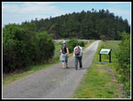
After another break we headed back. A short way up the gravel road the south trail cuts off. It is flatter as it avoids climbing the high point. It is an old road turning to trail. We met the main road again then dropped to the low narrow spot at the beginning of the peninsula. Here we heard then saw an eagle with a fish in its talons. Seagulls were harassing it. It and another eagle flew away then it came back and sat in a tree above us. Add eagle sightings to the day's adventure. Now it was just a short uphill climb back to the car. The trailhead is well signed that dogs are not allowed in the preserve. We saw two groups with dogs who did obey the rule. This completed part one of our trip. Now on to part two.
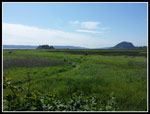
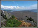
We headed to La Connor then farther south across the NF Skagit River. Gwen suggested a stop at Snow Goose Produce. Lots of art, craft, and edible things. We had the big ice cream cones. Very good. They take a while to eat. A battle to get it down before it melts away. A short drive from there to the end of the road and the start of hike two. We arrived at 1:50 pm. The tide had now gone negative and in another 90 minutes it would reach the -3 foot low for the day. We could see Craft Island across a sea of green. A marshy sea. At this time it is not possible to get out and back with dry boots. Lots of mud too. Our hike would be less than a mile out.
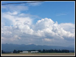
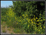
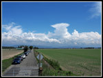
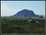
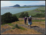
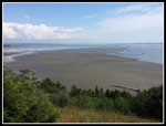
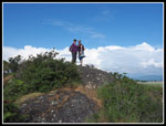
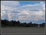
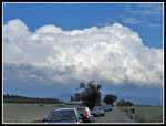
The most striking thing at the start were the clouds. It was blue sky over us but farther east tall white clouds dominated the view. I took a lot of photos coming and going. We were too late for a good wildflower show but we did see some color. The route is fairly easy to follow. We ended up at Craft Island. First we headed to a small high point for a look to the saltwater. The mouth of the NF Skagit is just north of here. The lowering tide showed lots of sandy ground that is usually underwater. We then headed over to Craft and followed a short trail to near the top. Two guys were on top so we sat down just to the west of the summit. The "summit is at an elevation of about 90 feet above sea level. Not exactly a mountain. Still, it is well above the flat land of Fir Island.
Craft Island is not really much of an island. Perhaps at a very high tide. It is surrounded by green marshland. I could imagine sinking in a ways if away from the route we took. In earlier times it may well have been surrounded by water. The view was pretty good up top. The clouds to the east. Whidbey Island out to the west. Saltwater to the northwest and southwest and right to the near west. It was sunny but a cool breeze was blowing making it very pleasant. We spent a full hour on top. I hated to leave. But leave we did. The walk back went quickly. By 5:00 pm we were on our way home. After our day in the sunshine we had some rain back closer to Seattle.
This was an unusual and fun hiking day for me. The 4 miles with 300' of elevation gain is somewhat below my average but I hiked two new to me trails with good company. A fun day was had by all. I think Gwen had just the kind of low key birthday she was looking for. I don't expect to come back to these trip often but I'm sure there will be another trip to come.
Click on thumbnails to get
larger pictures.
Trips - 2018
Home
Kukutali was Swinomish Tribal land. In 1928 the land was purchased by a consortium for a a resort. The Great Depression ended that. In 1943 one of the consortium bought out the others and built a home. In 1969 Seattle City Light bought the land as the site for a nuclear power plant. That fell through. In 1982 the land changed hands again. Finally, in 2010 the Swinomish Tribe and Washington State Parks became co-owners and co- managers of the site. The park has been open to the public ever since. A Discover Pass is required. The gravel road crosses the peninsula to the old home site in one mile. North and south trails leave the road and come back in at the far end. Beyond the home site is Flagstaff Point which is off limits.
We took the north trail on the way in. Some big trees and some wildflowers along the way. Nicer than the road walk. The route gains a few hundred feet and gives it back again. We dropped to the grassy far end. I went farther through some trees and reached the spit between the main part and Flagstaff Point. From there you can see into Deception Pass to the Deception Pass Bridge. The tide was going out and there was some rocky and some sandy beach. There are a number of signs telling the history of this land. I learned a lot. Kim and or Gwen spotted some oyster catchers. Medium sized birds with orange beaks and an orange circle around their eyes. They posed on the beach for us. We headed over to the big grassy field where the home once sat. A short trail too us down to the beach on the south side. Madrona trees line the area above the beach.
After another break we headed back. A short way up the gravel road the south trail cuts off. It is flatter as it avoids climbing the high point. It is an old road turning to trail. We met the main road again then dropped to the low narrow spot at the beginning of the peninsula. Here we heard then saw an eagle with a fish in its talons. Seagulls were harassing it. It and another eagle flew away then it came back and sat in a tree above us. Add eagle sightings to the day's adventure. Now it was just a short uphill climb back to the car. The trailhead is well signed that dogs are not allowed in the preserve. We saw two groups with dogs who did obey the rule. This completed part one of our trip. Now on to part two.
We headed to La Connor then farther south across the NF Skagit River. Gwen suggested a stop at Snow Goose Produce. Lots of art, craft, and edible things. We had the big ice cream cones. Very good. They take a while to eat. A battle to get it down before it melts away. A short drive from there to the end of the road and the start of hike two. We arrived at 1:50 pm. The tide had now gone negative and in another 90 minutes it would reach the -3 foot low for the day. We could see Craft Island across a sea of green. A marshy sea. At this time it is not possible to get out and back with dry boots. Lots of mud too. Our hike would be less than a mile out.
The most striking thing at the start were the clouds. It was blue sky over us but farther east tall white clouds dominated the view. I took a lot of photos coming and going. We were too late for a good wildflower show but we did see some color. The route is fairly easy to follow. We ended up at Craft Island. First we headed to a small high point for a look to the saltwater. The mouth of the NF Skagit is just north of here. The lowering tide showed lots of sandy ground that is usually underwater. We then headed over to Craft and followed a short trail to near the top. Two guys were on top so we sat down just to the west of the summit. The "summit is at an elevation of about 90 feet above sea level. Not exactly a mountain. Still, it is well above the flat land of Fir Island.
Craft Island is not really much of an island. Perhaps at a very high tide. It is surrounded by green marshland. I could imagine sinking in a ways if away from the route we took. In earlier times it may well have been surrounded by water. The view was pretty good up top. The clouds to the east. Whidbey Island out to the west. Saltwater to the northwest and southwest and right to the near west. It was sunny but a cool breeze was blowing making it very pleasant. We spent a full hour on top. I hated to leave. But leave we did. The walk back went quickly. By 5:00 pm we were on our way home. After our day in the sunshine we had some rain back closer to Seattle.
This was an unusual and fun hiking day for me. The 4 miles with 300' of elevation gain is somewhat below my average but I hiked two new to me trails with good company. A fun day was had by all. I think Gwen had just the kind of low key birthday she was looking for. I don't expect to come back to these trip often but I'm sure there will be another trip to come.
 Kukutali Trailhead |
 Hiking Down The Road |
 Lone Tree Point |
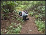
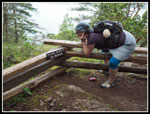
 Helpful Signboards |
 Kim At Work |
 Hiking Trail |
 Deception Pass |
 Disrespecting |
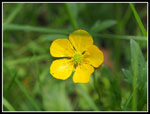 Buttercup |
 Old Home Site |
 Tombolo |
 Skagit Island |
 More Information |
 Map |
 Black Oystercatcher |
 History |
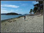 Gravel Beach |
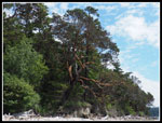 Madrona Trees |
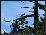 Eagle |
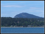 Mt. Erie |
 Flower Colors |
 Big Clouds |
 Yellow Flowers |
 Tall Cloud |
 Craft & Ika Islands |
 Ika Island |
 Damp Trail |
 White Flowers |
 Looking Northwest |
 NF Skagit River |
 Beach To The South |
 Gwen & Kim |
 Folks Below |
 Almost Low Tide |
 Ground Color |
 Summit Duo |
 View Southeast |
 Delta Rock |
 Cloud Show |
 Final Cloud Shot |
Trips - 2018
Home