6-23-18
Gary
was free and so was John. We
chose to head south to Shriner Peak. I did it for the first time in
2002
with Gary. I returned for a second time alone in 2015.
A recent
trip report mentioned snow the last mile. I had to be on the road by
5:55 am to get to Gary's by 6:30 am. We headed to John's house then on
to Enumclaw. Traffic was light at that hour and we made good time. The
forecast was for mostly sunny with early clouds burning off. I used my
wipers a bit as the cloud cover was total. It did not improve much as
we continued down Highway 410. As we climbed over Cayuse Pass it did
begin to clear a little. We reached the trailhead parking area just
after 8:00 am. By 8:14 am we were off for the short walk along the
highway to the trail. I was a little surprise to find we were the first
car in the parking area. Another arrived as we were getting started.
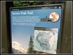
The trail up Shriner Peak gains 3400' in 4 miles. The stats are almost identical to Mt. Si. It is a lot farther drive from Seattle and a lot less crowded. Parking is in one wider spot along the highway. It is limited. The trail climbs steadily with no especially steep sections. Just a steady grind. We found some trillium well past flowering and some vanilla leaf down low. Some additional wildflowers were in bloom on the way up. It was a bit chilly at the start but soon I had to stop to zip off my pants legs and switch to a short sleeve shirt. It was still a bit cool but with the effort of climbing it was better in short sleeves. Well into the long rightward traverse Gary noticed that this was the old open burn area. His last visit was my first one in 2002. John had also been up a few times. The burn has now been enclosed by new trees. Much cooler on a hot day.
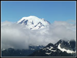
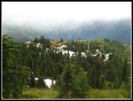
We saw a few lupine and Indian paintbrush in bloom. We took a break at the great viewpoint just off the trail at about 2.6 miles up. Unfortunately, the great view of Mt. Rainier was lost in clouds. We did get a few short looks at the summit then the clouds would enclose it again. We still held out hope that the clouds would clear later on. We did slow down a bit in an effort to get on top after the clearing. The route was now largely in the open. There would still be some forest higher up. We had some peekaboo views but not much. We hit snow at about 209 miles, just as the week earlier trip report folks mentioned. Patches gave way to solid snow. So far we had only seen one beargrass in bloom and no glacier lilies. We also noticed one set of fresh boot prints in the snow. Perhaps the person who arrived just after us passed on by during our viewpoint break.
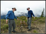
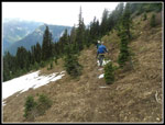
The prints seemed to know where they were going as we occasionally had short bits of trail. As we climbed up we lost the route but found it again where the trail crosses a steeply cascading creek. The trail was visible on bare dirt across the creek. At 5200' we stopped and discussed Gary's idea of a short cross country climb to the ridge then following it away from the summit to a spot where we might have a view down to Shriner Lake. Since there were no summit views at that time we decided to go for the lake view. It was pretty easy to climb to the ridge on solid snow. There we found a meadow under snow and partly open slopes leading towards the summit of Shriner. In the other direction we needed to climb up over on treed bump then drop steeply about 200' then another snort climb and drop to the ridge above the lake. The only hard part was the start of the big drop. It was very steep at first but John found a reasonable way down.
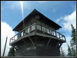
The ridge above the lake is almost totally forested. We looked around and found one rocky spot with minimal trees. We had a partial view of about half of the lake. Not total success but we did get the hoped for view. It was now about 11:20 am and time for a food and water break. It was also now partly sunny and warmer. Our break lasted for half an hour. We did have some good views to closer peaks above the lake. The climb back up the ridge was technically easier than the descent. We did find one spot where we had a view of Shriner and with maximum zoom we could see about half of the lookout building.
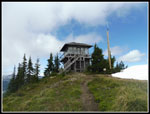
Above where we first reached the ridge it was very steep in places but not brushy or forested and it made for easy climbing. We leveled off on the summit ridge at the first campsite. It was snow free. The others were buried deeply with snow. (Shriner is in Mt. Rainier NP and requires a permit to camp.) There was still up to about 6 feet of snow in places. As we reached the lookout we could see that the far end of the summit was bare. No snow at the lookout but five feet of it 30' away. It was now 12:37 pm and I expected some folks would have arrived while we were looking for Shriner Lake. None were there at all.
We climbed up the ladder to the walkway around the lookout. On the west side was where there should have been a great view of Mt. Rainier. It was still completely socked in by clouds. It also had a very cold breeze blowing by. We headed for the other side where there was no wind. Sitting up on a lookout at over 5800' with great views, at least to the east, is a great experience. Doing it with total solitude in early afternoon is almost unheard of. We had been on the trail for almost 4 1/2 hours and had not seen a single person.
It was time for the rest of lunch. It was early enough that we could try to wait out the clearing sky. It was supposed to by mostly clear and sunny by this time but forecasts and reality do not always go hand in hand. After about an hour we did get some clearing. The summit of Rainier came out and some of the closer peaks as well. We saw much of the Cowlitz Chimneys and probably Tamanos Mountain. The base of Rainier never did clear but views with the swirling clouds were excellent in their own way. After almost 1 1/2 hours on the lookout another hiker arrived. The first person we had seen.
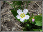
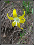
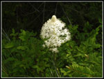
Clouds blew back in and we packed up and left at 2:22 pm. The first part of the trail down was snow free. We then had some patches but it was still mostly dirt. As we descended the snow became more consistent. We followed some boot prints but at one point we lost those. Using a GPS unit we were able to see where the trail should be and dropped down to the point where we had headed straight up to the ridge in the morning. Once on our own tracks we had no difficulty staying on route to the point where we were on dirt again. We saw some avalanche lilies on the route to the lake viewpoint. We saw a few more in bloom near the end of the snow cover. We also saw some glacier lilies. Lower down we began to see beargrass in bloom. Not a great wildflower show but we did see a fair number in bloom.
After the one hiker on the summit we saw a number of groups heading up as we headed down. We still had long stretches of solitude. By the time we were back at the highway our count had reached 17 hiker sightings. Still not many for such a nice trail to such a great viewpoint. It will be another week or two before the trail is snow free or at least beaten down to an easy to follow trench. My last trip was in fall with a terrific display of leaf color. this time there was some snow and some early wildflowers. I love to do a hike in different seasons. It makes for a much different experience. We made it down at 4:40 pm. Not a speedy descent but we did take a number of photo stops. A fun day on a trail I have only hiked three times now in 35 years. All of them were memorable.
Trips - 2018
Home


