12-22-18
I
don't mind hiking in the rain that much. I do fear hiking on very windy
days. Especially after a very rainy period. This day promised winds
gusting to 25 mph and afternoon rain. I chose a short drive and a hike
on the northwest side of Tiger Mountain when the wind would be coming
from the southeast. This has been a very good hiking year. Going into
the last nine days of the year I am only 29 miles short of my second
most miles in a year. I need to pass four other years to get there. So,
a snow free trip allowing for at least 10 miles was the goal. For a
change I started at the main High Point parking lot. It was more than
half full at 8:25 am. There were many more cars at the gate near the
Cable Line Trail start. By 8:33 am I was on my way. My plan was to hike
on the west side first going to Poo Poo Point. From there I would head
up Tiger 2 and come down the north side in case the wind was really
blowing.
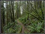
Unlike most hikes this one started level with some downhill. I turned onto the Bus Trail and motored along. The grade is slightly downhill. When I reached the gas line I turned left. Not a great choice. Just a few feet farther is the parallel gravel road. It is hard on the feet but dry. The gas line had muddy spots and wet grass. Oh well, it wasn't too bad. I reached the junction of the Section Line and Poo Poo Point Trails. I went right heading for Poo Poo Point. The grade is steady as the old road climbs up the slope. So far it was cool but dry with calm winds. One runner went by me. I saw folks off and on throughout the day. That said, there were long stretches of solitude between seeing folks. I reached the four way junction on the West Side Railroad Grade and turned right. The trail drops to the old road that leads to Poo Poo Point. I arrived at the point at 9:53 am.
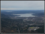
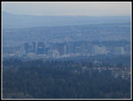
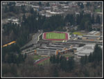
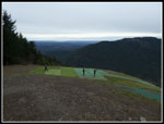
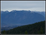
It was overcast all day but the clouds were high. I had pretty good views. This was my first hike with my new camera. It has a 30x zoom from 24mm to 720mm. More telephoto zoom than I have ever had. I could bring in Issaquah High School and even downtown Bellevue. Not the fastest lens but it sure has a wide ranging zoom lens. I saw a single hiker then a small group. After 15 minutes I headed on. Back up to the four way junction and I turned right heading up the One View Trail. The trail goes up with several downhill sections. After .80 miles I reached the Tiger Mountain Trail (TMT). The sign there shows it is 6.7 miles to the Tradition Plateau where I started. I had planned to go over Tiger 2 then down the K-3 Trail back to the TMT and out That would be about 10 miles. Now I started to think about following the TMT as it winds its way all over the north side of Tiger Mountain. I would make a final decision atop Tiger 2.
Just a week earlier I did a far different loop that included the section from here to T2. That's a section I only hike every few years. Now it would be twice in a week. There were three big trees down and a few small ones last week. I moved a few small ones off the trail then too. Since then someone cut out two of the three big ones. The route is much easier now. Thanks to whoever did the sawing. At Manning's Reach four runner went by. They were the first folks seen since Poo Poo Point. At the Seattle View Trail I turned right and headed uphill. Last week I noticed that the thick salal had been cut out. It is much easier to hike and much drier on a wet day. I arrived at the summit of Tiger 2 at 11:27 am. At 2757' this would be the highest point of the day. With 6.4 miles down I was more than half way done.
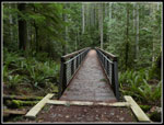
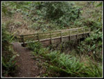
I had my lunch and then packed up for the descent. I was surprised to see that the high winds never materialized. Even on the summit the breeze was very light. The route down went smoothly. I saw a single hiker then another and a couple runners. Being so close to Christmas the trails seemed even more lonely than usual in the winter. When I reached the junction with the High Point Trail I had a chance to take a little shorter and flatter route. Instead I headed ahead on the TMT. I quickly reached Marat's Bridge. My loop crossed five bridge 60' or longer but none compare to 200' long Marat's Bridge. There is a big broken up log just before the bridge that you can go around but needs to be cleaned up. After the bridge the trail climbs 300' before finally descending to the Tradition Lake Trail near the trailhead.
My GPS showed I had hiked less than 6.7 miles since the top of the One View Trail sign. I chose to take the Bus Trail and Around the Lake Trail to bring by total distance up to just over 12 miles. With all the ups and downs I calculate about 3100' of elevation gain for the day. I arrived back at the trailhead at 2:06 pm. The lot was still not full. I have done a lot of loop trips on Tiger Mountain. I have hiked all the trails I was on this day. I can't recall ever doing this exact route. A first of sorts. All in all, I had a great trip. No snow, no rain, and no wind. It was not close to being crowded. I brought my goal down from 29 miles to 17 and I still have another weekend and my annual Tiger Mountain New Years Eve hike.
Click on thumbnails to get
larger pictures.
Trips - 2018
Home
Unlike most hikes this one started level with some downhill. I turned onto the Bus Trail and motored along. The grade is slightly downhill. When I reached the gas line I turned left. Not a great choice. Just a few feet farther is the parallel gravel road. It is hard on the feet but dry. The gas line had muddy spots and wet grass. Oh well, it wasn't too bad. I reached the junction of the Section Line and Poo Poo Point Trails. I went right heading for Poo Poo Point. The grade is steady as the old road climbs up the slope. So far it was cool but dry with calm winds. One runner went by me. I saw folks off and on throughout the day. That said, there were long stretches of solitude between seeing folks. I reached the four way junction on the West Side Railroad Grade and turned right. The trail drops to the old road that leads to Poo Poo Point. I arrived at the point at 9:53 am.
It was overcast all day but the clouds were high. I had pretty good views. This was my first hike with my new camera. It has a 30x zoom from 24mm to 720mm. More telephoto zoom than I have ever had. I could bring in Issaquah High School and even downtown Bellevue. Not the fastest lens but it sure has a wide ranging zoom lens. I saw a single hiker then a small group. After 15 minutes I headed on. Back up to the four way junction and I turned right heading up the One View Trail. The trail goes up with several downhill sections. After .80 miles I reached the Tiger Mountain Trail (TMT). The sign there shows it is 6.7 miles to the Tradition Plateau where I started. I had planned to go over Tiger 2 then down the K-3 Trail back to the TMT and out That would be about 10 miles. Now I started to think about following the TMT as it winds its way all over the north side of Tiger Mountain. I would make a final decision atop Tiger 2.
Just a week earlier I did a far different loop that included the section from here to T2. That's a section I only hike every few years. Now it would be twice in a week. There were three big trees down and a few small ones last week. I moved a few small ones off the trail then too. Since then someone cut out two of the three big ones. The route is much easier now. Thanks to whoever did the sawing. At Manning's Reach four runner went by. They were the first folks seen since Poo Poo Point. At the Seattle View Trail I turned right and headed uphill. Last week I noticed that the thick salal had been cut out. It is much easier to hike and much drier on a wet day. I arrived at the summit of Tiger 2 at 11:27 am. At 2757' this would be the highest point of the day. With 6.4 miles down I was more than half way done.
I had my lunch and then packed up for the descent. I was surprised to see that the high winds never materialized. Even on the summit the breeze was very light. The route down went smoothly. I saw a single hiker then another and a couple runners. Being so close to Christmas the trails seemed even more lonely than usual in the winter. When I reached the junction with the High Point Trail I had a chance to take a little shorter and flatter route. Instead I headed ahead on the TMT. I quickly reached Marat's Bridge. My loop crossed five bridge 60' or longer but none compare to 200' long Marat's Bridge. There is a big broken up log just before the bridge that you can go around but needs to be cleaned up. After the bridge the trail climbs 300' before finally descending to the Tradition Lake Trail near the trailhead.
My GPS showed I had hiked less than 6.7 miles since the top of the One View Trail sign. I chose to take the Bus Trail and Around the Lake Trail to bring by total distance up to just over 12 miles. With all the ups and downs I calculate about 3100' of elevation gain for the day. I arrived back at the trailhead at 2:06 pm. The lot was still not full. I have done a lot of loop trips on Tiger Mountain. I have hiked all the trails I was on this day. I can't recall ever doing this exact route. A first of sorts. All in all, I had a great trip. No snow, no rain, and no wind. It was not close to being crowded. I brought my goal down from 29 miles to 17 and I still have another weekend and my annual Tiger Mountain New Years Eve hike.
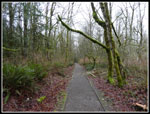 On The Bus Trail |
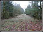 The Gas Line |
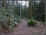 Poo Poo Point Trail |
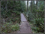 First Big Bridge |
 Poo Poo View |
 Downtown Bellevue |
 Issaquah High School |
 Take Off Zone |
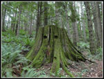 Face On A Stump |
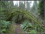 Mossy Arch I |
 One View Trail |
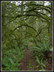 Very Colorful Arch II |
 On The TMT |
 Manning's Reach View |
 Fuzzy Moss |
 Very Old Sign |
 Mt. Si View |
 Big Bridge On TMT |
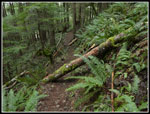 Log Across Trail |
 Log Is Gone |
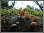 Tiny Mushrooms |
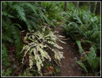
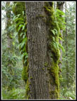
 Ferns On A Stump |
 Ruth's Cove |
 Near Murat's Bridge |
 Murat's Bridge |
 Fall Color |
 Another Big Bridge |
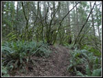
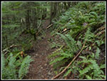
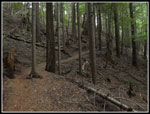 No Underbrush |
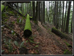 Very Green Log |
 Ferns On Tree |
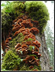 Colorful Mushrooms |
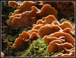 Close Up Shrooms |
Trips - 2018
Home