2-17-19
Lots
of snow in the lowlands left most DNR trailheads snow filled and gated
for Presidents Day Weekend. The low snow has kept me from getting in
much hiking in February. On one weekend I had trouble getting out of my
neighborhood. Now I wanted to find a trail that would not be over run
by all the folks who would not be able to hike Mailbox, Si, Little Si,
both ends of Rattlesnake, Tiger Summit, and Cougar Mountain. All the
snow also had the avalanche danger high in the mountains. On Wednesday
night Gary, John, and I did a hike on Tiger Mountain. There was not a
lot of room to park at the High Point exit. I hoped a few days of rain
would allow me to part on the north side of High Point to access Grand
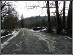
Ridge. I arrived at 8:10 am to find that the parking lot was mostly
bare with a few patches of ice. I was the second car to arrive.
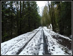
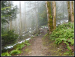
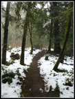
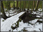
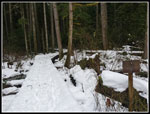
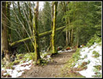
By 8:19 am I was packed up and on my way. It was just a degree or so above freezing. The railroad grade/trail was partly packed snow and ice. It was also a little bare. I had no trouble with getting enough traction. Half a mile at a gentle downhill grade did not warm me up. I was glad to reach the trail and begin to climb. Off the railroad grade and in forest the trail was bare dirt. I hiked a lot faster than on slick snow. As I ascended the trail became snow covered. It was never very deep. The highest point of the trip was only a little over 1000'.
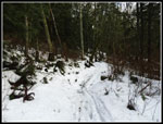
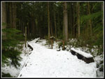
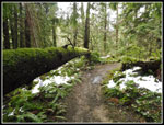
I carried microspikes but never did need them. There were some bike tire tracks but no bikes. This is a popular mountain bike trail and I have never seen it bike free. I saw only one bike all day and it was in the last mile. I did see a number of runners. Perhaps 7 or 8 of them. I saw only two other hikers. With all the most popular trails closed few folks thought of Grand Ridge. With the snow conditions being so good I just kept going. I often turn around just after the WTA Bridge at 4.5 miles but I just kept going. I reached the Micheal O Bridge at 11:01 am. 2:42 minutes to cover 6 miles is not bad but is slow for this trail. Considering the snow and lots of photo opportunities it was good enough.
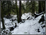
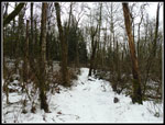
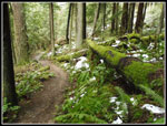
I hiked to the end of the bridge then back to the bench. Time for lunch. Now I just had six miles to go and at least half the elevation gain. The forecast was for partly sunny and it was not the case. I did get a few rays on the way back but very few. On the other hand, it never rained either. Pretty good conditions overall. On the way back I saw most of the runners. On the way in I saw only a few people. More solitude than I had any right to expect. After about eight miles on thin snow I was glad to be back on bare dirt for the last couple miles.
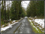
I reached the parking lot at 1:56 pm. A pretty early finish for a 12 mile hike. I was back home in no time. It was also my first trip north driving in the new Highway 99 tunnel under Seattle. February is still a poor month for hiking miles but it felt great to get in a double digit distance. This was only the third of fourteen trips so far this year. Short winter days and lots of snow has made it challenging. That will change soon enough. This trip gently graded and hikes fast. It is long enough that the gentle grade still provides 1800' of elevation gain. It turned out to be a fun day on the trail.
Click on thumbnails to get
larger pictures.
Trips - 2019
Home
By 8:19 am I was packed up and on my way. It was just a degree or so above freezing. The railroad grade/trail was partly packed snow and ice. It was also a little bare. I had no trouble with getting enough traction. Half a mile at a gentle downhill grade did not warm me up. I was glad to reach the trail and begin to climb. Off the railroad grade and in forest the trail was bare dirt. I hiked a lot faster than on slick snow. As I ascended the trail became snow covered. It was never very deep. The highest point of the trip was only a little over 1000'.
I carried microspikes but never did need them. There were some bike tire tracks but no bikes. This is a popular mountain bike trail and I have never seen it bike free. I saw only one bike all day and it was in the last mile. I did see a number of runners. Perhaps 7 or 8 of them. I saw only two other hikers. With all the most popular trails closed few folks thought of Grand Ridge. With the snow conditions being so good I just kept going. I often turn around just after the WTA Bridge at 4.5 miles but I just kept going. I reached the Micheal O Bridge at 11:01 am. 2:42 minutes to cover 6 miles is not bad but is slow for this trail. Considering the snow and lots of photo opportunities it was good enough.
I hiked to the end of the bridge then back to the bench. Time for lunch. Now I just had six miles to go and at least half the elevation gain. The forecast was for partly sunny and it was not the case. I did get a few rays on the way back but very few. On the other hand, it never rained either. Pretty good conditions overall. On the way back I saw most of the runners. On the way in I saw only a few people. More solitude than I had any right to expect. After about eight miles on thin snow I was glad to be back on bare dirt for the last couple miles.
I reached the parking lot at 1:56 pm. A pretty early finish for a 12 mile hike. I was back home in no time. It was also my first trip north driving in the new Highway 99 tunnel under Seattle. February is still a poor month for hiking miles but it felt great to get in a double digit distance. This was only the third of fourteen trips so far this year. Short winter days and lots of snow has made it challenging. That will change soon enough. This trip gently graded and hikes fast. It is long enough that the gentle grade still provides 1800' of elevation gain. It turned out to be a fun day on the trail.
 Leaving The Parking Lot |
 Issaquah Creek |
 Still Some Icy Snow |
 Falling Water |
 Finally Some Bare Trail |
 Nice Color |
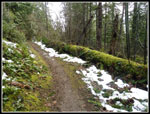
 Snow Lined Trail |
 Green & White |
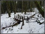
 Snowy Bridge |
 Now Snow Covered |
 Low Clearance |
 Quiet Solitude |
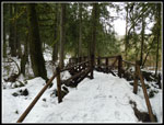
 Next Bridge |
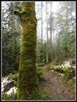
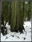 Big Tree |
 WTA Bridge |
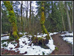
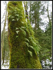
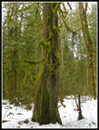 Another Mossy Tree |
 Michael O Bridge |
 Lunch Spot |
 Moss Along Trail |
 Open Forest |
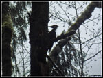 Woodpecker |
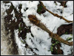
 Ferns & Moss |
 Devils Club |
 Mossy Log |
 Where In The "H"? |
 Log Border |
 Below The Snow |
 On The Road Again |
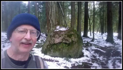 Me And My Erratic |
Trips - 2019
Home