6-01-19
Kim
was free for a hike. We had not
been hiking together since last November. Louise also signed on. Since
Kim had not been out hiking recently we chose a trip with a good chance
for blooming wildflowers and a steady grade. No really steep sections.
Iron Bear Peak seemed to be the best option. It was also supposed to be
a very comfortable 70 degrees on the east side of the Cascade Crest. We
met in North Seattle at 7:00 am and headed east. We had low clouds over
the Puget Sound Basin but east of Issaquah we were in the sunshine and
remained there the rest of the day. We drove just past Cle Elum then
headed north on Highways 970 and 97. 203 miles beyond Mineral Springs
Resort I turned left onto the Iron Creek Road. The road is in very good
condition. There are some pot holes but not many. Near the end of
the road it crosses a creek. The water was deep enough I would have
been
uncomfortable with a low clearance vehicle. With my small SUV it was no
problem at all. We parked at the 3650' lower lot just after the creek,
arriving at 8:48 am.
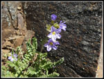
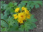
We packed up and started up the last short bit of road at 8:55 am. We arrived at the small trailhead parking lot at 9:03 am. Nobody had driven to the upper lot. The lower lot was almost full with about seven other cars. That last bit of road was not in bad shape though it is narrow and a bit rocky. Arnica and vanilla leaf were blooming at the start. The wildflower show continued most all the way up the trail. Indian paintbrush soon began to appear. We saw lots of red and orange plus some yellow too. After a short flatter section in forest the trail begins to climb and pops out into the open. The route is partly in sunshine and partly in trees as it climbs to the pass. The more open rocky hillsides had much of the best wildflower displays.
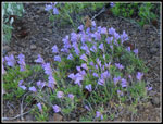
I saw arrowleaf balsam root at its peak near Wenatchee five weeks earlier. I was surprised to see that only a little of it was well past peak. Higher up some was still at peak. There were many sightings of pale blue penstemon. In the trees we saw yellow violets. Kim remembered the name of blue clematis. I recognized it but could not come up with the name. I mentioned that there is sometimes some scarlet gilia at one open slope. A minute later Louise pointed it out. Not huge profusion of any flower but a very good variety in bloom. Kim thought I was kidding when I could not recall the name of a mall blue flower. Yeah, it was forget-me-not. Another surprise was all the Solomons seal in bloom.
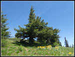
As we ascended a couple hikers went by us. One guy ran down the trail then back up again as part of a much longer trail run. It turned out that Louise knew him. It is a small world. There are some surprisingly big trees along the trail. Some big ponderosa pines are very impressive. Other sightings included glacier lily seed pods, service berry, silver crown, and death camas. Some more flowers will be appearing soon. There is at least a couple good weekends left here. We finally reached the ridge top at a four way junction. Ahead and downhill is the Bear Creek part of the Iron Bear Trail. Left is a long uphill on the Teanaway Ridge Trail. It continues all the way to Red Top Lookout. Right is the direction we took on the Teanaway Ridge Trail heading to Iron Bear Peak. It was getting warm fast. We found a spot in the shade for a foot and water break. it was 10:23 am. Our pace was slow but there were a lot of photo stops.
The trail follows the now bare ridge crest a short way before turned left and heading up the slope at a moderate grade. It is this bare spot where most of the bitterroot are found. We did see some bitterroot well above the trail on the way up. Now we found quite a few small ones in bloom right along the trail. These are among my favorite mountain wildflowers. The colors are so very vibrant. These ones mostly still had the many round "leaves" that usually have fallen off by the time the plant flowers. These were the only bitterroot we saw on the trail. Now the trail makes a series of long switchbacks to the left of the main ridge. It was getting much warmer in the open sections. We now had some better views out. The valley of Bear Creek was right below us.
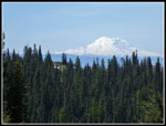
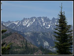
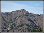
When we went back into forest some trillium appeared. Most were well past prime but a few were still a healthy white. There were even a some glacier lilies still in bloom. Mt. Rainier came into view and there was not a cloud near it. The summit does not come into view until right below it. There were a few folks in sight on top. We soon reached the 5489' top. Iron Bear Peak is a surprisingly good viewpoint.To the north is Miller Peak and Three Brothers. To the left are Navaho, Little Navaho, Earl, and Jolly Mountain. There is just enough snow left on the higher peaks to provide some nice contrast. Highest of all is Mt. Stuart. The folks at the summit left it to us. Another group was on a slightly lower point nearby. After a snack and lots of photos we headed on to Jester Mountain. Several more groups arrived as we left.
It is descent to a saddle then a short walk over to the junction with the County Line Trail. Right goes to the trailhead near old Blewett Pass. Left is the County Line Trail heading for Miller Peak. We went left then up off trail to the top of Jester. Thousands of spring beauty were in the meadows. There was a big patch of balsamroot near the top. I found the summit register and noticed the one person signed earlier this day. I told Kim Brown that a Harlan Brown had signed it. She was a bit shocked. Her father's name was Harlan Brown. What are the odds? That was a bit freaky. We now had good views out to the east. It was sunny but a bit hazy. Wildfire smoke has already begun to drift down from Canada. This may be a very smoky summer.
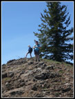
There were a couple good sized snow patches left on the summit ridge. The "ridge" is almost flat. The actual summit is more a small bump on a high meadow. We all laid down on the snow at some point. It was nicely cooling on what was becoming a much warmer day than forecast. We reached the top of Jester at 12:48 pm. We stayed on top until 1:47 pm. Just about an hour on top. We dropped down to the saddle and found a couple camping a few feet off the trail. That was unexpected. Other than the snow atop Jester there had been no water for a couple miles. A few years back I had seen photos of tiny steer's head blooming at the top of Iron Bear. I then went up and spent about an hour looking for it. I never found it. The same person posted more photos just this past week. As we approached the summit a couple hikers were yelling "we found them!". I asked if they had found steer's head. Yes they had. That saved the time I planned to use to look for it. This was only the third time I have seen it in 37 years of hiking. We went over to the lower point and enjoyed all the views. Soon we headed down.
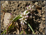
The trip down was much faster. More photo stops but far fewer than on the way up. We noticed that the bitterroot flower had closed. I have seen them closed in the morning then open in the afternoon. This time it was just the opposite. Wee did notice a good sized patch of onions in bloom. They likely were closed in the morning or all three of us missed them. We were back at the car at 5:03 pm. The drive back to Seattle was easier than usual. There were few big trucks seen.
This trip turned out exactly like we hoped. Kim did fine on an 8 mile hike with about 2400' of elevation gain. We had a very good wildflower display. There was enough snow on the higher peaks to make them stand out. We saw a number of people but it was never close to being crowded. Five minutes on the Lake 22 trail last Monday had more folks than this entire trip. We even had a full hour along atop Jester. Add in a drive home with less traffic than normal and it was a great trip. It was also great to have Louise along with us. I had not been on this trail for four years. That is a pretty long gap for me. It is an excellent spring wildflower hike.
Click on thumbnails to get
larger pictures.
Trips - 2019
Home
We packed up and started up the last short bit of road at 8:55 am. We arrived at the small trailhead parking lot at 9:03 am. Nobody had driven to the upper lot. The lower lot was almost full with about seven other cars. That last bit of road was not in bad shape though it is narrow and a bit rocky. Arnica and vanilla leaf were blooming at the start. The wildflower show continued most all the way up the trail. Indian paintbrush soon began to appear. We saw lots of red and orange plus some yellow too. After a short flatter section in forest the trail begins to climb and pops out into the open. The route is partly in sunshine and partly in trees as it climbs to the pass. The more open rocky hillsides had much of the best wildflower displays.
I saw arrowleaf balsam root at its peak near Wenatchee five weeks earlier. I was surprised to see that only a little of it was well past peak. Higher up some was still at peak. There were many sightings of pale blue penstemon. In the trees we saw yellow violets. Kim remembered the name of blue clematis. I recognized it but could not come up with the name. I mentioned that there is sometimes some scarlet gilia at one open slope. A minute later Louise pointed it out. Not huge profusion of any flower but a very good variety in bloom. Kim thought I was kidding when I could not recall the name of a mall blue flower. Yeah, it was forget-me-not. Another surprise was all the Solomons seal in bloom.
As we ascended a couple hikers went by us. One guy ran down the trail then back up again as part of a much longer trail run. It turned out that Louise knew him. It is a small world. There are some surprisingly big trees along the trail. Some big ponderosa pines are very impressive. Other sightings included glacier lily seed pods, service berry, silver crown, and death camas. Some more flowers will be appearing soon. There is at least a couple good weekends left here. We finally reached the ridge top at a four way junction. Ahead and downhill is the Bear Creek part of the Iron Bear Trail. Left is a long uphill on the Teanaway Ridge Trail. It continues all the way to Red Top Lookout. Right is the direction we took on the Teanaway Ridge Trail heading to Iron Bear Peak. It was getting warm fast. We found a spot in the shade for a foot and water break. it was 10:23 am. Our pace was slow but there were a lot of photo stops.
The trail follows the now bare ridge crest a short way before turned left and heading up the slope at a moderate grade. It is this bare spot where most of the bitterroot are found. We did see some bitterroot well above the trail on the way up. Now we found quite a few small ones in bloom right along the trail. These are among my favorite mountain wildflowers. The colors are so very vibrant. These ones mostly still had the many round "leaves" that usually have fallen off by the time the plant flowers. These were the only bitterroot we saw on the trail. Now the trail makes a series of long switchbacks to the left of the main ridge. It was getting much warmer in the open sections. We now had some better views out. The valley of Bear Creek was right below us.
When we went back into forest some trillium appeared. Most were well past prime but a few were still a healthy white. There were even a some glacier lilies still in bloom. Mt. Rainier came into view and there was not a cloud near it. The summit does not come into view until right below it. There were a few folks in sight on top. We soon reached the 5489' top. Iron Bear Peak is a surprisingly good viewpoint.To the north is Miller Peak and Three Brothers. To the left are Navaho, Little Navaho, Earl, and Jolly Mountain. There is just enough snow left on the higher peaks to provide some nice contrast. Highest of all is Mt. Stuart. The folks at the summit left it to us. Another group was on a slightly lower point nearby. After a snack and lots of photos we headed on to Jester Mountain. Several more groups arrived as we left.
It is descent to a saddle then a short walk over to the junction with the County Line Trail. Right goes to the trailhead near old Blewett Pass. Left is the County Line Trail heading for Miller Peak. We went left then up off trail to the top of Jester. Thousands of spring beauty were in the meadows. There was a big patch of balsamroot near the top. I found the summit register and noticed the one person signed earlier this day. I told Kim Brown that a Harlan Brown had signed it. She was a bit shocked. Her father's name was Harlan Brown. What are the odds? That was a bit freaky. We now had good views out to the east. It was sunny but a bit hazy. Wildfire smoke has already begun to drift down from Canada. This may be a very smoky summer.
There were a couple good sized snow patches left on the summit ridge. The "ridge" is almost flat. The actual summit is more a small bump on a high meadow. We all laid down on the snow at some point. It was nicely cooling on what was becoming a much warmer day than forecast. We reached the top of Jester at 12:48 pm. We stayed on top until 1:47 pm. Just about an hour on top. We dropped down to the saddle and found a couple camping a few feet off the trail. That was unexpected. Other than the snow atop Jester there had been no water for a couple miles. A few years back I had seen photos of tiny steer's head blooming at the top of Iron Bear. I then went up and spent about an hour looking for it. I never found it. The same person posted more photos just this past week. As we approached the summit a couple hikers were yelling "we found them!". I asked if they had found steer's head. Yes they had. That saved the time I planned to use to look for it. This was only the third time I have seen it in 37 years of hiking. We went over to the lower point and enjoyed all the views. Soon we headed down.
The trip down was much faster. More photo stops but far fewer than on the way up. We noticed that the bitterroot flower had closed. I have seen them closed in the morning then open in the afternoon. This time it was just the opposite. Wee did notice a good sized patch of onions in bloom. They likely were closed in the morning or all three of us missed them. We were back at the car at 5:03 pm. The drive back to Seattle was easier than usual. There were few big trucks seen.
This trip turned out exactly like we hoped. Kim did fine on an 8 mile hike with about 2400' of elevation gain. We had a very good wildflower display. There was enough snow on the higher peaks to make them stand out. We saw a number of people but it was never close to being crowded. Five minutes on the Lake 22 trail last Monday had more folks than this entire trip. We even had a full hour along atop Jester. Add in a drive home with less traffic than normal and it was a great trip. It was also great to have Louise along with us. I had not been on this trail for four years. That is a pretty long gap for me. It is an excellent spring wildflower hike.
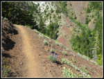 Narrow Open Trail |
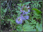 Ballhead Waterleaf |
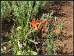 Scarlet Gilia |
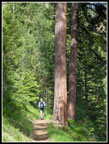 Big Ponderosa Pines |
Trips - 2019
Home


