8-31-19
Kim
joined me for a hike on the
first day of Labor Day Weekend. We decided to head up Highway 2. The
two choices were Tunnel Creek up to the Pacific Crest Trail (PCT) then
on to Trap Lake. The other option was to go up Smith Brook Road then
hike to Union Gap where we would reach the PCT and hike on to Janus
Lake and beyond. On the drive up we chose Janus Lake. I have only been
there one
time, in 2016, when I went on to
Grizzly Peak. That was a long 17 mile day. We planned to hike to Janus
Lake and then continue on to the top of the Cascade Crest. There were
some clouds but we hoped for afternoon views from up high. We arrived
at the 4000' trailhead at 8:45 am. By 8:54 am we were on our way. The
lot was not completely full. That was a surprise. This trailhead leads
to both Janus Lake and Lake Valhalla. Both are fairly short and easy
hikes for the day or for backpacking. A hiker was signing in and I
waited my turn. She headed out and I saw the last person to sign in was
Linda Roe. That is a familiar name from Facebook. She is friends with
some of my friends. She was also heading to Janus and Grizzly.
The trail up to Union Gap is well graded with many short switchbacks. It gains about 700' over 1.3 miles. We met a number of people coming down from Lake Valhalla. Several groups passed us going up to the gap too. We started seeing mushrooms near the start and continued to do so for most of the rest of the day. Lots of interesting varieties. Heading down from Union Gap the route has a few steeper spots but is mostly well graded. We stopped for more mushroom photos when a woman caught up with us. Kim asked her name. It was Linda. Linda Roe whose name we recognized. We quickly found out who our mutual friends are. Linda was out on her last hike of WTA Hike-a-thon month. She jointed us as we continued on to Janus Lake.
We had a few views out but for the most part the trail continued in forest. After dropping abut 700' the trail had some ups and downs on the way to the lake. A little before the lake is a creek crossing that I remembered. A wide and rocky creek with cascading falls dropping down. From there it is not far to the lake. I expected to see most if not all of the campsites already taken. That was far from the case. None of them seemed to be taken. There were two women sitting by the shore. Far up the lake we saw two folks who had passed us. The were fishing. That was it. The first day of a three day holiday weekend/ A nice 3.5 mile hike to the lake. Where was everyone? We took more than half an hour to sit by the shore. The lake is good sized. It was getting a little warm in the sunshine but it was not hot.
Linda had a 2:00 pm turnaround time and she left to hike farther up the trail. We followed about fifteen minutes later From the lake the PCT begins to climb at a steady pace. In about 1.5 miles it reaches the ridge top on the crest between the east and west sides of the Cascade Mountain. We found many more mushrooms in this section. The steady grade is great for fast hiking. We were not in much of a hurry however. Pearly everlasting is still very much in bloom. Asters are almost done. Not many other wildflowers to see. We saw a small amount of berries and these were quite sweet. As we neared the ridge top I noticed an old metal diamond shaped sign on a tree high above the trail. It as a "Pacific Crest Trail System" sign. These were on the trail up to 1968 when the PCT National Scenic Trail was created. It was at least 51 years old. I saw another one nine days earlier at Red Pass near Snoqualmie Pass. Later in the day I saw a third one. I don't recall seeing one before then three of them in nine days.
At the ridge top is a short trail up a small point above the trail. We had our first views out here. A little farther along the trail flattens and big views open up. I recognized Mt. David first. It looks to be a much steeper summit from the angle. Labyrinth Mountain was the largest point just to the east. Not the highest but it looked big since it was so close. Jove Peak is very meadow like on top. We soon had a look at Glacier Peak. The bottom with a large glacier was in sight. The top half was buried in clouds. That was a little disappointing. We crossed several rocky sections though the trail was easy walking We were not on the east side of the crest. Peaks to the west were not in site. Had we gone farther we would have been back on the west side with good views. Instead, we reached a big slab just off the trail. Linda was there taking a break. We joined her.
It was warm out in the sunshine for a change. So much of the way is in forest. We took another long break. A little before 2:00 pm Linda headed back. Kim and I extended our break. Coming down was much easier. We took a look at two campsites. One completely dry and one actually had a little running water. The steady grade made for much faster progress. We arrived back at Janus Lake and decided to have one more break. By now the late starting backpackers should be set up at the lake. Nope. We walked through a number of campsites and found...zero people. From the shore we could see...zero people. There was a duck at the lake. That was it.
We stayed until about 4:25 pm. It was eerie to be at a popular lake on a summer holiday evening and not see a single person. The lake has a haunted reputation and this only added to it. Add in dark clouds and it was pretty strange. When we reached the big creek crossing we met a forest service employee that Kim knew. I was not surprised. There was a backpacker there too. She was heading to Janus Lake. There was likely just one person there overnight. Our break here went on for a while. When we started on again we had a little light rain. I was almost ready to pull out a jacket as we neared a long boulder section in the open. At that point the rain suddenly stopped. On the way up to Union Gap we passed several PCT through hikers on their way to the Canadian border. I spoke with one guy who was hitting 30 miles per day. He said it was 180 miles to the border. He had just about six days to go.
The last 700' climb to the pass was not bad. I arrived first and just as I got there a hornet managed to get into the top of my hiking shoe and stung me. I've had some minor reactions to stings the past few years so I tore my first aid kit apart looking for benadryl. It as the last thing left at the bottom of the kit of course. The last 1.3 miles was not much fun as my foot was in pain. At least it happened near the end of the trip. We arrived to find the lot half full. Where were all the backpackers? Two lakes and not many people. The drive home was wide open. That does not happen often on Highway 2.
This turned out to be a great trip. A cool day with some periods of warm sunshine. Two stops at the lake with few other people. None on the way back. We saw almost nobody from the lake to the ridge and back to the lake. It always fun to talk with the through hikers. We were also able to put a face to a name when we met Linda. Also, Smith Brook Road is in excellent shape. Most any car can drive it. It was only my second visit to Janus Lake. I still have not made it to Lake Valhalla though I have looked down on it in winter from Mt. McCausland and Lichtenberg Peak. Perhaps I'll turn left at Union Gap some day and see Valhalla in the summer.
Click on thumbnails to get
larger pictures.
Trips - 2019
Home
The trail up to Union Gap is well graded with many short switchbacks. It gains about 700' over 1.3 miles. We met a number of people coming down from Lake Valhalla. Several groups passed us going up to the gap too. We started seeing mushrooms near the start and continued to do so for most of the rest of the day. Lots of interesting varieties. Heading down from Union Gap the route has a few steeper spots but is mostly well graded. We stopped for more mushroom photos when a woman caught up with us. Kim asked her name. It was Linda. Linda Roe whose name we recognized. We quickly found out who our mutual friends are. Linda was out on her last hike of WTA Hike-a-thon month. She jointed us as we continued on to Janus Lake.
We had a few views out but for the most part the trail continued in forest. After dropping abut 700' the trail had some ups and downs on the way to the lake. A little before the lake is a creek crossing that I remembered. A wide and rocky creek with cascading falls dropping down. From there it is not far to the lake. I expected to see most if not all of the campsites already taken. That was far from the case. None of them seemed to be taken. There were two women sitting by the shore. Far up the lake we saw two folks who had passed us. The were fishing. That was it. The first day of a three day holiday weekend/ A nice 3.5 mile hike to the lake. Where was everyone? We took more than half an hour to sit by the shore. The lake is good sized. It was getting a little warm in the sunshine but it was not hot.
Linda had a 2:00 pm turnaround time and she left to hike farther up the trail. We followed about fifteen minutes later From the lake the PCT begins to climb at a steady pace. In about 1.5 miles it reaches the ridge top on the crest between the east and west sides of the Cascade Mountain. We found many more mushrooms in this section. The steady grade is great for fast hiking. We were not in much of a hurry however. Pearly everlasting is still very much in bloom. Asters are almost done. Not many other wildflowers to see. We saw a small amount of berries and these were quite sweet. As we neared the ridge top I noticed an old metal diamond shaped sign on a tree high above the trail. It as a "Pacific Crest Trail System" sign. These were on the trail up to 1968 when the PCT National Scenic Trail was created. It was at least 51 years old. I saw another one nine days earlier at Red Pass near Snoqualmie Pass. Later in the day I saw a third one. I don't recall seeing one before then three of them in nine days.
At the ridge top is a short trail up a small point above the trail. We had our first views out here. A little farther along the trail flattens and big views open up. I recognized Mt. David first. It looks to be a much steeper summit from the angle. Labyrinth Mountain was the largest point just to the east. Not the highest but it looked big since it was so close. Jove Peak is very meadow like on top. We soon had a look at Glacier Peak. The bottom with a large glacier was in sight. The top half was buried in clouds. That was a little disappointing. We crossed several rocky sections though the trail was easy walking We were not on the east side of the crest. Peaks to the west were not in site. Had we gone farther we would have been back on the west side with good views. Instead, we reached a big slab just off the trail. Linda was there taking a break. We joined her.
It was warm out in the sunshine for a change. So much of the way is in forest. We took another long break. A little before 2:00 pm Linda headed back. Kim and I extended our break. Coming down was much easier. We took a look at two campsites. One completely dry and one actually had a little running water. The steady grade made for much faster progress. We arrived back at Janus Lake and decided to have one more break. By now the late starting backpackers should be set up at the lake. Nope. We walked through a number of campsites and found...zero people. From the shore we could see...zero people. There was a duck at the lake. That was it.
We stayed until about 4:25 pm. It was eerie to be at a popular lake on a summer holiday evening and not see a single person. The lake has a haunted reputation and this only added to it. Add in dark clouds and it was pretty strange. When we reached the big creek crossing we met a forest service employee that Kim knew. I was not surprised. There was a backpacker there too. She was heading to Janus Lake. There was likely just one person there overnight. Our break here went on for a while. When we started on again we had a little light rain. I was almost ready to pull out a jacket as we neared a long boulder section in the open. At that point the rain suddenly stopped. On the way up to Union Gap we passed several PCT through hikers on their way to the Canadian border. I spoke with one guy who was hitting 30 miles per day. He said it was 180 miles to the border. He had just about six days to go.
The last 700' climb to the pass was not bad. I arrived first and just as I got there a hornet managed to get into the top of my hiking shoe and stung me. I've had some minor reactions to stings the past few years so I tore my first aid kit apart looking for benadryl. It as the last thing left at the bottom of the kit of course. The last 1.3 miles was not much fun as my foot was in pain. At least it happened near the end of the trip. We arrived to find the lot half full. Where were all the backpackers? Two lakes and not many people. The drive home was wide open. That does not happen often on Highway 2.
This turned out to be a great trip. A cool day with some periods of warm sunshine. Two stops at the lake with few other people. None on the way back. We saw almost nobody from the lake to the ridge and back to the lake. It always fun to talk with the through hikers. We were also able to put a face to a name when we met Linda. Also, Smith Brook Road is in excellent shape. Most any car can drive it. It was only my second visit to Janus Lake. I still have not made it to Lake Valhalla though I have looked down on it in winter from Mt. McCausland and Lichtenberg Peak. Perhaps I'll turn left at Union Gap some day and see Valhalla in the summer.
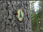 Second PCTS Sign |
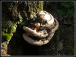 Three Shelves Fungus |
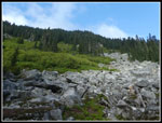 Blue Sky |
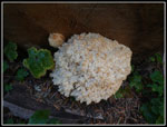 Last Fungus |
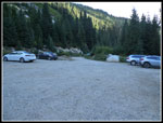 Parking Lot |
Trips - 2019
Home


