6-30-19
For
the second hike of the weekend Kim and I headed to the Middle Fork
Snoqualmie River Valley. A shorter than average summer drive. I hiked
this trail with Kim in 2011. My first time on it. Back then the new
trail went part way then ended. The old boot path was a very minimal
trail with no real bridges. We came back mostly on that trail. Two
years later the new trail was finished and I hiked
it all the way to the old Pratt
River rail/trail and part way up then over to the big tree. I
returned a couple weeks later
when Kim and I visited with some fresh snow on the ground. We reached
the old trail and found where the old cable bridge was located. A cable
was still around a stump. I had been aware of the old trail for
decades. in the early 1980s I drove off the MF Road to near the
location of the other end of the bridge. It was gone be that point. It
was summer and the river was impossibly deep and swift to cross. With
the construction of the new bridge it brought up the idea of a trip
from I-90 to the Middle Fork on the old route. I had been poking around
Pratt Lake for many years looking for the other end of the abandoned
trail. Those trips were in March. In
September of that year, Kim and
I invited Gwen and arranged a key exchange with Monty Vanderbilt to do
the trip one way from I-90. The water level was low enough for us to
ford the MF instead of using the new trail. I had not been back since
then.
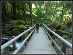
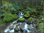
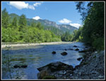
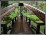
We met 45 minutes later than the day before at 7:15 am in North Seattle. The drive is now very easy since the Middle Fork Road has been paved. We did the gravel section at about 10 mph in 2013. This day was much faster. After a gas stop in North Bend, we arrived at the Middle Fork Trailhead at about 8:25 am. There were only about half a dozen cars in the lot. By 8:40 am we were on our way. The Gateway Bridge has been completely redecked this spring. It looks almost new. At the far end is the junction with the Middle Fork and Pratt River Trails. The MF Trail was washed out a year or so back and it is closed right at the start. That leaves just the Pratt River Trail for hikers. The river looked lower than I was expecting and looking at the stream flow records it was about half the rate of usual for June 30th. The lower than average snow pack is already showing.
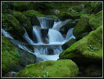
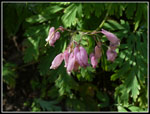
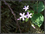
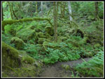
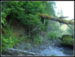
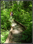
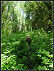
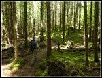
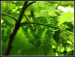
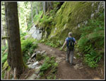
We were in no hurry today. More time was probably spent taking photos and poking around than actually hiking. That was the plan. Though there are no views, no lakes, and few places that the river is in site, this is a great hike. Lots of small things for those looking for them. Kim is one of the best at it. A bank of small twin flowers was right near the start. There is a lot of moss on this hike. Many shades of green in the trees, the bushes, and the ground cover. The night before the chance of rain was 50% with possible thunder showers. In the morning that changed to 20$ and no thunder showers. No likely need for umbrellas. The day before we carried them and it was much sunnier than expected. There were a number of paces in the first mile or so that the old trail could be seen.
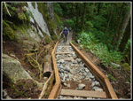
A photo stop on the bridge at Rainy Creek was mandatory. The large flat round handrail posts make for a tripod substitute for long cascading creek photos. We saw a few folks coming back as we hiked out. Later a few more groups passed by us. One group with a dog mentioned seeing a bear and turning around there. We had no such luck. The trail is in good shape. One surprise is at what was a long downhill stairway. The stairs were removed and a whole lot of rocks have been placed in the framework. A bit of a pain to descend. Much more so than the old staircase. I will be interested to see how it looks when the make over is done. No logs were down. There were a few muddy spots but I had no trouble with low top hiking shoes.
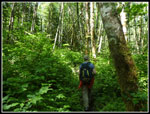
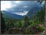
After about 2.5 miles the new trail ends an the route continues on an old roadbed. The transition did not seem clear to us. The road looked nothing like we remembered it. After a scrub forest section the route get more brushy. While brush never touched us it is narrowing and the brush is quite hight. Even for someone well over 6 foot tall. This seemed much different compared to our memories of six years ago. The short side trail to the river is obvious. At the end it is a dozen feet or more above river level. A side trail goes right then descends to the river. The dry area is not large but plenty of room for us. We arrived at about 11:15 am after hiking about 3.5 miles. We stayed until a little after 12:00 pm. The day was warming but we were in the shade. Great views of the river and ridges to the north. Kim did find the old cable where it falls into the river. It was a fine lunch break.
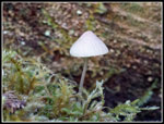
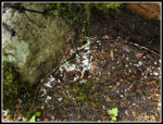
When we headed out we went over to above the cable. Try as we might, we were not able to find the tree it was wrapped around. It was very brushy. Also, we were looking for a tree and a later check of photos from the trip in 2013 showed it was just a stump. We did meet one guy camping right above. After giving up the cable search we headed back to the main trail. We went a little farther up the trail and turned around. The amount of brush was really surprising. Again, not on the trail but around it. The trip back took a little longer. We did hike at a good pace in some spots but took more and longer photo breaks. There were quite a few berries all ready out. Even some blue blueberries. Not yet ripe but they looked to be. Kim found saprophytes and several plants that I don't recall seeing before. Always part of the fun.
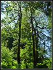
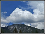
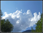
As we came with in less than a mile of the bridge we heard thunder. We had been seeing darker clouds coming down the valley. They became pretty black. It was still quite warm when the rain started. Not just normal light showers. This was hard rain and hail. Really? On the last day of June.? Those umbrellas would have been useful. The hard rain came and went along with more thunderous "booms". Back at the bridge it was raining hard once again. We took a walk through the day use picnic area. Some of those old growth tree are enormous. Some folks were still starting out in shorts and short sleeves as we finished in the rain. A not so unusual summer day in the Cascade Mountains.
On the way back we detoured on a new trail to the area across from where we stopped near the Pratt River. We worked our way up stream to right across and looked for any signs of the old cable bridge. We found none. By now it was mostly sunny and hot again. There were a number of folks sunbathing, camping, wading, and fishing. Lots of folks enjoying a summer weekend day. Once on the highway I had cell service again and the backup on I-90 east of the pass was 90 minutes. We were glad to have stayed on the west side.
For the day we hiked a big 7 miles with about 500' of elevation gain. A good trail for those not looking for a lot of gain. The forest was cool most of the day even when the temperature went to near 80 degrees. I did not even put on any sun screen. That makes this a very nice trail on a hot summer day. I generally go for more miles and elevation gain but every now and then a trip like this is just a lot of fun. Now to get to work selecting photos from the 186 I took today.
Click on thumbnails to get
larger pictures.
Trips - 2019
Home
We met 45 minutes later than the day before at 7:15 am in North Seattle. The drive is now very easy since the Middle Fork Road has been paved. We did the gravel section at about 10 mph in 2013. This day was much faster. After a gas stop in North Bend, we arrived at the Middle Fork Trailhead at about 8:25 am. There were only about half a dozen cars in the lot. By 8:40 am we were on our way. The Gateway Bridge has been completely redecked this spring. It looks almost new. At the far end is the junction with the Middle Fork and Pratt River Trails. The MF Trail was washed out a year or so back and it is closed right at the start. That leaves just the Pratt River Trail for hikers. The river looked lower than I was expecting and looking at the stream flow records it was about half the rate of usual for June 30th. The lower than average snow pack is already showing.
We were in no hurry today. More time was probably spent taking photos and poking around than actually hiking. That was the plan. Though there are no views, no lakes, and few places that the river is in site, this is a great hike. Lots of small things for those looking for them. Kim is one of the best at it. A bank of small twin flowers was right near the start. There is a lot of moss on this hike. Many shades of green in the trees, the bushes, and the ground cover. The night before the chance of rain was 50% with possible thunder showers. In the morning that changed to 20$ and no thunder showers. No likely need for umbrellas. The day before we carried them and it was much sunnier than expected. There were a number of paces in the first mile or so that the old trail could be seen.
A photo stop on the bridge at Rainy Creek was mandatory. The large flat round handrail posts make for a tripod substitute for long cascading creek photos. We saw a few folks coming back as we hiked out. Later a few more groups passed by us. One group with a dog mentioned seeing a bear and turning around there. We had no such luck. The trail is in good shape. One surprise is at what was a long downhill stairway. The stairs were removed and a whole lot of rocks have been placed in the framework. A bit of a pain to descend. Much more so than the old staircase. I will be interested to see how it looks when the make over is done. No logs were down. There were a few muddy spots but I had no trouble with low top hiking shoes.
After about 2.5 miles the new trail ends an the route continues on an old roadbed. The transition did not seem clear to us. The road looked nothing like we remembered it. After a scrub forest section the route get more brushy. While brush never touched us it is narrowing and the brush is quite hight. Even for someone well over 6 foot tall. This seemed much different compared to our memories of six years ago. The short side trail to the river is obvious. At the end it is a dozen feet or more above river level. A side trail goes right then descends to the river. The dry area is not large but plenty of room for us. We arrived at about 11:15 am after hiking about 3.5 miles. We stayed until a little after 12:00 pm. The day was warming but we were in the shade. Great views of the river and ridges to the north. Kim did find the old cable where it falls into the river. It was a fine lunch break.
When we headed out we went over to above the cable. Try as we might, we were not able to find the tree it was wrapped around. It was very brushy. Also, we were looking for a tree and a later check of photos from the trip in 2013 showed it was just a stump. We did meet one guy camping right above. After giving up the cable search we headed back to the main trail. We went a little farther up the trail and turned around. The amount of brush was really surprising. Again, not on the trail but around it. The trip back took a little longer. We did hike at a good pace in some spots but took more and longer photo breaks. There were quite a few berries all ready out. Even some blue blueberries. Not yet ripe but they looked to be. Kim found saprophytes and several plants that I don't recall seeing before. Always part of the fun.
As we came with in less than a mile of the bridge we heard thunder. We had been seeing darker clouds coming down the valley. They became pretty black. It was still quite warm when the rain started. Not just normal light showers. This was hard rain and hail. Really? On the last day of June.? Those umbrellas would have been useful. The hard rain came and went along with more thunderous "booms". Back at the bridge it was raining hard once again. We took a walk through the day use picnic area. Some of those old growth tree are enormous. Some folks were still starting out in shorts and short sleeves as we finished in the rain. A not so unusual summer day in the Cascade Mountains.
On the way back we detoured on a new trail to the area across from where we stopped near the Pratt River. We worked our way up stream to right across and looked for any signs of the old cable bridge. We found none. By now it was mostly sunny and hot again. There were a number of folks sunbathing, camping, wading, and fishing. Lots of folks enjoying a summer weekend day. Once on the highway I had cell service again and the backup on I-90 east of the pass was 90 minutes. We were glad to have stayed on the west side.
For the day we hiked a big 7 miles with about 500' of elevation gain. A good trail for those not looking for a lot of gain. The forest was cool most of the day even when the temperature went to near 80 degrees. I did not even put on any sun screen. That makes this a very nice trail on a hot summer day. I generally go for more miles and elevation gain but every now and then a trip like this is just a lot of fun. Now to get to work selecting photos from the 186 I took today.
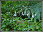 Twinflower |
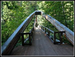 Gateway Bridge |
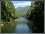 Middle Fork River |
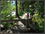 Closed Trail |
 Rainy Creek Bridge |
 Rainy Creek |
 Close Up Cascade |
 Bleeding Hearts |
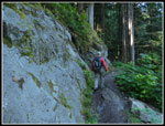 Blasted Rock Wall |
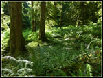 Green Ground |
 Great Contrast |
 Small Forest |
 Spring Beauty |
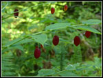 Big Red Berries |
 Very Green Grotto |
 A Little Overgrown |
 Lunch Along The River |
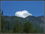 Big Puffy Cloud |
 Old Bridge Cable |
 Brushy Bridge |
 Back In The Brush |
 Scrubby Forest |
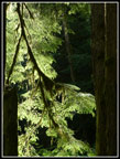
 Lit Up Trees |
 Fern Shadow |
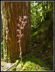 Coral Root |
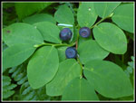 Blueberries |
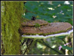 Shelf Fungus |
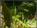 Saguaro Moss? |
 Taller Clouds |
 Rocky Steps |
 Another Rocky Wall |
 Dark Clouds |
 Wet Bridge |
 Hail |
 Clouds & Blue Sky |
 Thunder Clouds |
Trips - 2019
Home