7-03-20
The
Fourth of July holiday was on Friday this year. Gary and John joined me
for a 4000'+ elevation gain hike up Earl Peak in the Teanaway Valley.
Bean Creek Basin and Stafford Creek would be very crowded so we chose a
lesser used trail up Standup Creek. I have done the trip a number of
times. John had not done it yet. Gary did it on May 18th, 1980. Mt. St.
Helens erupted while they were hiking this trail. I was out the door by
5:55 am heading east. Over Snoqualmie Pass, onto Highway 970 at Cle
Elum, and then 13 miles up the paved Teanaway Road. We met two miles
after pavement at the start of the Standup Creek Road. The road has
some big dips. I went too fast on one and bottomed out with 8.5" of
ground clearance. Otherwise it was fine. I would not drive a sedan up
the road. it ends in about a mile. We were the first folks to arrive.
We packed up and were on our way at about 8:00 am. The high
was forecast to only be 50 degrees on the 7036' summit. It was cool buy
not cold as we started out. A recent report talked about overgrown
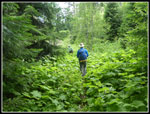
trail with many logs to cross the first 1.5 miles. The brush was not as
bad as I expected though if it was wet it would soak you. There are
trees down with paths around them or they just need to be gone over.
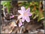
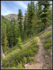
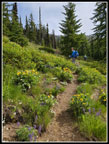
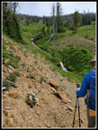
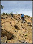
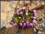
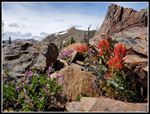
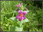
There are half a dozen creek crossings. In late spring they can be serious. By now they are not bad. Some have logs across and others are rock hops. Wildflowers started near the bottom and continued most of they way. Lots of columbine early on and a few tiger lilies. Clover and starflowers are blooming. On the way down Gary noticed some pink monkeyflower and there was some yellow ones right nearby. It did not take long for the temperature to rise. I kept on long sleeves and pants legs all day but I was sweating going up. After the lower brushy section the trail finally climbs above the creek. It is rocky and there is some brush but it is better.
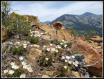
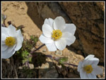
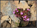
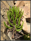
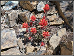
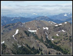
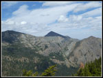
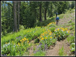
On the more open slopes we found a lot of stonecrop, Indian paintbrush and desert parsley, Higher up there was penstemon and a whole slope of Columbia Lewisia. I lagged behind as I kept taking photos. I finally caught up at the next to last creek crossing. There is a waterfall above the crossing. All around it were blooming arrowleaf balsamroot. We saw some below that was past prime. Up high it was close to peak. The route switchbacked up the slope until we came to the junction with the trail from Bean creek Basin. This used to be very hard to find but now the trail has been redone and is clear and signed. We went right on the Standup Creek Trail. A traverse brought us to the final creek crossing. As is usual this time of year, the creek was lined with blooming shooting stars. Another wildflower I had not seen this year. The creek comes out of a spring high under the summit of Earl Peak. Plenty of water still flowing. The creek has a number of small waterfalls as it cascades down the slope. We could see near the summit of Earl Peak and the ridge we would soon be taking to the top.
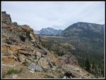
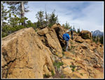
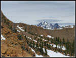
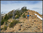
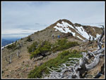
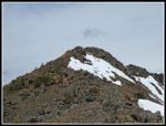
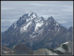
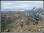
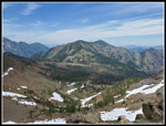
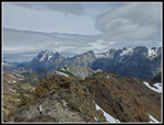
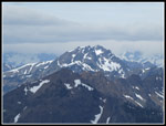
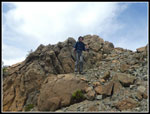
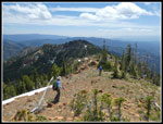
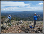
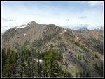
The trail goes back into forest for the last switchbacking climb to the saddle between Standup and Stafford creek valleys. On this section we passed a lone hiker coming down the trail. He was the only person we passed before reaching the summit. We went a little above the saddle and stopped for a break. We now had views out to Miller, Three Brothers, Little Navaho, Navaho, and the east end of the Stuart Range. Quite a nice viewpoint. Now came my favorite part of the trip. The ridge walk gains about 800' over .80 miles. There are more wildflowers along the ridge. Douglasia and western anemone were seen in many places. As we neared the summit views improved including Mt. Stuart. We could also see a number of folks on the summit. That was no surprise. High winds were forecast the day before but downgraded overnight. There was a breeze but it was not too bad. We reached the 7036' summit of Earl Peak at 11:43 am. Our overall time was very slow but we started early and took a few breaks and a lot of photo stops. We still had plenty of time left.
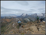
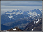
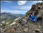
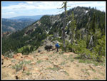
We climbed down about 20' and were out of the wind and away from all the other folks. We had plenty of social distancing room for each of us. We had been watching the crowds on the upper Navaho Pass Trail below the pass. On the summit the numbers continued. With my super zoom lens I could see Red Top Lookout and people atop Navaho and Bean Peaks. Clouds came and went. It was pleasant in the sunshine but a bit cool when clouds were overhead. We stayed on top until 12:45 pm. A full hour on the summit. The hike down the ridge was as pleasant as the ascent. The sun came back out. The guys spotted a ptarmigan but it took off before I could see it. On the lower ridge the discussion went to whether we should climb up the bump on the other side of the saddle. The map showed it as only 250' higher than the saddle. On all my other trips I had never done so.
Down at the pass we decided to head on up. The slope was not as steep as it appeared from the ridge. In short order we summited what we called "Little Earl". Nice flower show up there along with more great views. Time for another break. Eventually we had to start down the trail. Back we went to the saddle and down the trail. At the Bean Creek Trail junction we met a hiker descending that trail. We saw several runners and a couple of hikers. I took a break along the trail while the guys were out of sight. One of the runners went by. For the day I saw 6 other people and they saw 5. That is not counting the folks we saw on the summit. Six people on the trail is not bad for a holiday weekend. The trail is a bit rocky and my feet were ready for the trailhead way before we reached it. Thankfully this was a cool day for a Teanaway hike in July. That did not prove to be a problem.
We reached the cars at 4:57 pm. Somehow 8 cars were shoehorned into a small area. Thankfully nobody was coming up the road as we drove out. There is not room to pass along much of it. The two hour drive home was fine. Two weeks ago we had a long backup when a semi truck caught fire. No problems this day. Earl is one of the peaks I climb up every few years. I have done it via five different routes. This one is my favorite. We hit the wildflower show right near the peak and had great views. The surrounding peaks look best before all the snow melts off. There was snow on the north side of the summit ridge but we did not have to cross any this day. A really fun day in the mountains and my first 4000' elevation gain hike since last November 23rd. It is high time to get high up in the mountains once again.
Click on thumbnails to get
larger pictures.
Trips - 2020
Home
There are half a dozen creek crossings. In late spring they can be serious. By now they are not bad. Some have logs across and others are rock hops. Wildflowers started near the bottom and continued most of they way. Lots of columbine early on and a few tiger lilies. Clover and starflowers are blooming. On the way down Gary noticed some pink monkeyflower and there was some yellow ones right nearby. It did not take long for the temperature to rise. I kept on long sleeves and pants legs all day but I was sweating going up. After the lower brushy section the trail finally climbs above the creek. It is rocky and there is some brush but it is better.
On the more open slopes we found a lot of stonecrop, Indian paintbrush and desert parsley, Higher up there was penstemon and a whole slope of Columbia Lewisia. I lagged behind as I kept taking photos. I finally caught up at the next to last creek crossing. There is a waterfall above the crossing. All around it were blooming arrowleaf balsamroot. We saw some below that was past prime. Up high it was close to peak. The route switchbacked up the slope until we came to the junction with the trail from Bean creek Basin. This used to be very hard to find but now the trail has been redone and is clear and signed. We went right on the Standup Creek Trail. A traverse brought us to the final creek crossing. As is usual this time of year, the creek was lined with blooming shooting stars. Another wildflower I had not seen this year. The creek comes out of a spring high under the summit of Earl Peak. Plenty of water still flowing. The creek has a number of small waterfalls as it cascades down the slope. We could see near the summit of Earl Peak and the ridge we would soon be taking to the top.
The trail goes back into forest for the last switchbacking climb to the saddle between Standup and Stafford creek valleys. On this section we passed a lone hiker coming down the trail. He was the only person we passed before reaching the summit. We went a little above the saddle and stopped for a break. We now had views out to Miller, Three Brothers, Little Navaho, Navaho, and the east end of the Stuart Range. Quite a nice viewpoint. Now came my favorite part of the trip. The ridge walk gains about 800' over .80 miles. There are more wildflowers along the ridge. Douglasia and western anemone were seen in many places. As we neared the summit views improved including Mt. Stuart. We could also see a number of folks on the summit. That was no surprise. High winds were forecast the day before but downgraded overnight. There was a breeze but it was not too bad. We reached the 7036' summit of Earl Peak at 11:43 am. Our overall time was very slow but we started early and took a few breaks and a lot of photo stops. We still had plenty of time left.
We climbed down about 20' and were out of the wind and away from all the other folks. We had plenty of social distancing room for each of us. We had been watching the crowds on the upper Navaho Pass Trail below the pass. On the summit the numbers continued. With my super zoom lens I could see Red Top Lookout and people atop Navaho and Bean Peaks. Clouds came and went. It was pleasant in the sunshine but a bit cool when clouds were overhead. We stayed on top until 12:45 pm. A full hour on the summit. The hike down the ridge was as pleasant as the ascent. The sun came back out. The guys spotted a ptarmigan but it took off before I could see it. On the lower ridge the discussion went to whether we should climb up the bump on the other side of the saddle. The map showed it as only 250' higher than the saddle. On all my other trips I had never done so.
Down at the pass we decided to head on up. The slope was not as steep as it appeared from the ridge. In short order we summited what we called "Little Earl". Nice flower show up there along with more great views. Time for another break. Eventually we had to start down the trail. Back we went to the saddle and down the trail. At the Bean Creek Trail junction we met a hiker descending that trail. We saw several runners and a couple of hikers. I took a break along the trail while the guys were out of sight. One of the runners went by. For the day I saw 6 other people and they saw 5. That is not counting the folks we saw on the summit. Six people on the trail is not bad for a holiday weekend. The trail is a bit rocky and my feet were ready for the trailhead way before we reached it. Thankfully this was a cool day for a Teanaway hike in July. That did not prove to be a problem.
We reached the cars at 4:57 pm. Somehow 8 cars were shoehorned into a small area. Thankfully nobody was coming up the road as we drove out. There is not room to pass along much of it. The two hour drive home was fine. Two weeks ago we had a long backup when a semi truck caught fire. No problems this day. Earl is one of the peaks I climb up every few years. I have done it via five different routes. This one is my favorite. We hit the wildflower show right near the peak and had great views. The surrounding peaks look best before all the snow melts off. There was snow on the north side of the summit ridge but we did not have to cross any this day. A really fun day in the mountains and my first 4000' elevation gain hike since last November 23rd. It is high time to get high up in the mountains once again.
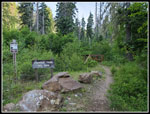 Standup Trailhead |
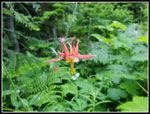 Columbine |
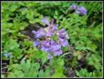 Penstemon |
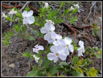
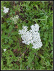 White Flower |
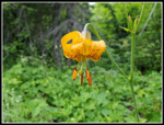 Tiger Lily |
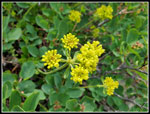 Yellow Flower |
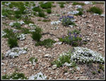
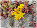 Stonecrop |
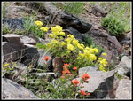 Open Flower Slope |
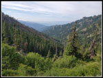 Looking Down Valley |
 Columbia Lewisia |
 Earl Peak Is In View |
 Phlox |
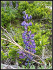 Lupine |
 Creek Crossing |
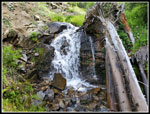 Waterfall |
 Balsamroot Along Trail |
 Last Creek Crossing |
 Shooting Star |
 Ridge Break Spot |
 Heading Up Ridge |
 Climbing Higher |
 Western Anemone |
 Close Up Anemone |
 Mt. Stuart In Sight |
 Douglasia |
 Another Ridge Bump |
 Ferns |
 Indian Paintbrush |
 Summit Is Ahead |
 People On Summit |
 Summit Views |
 Mt. Stuart |
 Bean Creek Basin |
 Cascade Crest Peaks |
 Lunch Spot Near Top |
 Navaho Peak |
 Stuart Range |
 Hawkins Mountain |
 Iron Peak |
 Heading Down |
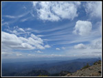 Cloud Show |
 Another Douglasia |
 Descending Ridge |
 Little Earl Ahead |
 Gary & John At Work |
 Ridge To Earl |
 Dark Brother Mountain |
 Earl Framed |
 Phlox Carpet |
 More Balsamroot |
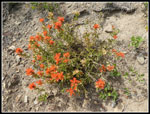 Orange Paintbrush |
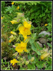 Yellow Monkeyflower |
 Pink Monkeyflower |
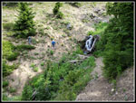
 A Little Brushy |
Trips - 2020
Home