8-09-20
I
needed to be home early. I wanted to get in a long hike. I did not want
to pass a lot of people on a narrow trail. Time for only my second
trip on this Tiger Mountain route. I headed off I-90 towards Tiger
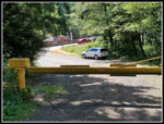
Summit. About a mile before reaching it I pulled off at the start of
the gated dirt road that would be my route. There were no other cars at
7:35 am. By 7:39 am I was on my way. The day would get into the 70s but
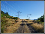
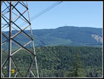
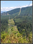
it was cool at the start. The road quickly reaches the big powerline
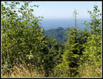
corridor and goes under the lines. The lack of trees means this is out
in the open. Nice views across to the towers of West Rattlesnake
Mountain. At one place I even had a clear look at Mt. Baker. Near the
start a signed route goes the other way under the powerlines. It is
marked as 1.2 miles to Tiger Summit.
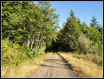
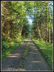
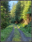
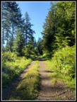
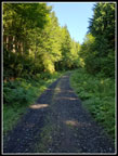
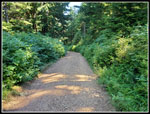
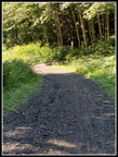
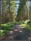
After half a mile the road leaves the corridor and heads into the forest. Most of the rest of the way up is in forest. In many places the trees overhang and form a cathedral roof over the trail. The usual and shorter road up East Tiger used to look like this until the last round of logging where all the trees along a big section of the road were removed. The road winds around a number of stream gullies. There are a few ups and downs early before the steady climbing begins. At 1.3 miles the Northwest Timber trail is reached. This can be a short cut up East Tiger. This day I wanted a longer hike and a more coronavirus friendly one. The grade is mostly very moderate and I had no problem keeping up a fast pace.
My only other trip on this route was on 1-31-10, some 10 1/2 years ago. That was a foggy and misty winter day. The Silent Swamp Trail was being logged and eliminated thereafter. A new bike trail has the same name but not the same route. I wanted to hike it once before it was destroyed and I did. so on the way up. I came down the longer road route. At that time section near the Silent Swamp Trail and beyond along the road had been freshly logged. There would have been views except for all the clouds that day. Now the trees have grown back quite a bit. Tall enough to once again block views. There are a number of old roads on the map. Only a grassy overgrown road heading down to Preston and a gated road at the big switchback are walkable in the first 3 miles. The gate makes it obvious that you need to take the switchbacking road.
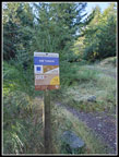
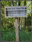
At 3.2 miles I reached the Preston Railroad Trail. Side trails were all well marked. Right after that is the junction with the Silent Swamp Trail. At about 3.3 miles I was almost half way along the 6.7 mile road to the summit of East Tiger. At 1560' I had only gained 371' of the 1811' net gain to the top. It began to get a bit steeper. So far I had seen one bicycler zooming by on his way down. There is one more junction that is unsigned. The main road keeps climbing and the other road heads downhill to later hook up with more bike trails. Past that I reached where the Master Link Trail crosses the road and becomes the Quick Link. A biker crossed the road just ahead of me. The Quick Link returns to the road higher up. The road is short and steep. The QL makes several switchbacks to climb up. I made good time and the biker was not much farther ahead when he returned to the road.
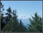
The road then reaches the high point at the Predator Trail and drops a little to the junction with the East Tiger Summit Spur. I expected to see more folks near the top and I did. Two or three more bike groups passed me on the last leg up. Most folks here came up the Master Link or the shorter road from Tiger Summit. The last .70 miles gains about 350' to the top. I did it in 15 minutes arriving at the summit at 9:55 am. I hiked 6.7 miles gaining about 1925' in 2:16. Hiking uphill at a 20.3 minutes per mile pace is pretty fast for me. Especially with a number of photo and one clothing stop. Mt. Rainier was completely in the clear with almost no glare. There were two bikers at the picnic tables staring at their phones. I upload some photos too but it looked funny to see that they had some great views from the 3004' summit and the phone was what they were looking at.
The hike up is long but with only about 2000' of gain up and down. I wanted more so I quickly headed right down the road. .70 miles down and then right back up tot he top one more time. This turned a 13.4 mile hike into 14.8 and bright the elevation gain up to 2400'. Two hikers were coming up as I descended. They were the only hikers I saw all day. With the road being about 20' wide most of the way it was easy to pass folks safely. In fact, this was my first hike in months where I did not need to pull out my mask all day long. After reaching the summit for the second time I had a longer break. There were now a number of bikers on the summit. I packed up and headed down at 10:47 am. I had 8.1 miles under my belt and it as still before 11:00 am.
The way down was just a little faster. I recorded a gps track for the descent. I saw some bikers taking breaks at a few bike trail junctions and a couple rode by on the road but that was it. The majority of people seen were on the summit of East Tiger or the summit spur road. The rest of my trip provided a lot of solitude. It was warmer on the way down but never hot. I had almost perfect weather conditions this day. On a summer day when I had to be home early this provided a great close in hike. I would have preferred and alpine meadow That would have taken much more time and been much more crowded.
I reached my car at 12:52 pm. The 6.7 mile descent took 2:05. That is an 18.66 minute per mile pace. Fast for me but not a lot faster than my uphill speed. The drive home requires darting out onto a highway with traffic speeding by at 60+ mph. I waited for a big enough space. At Tiger summit I turned into the lot and then had to cross two lanes of traffic turning left into 60+ mph traffic. That can be interesting. I was home by 1:40 pm. Mission accomplished. I hiked 14.8 miles and was home by early afternoon. This is not a trip to look forward to but it is a way to avoid crowds, hike a lot of miles on a steady smooth grade, and to do it fast. Perhaps I will hike it again in the next 10 years.
Click on thumbnails to get
larger pictures.
Trips - 2020
Home
After half a mile the road leaves the corridor and heads into the forest. Most of the rest of the way up is in forest. In many places the trees overhang and form a cathedral roof over the trail. The usual and shorter road up East Tiger used to look like this until the last round of logging where all the trees along a big section of the road were removed. The road winds around a number of stream gullies. There are a few ups and downs early before the steady climbing begins. At 1.3 miles the Northwest Timber trail is reached. This can be a short cut up East Tiger. This day I wanted a longer hike and a more coronavirus friendly one. The grade is mostly very moderate and I had no problem keeping up a fast pace.
My only other trip on this route was on 1-31-10, some 10 1/2 years ago. That was a foggy and misty winter day. The Silent Swamp Trail was being logged and eliminated thereafter. A new bike trail has the same name but not the same route. I wanted to hike it once before it was destroyed and I did. so on the way up. I came down the longer road route. At that time section near the Silent Swamp Trail and beyond along the road had been freshly logged. There would have been views except for all the clouds that day. Now the trees have grown back quite a bit. Tall enough to once again block views. There are a number of old roads on the map. Only a grassy overgrown road heading down to Preston and a gated road at the big switchback are walkable in the first 3 miles. The gate makes it obvious that you need to take the switchbacking road.
At 3.2 miles I reached the Preston Railroad Trail. Side trails were all well marked. Right after that is the junction with the Silent Swamp Trail. At about 3.3 miles I was almost half way along the 6.7 mile road to the summit of East Tiger. At 1560' I had only gained 371' of the 1811' net gain to the top. It began to get a bit steeper. So far I had seen one bicycler zooming by on his way down. There is one more junction that is unsigned. The main road keeps climbing and the other road heads downhill to later hook up with more bike trails. Past that I reached where the Master Link Trail crosses the road and becomes the Quick Link. A biker crossed the road just ahead of me. The Quick Link returns to the road higher up. The road is short and steep. The QL makes several switchbacks to climb up. I made good time and the biker was not much farther ahead when he returned to the road.
The road then reaches the high point at the Predator Trail and drops a little to the junction with the East Tiger Summit Spur. I expected to see more folks near the top and I did. Two or three more bike groups passed me on the last leg up. Most folks here came up the Master Link or the shorter road from Tiger Summit. The last .70 miles gains about 350' to the top. I did it in 15 minutes arriving at the summit at 9:55 am. I hiked 6.7 miles gaining about 1925' in 2:16. Hiking uphill at a 20.3 minutes per mile pace is pretty fast for me. Especially with a number of photo and one clothing stop. Mt. Rainier was completely in the clear with almost no glare. There were two bikers at the picnic tables staring at their phones. I upload some photos too but it looked funny to see that they had some great views from the 3004' summit and the phone was what they were looking at.
The hike up is long but with only about 2000' of gain up and down. I wanted more so I quickly headed right down the road. .70 miles down and then right back up tot he top one more time. This turned a 13.4 mile hike into 14.8 and bright the elevation gain up to 2400'. Two hikers were coming up as I descended. They were the only hikers I saw all day. With the road being about 20' wide most of the way it was easy to pass folks safely. In fact, this was my first hike in months where I did not need to pull out my mask all day long. After reaching the summit for the second time I had a longer break. There were now a number of bikers on the summit. I packed up and headed down at 10:47 am. I had 8.1 miles under my belt and it as still before 11:00 am.
The way down was just a little faster. I recorded a gps track for the descent. I saw some bikers taking breaks at a few bike trail junctions and a couple rode by on the road but that was it. The majority of people seen were on the summit of East Tiger or the summit spur road. The rest of my trip provided a lot of solitude. It was warmer on the way down but never hot. I had almost perfect weather conditions this day. On a summer day when I had to be home early this provided a great close in hike. I would have preferred and alpine meadow That would have taken much more time and been much more crowded.
I reached my car at 12:52 pm. The 6.7 mile descent took 2:05. That is an 18.66 minute per mile pace. Fast for me but not a lot faster than my uphill speed. The drive home requires darting out onto a highway with traffic speeding by at 60+ mph. I waited for a big enough space. At Tiger summit I turned into the lot and then had to cross two lanes of traffic turning left into 60+ mph traffic. That can be interesting. I was home by 1:40 pm. Mission accomplished. I hiked 14.8 miles and was home by early afternoon. This is not a trip to look forward to but it is a way to avoid crowds, hike a lot of miles on a steady smooth grade, and to do it fast. Perhaps I will hike it again in the next 10 years.
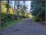 Shade At The Gate |
 Sunshine On The Road |
 Dark Forest Ahead |
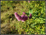 First Flowers |
 Daisy Like |
 Trees Form Roof |
 NW Timber Trail |
 Lots Of Signs |
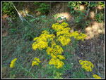
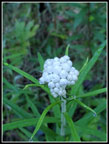 Pearly Everlasting |
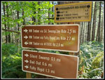 Lots Of Signs |
 Grassy Road |
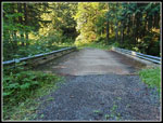 Big Bridge |
 A Little Sunshine |
 Nearing The Summit |
 Mt. Rainier |
 Foxglove |
 Tall Brush |
 Lower Viewpoint |
 Trail Junction |
 Thistle |
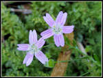 Spring Beauty |
 On The Flats |
 View Of Rattlesnake Mt. |
 Powerlines |
 Back At The Gate |
Trips - 2020
Home