5-09-20
It
is early May and I would be
driving beyond North Bend for the first time this year. Gary drove for
a cross country ski trip at the WF Teanaway. John drove to Chuckanut
Mountain near Bellingham. Just unbelievable. This pandemic hike would
require Gary, John, and I to drive separately. The trip is largely on a
road allowing us to maintain social distance. As safe as possible for
three people hiking together. We decided to meet at the end of pavement
on the West Fork Teanaway (WFT) Road. When I arrived at 8:05 am Gary
was already there. John arrived a few minutes later. After turning off
the Teanaway Road there is a great view of the Stuart Range and closer
Teanaway Peaks. I stopped and took a few photos. The clear sky and
snowy peaks makes for a great shot. The last 1.8 miles of dirt to the
WFT gate is pretty pot holed and a bit wet. There are tire ruts made
when the ground was wetter this spring. We had no trouble with our car
based SUVs. At the gate we found two vehicles. Two people in one car
left after us.
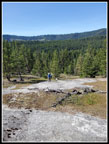
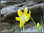
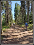
We were packed up and on our way at 8:16 am. The big meadow between the road and the river was very green. Some wildflowers started right away. There was a little lupine and arnica, and Indian paintbrush. Not much but just a taste of spring colors. The road quickly reaches a switchback. The old washed out road continues straight ahead. More on that later. The road climbs to what was a four way junction just a few years ago. Now the correct left turn is very obvious. The two other roads are getting less distinct. The next few miles parallels the river at a higher elevation. We saw a turkey hunter coming down. There are small patches of wildflowers along the road. Never a lot, you have to look for many of them. The chocolate lilies are so well camouflaged that I almost never see them even though I know roughly where to look. Fortunately, John always seems to see them. We saw a few of them.
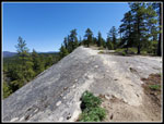
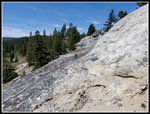
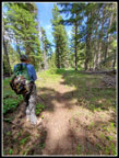
Gary noticed a large sandstone rock slab from a satellite view a short distance off the road. We set out to find it. On the way up the slope we saw lupine, penstemon, larkspur, ballhead waterleaf, spring beauty, a few more wildflowers. We also saw some larger patches of arrowleaf balsamroot. The detour was will worth it just for the blooming wildflowers. After hunting around a bit we came out of some trees to see the big slab. Not nearly as large as Mammoth Rock but still quite big. We could just make out a bit of Mammoth Rock from the top of the slab. Great views all around. After a short break we headed down. I soon realized I did not have my poles anymore. I headed back up the slope to look for them. Not as easy to find as you might imagine. The guys spotted them.
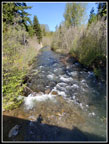
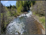
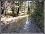
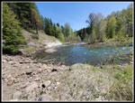
Back at the road we were soon heading downhill. At the bottom of the hill is the other end of the old WFT Road. Our pan was to try to follow it back to the start. We knew it was washed out. We did not know if it could still be followed. The road splits and we turned left and crossed the WF Teanaway River on a big bridge. For the first time ever I saw folks at the cabin located there. The road spits again. Right is the road up Sandstone Creek. We stayed left on the road along Dingbat Creek. There is a big puddle in the road in spring and fall. It was quite big this day. The wet mud around th edges showed it to have recently been bigger than I have ever seen. To keep dry boots at that time would have required going into the brush to get around it.
More flat walking led to the final climb up to Exclamation Point Rock and Mammoth Rocks. Some more chocolate lilies along here. More of the wildflowers we had seen earlier too. We passed the turnoff to Exclamation and continued ahead. Last October Gary and I came down the far side of Mammoth Rock. We heard running water nearby and detoured over to it. We found a waterfall in which the outflow went underground immediately. A falls with no continuing creek. We climbed up above it and found the creek coming out of the ground near the falls. It was underground except for the falls itself. Really a neat find. We hoped that it would be running in spring too. We found the falls and there were a few drops coming over it. After our build up talking to John it was a bit of a let down. John was not impressed. Oh Well...
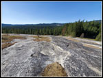
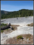
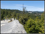
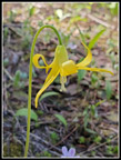
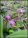
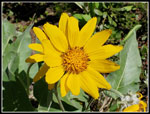
Back on the trail we soon reached the end of Mammoth Rock. To our surprise there were two folks up there. As we got on the rock we saw two more. That was the largest crowd I have seen there. The high for the day was supposed to be about 73 degrees. It was before noon and already in the high 60s. With all the sun on the rock it felt even warmer. From the other end of Mammoth Rock we could see Bible Rock near the end of pavement and the slab we had seen earlier in the day. Three big slabs of sandstone. We arrived at the lunch spot at 11:05 am. I could have sent a few hours there but we had some other exploring to do. We packed up and left at 11:53 am. First we had to walk the length of the rock. At the far end is a nice patch of balsamroot and lupine. We continued hiking a grassy slope on the back (north) side of the ridge. We were off the main rock but a sandstone cliff prevented an easy descent. We had to go a bit farther. Along this slope we found some glacier lilies still in bloom. We also found a patch of calypso orchids. Not many but they were right at their peak.
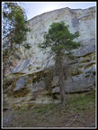
Soon we could drop below the cliff and take the trail that goes right up against a vertical wall of Mammoth Rock. The slope below gets quite steep. We walked the full length of the rock and at the other end is Exclamation Point Rock. Such an unusual site in Washington State. A tall spire of sandstone that is bigger at the top than the bottom. It looks a bit like an Exclamation Point. At th right angle I think it looks more like a boat's outboard motor. I took a few more photos for my growing collection. Normally we would drop down to the slickrock slabs below and take them back to the road. This time we decided to follow the ridge. The trail remains right on the ridge top whee possible. We found more wildflowers here, especially balsamroot. Gary and I did this a few year ago. This time we went all the way to the end.
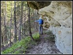
Part of the ridge is on grassy dirt and part is on more sandstone. At the far end is another good sized sandstone rock. The backside is a big cliff. The end is a slightly smaller cliff. The near side is a rock ramp down off the main rock and onto dirt. We took it. Now we just had to head for the road. We quickly found a motorcycle/bike trail. One way likely led back to the road. The other way dropped over th ridge and down towards Sandstone Creek. Should we take the easy known way or the unknown one? Over the ridge we went. The route switchbacked down and then began heading in the opposite direction that we needed to get back. There is a long flat ramp on the side of a cliff. It is the only way down without a rope and a harness. The trail descended to Sandstone Creek. We actually had a good idea as the very unofficial trail showed up on the phone GPS maps Gary and John were using. The creek was not too wide but way to deep to rock hop. We scouted around and found a small logs to help get us across two branches. We pushed through brush to get to the Sandstone Creek Road where a several motorcycle riders had stopped. They asked if we knew where we were and then took off.
Now we just had to walk the road back to the cabin. This dirt road was much softer than the others we had hiked this trip. We reached the junction at the cabin and crossed the WF Teanaway again. We walked the flat road to where it starts to climb and stayed low on the old washed out section of the WFT Road. The road starts out pretty nice except for trees that have fallen since the road was abandoned. No problems getting over them. We did meet two bicyclers in the forest near the road. I have no idea what they were doing. We were feeling pretty good about things when we reached a reason the road is abandoned. The river took out the entire road right up to a vertical sandstone wall. No going farther along the river. We had two choices. Go back or go straight up the steep slope. We headed up. High above the river we found flat ground. We could beat our way over to the main road we came in on or head downstream and look for a way to get back down to the river. We chose the latter. The GPS maps showed a path that would lead back down to the river. We found it and followed it down.
We were back on the old grade right near a creek crossing by the river. Easy to get across. Now we could see that the road was immediately washed out again. Not what we had hoped for. A path led uphill heading downstream. We took it. it soon petered out to a game trail.We found a path heading up to the top but chose to side hill above the river. This did not get us anywhere good. We finally chose to head straight uphill again. Once on top we consulted the map. It showed a trail nearby. It stayed high above the creek for a while then dropped back down to the creek. Were we ready for another descent? Yep. The flat trail wound through a nice forest. It is a pleasant walk. After a while it began the descend and dropped us back on the old WFT Road right next to the big meadow near the start of our trek.
Rather than walk the hard road we chose to head into the meadow. There is a path there too. I knew the meadow seen from the start of the main road is big. Once in it it is much longer than I had imagined. The path took us right back to the cars. We arrived at 2:44 pm. The drive home was easy as in these Covid-19 days traffic is still pretty light.
We took a trip that I had done half a dozen times and added some exploration. The big bald slab off the road was a fun detour. It also provided some of the best wildflowers of the day. The ridge beyond Exclamation Point Rock was fun. The drop to Sandstone Creek was unplanned but worked out well. We also now know why nobody takes the old abandoned section of the WFT Road. It took two trips up and down the hill to find out that there are two total removals of the road by the river. It turned out to be a fun day. With all the wide roads and lack of other people it was a very pandemic safe hike too. For the day we hiked 10.4 miles with 1700' of elevation gain.
Click on thumbnails to get
larger pictures.
Trips - 2020
Home
We were packed up and on our way at 8:16 am. The big meadow between the road and the river was very green. Some wildflowers started right away. There was a little lupine and arnica, and Indian paintbrush. Not much but just a taste of spring colors. The road quickly reaches a switchback. The old washed out road continues straight ahead. More on that later. The road climbs to what was a four way junction just a few years ago. Now the correct left turn is very obvious. The two other roads are getting less distinct. The next few miles parallels the river at a higher elevation. We saw a turkey hunter coming down. There are small patches of wildflowers along the road. Never a lot, you have to look for many of them. The chocolate lilies are so well camouflaged that I almost never see them even though I know roughly where to look. Fortunately, John always seems to see them. We saw a few of them.
Gary noticed a large sandstone rock slab from a satellite view a short distance off the road. We set out to find it. On the way up the slope we saw lupine, penstemon, larkspur, ballhead waterleaf, spring beauty, a few more wildflowers. We also saw some larger patches of arrowleaf balsamroot. The detour was will worth it just for the blooming wildflowers. After hunting around a bit we came out of some trees to see the big slab. Not nearly as large as Mammoth Rock but still quite big. We could just make out a bit of Mammoth Rock from the top of the slab. Great views all around. After a short break we headed down. I soon realized I did not have my poles anymore. I headed back up the slope to look for them. Not as easy to find as you might imagine. The guys spotted them.
Back at the road we were soon heading downhill. At the bottom of the hill is the other end of the old WFT Road. Our pan was to try to follow it back to the start. We knew it was washed out. We did not know if it could still be followed. The road splits and we turned left and crossed the WF Teanaway River on a big bridge. For the first time ever I saw folks at the cabin located there. The road spits again. Right is the road up Sandstone Creek. We stayed left on the road along Dingbat Creek. There is a big puddle in the road in spring and fall. It was quite big this day. The wet mud around th edges showed it to have recently been bigger than I have ever seen. To keep dry boots at that time would have required going into the brush to get around it.
More flat walking led to the final climb up to Exclamation Point Rock and Mammoth Rocks. Some more chocolate lilies along here. More of the wildflowers we had seen earlier too. We passed the turnoff to Exclamation and continued ahead. Last October Gary and I came down the far side of Mammoth Rock. We heard running water nearby and detoured over to it. We found a waterfall in which the outflow went underground immediately. A falls with no continuing creek. We climbed up above it and found the creek coming out of the ground near the falls. It was underground except for the falls itself. Really a neat find. We hoped that it would be running in spring too. We found the falls and there were a few drops coming over it. After our build up talking to John it was a bit of a let down. John was not impressed. Oh Well...
Back on the trail we soon reached the end of Mammoth Rock. To our surprise there were two folks up there. As we got on the rock we saw two more. That was the largest crowd I have seen there. The high for the day was supposed to be about 73 degrees. It was before noon and already in the high 60s. With all the sun on the rock it felt even warmer. From the other end of Mammoth Rock we could see Bible Rock near the end of pavement and the slab we had seen earlier in the day. Three big slabs of sandstone. We arrived at the lunch spot at 11:05 am. I could have sent a few hours there but we had some other exploring to do. We packed up and left at 11:53 am. First we had to walk the length of the rock. At the far end is a nice patch of balsamroot and lupine. We continued hiking a grassy slope on the back (north) side of the ridge. We were off the main rock but a sandstone cliff prevented an easy descent. We had to go a bit farther. Along this slope we found some glacier lilies still in bloom. We also found a patch of calypso orchids. Not many but they were right at their peak.
Soon we could drop below the cliff and take the trail that goes right up against a vertical wall of Mammoth Rock. The slope below gets quite steep. We walked the full length of the rock and at the other end is Exclamation Point Rock. Such an unusual site in Washington State. A tall spire of sandstone that is bigger at the top than the bottom. It looks a bit like an Exclamation Point. At th right angle I think it looks more like a boat's outboard motor. I took a few more photos for my growing collection. Normally we would drop down to the slickrock slabs below and take them back to the road. This time we decided to follow the ridge. The trail remains right on the ridge top whee possible. We found more wildflowers here, especially balsamroot. Gary and I did this a few year ago. This time we went all the way to the end.
Part of the ridge is on grassy dirt and part is on more sandstone. At the far end is another good sized sandstone rock. The backside is a big cliff. The end is a slightly smaller cliff. The near side is a rock ramp down off the main rock and onto dirt. We took it. Now we just had to head for the road. We quickly found a motorcycle/bike trail. One way likely led back to the road. The other way dropped over th ridge and down towards Sandstone Creek. Should we take the easy known way or the unknown one? Over the ridge we went. The route switchbacked down and then began heading in the opposite direction that we needed to get back. There is a long flat ramp on the side of a cliff. It is the only way down without a rope and a harness. The trail descended to Sandstone Creek. We actually had a good idea as the very unofficial trail showed up on the phone GPS maps Gary and John were using. The creek was not too wide but way to deep to rock hop. We scouted around and found a small logs to help get us across two branches. We pushed through brush to get to the Sandstone Creek Road where a several motorcycle riders had stopped. They asked if we knew where we were and then took off.
Now we just had to walk the road back to the cabin. This dirt road was much softer than the others we had hiked this trip. We reached the junction at the cabin and crossed the WF Teanaway again. We walked the flat road to where it starts to climb and stayed low on the old washed out section of the WFT Road. The road starts out pretty nice except for trees that have fallen since the road was abandoned. No problems getting over them. We did meet two bicyclers in the forest near the road. I have no idea what they were doing. We were feeling pretty good about things when we reached a reason the road is abandoned. The river took out the entire road right up to a vertical sandstone wall. No going farther along the river. We had two choices. Go back or go straight up the steep slope. We headed up. High above the river we found flat ground. We could beat our way over to the main road we came in on or head downstream and look for a way to get back down to the river. We chose the latter. The GPS maps showed a path that would lead back down to the river. We found it and followed it down.
We were back on the old grade right near a creek crossing by the river. Easy to get across. Now we could see that the road was immediately washed out again. Not what we had hoped for. A path led uphill heading downstream. We took it. it soon petered out to a game trail.We found a path heading up to the top but chose to side hill above the river. This did not get us anywhere good. We finally chose to head straight uphill again. Once on top we consulted the map. It showed a trail nearby. It stayed high above the creek for a while then dropped back down to the creek. Were we ready for another descent? Yep. The flat trail wound through a nice forest. It is a pleasant walk. After a while it began the descend and dropped us back on the old WFT Road right next to the big meadow near the start of our trek.
Rather than walk the hard road we chose to head into the meadow. There is a path there too. I knew the meadow seen from the start of the main road is big. Once in it it is much longer than I had imagined. The path took us right back to the cars. We arrived at 2:44 pm. The drive home was easy as in these Covid-19 days traffic is still pretty light.
We took a trip that I had done half a dozen times and added some exploration. The big bald slab off the road was a fun detour. It also provided some of the best wildflowers of the day. The ridge beyond Exclamation Point Rock was fun. The drop to Sandstone Creek was unplanned but worked out well. We also now know why nobody takes the old abandoned section of the WFT Road. It took two trips up and down the hill to find out that there are two total removals of the road by the river. It turned out to be a fun day. With all the wide roads and lack of other people it was a very pandemic safe hike too. For the day we hiked 10.4 miles with 1700' of elevation gain.
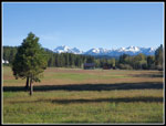 Stuart Range |
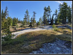
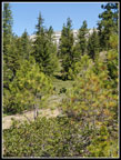
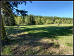 Big Meadow |
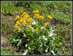
 Arnica |
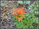 Orange Indian Paintbrush |
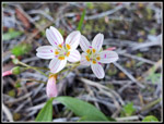
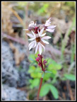 Prairie Star |
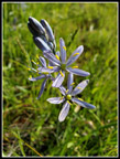 Camas |
 Ascending Slickrock |
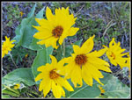 Arrowleaf Balsamroot |
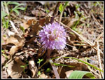
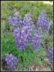 Lupine |
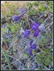 Larkspur |
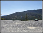
 View From The Top |
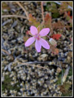 Pink Flower |
 Spring Beauty |
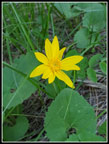
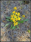 Yellow Flower |
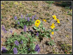 Lupine & Balsamroot |
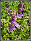 Penstemon |
 Heading Down |
 WF Teanaway Upstream |
 WF Downstream |
 WF Teanaway Lake |
 Ballhead Waterleaf |
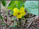 Yellow Violet |
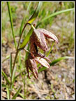 Chocolate Lilies |
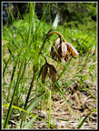 Chocolate Lilies Again |
 Mammoth Rock Above |
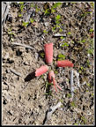 Red Shellflower |
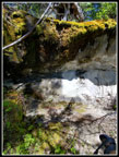 Dry Falls |
 Atop Mammoth Rock |
 Crossing Mammoth Rock |
 Snowy Peaks |
 Glacier Lily |
 Calypso Orchids |
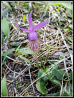 Lone Calypso Orchid |
 Backside Of Rock |
 Bright Glacier Lily |
 Overhanging Rock |
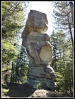 Exclamation Point Rock |
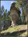 Backside View |
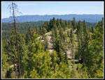 Ridge Ahead |
 Balsamroot Close Up |
 Sandstone Ridge |
 More Balsamroot |
 Gary Crossing Rock |
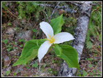 Trillium |
 Sandstone Creek Road |
 Washed Out Road |
 Found Unknown Trail |
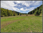 Very Big Meadow |
Trips - 2020
Home