5-23-20
Day
one of a holiday weekend during a pandemic. National Forest lands
reopened just the day before. The crowds would be huge. So much for
social distancing. I needed a trip that would not be too crowded. I
also needed a long hike with lots of elevation gain. I have had only
one trip in nearly five months with more than 3000' of elevation gain.
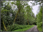
McDonald Mountain fit the bill. I headed out at 7:00 am and reached the
trailhead at 7:55 am. There were already four cars parked near the gate
at the east end of the Kent Kangley Road. I was on my way just after
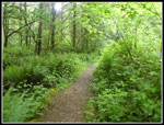
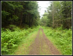
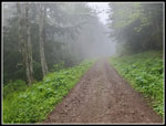
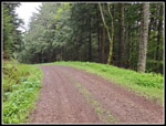
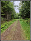
8:00 am. Much of the way is on logging roads. The first roughly 1.25
miles is on a road that has been decommissioned. It was a normal
logging road on my first visit in 2011. On my 2014 visit all the
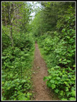
culverts had been removed in the decommissioning. There are now about
twenty 5-10' deep stream cuts that need to be crossed. That means a
steep trail down and back up again. Since the decommissioning the wide
road has been filled with brush and small trees. It is now a narrow
brown cut in the green brush. Not yet overgrown but not good for
keeping ones distance from others. I went pretty fast through this part
and did not see anyone else.
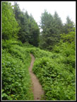
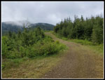
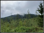
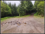
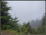
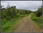
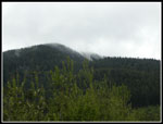
At the end of the narrow trail the route reverts to wide old road. On my first three visits I had to check to map closely as the real route takes a sharp left turn. The road going straight ahead was just as well maintained as the correct road. That has chanced radically. Now the road ahead is all grass and the left turn is the obvious route. In fact there is very little route finding needed now. After the narrow section I zipped off my pants legs and went to a short sleeve shirt. It was chilly but better than sweating in heavier clothing. I soon started meeting folks coming down. A group of two and a single hiker went by. The new clear cut is growing fast. On my second trip it was fresh. The trees and brush were non existent. Great views out to the north and east. Now the views are still there for the most part but closing in. The cloud layer was now not far above. The tower can be seen but this day it was in the clouds.
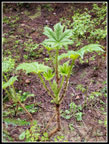
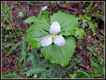
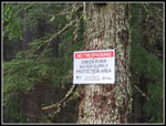
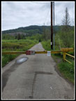
The road reaches a "T" and there is now a sign. Turing right does not go through. The way I came is signed for the blue gate at the bottom. Those not prepared for route finding will find the sign helpful. I turned left and quickly right on the road to the summit. The gate up here was closed on my first visit but has been open for the last three. I expected to see the usual spring wildflowers along the lower route but was a bit disappointed. I saw a few salmonberry flowers, a couple coltsfoot, and a few yellow violets. That was it. Perhaps they are already finished. It became colder as I entered the clouds. Gloves went on. I passed the third group before the quarry and roads junction. I turned uphill on the right hand road right at the quarry. The blue gate was closed. I met the fourth an last group right at the gate. This group of one accounted for the last car I saw at the trailhead. I would have the summit to myself. the final road switches back a few times on the way up. Near the top is an old road heading south that is now completely filled in with trees and brush. It also had a Tacoma Water Supply No Trespassing sign. That was not there before.
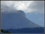
The watershed goes up to the ridge top. The trail to the real summit goes along the ridge crest. I hoped it had not been closed too. A few minutes later I had my answer. Two big No Trespassing signs are there. Crap! No legal access to the real summit now. I reached the viewpoint summit a couple minutes later. I went by the tower to the view between the trees. The view id pretty good. Not his day. All I could see were clouds. Time to reassess my day. 8 miles with 2400' of gain is an okay day but not what I wanted. I headed down while trying to come up with another nearby trip that would not be crowded for a noon time start. I had a few candidates but nothing great. On the drop to the quarry I passed three groups coming up. Hmmm, McDonald seems to be getting more popular. On the rest of the hike down I passed 8 more groups and then a hiking group and a biking group within site of the trailhead gate. About five times more folks than seen on any other trip here. Not seriously crowded but more than earlier times. I reached the bottom at about 11:15 am.
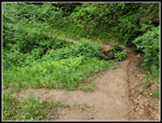
I headed north and reached Highway 18 near Taylor Mountain. Taylor was a possible second hike but can be a bit crowded by noon time. I drove back to near I-90 where I parked. The road up West Rattlesnake Mountain starts here. It is flat at first so I could at least get in some easy miles. There were only five or six cards there. At 11:45 am I started down the road. At one mile I passed the power sub station. A half mile later I passed a family out hiking. They represented more than half the folks seen on this hike. At 2.5 miles I stopped to talk with a guy working on mountain bike trails. The road climbs steeply after crossing Canyon Creek. At the top I left the main road and headed north on a side road. I first hiked this road in 1993 on a failed attempt to reach the West Peak. I crossed Canyon Creek again on a new bridge. At the next junction I headed uphill. I now had a little sunshine. It was still quite cold. At 4 miles I stopped and turned around. I had added 900' more elevation gain.
I had one biker pass me going up and again going down. That was it for 8 miles. A perfect pandemic hike. No need to ever move off the trail/road. The last couple miles were getting a bit painful on my feet. 16 miles for the day on different types of old roads. The Rattlesnake part starts and ends with a mile of asphalt. Other than my feet I felt great. For the day I drove about 90 miles and hiked 16 with 3300' of elevation gain. It was the most mileage I have hiked in two months and the second most for the year. The elevation gain was also the most I have hiked this year. Hopefully I can pick up the pace now that forest service trailheads are open once again.
Click on thumbnails to get
larger pictures.
Trips - 2020
Home
At the end of the narrow trail the route reverts to wide old road. On my first three visits I had to check to map closely as the real route takes a sharp left turn. The road going straight ahead was just as well maintained as the correct road. That has chanced radically. Now the road ahead is all grass and the left turn is the obvious route. In fact there is very little route finding needed now. After the narrow section I zipped off my pants legs and went to a short sleeve shirt. It was chilly but better than sweating in heavier clothing. I soon started meeting folks coming down. A group of two and a single hiker went by. The new clear cut is growing fast. On my second trip it was fresh. The trees and brush were non existent. Great views out to the north and east. Now the views are still there for the most part but closing in. The cloud layer was now not far above. The tower can be seen but this day it was in the clouds.
The road reaches a "T" and there is now a sign. Turing right does not go through. The way I came is signed for the blue gate at the bottom. Those not prepared for route finding will find the sign helpful. I turned left and quickly right on the road to the summit. The gate up here was closed on my first visit but has been open for the last three. I expected to see the usual spring wildflowers along the lower route but was a bit disappointed. I saw a few salmonberry flowers, a couple coltsfoot, and a few yellow violets. That was it. Perhaps they are already finished. It became colder as I entered the clouds. Gloves went on. I passed the third group before the quarry and roads junction. I turned uphill on the right hand road right at the quarry. The blue gate was closed. I met the fourth an last group right at the gate. This group of one accounted for the last car I saw at the trailhead. I would have the summit to myself. the final road switches back a few times on the way up. Near the top is an old road heading south that is now completely filled in with trees and brush. It also had a Tacoma Water Supply No Trespassing sign. That was not there before.
The watershed goes up to the ridge top. The trail to the real summit goes along the ridge crest. I hoped it had not been closed too. A few minutes later I had my answer. Two big No Trespassing signs are there. Crap! No legal access to the real summit now. I reached the viewpoint summit a couple minutes later. I went by the tower to the view between the trees. The view id pretty good. Not his day. All I could see were clouds. Time to reassess my day. 8 miles with 2400' of gain is an okay day but not what I wanted. I headed down while trying to come up with another nearby trip that would not be crowded for a noon time start. I had a few candidates but nothing great. On the drop to the quarry I passed three groups coming up. Hmmm, McDonald seems to be getting more popular. On the rest of the hike down I passed 8 more groups and then a hiking group and a biking group within site of the trailhead gate. About five times more folks than seen on any other trip here. Not seriously crowded but more than earlier times. I reached the bottom at about 11:15 am.
I headed north and reached Highway 18 near Taylor Mountain. Taylor was a possible second hike but can be a bit crowded by noon time. I drove back to near I-90 where I parked. The road up West Rattlesnake Mountain starts here. It is flat at first so I could at least get in some easy miles. There were only five or six cards there. At 11:45 am I started down the road. At one mile I passed the power sub station. A half mile later I passed a family out hiking. They represented more than half the folks seen on this hike. At 2.5 miles I stopped to talk with a guy working on mountain bike trails. The road climbs steeply after crossing Canyon Creek. At the top I left the main road and headed north on a side road. I first hiked this road in 1993 on a failed attempt to reach the West Peak. I crossed Canyon Creek again on a new bridge. At the next junction I headed uphill. I now had a little sunshine. It was still quite cold. At 4 miles I stopped and turned around. I had added 900' more elevation gain.
I had one biker pass me going up and again going down. That was it for 8 miles. A perfect pandemic hike. No need to ever move off the trail/road. The last couple miles were getting a bit painful on my feet. 16 miles for the day on different types of old roads. The Rattlesnake part starts and ends with a mile of asphalt. Other than my feet I felt great. For the day I drove about 90 miles and hiked 16 with 3300' of elevation gain. It was the most mileage I have hiked in two months and the second most for the year. The elevation gain was also the most I have hiked this year. Hopefully I can pick up the pace now that forest service trailheads are open once again.
 Starting Out |
 Narrow Trail |
 Onto A Wider Road |
 Into The Clear Cut |
 Summit Is In Sight |
 Into The Clouds |
 Road Junction |
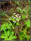
 Devil's Club |
 Trillium |
 Cloudy View |
 New Sign |
 Coltsfoot |
 Beneath The Clouds |
 Back To Clear Cut |
 Rattlesnake Ledge |
 Summit Tower |
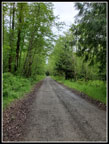
 Wide Forest Road |
 Narrow Trail Again |
 Dip To Cross Creek |
 Start Of Hike #2 |
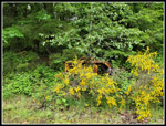 Scotch Broom |
 Off The Asphalt |
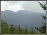 East Tiger Mountain |
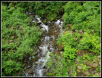 Canyon Creek |
 Big Leaf Trees |
 16 Miles Hiked |
Trips - 2020
Home