2-22-20
I
tried to avoid more rain by staying close to Seattle. Logging closed
down the South Tiger Traverse trail sometime after my last visit in
March 2018. The logging was done and it has reopened. Time to see what
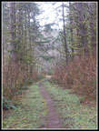
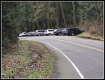
the trail looks like now. I arrived at the south Tiger Mountain Trail
(TMT) at 9:10 am. There were 8 or 9 cars there already. On the drive
over it began to rain at High Point on I-90 and continued until after I
passed Tiger Summit on Highway 18. It was misty at the trailhead but
not
raining. I was on the trail at 9:15 am. Not an early start but not too
late either. I expected mud after all the recent rain and brought high
top hiking boots. On the positive side there were almost no trees down
across the trails. There was mud but not all that bad
overall. I sped up the trail to the hiker/horse junction and went left
on the hikers trail. I passed a hiker coming down. Just before the next
junction I passed a hiker heading up. At the junction I noticed that
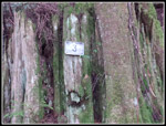
the old wooden signs are gone and metal signs are now at all the
junctions. Good news for anyone without a map or gps.
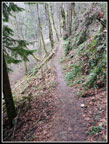
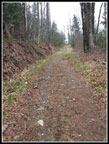
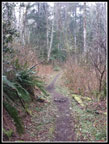
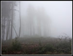
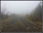
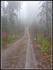
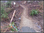
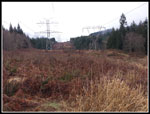
I turned left then right and steeply uphill. All junctions now signed. Up at the powerline corridor I had no views. The clouds were all around. I could see down but not out or up. No mountains in sight this day. The old road from here was first lined with blackberry bushes then more brush. I was soaked by dew along here one time. Not anymore. Now the trees are gone and the road is wide and graveled. The new sign posted the road as the South Tiger Traverse Trail. I was now in the clouds. Very misty with an eerie feeling. Once again I could hike a route I have done a dozen times and the gravel road and misty clouds made it seem entirely different. Part way up the hill A sign points off to the right on a dirt trail. I went up higher until the road levels off. Nothing to see. I returned to the trail junction. The trail heads into a bank of forest.
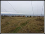
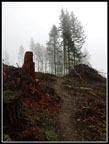
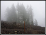
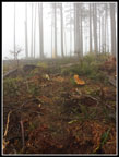
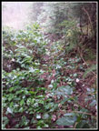
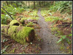
The upper part of the first summit of South Tiger has been logged. A band of trees that contain part of the old trail remains. I recognized some of the trail and a bridge that was replaced just a decade or so ago. The trail then climbs up out of the forest and into the cut. It levels off and heads below South Tiger. I was looking for the old stump with a face that marked the forested trail to the summit. I have seen photos of it since the logging. Much to my surprise I found it. The trail starts out climbing in grass and brush. There quite a few trees down that get in the way. I followed the route for a short way and lost it where three big trees are down and three more right beyond. The grass was soaked by dew and rain and My pants quickly became wet. It was not too tough to weave between the trees and slag and holes. It was tedious though. Soon I met a road. It went across the slope and I headed straight up. Walking up the road would have been a little longer but much easier. There are a few trees at the top. I will be interested to see what the views are like on a clear day.
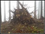
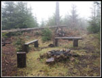
A big tree fell over at the summit and the root ball hole is good sized. I found a little of the old cache. Past time to put on rain pants. There used to be a boot path through the forest down to a road between the two South Tiger Summits. The road went in when the other summit was logged maybe ten years ago. I could not find the path but it was not hard at all to drop to the road. From there I turned left a short way to the end of the road. On my first visit on this route the other summit was completely bare. A boot path went up the bare slope to the summit. Now there are 15' - 25' tall trees. The route is overgrown but easy to follow. The benches and fire put remains. I recall on my first visit I could see the towers atop East Tiger and even Mt. Si. Those views are already gone. After some food and water I headed on.
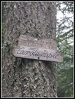
Down to the road then I followed it farther downhill. A side road went off left. I knew the road worked and I wondered if the side road would meet the South Tiger Traverse that was running parallel. It did. More signs at the STT trail. A right turn and i was back on trail. I passed three women hiking towards me. I quickly reached a road. I went left a short way and found the start of the trail up to the Carole Hapke picnic spot. It was built for horses and has an overgrown tie up spot. The trail is now very overgrown. I headed up. A bench is still there but it is all overgrown. Down I went. The road meets the road that I followed down from South Tiger. It continues dropping to where it meets the TMT. Now I had a decision to make. The South Tiger Circuit follows the TMT back to the trailhead. That is a 7 mile hike. Though ti was still damp and misty it had not yet rained. I chose to turn left and follow the TMT higher.
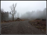
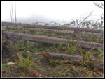
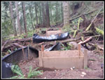
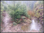
The TMT is a road for a few hundred feet until it crosses the road from Tiger Summit to Poo Poo Point. This part was also logged a few years ago. The TMT is in forest then in the cut. As I ascended a group of women runners passed me heading down. I had not seen many folks so far. At the big switchback I went straight ahead to the train wreck site. This spot is often muddy and was very muddy this day. I headed towards the creek where I found frames for cement footings for a new bridge. It seemed like a lot of work to replace the short wooden bridge there now. Most of the new trails on this side of Tiger are mountain bike trails. The TMT is not open to bikes. Why build a trail that ends at the TMT? I don't have an answer for that. Beyond the bridge site is a trail that was not there on my last visit.
Well, I have come this fare... I followed it. It crosses the hillside and climbs to the fats above. The trail splits. The right fork drops towards the road and.or the Iverson RR Trail. I went left. This is roughly where the old railroad grade was. Later it was resurrected as the Artifacts Trail.. That trail went to a very old logging camp with artifacts. I visited twice before recent logging obliterated it. This new trail ended at a road. A spotted whee the old RR grade met the new trail. just before the road. At the road I turned left uphill. I might as well get in more mileage and some more elevation gain. The road climbed until another new trail crossed the road. This one was still under construction. A sign asked to not hike it. I did not. I continued up the road until it flattened. This was the end of my road. Time to head back. I turned on my phone gps where I met the TMT and it was 1.6 miles to this spot. I returned the way I came. At the wreck site I noticed the date on the sign marking the site. It was one day short of 95 years since the 2-23-1925 date of the wreck.
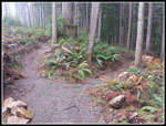
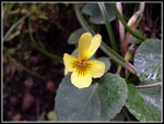
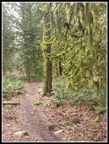
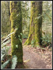
I hiked down to where I met the TMT and continued on it. The grade is very gentle along here. Lots of mossy trees and stumps along the way. I passed several groups along here. The route ends at a side road. The next turns all now have trail signs. I turned left and the side road goes out to under the powerlines. The sign here had been missing for many years. Right under the lines and left on the TMT dirt trail. This route took be back to the main junction where the horse and hiker routes met. This time I took the horse trail down. The highlight of this section was my first wildflower sighting of the spring. Two tiny yellow violets were beside the trail. The rest of the way back was fast and easy hiking. I reached the trailhead at 2:15 pm.
For the day I hiked 10 miles with 2100' of elevation gain. Though rain threatened all day it never fell. The wet brush and grass made it helpful to put on rain pants but it did not rain. I now know that the South Tiger Traverse Trail is open and in fine shape. Getting to the first South Tiger summit is now more difficult. The old trail is lost under logs and more logs are down. Harder but not too hard. I also have some new trails to explore. All in all it was a fun day on the trail. I saw more people than in years past but much less than on other sides of Tiger.
Click
on thumbnails to get
larger pictures.
Trips - 2020
Home
I turned left then right and steeply uphill. All junctions now signed. Up at the powerline corridor I had no views. The clouds were all around. I could see down but not out or up. No mountains in sight this day. The old road from here was first lined with blackberry bushes then more brush. I was soaked by dew along here one time. Not anymore. Now the trees are gone and the road is wide and graveled. The new sign posted the road as the South Tiger Traverse Trail. I was now in the clouds. Very misty with an eerie feeling. Once again I could hike a route I have done a dozen times and the gravel road and misty clouds made it seem entirely different. Part way up the hill A sign points off to the right on a dirt trail. I went up higher until the road levels off. Nothing to see. I returned to the trail junction. The trail heads into a bank of forest.
The upper part of the first summit of South Tiger has been logged. A band of trees that contain part of the old trail remains. I recognized some of the trail and a bridge that was replaced just a decade or so ago. The trail then climbs up out of the forest and into the cut. It levels off and heads below South Tiger. I was looking for the old stump with a face that marked the forested trail to the summit. I have seen photos of it since the logging. Much to my surprise I found it. The trail starts out climbing in grass and brush. There quite a few trees down that get in the way. I followed the route for a short way and lost it where three big trees are down and three more right beyond. The grass was soaked by dew and rain and My pants quickly became wet. It was not too tough to weave between the trees and slag and holes. It was tedious though. Soon I met a road. It went across the slope and I headed straight up. Walking up the road would have been a little longer but much easier. There are a few trees at the top. I will be interested to see what the views are like on a clear day.
A big tree fell over at the summit and the root ball hole is good sized. I found a little of the old cache. Past time to put on rain pants. There used to be a boot path through the forest down to a road between the two South Tiger Summits. The road went in when the other summit was logged maybe ten years ago. I could not find the path but it was not hard at all to drop to the road. From there I turned left a short way to the end of the road. On my first visit on this route the other summit was completely bare. A boot path went up the bare slope to the summit. Now there are 15' - 25' tall trees. The route is overgrown but easy to follow. The benches and fire put remains. I recall on my first visit I could see the towers atop East Tiger and even Mt. Si. Those views are already gone. After some food and water I headed on.
Down to the road then I followed it farther downhill. A side road went off left. I knew the road worked and I wondered if the side road would meet the South Tiger Traverse that was running parallel. It did. More signs at the STT trail. A right turn and i was back on trail. I passed three women hiking towards me. I quickly reached a road. I went left a short way and found the start of the trail up to the Carole Hapke picnic spot. It was built for horses and has an overgrown tie up spot. The trail is now very overgrown. I headed up. A bench is still there but it is all overgrown. Down I went. The road meets the road that I followed down from South Tiger. It continues dropping to where it meets the TMT. Now I had a decision to make. The South Tiger Circuit follows the TMT back to the trailhead. That is a 7 mile hike. Though ti was still damp and misty it had not yet rained. I chose to turn left and follow the TMT higher.
The TMT is a road for a few hundred feet until it crosses the road from Tiger Summit to Poo Poo Point. This part was also logged a few years ago. The TMT is in forest then in the cut. As I ascended a group of women runners passed me heading down. I had not seen many folks so far. At the big switchback I went straight ahead to the train wreck site. This spot is often muddy and was very muddy this day. I headed towards the creek where I found frames for cement footings for a new bridge. It seemed like a lot of work to replace the short wooden bridge there now. Most of the new trails on this side of Tiger are mountain bike trails. The TMT is not open to bikes. Why build a trail that ends at the TMT? I don't have an answer for that. Beyond the bridge site is a trail that was not there on my last visit.
Well, I have come this fare... I followed it. It crosses the hillside and climbs to the fats above. The trail splits. The right fork drops towards the road and.or the Iverson RR Trail. I went left. This is roughly where the old railroad grade was. Later it was resurrected as the Artifacts Trail.. That trail went to a very old logging camp with artifacts. I visited twice before recent logging obliterated it. This new trail ended at a road. A spotted whee the old RR grade met the new trail. just before the road. At the road I turned left uphill. I might as well get in more mileage and some more elevation gain. The road climbed until another new trail crossed the road. This one was still under construction. A sign asked to not hike it. I did not. I continued up the road until it flattened. This was the end of my road. Time to head back. I turned on my phone gps where I met the TMT and it was 1.6 miles to this spot. I returned the way I came. At the wreck site I noticed the date on the sign marking the site. It was one day short of 95 years since the 2-23-1925 date of the wreck.
I hiked down to where I met the TMT and continued on it. The grade is very gentle along here. Lots of mossy trees and stumps along the way. I passed several groups along here. The route ends at a side road. The next turns all now have trail signs. I turned left and the side road goes out to under the powerlines. The sign here had been missing for many years. Right under the lines and left on the TMT dirt trail. This route took be back to the main junction where the horse and hiker routes met. This time I took the horse trail down. The highlight of this section was my first wildflower sighting of the spring. Two tiny yellow violets were beside the trail. The rest of the way back was fast and easy hiking. I reached the trailhead at 2:15 pm.
For the day I hiked 10 miles with 2100' of elevation gain. Though rain threatened all day it never fell. The wet brush and grass made it helpful to put on rain pants but it did not rain. I now know that the South Tiger Traverse Trail is open and in fine shape. Getting to the first South Tiger summit is now more difficult. The old trail is lost under logs and more logs are down. Harder but not too hard. I also have some new trails to explore. All in all it was a fun day on the trail. I saw more people than in years past but much less than on other sides of Tiger.
 Hiker Only Trail Section |
 Steepest Climb |
 Powerline Corridor |
 New Road/Trail |
 Back On Old Trail |
 Into The Almost Clear Cut |
 Some Trees Left |
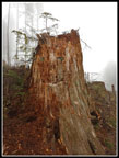 Face On Stump |
 Start Of Old Trail |
 Many Logs Down |
 South Tiger First Summit |
 Getting Cloudier |
 Second Summit |
 Heading Down |
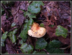 Mushroom |
 Lunch Spot |
 Overgrown Trail |
 New Bridge Site |
 Trail Junction |
 On Another Logging Road |
 Another New Trail |
 Old Artifacts Trail |
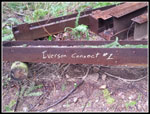 Iverson Connector |
 Train Wreck Debris |
 Back On TMT |
 3 Mile Marker |
 Mossy Forest |
 Powerlines Again |
 Yellow Violet |
 More Moss |
 Moss & Ferns |
 Parking Area |
Trips - 2020
Home