12-12-20
The
year is quickly coming to an
end and I was still short on my main two hiking goals. I have hiked at
lest 800 miles for the past 11 consecutive years and gained at least
200,000' for 17 consecutive years. With the pandemic hitting this year
it has been more challenging to get in miles and elevation than most
years. Just before the stay at home order hit in March John Sluder and
I hiked West Rattlesnake Mountain the long way from Highway 18. We
wanted to get in a long hike in case we were stuck near home for some
time. It turned out we were just a week later. Now, near the end of the
year I wanted another long trip with few folks seen. A rare repeat or
this 17 mile trip with 2500' of gain. The snow level was low the day
before and I hoped to see the road covered with enough snow to make it
beautiful but not impede hiking much. I got my with.
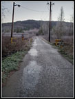
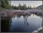
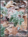
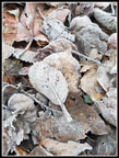
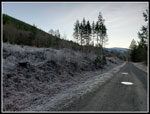
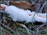
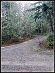
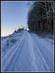
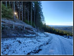
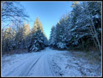
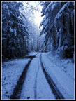
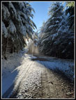
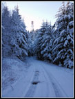
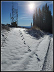
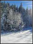
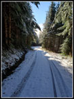
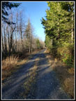
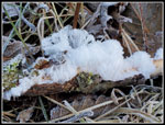
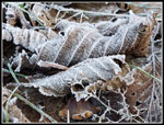
I headed out of North Seattle at 7:00 am in the dark and with fog. Heading east the fog cleared until I was east of Issaquah. It cleared again as I climbed up to about 1000' where I-90 meets Highway 18. I turned onto 18 and quickly reached my starting stop. It was 29 degrees at home and 35 degrees as I got started. It never become any warmer for my whole trip. When I finished in mid afternoon it was still 35 degrees. I arrived at 7:37 am. I was on my way at 7:43 am. It was really cold crossing the wetland. The road had some ice on it. Two bikers passed my almost immediately. I would not see any hikers or bikers again until near the summit. I reached the power sub station in a fast mile. The next 1.5 miles are flat. Near the 2.5 mile mark I saw some hair ice. I neat thing to see.
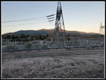
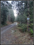
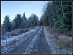
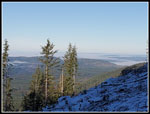
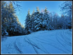
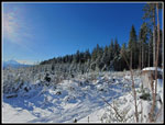
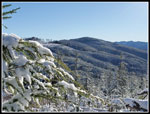
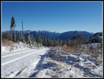
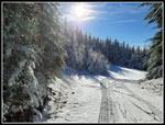
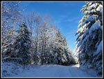
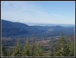
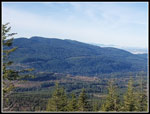
I crossed the bridge over the creek and began the climb. At least I warmed up on the ascent. At the top the grade lessens until the junction at 4.5 miles. Here I turned left and began the steady climb to the top. Soon there were a few small snow patches. As I climbed to 5 miles there was a bit more. Past the 5 miles mark the road was half snow covered. By 5.5 miles it was almost entirely snowy. The fairly new clear cut here has some good views out. Taylor Mountain is across the way and Tiger Mountain is just beyond. I could see the powerline corridor where Highway 18 is located. In the blue sky was overhead but at a distance the lowlands were under a layer of fog. Much to my surprise a truck passed me. The snow was untracked before. Now there tire tracks. I reached the main junction at near 6.5 miles at 10:03 am. I took 2:20 to hike 6.5 miles.
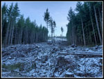
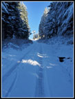
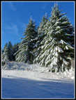
I passed one bike trail just before the junction. Now there were a number of bike tracks in the snow. The snow was only about 3 inches deep. Still easy walking. I trudge along until I reached the crossing of the trail up from Snoqualmie Point. There was a biker here. He mentioned the trail was a little icy. I carried Yaktrax but chose to stay on the road where footing was good. It also allowed me to avoid any other bikers coming up. Where the road switches back the Rattlesnake Mountain Trail is very close. I heard a number of women running and laughing on the RMT. The next leg had a little sunshine in places. It felt warm after being in the shade all the way up. From 6.5 miles on the trees were heavily flocked with fresh snow. The sun caused the snow to melt. The melting snow fell from the trees. The sky was blue but I was getting snowed on. Kind of a neat scene. I crossed the trail once more and reached the last switchback. This spot was completely in the sunshine and there was no wind. Very nice.
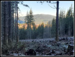
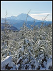
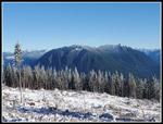
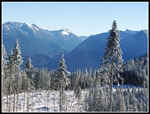
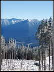
After a few minutes in the sunshine I hiked the short distance to the last bike trail crossing. I turned right on the trail and in a minute or two I left the forest and entered the clear cut. I arrived at 10:45 am. 3:02 to cover 8.1 miles. Mt. Rainier was in the clear to the south. The ridge leading to the east peak of Rattlesnake Mountain was right ahead. The biker I saw below was here. Did I mention the wind? It was blowing a steady 5-10 mph with higher gusts. Not all that strong but with the temperature around 30 degrees it was very cold. My jacket went on immediately. After some lunch I headed up the clear cut to the top of the mountain. From higher up I had views over to Mt. Si and Mt. Teneriffe. Those peaks and Mailbox, also in view, had big crowds. I saw a few folks over 8.1 miles of hiking. Not bad solitude at all.
There is a small building with steps up to the door. As on several other visits the steps were out of the wind. I had a spot to rest in sunshine and without the wind. Very nice. The views were great. The temperature was low. I hung around for quite a while. Taking photos required taking off my gloves and my fingers were soon frozen. Enough. I headed down to the lower towers then came back up. Time to head on down. It was now 11:32 am. I spent 47 minutes on top. I quickly reached the first switchback where the sun was still shining and the wind was non existent. I spent some time enjoying the sun before heading back into the shade. The trip down was pretty easy. Easy walking but the miles kept adding up. Once off the snow it was a bit warmer. Not warm enough for me to ever take off my jacket.
Down to the 4.5 mile junction. Then it was flat for a mile. I took one side trip over to the upper bridge over the creek. This .75 mile detour brought my total mileage up to 17 and my elevation gain up to 2500'. Once back on track I picked up the pace. Down the steep section, across the bridge, and down to the long flat section. By the 1.5 mile mark I met a couple hikers and a family. The only hikers seen all day. Back at the wetland near the end it was noticeably colder. As stated earlier, it was only 35 degrees back at the car. I arrived at the car at 2:18 pm. I took 2:46 to hike down including the detour.
I had a very nice hike. The 17 miles put me over 800 at 803. That makes the eleventh straight year. I am also now just 4,200' short of 200,000'. This will probably be my last 13+ mile hike of the year. The sunshine was great. The snow was scenic without slowing me down much. Pretty great conditions over all. I could have done with less wind on top but it was not all that bad. I really liked to have a pandemic year hike with so few folks seen and a wide road on those few times I did pass people. A great day to be out hiking.
Click on thumbnails to get
larger pictures.
Trips - 2020
Home
I headed out of North Seattle at 7:00 am in the dark and with fog. Heading east the fog cleared until I was east of Issaquah. It cleared again as I climbed up to about 1000' where I-90 meets Highway 18. I turned onto 18 and quickly reached my starting stop. It was 29 degrees at home and 35 degrees as I got started. It never become any warmer for my whole trip. When I finished in mid afternoon it was still 35 degrees. I arrived at 7:37 am. I was on my way at 7:43 am. It was really cold crossing the wetland. The road had some ice on it. Two bikers passed my almost immediately. I would not see any hikers or bikers again until near the summit. I reached the power sub station in a fast mile. The next 1.5 miles are flat. Near the 2.5 mile mark I saw some hair ice. I neat thing to see.
I crossed the bridge over the creek and began the climb. At least I warmed up on the ascent. At the top the grade lessens until the junction at 4.5 miles. Here I turned left and began the steady climb to the top. Soon there were a few small snow patches. As I climbed to 5 miles there was a bit more. Past the 5 miles mark the road was half snow covered. By 5.5 miles it was almost entirely snowy. The fairly new clear cut here has some good views out. Taylor Mountain is across the way and Tiger Mountain is just beyond. I could see the powerline corridor where Highway 18 is located. In the blue sky was overhead but at a distance the lowlands were under a layer of fog. Much to my surprise a truck passed me. The snow was untracked before. Now there tire tracks. I reached the main junction at near 6.5 miles at 10:03 am. I took 2:20 to hike 6.5 miles.
I passed one bike trail just before the junction. Now there were a number of bike tracks in the snow. The snow was only about 3 inches deep. Still easy walking. I trudge along until I reached the crossing of the trail up from Snoqualmie Point. There was a biker here. He mentioned the trail was a little icy. I carried Yaktrax but chose to stay on the road where footing was good. It also allowed me to avoid any other bikers coming up. Where the road switches back the Rattlesnake Mountain Trail is very close. I heard a number of women running and laughing on the RMT. The next leg had a little sunshine in places. It felt warm after being in the shade all the way up. From 6.5 miles on the trees were heavily flocked with fresh snow. The sun caused the snow to melt. The melting snow fell from the trees. The sky was blue but I was getting snowed on. Kind of a neat scene. I crossed the trail once more and reached the last switchback. This spot was completely in the sunshine and there was no wind. Very nice.
After a few minutes in the sunshine I hiked the short distance to the last bike trail crossing. I turned right on the trail and in a minute or two I left the forest and entered the clear cut. I arrived at 10:45 am. 3:02 to cover 8.1 miles. Mt. Rainier was in the clear to the south. The ridge leading to the east peak of Rattlesnake Mountain was right ahead. The biker I saw below was here. Did I mention the wind? It was blowing a steady 5-10 mph with higher gusts. Not all that strong but with the temperature around 30 degrees it was very cold. My jacket went on immediately. After some lunch I headed up the clear cut to the top of the mountain. From higher up I had views over to Mt. Si and Mt. Teneriffe. Those peaks and Mailbox, also in view, had big crowds. I saw a few folks over 8.1 miles of hiking. Not bad solitude at all.
There is a small building with steps up to the door. As on several other visits the steps were out of the wind. I had a spot to rest in sunshine and without the wind. Very nice. The views were great. The temperature was low. I hung around for quite a while. Taking photos required taking off my gloves and my fingers were soon frozen. Enough. I headed down to the lower towers then came back up. Time to head on down. It was now 11:32 am. I spent 47 minutes on top. I quickly reached the first switchback where the sun was still shining and the wind was non existent. I spent some time enjoying the sun before heading back into the shade. The trip down was pretty easy. Easy walking but the miles kept adding up. Once off the snow it was a bit warmer. Not warm enough for me to ever take off my jacket.
Down to the 4.5 mile junction. Then it was flat for a mile. I took one side trip over to the upper bridge over the creek. This .75 mile detour brought my total mileage up to 17 and my elevation gain up to 2500'. Once back on track I picked up the pace. Down the steep section, across the bridge, and down to the long flat section. By the 1.5 mile mark I met a couple hikers and a family. The only hikers seen all day. Back at the wetland near the end it was noticeably colder. As stated earlier, it was only 35 degrees back at the car. I arrived at the car at 2:18 pm. I took 2:46 to hike down including the detour.
I had a very nice hike. The 17 miles put me over 800 at 803. That makes the eleventh straight year. I am also now just 4,200' short of 200,000'. This will probably be my last 13+ mile hike of the year. The sunshine was great. The snow was scenic without slowing me down much. Pretty great conditions over all. I could have done with less wind on top but it was not all that bad. I really liked to have a pandemic year hike with so few folks seen and a wide road on those few times I did pass people. A great day to be out hiking.
 Icy Road |
 Frosty Wetland |
 Tiger & Substation |
 |
 Leaves Along Road |
 Long Straight Road |
 Hair Ice |
 4 1/2 Miles Done |
 Uphill At Junction |
 Snow Starts |
 View Of Tiger |
 Newer Clear Cut |
 Snow Covered Road |
 Foggy Lowlands |
 Truck Passes By |
 Sun Through The Trees |
 Flocked Trees |
 Upper Junction |
 Getting Very Cold |
 Sunny & Snowing |
 Tower In Sight |
 Almost On Top |
 Mt. Rainier |
 Sunshine! |
 East Rattlesnake Mt. |
 Mts Si & Teneriffe |
 SF Snoqualmie Valley |
 Mailbox Peak |
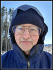 It's Me! |
 Road Continues |
 Snowy Trees |
 Lone Footprints |
 Heading Down |
 Sunny & Calm |
 Back In The Shade |
 Snow Is Thinning |
 Still A Little Fog |
 Tiger Summits |
 No More Snow |
 More Hair Ice |
 Leaves Still Icy |
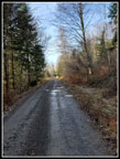 Long Straight Mile |
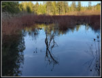 No Frost Reflection |
Trips - 2020
Home