9-06-21
Plans
for the Labor Day holiday weekend changed several times. The weather
and wildfire smoke forecast kept changing. We planned a three day
backpacking loop trip up the NF Skykomish and out West Cady Ridge. We
saw a report that water was much less available than we thought. Add in
a higher chance of smoke and we decided to change plans. Last Labor Day
weekend John and I hiked to Glacier Basin. Much to our surprise we saw
the usual pink and yellow monkey flower blooming in profusion. We also
saw pure white monkey flower. That is something neither of us had seen
or even heard about. We decided to go back and see if it was a fluke or
if they were there a second year. The forecast was for morning clouds
giving way to sunshine. It is a long and very strenuous hike so we
planned on an early start and a full day in Glacier Basin.
We met in Lynnwood at 6:10 am and headed north. On to the Mountain Loop Highway we went. We expected that there would be a lot of folks backpacking to Gothic Basin for the weekend. Still, I was surprised to see most all the spaces along the road at Barlow Pass were taken. Even down the road in both directions. We pulled into the upper lot and it was less than half full. We were quickly on our way leaving the 2361' pass at 7:21 am. Two other groups left just ahead of us. The old road to Monte Cristo is an easy walk. Slightly downhill for the first mile to the crossing of the SF Sauk River. Then slightly uphill for the next three miles. The first of two bridges washed out quite a few years ago. A big log crosses the first channel. The second bridge is just fine. We set out at a pretty fast pace and kept it up. There are a few leaves turning color already. Flowers are all finished.
Last year the big log over the river crossed a large puddle then crossed about a 15 foot wide channel. It was only about 4-5 inches deep. This year there was the puddle then no water at all in the channel. We crossed the second bridge and headed on. At the two mile mark the old wagon road, turned access for the superfund cleanup of Monte Cristo, is reached. We saw one tent at the crossing of the river and no more until Monte Cristo. Last year we saw a number of folks camping along the way. Two mountain bikers passed us. That was it. The hikers we started behind all went up the trail to Gothic Basin. We arrived at the bridge at the entrance to Monte Cristo at 8:38 am. Just over 4 miles in 1:17. Not bad at all. It was a bit cold at the start and with the total overcast it remained cool on the hike in. We did notice some humidity however.
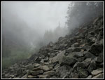
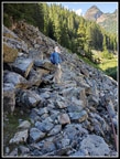
We took a short break at Monte Cristo. There were 8 bikes locked up in the bike rack. They were still there when we were heading back nearly six hours later. We did not see any of the riders. We hiked through the old town site and up the road turned trail to Glacier Basin. The humidity was more noticeable. The brush was a bit damp and there were spider webs everywhere. Looked like we were the first hikers of the day. Some more good though small bits of fall color along here. We took another short break at the waterfall. This spot is just above the big fan shaped falls. We never saw that coming up in the clouds. The flow was noticeably less than the year before. Now comes the hard part. The trail becomes a straight up gully with rocks to climb over, sleep rock slabs, and some hands on branches to pull yourself up. My knee has been a little sore and this was a bit more challenging than usual.
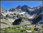
The last few times I have climbed up here there was a big rope to help in the steepest spot. It is now gone. Up one very steep part, a flatter part, and then another steep rocky bit. After than it was mostly just rocky and narrow trail. The upper part had very good sweet huckleberries last year. This year they were there but almost all were still tart. It has been a very good berry season but not here. The trail comes back to near the creek though far above it. At first there was running water. A little later the creek was under ground. No water and no sound of it at all. Shortly the water returned. Visibility was minimal in the clouds but they began to thin. Nearing the basin visibility improved a little. We entered the basin at 10:00 am. We could see down the basin to Ray's Knoll but there were still a lot of clouds. We met three backpackers heading out. They said they were the only folks in the basin the past night.
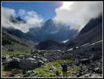
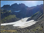
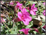
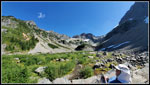
There was blooming pink and yellow monkey flower in the lower basin. We headed up the right side of the basin. Mostly all on big and small rocks. We headed up to cross part of it on snow. This is under the north facing ridge of the basin and snow had lasted into September at only 4500'. At the end of the snow we took the route up to the upper basin we had taken last year. Straight up a steep hillside of jumbled loose rocks. We took separate routes so as not to knock rocks down on the other. This brought us into the upper basin. The amount of snow looked similar to last year. Lots of pink and yellow patches of monkey flower. By now the sky had quickly cleared. Still some clouds covering peaks near the entrance to the basin. Otherwise the sky was mostly blue sky and sunshine. We found the spot with the white monkey flower from the previous year. No white ones. There were a number of flowers done blooming and some decomposing flowers looked a bit white. We did find two white/pink flowers. Much more white than pink.
This was the same calendar day as the year before but the flowers were farther along. Everything but monkey flower was finished. Some monkey flowers were peaking and some were done. We were a week or two too late. Still it was really beautiful. Braided creeks were running out of the snowfields. The wet ground is ideal for monkey flowers. We were in no hurry to leave. We took a lot of photos exploring around the upper basin. We finally packed up to leave at 12:25 pm. Last year we followed the creek around the right side of Ray's Knoll. Down loose rock and then a crossing of the cascading creek. It worked but was a bit of a pain. Coming up we saw the obvious low spot between Ray's Knoll and where we climbed up the loose rock. It just looked like a short cliff down to big rocks and then to the lower basin floor. We decided to head down left the the knoll to check it out. A boot path through the heather gave a clue that it might work. John peered down the cliff and found a reasonable way to get down. It was definitely hands on and it worked pretty well. A shorter and easier way down. We had seen two other groups from above.
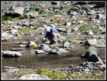
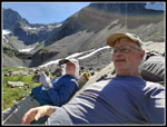
Now down in the basin one of the groups headed our way. We followed our up route back down the basin. We detoured over to Jim's Rock. Not an official name but one I have given it. A lost big step brought us tot he top. A perfectly angled rock with a large footrest to keep you in place. I have spent a number of hours resting and sleeping here. The sun was still above the south rim of the basin and it was warm but not too hot. We reached the rock at 1:04 pm and stayed until 2:26 pm. We pumped some water right next to the rock and headed out. The steep, rocky, and crappy trail/gully down to the waterfall was a real pain in the rear for me. Last year I had no real problem. My knee is fine for hiking but this is rocky scrambling. I was much slower than John would have been. Slowly and steadily we made it down. Another water stop at the falls and we continued back to the townsite. We met one guy between town and falls. We had seen remarkably few folks for a holiday evening. One more stop in Monte Cristo for food, water, and a short sleeve shirt. I had managed to soak my shirt sweating coming downhill.
A bit beaten up from the first 10 miles we set out for the last 4 on the road. We passed several groups coming out. After crossing the first bridge over the river we passed the trail over tot he log and checked out the other bridge. It too is a bit beaten up but easily crossed. The old approach and a long chuck of the road was completely washed out. What was a forest road alongside the river is now nothing but jumbled rocks. We spotted a trail that quickly meets the trail to the log bridge. our detour was shorter than crossing the log. Most of the summer it requires fording a channel of the river. Not right now.
When we reached the Gothic Basin Trail junction we found ourselves in a line of four groups. One behind us and several ahead of us. In short order we reached the gate. It was 5:50 pm. We came out in 1:20. The parking along the highway was still mostly full. The upper lot was mostly full. Either folks were staying past the holiday or going in this day. For all the cars we saw few folks as stated earlier. We expected a slow drive home from Everett south. It was not to be. Reaching I-5 at 6:45 pm traffic was pretty light. So much the better.
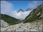
This turned out to be a great hike. The cool cloudy morning turning to sunny afternoon provided excellent hiking conditions. Cool on the climb and warm but not hot on the descent. It also provided excellent contrast for photos. Moody cloudy shots and bright sunny ones. As mentioned it was great to have so much solitude leaving from a packed parking lot. The monkey flower alone would have made for a great trip. Mixed results for the white variety. Along with 14 miles of hiking with abut 2600' of elevation gain was much photo time and relaxing time. We were out for more than 10 hours. I was still quite sore the next day but a small price to pay for a great summer hike.
Click on thumbnails to get
larger pictures.
Trips - 2021
Home
We met in Lynnwood at 6:10 am and headed north. On to the Mountain Loop Highway we went. We expected that there would be a lot of folks backpacking to Gothic Basin for the weekend. Still, I was surprised to see most all the spaces along the road at Barlow Pass were taken. Even down the road in both directions. We pulled into the upper lot and it was less than half full. We were quickly on our way leaving the 2361' pass at 7:21 am. Two other groups left just ahead of us. The old road to Monte Cristo is an easy walk. Slightly downhill for the first mile to the crossing of the SF Sauk River. Then slightly uphill for the next three miles. The first of two bridges washed out quite a few years ago. A big log crosses the first channel. The second bridge is just fine. We set out at a pretty fast pace and kept it up. There are a few leaves turning color already. Flowers are all finished.
Last year the big log over the river crossed a large puddle then crossed about a 15 foot wide channel. It was only about 4-5 inches deep. This year there was the puddle then no water at all in the channel. We crossed the second bridge and headed on. At the two mile mark the old wagon road, turned access for the superfund cleanup of Monte Cristo, is reached. We saw one tent at the crossing of the river and no more until Monte Cristo. Last year we saw a number of folks camping along the way. Two mountain bikers passed us. That was it. The hikers we started behind all went up the trail to Gothic Basin. We arrived at the bridge at the entrance to Monte Cristo at 8:38 am. Just over 4 miles in 1:17. Not bad at all. It was a bit cold at the start and with the total overcast it remained cool on the hike in. We did notice some humidity however.
We took a short break at Monte Cristo. There were 8 bikes locked up in the bike rack. They were still there when we were heading back nearly six hours later. We did not see any of the riders. We hiked through the old town site and up the road turned trail to Glacier Basin. The humidity was more noticeable. The brush was a bit damp and there were spider webs everywhere. Looked like we were the first hikers of the day. Some more good though small bits of fall color along here. We took another short break at the waterfall. This spot is just above the big fan shaped falls. We never saw that coming up in the clouds. The flow was noticeably less than the year before. Now comes the hard part. The trail becomes a straight up gully with rocks to climb over, sleep rock slabs, and some hands on branches to pull yourself up. My knee has been a little sore and this was a bit more challenging than usual.
The last few times I have climbed up here there was a big rope to help in the steepest spot. It is now gone. Up one very steep part, a flatter part, and then another steep rocky bit. After than it was mostly just rocky and narrow trail. The upper part had very good sweet huckleberries last year. This year they were there but almost all were still tart. It has been a very good berry season but not here. The trail comes back to near the creek though far above it. At first there was running water. A little later the creek was under ground. No water and no sound of it at all. Shortly the water returned. Visibility was minimal in the clouds but they began to thin. Nearing the basin visibility improved a little. We entered the basin at 10:00 am. We could see down the basin to Ray's Knoll but there were still a lot of clouds. We met three backpackers heading out. They said they were the only folks in the basin the past night.
There was blooming pink and yellow monkey flower in the lower basin. We headed up the right side of the basin. Mostly all on big and small rocks. We headed up to cross part of it on snow. This is under the north facing ridge of the basin and snow had lasted into September at only 4500'. At the end of the snow we took the route up to the upper basin we had taken last year. Straight up a steep hillside of jumbled loose rocks. We took separate routes so as not to knock rocks down on the other. This brought us into the upper basin. The amount of snow looked similar to last year. Lots of pink and yellow patches of monkey flower. By now the sky had quickly cleared. Still some clouds covering peaks near the entrance to the basin. Otherwise the sky was mostly blue sky and sunshine. We found the spot with the white monkey flower from the previous year. No white ones. There were a number of flowers done blooming and some decomposing flowers looked a bit white. We did find two white/pink flowers. Much more white than pink.
This was the same calendar day as the year before but the flowers were farther along. Everything but monkey flower was finished. Some monkey flowers were peaking and some were done. We were a week or two too late. Still it was really beautiful. Braided creeks were running out of the snowfields. The wet ground is ideal for monkey flowers. We were in no hurry to leave. We took a lot of photos exploring around the upper basin. We finally packed up to leave at 12:25 pm. Last year we followed the creek around the right side of Ray's Knoll. Down loose rock and then a crossing of the cascading creek. It worked but was a bit of a pain. Coming up we saw the obvious low spot between Ray's Knoll and where we climbed up the loose rock. It just looked like a short cliff down to big rocks and then to the lower basin floor. We decided to head down left the the knoll to check it out. A boot path through the heather gave a clue that it might work. John peered down the cliff and found a reasonable way to get down. It was definitely hands on and it worked pretty well. A shorter and easier way down. We had seen two other groups from above.
Now down in the basin one of the groups headed our way. We followed our up route back down the basin. We detoured over to Jim's Rock. Not an official name but one I have given it. A lost big step brought us tot he top. A perfectly angled rock with a large footrest to keep you in place. I have spent a number of hours resting and sleeping here. The sun was still above the south rim of the basin and it was warm but not too hot. We reached the rock at 1:04 pm and stayed until 2:26 pm. We pumped some water right next to the rock and headed out. The steep, rocky, and crappy trail/gully down to the waterfall was a real pain in the rear for me. Last year I had no real problem. My knee is fine for hiking but this is rocky scrambling. I was much slower than John would have been. Slowly and steadily we made it down. Another water stop at the falls and we continued back to the townsite. We met one guy between town and falls. We had seen remarkably few folks for a holiday evening. One more stop in Monte Cristo for food, water, and a short sleeve shirt. I had managed to soak my shirt sweating coming downhill.
A bit beaten up from the first 10 miles we set out for the last 4 on the road. We passed several groups coming out. After crossing the first bridge over the river we passed the trail over tot he log and checked out the other bridge. It too is a bit beaten up but easily crossed. The old approach and a long chuck of the road was completely washed out. What was a forest road alongside the river is now nothing but jumbled rocks. We spotted a trail that quickly meets the trail to the log bridge. our detour was shorter than crossing the log. Most of the summer it requires fording a channel of the river. Not right now.
When we reached the Gothic Basin Trail junction we found ourselves in a line of four groups. One behind us and several ahead of us. In short order we reached the gate. It was 5:50 pm. We came out in 1:20. The parking along the highway was still mostly full. The upper lot was mostly full. Either folks were staying past the holiday or going in this day. For all the cars we saw few folks as stated earlier. We expected a slow drive home from Everett south. It was not to be. Reaching I-5 at 6:45 pm traffic was pretty light. So much the better.
This turned out to be a great hike. The cool cloudy morning turning to sunny afternoon provided excellent hiking conditions. Cool on the climb and warm but not hot on the descent. It also provided excellent contrast for photos. Moody cloudy shots and bright sunny ones. As mentioned it was great to have so much solitude leaving from a packed parking lot. The monkey flower alone would have made for a great trip. Mixed results for the white variety. Along with 14 miles of hiking with abut 2600' of elevation gain was much photo time and relaxing time. We were out for more than 10 hours. I was still quite sore the next day but a small price to pay for a great summer hike.
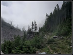
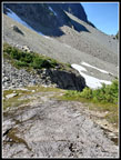
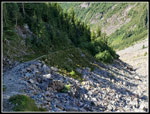
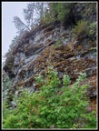 Blasted Hillside |
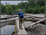 John On The Log |
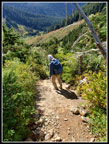
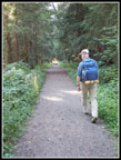
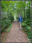 Narrow Old Road |
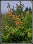 First Fall Color |
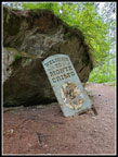 Entering Monte Cristo |
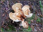 Mushroom |
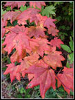 Nice Fall Color |
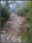
 Narrow Wet Trail |
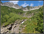
 John At Waterfall |
 Getting Steep |
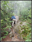 Some Easy Scrambling |
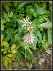 Asters |
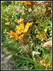
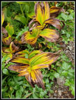 Colorful Hellebore |
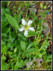 White Flower |
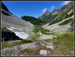
 Cloudy Trail |
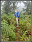
 Outstanding Trees |
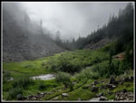 Misty Meadow |
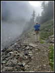
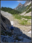
 Cloudy On Walkway |
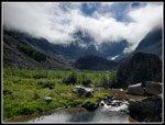 Entering Glacier Basin |
 John & Monte Cristo Pk |
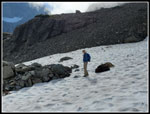 Snow Crossing |
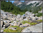
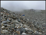 Heading Up Rocks |
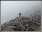
 High Point Of Day |
 Cloudy Peaks |
 Upper Basin |
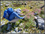 John At Work |
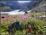 Monkey Flowers & Snow |
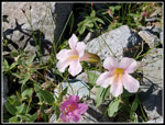 Pale Pink Monkey Flower |
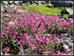 Pink Profusion |
 More Photos |
 Close Up |
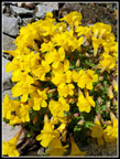 Wall Of Yellow |
 Heading Down |
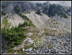
 Lower Basin View |
 Part Way Down |
 Jim's Rock |
 Rare Selie |
 Basin From Rock |
 Basin Wide Angle |
 Leaving Basin |
 Trail Ahead |
 Steep Part Coming |
 Waterfall From Below |
 More Fall Color |
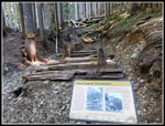 Historical Sign |
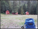 Monte Cristo Townsite |
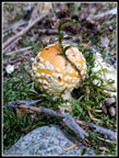 Another Mushroom |
 Nearing The End |
Trips - 2021
Home