1-18-21
Gary
joined me for a hike up Mt. Si via the less used Mt. Teneriffe
Road/Trail. His recuperation from surgery has allowed him to keep
upping the elevation gain. He was ready for the mid 3000's. I used this
trailhead three times last year as a way to take a longer route up
Teneriffe and Si with a much smaller crowd. We met at the Mt. Teneriffe
Trailhead at 7:50 am and were on the trail at 8:00 am. It was chilly
but a dry day. Gary had only done a small part of the Teneriffe Road
remake as a trail and had not done the new half mile trail that
connects up the the old road route. There were cars in the lot ahead of
us but it was far from full. We climbed up the new trail and settled
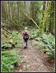
into a steady pace on the mostly flat road as it headed towards Mt. Si.
Recent rains had all the creeks flowing strong. There are some bridges
and some rock hops along the way.
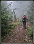
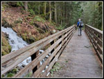
We reached the third and last bridge at 1.4 miles having gained only 520'. The waterfall from the bridge was really flowing. Now the route gets down to climbing. For an old logging road it is pretty steep. We brought yaktrax in case of packed snow up high. It was not clear if or where we would hit snow.We had snow up high earlier but as mentioned the recent hard rain had washed a lot away. The climb is a bit of a grind. The old road has been converted to trail. In places it is very trail like. Where there is little brush it still looks a bit like a road. Just a lot of switchbacks up the steep slope.
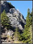
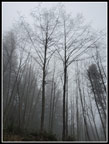
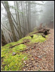
When we reached the switchback with a wooden bench the view was entirely blocked by clouds. Just after the next switchback is a bit better viewpoint. Trees are starting to close out that view but there is still a bit of a look at Mt. Rainier, Rattlesnake Lake and Ledges, and Mailbox Peak. No views to be seen. Just up the road I looked back and did see the summit of Mt. Teneriffe. we were hiking directly away from it. On my three trips up last year I saw at least on person hiking up faster or coming down already. Not his day. We had still not seen a single person. The trail grade flattens then the final climb up to the junction with the trail over to Mt. Si. Many years ago I hiked up here looking for a route over to Mt. Si. There were a number of deteriorating logging spurs. Most were not on the map. It took me three trips to find the correct route. Now there is an improved trail to Si.
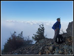
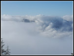
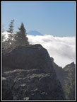
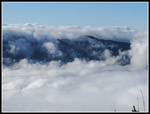
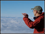
As we hiked higher snow began to appear. At the unmarked trail over to Blowdown Mountain we passed the first person seen all day. He was stopped on his way down. From there it was not far to the high point. It was a bit slick but we did not need traction devices. We dropped down and into Haystack Basin. We now had some blue sky overhead. From the side we had an unusual view of the summit haystack of Mt. Si. We dropped into the basin and then across to the viewpoint above North Bend. There was no North Bend. There was nothing below us but the top of the clouds layer. Some blue sky above and white clouds below us. This is one of my favorite hiking experiences. Below it was dark under the clouds. We had bright sunshine. Well, some sunshine. It went in and out of clouds to the south. It was much clearer to the west. In the sunshine it was pretty pleasant. When it went away it was pretty chilly.
We were along for some time. Then a coupe guys arrived. Then a small group. Then a few more folks. We were spread out for plenty of social distancing but we did lose our solitude. We arrived at 10:25 am. We spent a full hour on top. We would not have much sunshine on the backside of the mountain. I hated to go. We dropped down to the Teneriffe junction. Gary was feeling good and asked if I wanted to go up that route a ways. It starts out pretty steeply. Why not? When we reached a total of 3600' of gain for the day we turned around.
Going down we did see some folks coming up. No repeat of the ascending solitude. Compared to the Mt. Si Trail it was very uncrowded. We had no trouble passing the folks we saw. We reached the trailhead at 2:00 pm. The lot was mostly full but with a number of empty spaces. The Teneriffe Falls Trail is pretty popular so I was a little surprised to see the lot was not full.
This was an excellent trip. Gary got in the most elevation gain since last summer, we saw almost nobody on the way up, and we had some solitude on top of Si. The lower cloud level and sun shining on them was a treat. When the sun shone on us it was actually not that cold. The totals on the day including our little climb in the descent was 10 miles hiked with 3600' of elevation gain. Last year my first 3000' gain was at the end of February. This year it was only mid January. It was nice to get in a lot of elevation gain in January with almost no snow and not a lot of other people. A good day indeed.
Trips - 2021
Home


