12-03-22
I
needed another big mileage day as
I push for my second 1000 mile year. The forecast had overnight snow
and wind gusts in the 20 mph+ range. What to do? The wind was expected
from the east. I looked for something protected from the wind. I could
do a long trip up Coal Creek to Red Town and then onto the Cougar
Mountain trails. The wind forecast was lower and I would be hiking from
west to east with Cougar Mountain blocking the wind. Also, the
trailhead at 170' elevation would likely have less snow and ice. I was
on the road at 7:55 am. The road in front of my house was the snowiest
one of the day. I exited onto Coal Creek Parkway with no snow in sight.
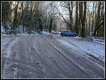
I arrived at the trailhead at 8:30 am. It was 34 degrees. I knew that
work was done at the old trailhead which had room for 5 or 6 cars just
off the road. It was not until looking at the satellite image the night
before that I found out there are now 18 general parking spots off the
road and one handicapped parking spot. I arrived to find one car in the
lot. That person returned and drove away while I was putting on my
boots. I was on the trail at 8:35 am.
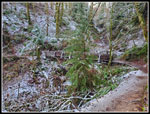
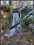
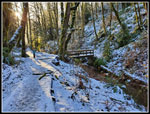
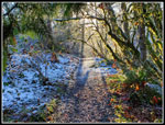
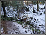
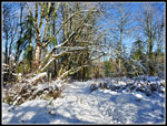
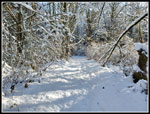
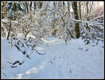
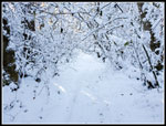
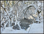
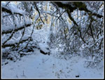
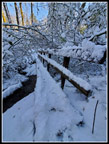
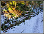
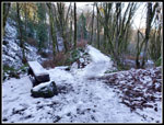
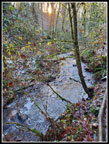
The recent snow and frost left everything white. The trail had little snow but it was white. All the tree branches were white. The bridges had ice on them. It was a very pretty setting. Branches were weighted down by icy snow too. I had to duck under several on the Coal Creek Trail. I have visited this trail more than half a dozen times over the past 39 years. There were improvements since my last visit in 2010. On my first visit, the route was more of a boot path. Now it is a very nice trail with bridges. switchbacks, and plenty of signs. From the start to Red Town was 2.8 miles. I came back via the Primrose Trail and it was 2.9 miles. Up to Red Town and back adds 5.7 miles to my usual Cougar Mountain hikes.
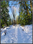
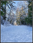
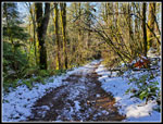
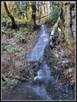
The day started sunny and stayed that way. The creek sits far down in a valley and I did not have much sunshine until I reached Red Town. I also did not have company. I saw nobody for the first 3.8 miles of the hike. Most of the hike was on thin or well packed snow. That usually means microspikes. Much to my surprise, the footing was good enough I never put them on. I did finally put on gaiters but not until the top of AA Peak where the snow was more than boot high in the meadow. There was one good waterfall on the way up and another on the Primrose Trail coming down. I reached Red Town at 9:42 am. I took 1:07 to hike 2.8 miles. The lot at Red Town was only about one third full. I headed up the Military Road. I have been hiking this route since the start of Covid as it is not crowded. Lots more icy trees and slightly deeper snow as I ascended. At 3.8 miles I reached the Sky County Trailhead. I saw the first person of the day. The lot was snow covered with no tire tracks or cars. l had not seen it empty before.
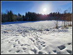
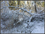
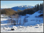
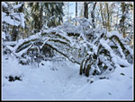
The big meadow was snow covered and in the sunshine. I continued on and quickly reached the Cave Hole Road. My short hike along the road included several trees down across it. I had to push through the icy branches then duck down under the tree to get by. I would be doing much more this later on. I took the Bypass Trail over to Fred's Railroad. At this point I decided to do a counterclockwise loop to the Clay Pit and then Anti-Aircraft Peak. Fred's Railroad was no problem. I then turned left on the East Fork Trail. It is only 1 mile to the Clay Pit Road near the Clay Pit. In that distance, I had to go over, under, or through a lot of trees over the trail. I was ducking way down to get through on many of them. I had to crawl for ten feet to get through one icy mess. The snow fell off as I pushed through. A good way to get wet. I had made very good time up until this section. It slowed me way down. I was very happy to reach Jerry's Duck Pond and the end of the worst of the icy tree branches. I reached the Clay Pit at 11:25 am. With the high easterly winds, I expected the open Clay Pit to be very windy. It was not. I never did have any winds on the whole trip.
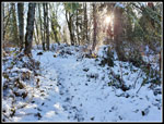
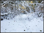
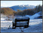
I did have some very nice views from the Clay Pit. The bench had lots of snow on it. The entire pit was white with snow. The clear cuts on Tiger Mountain made it easy to see the summits of Tiger 3, Tiger 2, and Tiger 1. They were all covered with snow. I could also see Mt. Si and the Cascade Mountain front. After a few photos, I was off for AA Peak. The traction was great as I descended to Tibbets Creek. I had to push through another down tree with lots of branches to get on the bridge. Another tree was hanging over the bridge I had to duck down while crossing the icy bridge. The good news it that I did not fall off. All the white snow and ice with sun shining down in this more open section was very beautiful. In addition to getting through the down and low hanging trees, I also kept stopping for photos of the winter wonderland. The snow was never more than 7" deep but it covered everything.
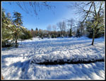
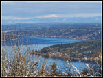
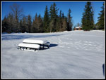
As I reached AA Peak I detoured over to the Million Dollar View. Most of the year the leaves on the trees block most of the views. This day with all the leaves fallen, I had a very good look at Lake Sammamish with Mt. Baker above it. Sun shone on the fresh snow of Baker and really lit it up. The parking lot was empty with only one set of deep tracks. I think the lot was closed lower down. I headed for the meadow for lunch in sunshine. The first picnic shelter was in the shade. The one across the meadow was in sunshine. I put on gaiters as the snow was deep enough to get in my boots. I sat in the shelter at a picnic table and the low sun shone right on me. It felt much warmer. The entire day was in the mid 30s. With all the slowdowns it was 12:14 when I arrived. I had taken 3:39 minutes to hike 8.0 miles. I had just over 4 hours left before sunset. My lunch break lasted until 12:23. While I sat there I heard two big "whomp" noises. The snow on the roof fell on two sides. All that snow made noise and would be heavy enough to knock me down if I was under it.
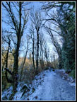
After the short lunch, it was time to head back. I still had about 6 miles to go. I usually go down the Lost Beagle Trail to the Klondike Swamp Trail. In previous years I have seen several trees down across those trails. I chose to head back the way I came up then turn onto the trail back to Cougar Pass. This was a good choice I did not have any down trees all the way back to the Clay Pit Road. I crossed that road and completed the loop. I was now on the Bypass Trail heading down the route I had come up. It was easy going back to the Sky Country Trailhead. I detoured here across the big meadow as it was out in the sunshine. I had to break trail but it was worth it for the warmth. I made good time on the mile back to Red Town, arriving at 1:41 pm.
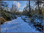
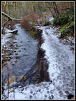
Now I just had to hike back down the Coal Creek Trail. As I descended into the gorge, I said goodbye to the sunshine. As I mentioned earlier, I took the Primrose Loop Trail for variety. There are quite a few bridges in this section. In the morning, all the ground and most all tree branches were coated in white. After a day slightly above freezing, much of the ground in the last miles was brown dirt. Some trees I had to duck under were now higher as the weight of the ice had melted away. I arrived back at the trailhead at 2:43 pm, well before sunset. The lot was now three quarters full.
This turned out to be a great hike. I did not know what to do the night before and this idea provided no wind, an easy drive, snow but not slick walking, and a real winter wonderland without deep snow or crowds. I hoped to get in about 10 miles and ended up with 14. That is the most miles I have hiked at Cougar Mountain. The trip had only 1600' of elevation gain but with all the snow and mileage it was a very good workout. After a record 120 mile November, December was off to a great start.
Click on thumbnails to get
larger pictures.
Trips - 2022
Home
The recent snow and frost left everything white. The trail had little snow but it was white. All the tree branches were white. The bridges had ice on them. It was a very pretty setting. Branches were weighted down by icy snow too. I had to duck under several on the Coal Creek Trail. I have visited this trail more than half a dozen times over the past 39 years. There were improvements since my last visit in 2010. On my first visit, the route was more of a boot path. Now it is a very nice trail with bridges. switchbacks, and plenty of signs. From the start to Red Town was 2.8 miles. I came back via the Primrose Trail and it was 2.9 miles. Up to Red Town and back adds 5.7 miles to my usual Cougar Mountain hikes.
The day started sunny and stayed that way. The creek sits far down in a valley and I did not have much sunshine until I reached Red Town. I also did not have company. I saw nobody for the first 3.8 miles of the hike. Most of the hike was on thin or well packed snow. That usually means microspikes. Much to my surprise, the footing was good enough I never put them on. I did finally put on gaiters but not until the top of AA Peak where the snow was more than boot high in the meadow. There was one good waterfall on the way up and another on the Primrose Trail coming down. I reached Red Town at 9:42 am. I took 1:07 to hike 2.8 miles. The lot at Red Town was only about one third full. I headed up the Military Road. I have been hiking this route since the start of Covid as it is not crowded. Lots more icy trees and slightly deeper snow as I ascended. At 3.8 miles I reached the Sky County Trailhead. I saw the first person of the day. The lot was snow covered with no tire tracks or cars. l had not seen it empty before.
The big meadow was snow covered and in the sunshine. I continued on and quickly reached the Cave Hole Road. My short hike along the road included several trees down across it. I had to push through the icy branches then duck down under the tree to get by. I would be doing much more this later on. I took the Bypass Trail over to Fred's Railroad. At this point I decided to do a counterclockwise loop to the Clay Pit and then Anti-Aircraft Peak. Fred's Railroad was no problem. I then turned left on the East Fork Trail. It is only 1 mile to the Clay Pit Road near the Clay Pit. In that distance, I had to go over, under, or through a lot of trees over the trail. I was ducking way down to get through on many of them. I had to crawl for ten feet to get through one icy mess. The snow fell off as I pushed through. A good way to get wet. I had made very good time up until this section. It slowed me way down. I was very happy to reach Jerry's Duck Pond and the end of the worst of the icy tree branches. I reached the Clay Pit at 11:25 am. With the high easterly winds, I expected the open Clay Pit to be very windy. It was not. I never did have any winds on the whole trip.
I did have some very nice views from the Clay Pit. The bench had lots of snow on it. The entire pit was white with snow. The clear cuts on Tiger Mountain made it easy to see the summits of Tiger 3, Tiger 2, and Tiger 1. They were all covered with snow. I could also see Mt. Si and the Cascade Mountain front. After a few photos, I was off for AA Peak. The traction was great as I descended to Tibbets Creek. I had to push through another down tree with lots of branches to get on the bridge. Another tree was hanging over the bridge I had to duck down while crossing the icy bridge. The good news it that I did not fall off. All the white snow and ice with sun shining down in this more open section was very beautiful. In addition to getting through the down and low hanging trees, I also kept stopping for photos of the winter wonderland. The snow was never more than 7" deep but it covered everything.
As I reached AA Peak I detoured over to the Million Dollar View. Most of the year the leaves on the trees block most of the views. This day with all the leaves fallen, I had a very good look at Lake Sammamish with Mt. Baker above it. Sun shone on the fresh snow of Baker and really lit it up. The parking lot was empty with only one set of deep tracks. I think the lot was closed lower down. I headed for the meadow for lunch in sunshine. The first picnic shelter was in the shade. The one across the meadow was in sunshine. I put on gaiters as the snow was deep enough to get in my boots. I sat in the shelter at a picnic table and the low sun shone right on me. It felt much warmer. The entire day was in the mid 30s. With all the slowdowns it was 12:14 when I arrived. I had taken 3:39 minutes to hike 8.0 miles. I had just over 4 hours left before sunset. My lunch break lasted until 12:23. While I sat there I heard two big "whomp" noises. The snow on the roof fell on two sides. All that snow made noise and would be heavy enough to knock me down if I was under it.
After the short lunch, it was time to head back. I still had about 6 miles to go. I usually go down the Lost Beagle Trail to the Klondike Swamp Trail. In previous years I have seen several trees down across those trails. I chose to head back the way I came up then turn onto the trail back to Cougar Pass. This was a good choice I did not have any down trees all the way back to the Clay Pit Road. I crossed that road and completed the loop. I was now on the Bypass Trail heading down the route I had come up. It was easy going back to the Sky Country Trailhead. I detoured here across the big meadow as it was out in the sunshine. I had to break trail but it was worth it for the warmth. I made good time on the mile back to Red Town, arriving at 1:41 pm.
Now I just had to hike back down the Coal Creek Trail. As I descended into the gorge, I said goodbye to the sunshine. As I mentioned earlier, I took the Primrose Loop Trail for variety. There are quite a few bridges in this section. In the morning, all the ground and most all tree branches were coated in white. After a day slightly above freezing, much of the ground in the last miles was brown dirt. Some trees I had to duck under were now higher as the weight of the ice had melted away. I arrived back at the trailhead at 2:43 pm, well before sunset. The lot was now three quarters full.
This turned out to be a great hike. I did not know what to do the night before and this idea provided no wind, an easy drive, snow but not slick walking, and a real winter wonderland without deep snow or crowds. I hoped to get in about 10 miles and ended up with 14. That is the most miles I have hiked at Cougar Mountain. The trip had only 1600' of elevation gain but with all the snow and mileage it was a very good workout. After a record 120 mile November, December was off to a great start.
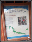 Trailhead Signboard |
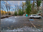 Parking Lot |
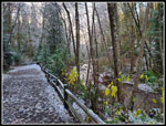 Creek & Trail |
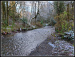 Coal Creek |
 Long Bridge |
 Snowy Grade |
 Thick Ice |
 Bare Trees & Ice |
 First Waterfall |
 Nice Scene |
 Sun Lit Moss |
 Red Town |
 Sky Country Bridge |
 Blue Sky |
 Low Sunlight |
 Sky Country Lot |
 Highlighted Branches |
 Big Meadow |
 Cave Hole Road |
 More Obstacles |
 East Fork Trail |
 More Difficulties |
 Snow Everywhere |
 Jerry's Duck Pond |
 Almost To Clay Pit |
 Snowy Bench |
 Clay Pit Road |
 Clay Pit & W Tiger Mt. |
 Snowy Tibbets Bridge |
 Mt. Baker |
 Snowy AA Peak |
 Snowy Obstacle |
 Melting Snow |
 Bare Trail |
 Winter Scene |
 Second Waterfall |
 Coal Creek Near End |
 Trail Undercut |
Trips - 2022
Home