10-16-22
Another
day of offshore winds, high
temperatures, and smoke in the lowlands. When I went to bed on Saturday
the AQI at my home was 160. The day before I headed up to hike the
Snoqualmie Tunnel to avoid the smoke to find clear air in the upper SF
Snoqualmie River Valley off I-90. This day I was planning to head to
the
tunnel to avoid the worsening smoke. The tunnel hikes very fast. It is
completely flat. I did not get up as early as usual. This day was
supposed to be warmer than the 75 degrees on Saturday but the tunnel is
always about 54 degrees. No need to beat the heat. I checked the air
quality and very much to my surprise it was enormously better than 8
hours earlier when I went to bed. The 160 AQI was not 70. In North Bend
it was 40. Even at Cougar Mountain it was only 45. Scratch the tunnel
hike for the second day in a row. At $5.40/gallon, I was okay with a
shorter drive. I hiked 8 miles with 2400' of gain on Wednesday
afternoon/evening and 8 miles with 2400' of gain on Saturday. An easier
hike sounded good to me.
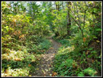
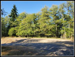
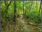
On Cougar Mountain I would have a short drive after a late start and the ability to get in a fast longer hike with less elevation gain than mountains farther east. More miles, less time in the car, and home earlier. That sounded good. I was out the door at about 8:10 am and on the trail at 8:44 am. The lot was only about 2/3 full. On a sunny weekend day it would usually be nearly full by this time. The air was clean as shown on the websites. I planned a 10+ mile loop with only the trail up Wilderness Peak repeated. I headed off on the Wildside Trail and then the Indian Trail. As I would see all day there were few hikers and a lot of runners passing by me. After a ridiculously dry summer there was no point detouring to Far Country Falls or Doughty Falls. The creek for Doughty was completely dry. The bridge crossed a dry creek bed.
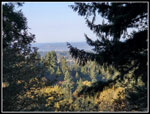
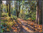
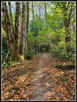
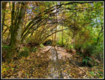
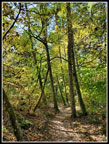
It was a a bit chilly at the start but when I left the valley floor and headed up to Far Country Lookout the temperature rose dramatically very fast. I stopped at the lookout to zip off pants legs roll up my sleeves. It was plenty warm the rest of the day. As I headed on I had the low morning sun right in front of me. Forest blocked much of it but not all. The trees and fallen leaves were lit up very nicely. I took quite a few photos while the lighting was so good. Some leaves have fallen but many are shriveling up and still on the trees. Later in the day I saw many deciduous trees still full of green leaves. This is mid October. The leaves are supposed to turn color and fall. I turned off the Shy Bear Trail onto the Deceiver Ridge Trail. This took me over the ridge and down to the Doughty Falls creek. As mentioned there was no water at all. Now I had to climb up to the top of Deceiver Ridge. It was getting very warm already.
I slowed down as sweat feel into my eyes. This was morning in mid October? I reached the short side trail up Long View Peak at 10:04 am. I was 3.7 miles along in 1:20. That was 2.7 mph including stops and photos. I was off to a good start. There were several hikers up at the forested peak so for once I did not go on up. I zoomed on to The top of the Shy Bear Passs Trail where the new trail up Wilderness Peak takes off. I stumbled onto the mostly finished new trail last December and hiked the open new trail this spring. The old trail was .40 miles right up the fall line to the summit. The new one is .60 miles with an easy grade and switchbacks. That would add .40 miles round trip to my usual route. This trail is getting well known. I passed half a dozen groups on the short climb up. At the summit were three hikers so I just turned around and headed down.
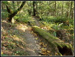
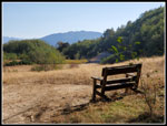
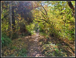
I dropped back down to Shy Bear Pass and took the SB Trail downhill. At the junction that continues down to Far Country Lookout, I went right on Fred's Railroad. I passed the Quarry Trail and continued on to the East Fork Trail. I took a right and was off towards the Clay Pit. Runners continued to zip by me as they had been doing all day. At the Clay Pit I stopped for a food and water break. I sat on the newish bench and discovered that even with my 35" inseam, my feet dangled. That is unusual for me. Yesterday I drove through Issaquah and all of Tiger Mountain was hidden by smoke and dirty air. This day it was very clearly visible. What a difference a day makes. Especially when the wind was blowing mountain wildfire smoke down to the Puget Sound Basin. I packed up and headed on the trail to Anti-Aircraft Peak. The low point crosses Tibbetts Creek on a log bridge. The creek was dry and there was not even any moisture at all in the creek bed.
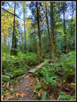
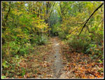
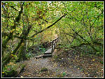
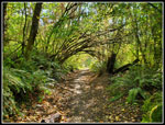
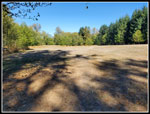
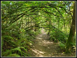
I climbed up to the trailhead and parking lot at AA Peak. The Million Dollar View was not with a buck fifty as the trees still had leaves. I went to the far end of the very brown grassy field for a last break. It was very hot crossing the field as I was now out of the forest. It was very nice in the shade under a big evergreen tree. I arrived at 11:51 am and stayed until 12:20 pm. I was 8.5 miles into my hike. The rest of the way was almost entirely downhill. I headed over to the highest point on AA Peak and picked up the Lost Beagle Trail. It drops steadily down to the Klondike Swamp Trail. Most all the trees atop AA Peak still have green leaves on them. The Klondike Swamp Trail is fairly flat and goes through some neat arbors. There were fallen yellow leaves and leaves still on the arches. This made for some more good photos.
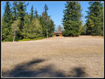
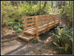
I crossed the Clay Pit Road and at the start of Fred's Railroad I turned onto the Bypass Trail. This quickly brought me to the Cave Hole Road. It is the quickest way down to Red Town where I started. I followed it until I reached the Nike Horse Trail and turned onto it. This is a little longer but is a more interesting trail. By now it should be clear that there are a lot of trails on Cougar Mountain. I hiked just over a dozen of them on this loop trip. I passed the big meadow where the underground Nike Missiles used to be housed. As expected, there were no signs of green grass there. I turned onto the Sky Country Trail at the Sky Country Trailhead. That took be down to the Military Road. There is a brand new bridge near the junction. Now I just had half a mile down to my car. I saw more hikers near the trailhead as expected. I arrived at the finish at 1:33 pm. The lot was still not full. There was a home Seahawks game starting right about that time so that might have had something to do with it. My shirt was soaked at the end. It turned out that this day was 88 degrees at Sea-Tac Airport. That is the latest day to have 80+ degrees in Seattle history. It was almost 90 degrees. I finished before the hottest time of day but it was very warm, especially for mid October.
For the second day in a row I planned to hike underground in the Snoqualmie Tunnel to avoid really bad wildfire smoke in the mountains and the lowlands. For the second day in a row I ended up hiking above ground in forest with clear air. It was so much better than expected. I appreciated the short drove home and the easy hiking. It turned out to be 12 miles with 2000' of gain but the trails were never all that steep. I made very good time when I was not taking breaks or stopping for photos. For the last 5 days I hiked 28 miles with 6800' of elevation gain. Not bad at all for a week of wildfire smoke. It turned out far better than I expected.
Click on thumbnails to get
larger pictures.
Trips - 2022
Home
On Cougar Mountain I would have a short drive after a late start and the ability to get in a fast longer hike with less elevation gain than mountains farther east. More miles, less time in the car, and home earlier. That sounded good. I was out the door at about 8:10 am and on the trail at 8:44 am. The lot was only about 2/3 full. On a sunny weekend day it would usually be nearly full by this time. The air was clean as shown on the websites. I planned a 10+ mile loop with only the trail up Wilderness Peak repeated. I headed off on the Wildside Trail and then the Indian Trail. As I would see all day there were few hikers and a lot of runners passing by me. After a ridiculously dry summer there was no point detouring to Far Country Falls or Doughty Falls. The creek for Doughty was completely dry. The bridge crossed a dry creek bed.
It was a a bit chilly at the start but when I left the valley floor and headed up to Far Country Lookout the temperature rose dramatically very fast. I stopped at the lookout to zip off pants legs roll up my sleeves. It was plenty warm the rest of the day. As I headed on I had the low morning sun right in front of me. Forest blocked much of it but not all. The trees and fallen leaves were lit up very nicely. I took quite a few photos while the lighting was so good. Some leaves have fallen but many are shriveling up and still on the trees. Later in the day I saw many deciduous trees still full of green leaves. This is mid October. The leaves are supposed to turn color and fall. I turned off the Shy Bear Trail onto the Deceiver Ridge Trail. This took me over the ridge and down to the Doughty Falls creek. As mentioned there was no water at all. Now I had to climb up to the top of Deceiver Ridge. It was getting very warm already.
I slowed down as sweat feel into my eyes. This was morning in mid October? I reached the short side trail up Long View Peak at 10:04 am. I was 3.7 miles along in 1:20. That was 2.7 mph including stops and photos. I was off to a good start. There were several hikers up at the forested peak so for once I did not go on up. I zoomed on to The top of the Shy Bear Passs Trail where the new trail up Wilderness Peak takes off. I stumbled onto the mostly finished new trail last December and hiked the open new trail this spring. The old trail was .40 miles right up the fall line to the summit. The new one is .60 miles with an easy grade and switchbacks. That would add .40 miles round trip to my usual route. This trail is getting well known. I passed half a dozen groups on the short climb up. At the summit were three hikers so I just turned around and headed down.
I dropped back down to Shy Bear Pass and took the SB Trail downhill. At the junction that continues down to Far Country Lookout, I went right on Fred's Railroad. I passed the Quarry Trail and continued on to the East Fork Trail. I took a right and was off towards the Clay Pit. Runners continued to zip by me as they had been doing all day. At the Clay Pit I stopped for a food and water break. I sat on the newish bench and discovered that even with my 35" inseam, my feet dangled. That is unusual for me. Yesterday I drove through Issaquah and all of Tiger Mountain was hidden by smoke and dirty air. This day it was very clearly visible. What a difference a day makes. Especially when the wind was blowing mountain wildfire smoke down to the Puget Sound Basin. I packed up and headed on the trail to Anti-Aircraft Peak. The low point crosses Tibbetts Creek on a log bridge. The creek was dry and there was not even any moisture at all in the creek bed.
I climbed up to the trailhead and parking lot at AA Peak. The Million Dollar View was not with a buck fifty as the trees still had leaves. I went to the far end of the very brown grassy field for a last break. It was very hot crossing the field as I was now out of the forest. It was very nice in the shade under a big evergreen tree. I arrived at 11:51 am and stayed until 12:20 pm. I was 8.5 miles into my hike. The rest of the way was almost entirely downhill. I headed over to the highest point on AA Peak and picked up the Lost Beagle Trail. It drops steadily down to the Klondike Swamp Trail. Most all the trees atop AA Peak still have green leaves on them. The Klondike Swamp Trail is fairly flat and goes through some neat arbors. There were fallen yellow leaves and leaves still on the arches. This made for some more good photos.
I crossed the Clay Pit Road and at the start of Fred's Railroad I turned onto the Bypass Trail. This quickly brought me to the Cave Hole Road. It is the quickest way down to Red Town where I started. I followed it until I reached the Nike Horse Trail and turned onto it. This is a little longer but is a more interesting trail. By now it should be clear that there are a lot of trails on Cougar Mountain. I hiked just over a dozen of them on this loop trip. I passed the big meadow where the underground Nike Missiles used to be housed. As expected, there were no signs of green grass there. I turned onto the Sky Country Trail at the Sky Country Trailhead. That took be down to the Military Road. There is a brand new bridge near the junction. Now I just had half a mile down to my car. I saw more hikers near the trailhead as expected. I arrived at the finish at 1:33 pm. The lot was still not full. There was a home Seahawks game starting right about that time so that might have had something to do with it. My shirt was soaked at the end. It turned out that this day was 88 degrees at Sea-Tac Airport. That is the latest day to have 80+ degrees in Seattle history. It was almost 90 degrees. I finished before the hottest time of day but it was very warm, especially for mid October.
For the second day in a row I planned to hike underground in the Snoqualmie Tunnel to avoid really bad wildfire smoke in the mountains and the lowlands. For the second day in a row I ended up hiking above ground in forest with clear air. It was so much better than expected. I appreciated the short drove home and the easy hiking. It turned out to be 12 miles with 2000' of gain but the trails were never all that steep. I made very good time when I was not taking breaks or stopping for photos. For the last 5 days I hiked 28 miles with 6800' of elevation gain. Not bad at all for a week of wildfire smoke. It turned out far better than I expected.
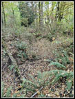 Coal Creek? |
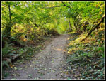 Nice Morning Light |
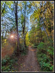 Low Morning Sun |
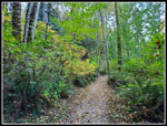 Zooming Along |
 Far Country Lookout |
 Shy Bear Trail |
 Bridge |
 Long View Junction |
 Light & Shadows |
 Fallen Leaves |
 Tunnel |
 Meandering |
 Clay Pit |
 Tibbetts Creek Bridge |
 AA Peak Meadow |
 Leaves Still On Trees |
 Lost Beagle Trail |
 Leafy Arbor |
 Colorful Leaves |
 Another Arbor |
 Nike Meadow |
 New Bridge |
 Weaving Trail |
 Last Arbor |
Trips - 2022
Home