04-15-22
In
my business, Good Friday
is a holiday. I get a day off that few other people do. I almost always
get out for a hike with a lot of solitude. I mentioned to Gary that it
was coming up. He was free and John decided to take a vacation day to
join us. We had snow in the mountains at the start of the week. Gary
suggested a snowshoe hike. We decided on Kendall Peak Lakes. Gary and I
used to ski up to the lakes when only a few folks went up there. Later,
snowshoeing became very popular and we started running into big crowds
of them heading up as we skied down. Not being a great skier, I had
enough trouble skiing down an ungroomed road. Add in snowshoers walking
up side by side and it was just not much fun. We started snowshoeing up
the road most of the time. Our last
visit
was on 12-30-19. We wanted to get out of town before morning traffic
picked up. We chose to meet at High Point at 7:15 am.
Traffic out of North Seattle was very light. I zoomed down I-5 and onto I-90. I arrived at the High Point exit at 7:07 am. Gary and John arrived just a few minutes later. I had the sno-park permit so I drove. We headed over Snoqualmie Pass and exited at Hyak. There was only 1 parked car. Gary told him he had his lights on and was draining his battery. He was not heading onto the trails. We were packed and on our way at 7:52 am. We decided to start with snowshoes on our packs. There was a packed trench with about 2" of fresh snow in it. Pretty good conditions for just booting it. It was 29 degrees and completely overcast. Right after the start is an old cement bridge. I recalled it was damaged on our last trip. There is just a narrow strip connecting the far end. We passed by easily enough.
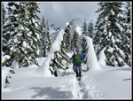
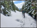
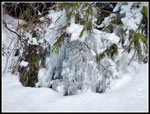
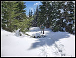
The road starts flat and soon we turned left and started climbing. I was expecting solitude for a late season snowshoe trip on a Friday. I was a little surprised to see that there was nobody ahead of us. There were no tracks on the new snow. The road climbs steadily. Never very steep and never entirely flat. I was heating up quickly. The recent snow had flocked all the trees. That made it look like mid winter and not three weeks into spring. It was very pretty scenery to see and photograph. The road is heavily forested. We could just hear the highway but not see out. At one point we did have a small window to see the ski area on the other side of I-90. There are a couple switchbacks along the way. The trench did not get much snowier and we had no trouble hiking in boots. A step outside the trench meant sinking into soft foot deep snow. We stayed in the track.
After the switchbacks the road makes a ninety degree turn tot he right and follows above a creek valley On the other side is a point that is rapidly becoming reforested. It was a bare clearcut when I fist started skiing up the road. Long ago I snowshoed to the top of it several times. We continued up the road to the "T" junction. The road used to drop left and cross the creek on a concrete bridge. The bridge has been gone for some years now. Almost everyone turns right and follows the road tot he ridge top. We stopped at the junction and took a break. It was 9:38 am. We had covered exactly 3 miles in 1:46. Our usual route is to cross the creek and go cross country up to the lakes. With a foot or more of soft snow I was inclined to just follow the road in the packed trench. Gary was up for a bit more of an adventure and I agreed to take the shorter but more difficult option.
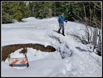
We pulled out our snowshoes to put them on. I slid my foot into the first one and grabbed the rubber strap. If fell off in my hand. Not a good sigh. The next one fell off without a pull. The entire binding was very brittle. There was no way I could post hole in soft fresh snow without snowshoes. Our chances of reaching even the lower lake now looked pretty bleak. Ironically, a year earlier we snowshoed up the Nordic Pass Trail across the highway and John had a binding strap break in the middle of the trip. We turned around and another one broke. We had to jury rig it for him to get back down. Now it was my turn. I had been using my Lightening Ascents most of the time the past couple years but I thought I had used these Denali Ascents fairly recently. Oh well...
The trench was getting a little snowier but it was still easy enough to keep booting our way higher. The road section up to the ridge top is on a steep slope. The snow was quite deep on the uphill side. The trench was right near the steep drop on the right side. At the ridge top we looked to see the trench conditions ahead. A trench turned left and climbed the ridge towards the lakes. The more popular short road to the right goes to a viewpoint called Kendall Knob. The track up that was not in place. That was a surprise. It was doubtful that I could get up there even following a track set by Gary and John. Continuing towards the lakes was the best option. I was in the lead for this section. Some folks turned around at the ridge top. Part way up the ridge some more turned around. A trench was still in place but with fewer folks compacting it it became softer. Every dozen or so steps I post holed. I was only sinking in 5-6 inches but it was a lot more work.
We stopped one more time where the track left the road and headed left to the lower lake. Gary and John went first and packed the track down a bit. I followed. Now I was sinking in up to my knees in places. We were close to the lake but I was moving very slowly. I was too close to turnaround now. It took a while but I caught up to them at a flat spot looking across and down to the lower lake. The middle lake was out of the question but at least I saw the lower one. We stopped for lunch. It was now 10:45 am. We had traveled just about 4 miles so far. There was a cold light breeze that make it much colder than on the way up. While we were there a couple skiers passed by heading down to the lake. We did not see them again. Three hours into the day we saw the first people. That never happens on a weekend on the route.
Our break lasted until 11:17 for Gary and John. I started back a bit earlier since I was going to be so slow. Before leaving, I checked out the other snowshoe. With one binding completely brittle it was a good guess the other one was too. Except it was not. It was just fine. I put it on and it helped a bit heading down. I replaced the original bindings some years ago. All I can guess is that I only replaced one of them. Now One foot stayed atop the snow and the other one sank down. Better but now great. I was still pretty slow. We kept the snowshoes on when we reached the road. I did much better dropped down the ridge. At the bottom We saw a track was now in place heading up to Kendall Knob. Gary and John headed up. I quickly fell out of sight. With just four sets of snowshoes since the snow fell, it was still very soft. Now one foot floated and one fell up to my knee. At one point a small tree fell and created void. The others walked right over it. I fell in to my crotch and still did not touch anything solid. It took some time and effort to get out. It was only .30 miles up but it took me a long time. I was beat when I reached the viewpoint. The two women who put in the track were their too.
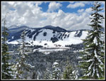
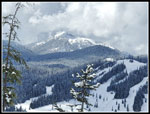
The view was great. Alta Mountain and Rampart Ridge went in and out of the clouds. Lake Keechelus was below. Summit Central was just across the valley. We picked out some tiny downhill skiers. John noticed that one left was running. The sun now began to break out. The sky was still partly cloudy but some sunshine really warmed us up. Soon, the camp robber jays zeroed in on us. I was dive bombed a time or two while eating a snack. Our early start was helpful. Even with my slow speed, it was still only 11:59 am when Gary and John arrived. I did not record my own gps track so I would guess I was about 5+ minutes behind them. With the sunshine and some views it was hard to get motivated to leave. We stayed until 12:28 pm. I did not want to get back to Seattle at the peak of rush hour traffic.
The first .30 miles was a pain for me. Once back on the road it as much better. We kept our snowshoe(s) on past the "T" junction. Where the road leaves the creek valley makes a left 90 degree turn we stopped and took them off. The two women passed us here.The road was a bit softer in the afternoon but not a problem with just boots. On the way down we saw two more groups of two. That brought us up to 8 people seen the entire day. Not bad solitude on a very popular snowshoe route. The sun on the flocked trees provided a different view than on the way up. I also applied sunscreen when I took off my snowshoe. It was getting pretty toasty. The last mile seemed to go on and on. I was pleased to reach the flat part again. A few minutes later we crossed the broken bridge and arrived at the car. It was 2:26 pm
I look forward each year to my Good Friday hike when I can do very popular trails without the weekend crowds. This trip worked out great. Fresh snow and flocked trees in mid April was a treat. We had just a little snow fall on us but no rain. It was not very windy. The sun even came out. Very nice conditions overall. It was my first snowshoe trip of the year. The extra weight on your feet and wider steps take a toll on muscles used to just hiking. With only one snowshoe and a lot of sinking in and having to pull myself out of those holes it was tiring. I would have preferred to use the snowshoes I carried much of the day but it all worked out okay in the end. The only disappointment was not being able to snowshoe u to the middle lake. It turned out to be a great spring day for a winter-like snowshoe trip.
Trips - 2022
Home


