01-22-22
We had been under an inversion for about a week. Thick fog near the
surface and sunshine above. I sat in the sun last Saturday then
descended back into the cold mist. This weekend we were looking for
more of the same. No snow in weeks left a hard crust in the mountains.
We chose to hike a one way trip across Rattlesnake Mountain. The lower
ends were bare with snow higher up. No recent trip reports left the
actual snow conditions unknown. We chose to take microspikes but not
snowshoes. We met at Snoqualmie Point at 7:30 am and headed to
Rattlesnake Lake at the other end of the Rattlesnake Mountain Trail
(RMT).
Most of the drive was in the dark but it was clear at the start. We
have done this trip before. We start at the lake and climb up to
Rattlesnake Ledge before the crowds arrive. This year it did not work.
The parking lot was about 3/4 full at 7:50 am when we started our hike.
I guess that is not early enough in January any longer.
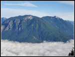
We made good time hiking around the lake and then on the 1.9 miles of trail to the lower ledge. On the way up we passed a few folks ascending and passed many more already coming down. It looks like sunrise at the ledge is now a thing. I had heard that the trail was being improved and noticed that a number of steps and rocks have been removed. It is a very smooth trail now. I also heard that steps were built for the last short bit to the lower ledge. We arrived to see the new steps. Just before the stop is a view north to Mt. Si and Mt. Teneriffe. There was fog in the lowlands and most of the mountains were in bright sunshine. So were we at the lower ledge. There was the expected crowd so we just took some photos and headed on. It was still snow free as we hiked up to the middle and upper ledges. We stopped at the upper ledge for some more photos. There were two couples at that spot.
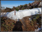
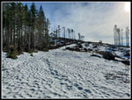
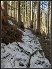
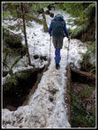
On we went. The trail climbs straight up the ridge and then begins a traverse to the left. At the start of the traverse, we started to see a little snow on the trail. We started to see small trees and branches down across the trail. We did not have a saw but were able to remove several, sliding them off the trail. Another hiker coming down had a hatchet and cut another in half so we could remove it. In quite a few spots were able to clear small logs from the trail. After switching back, the trail became more snow covered. We soon stopped to put on microspikes. Footing was not terrible in boots but much better with the spikes. Up above the old quarry we passed two younger guys. In fairness, most of the guys were younger. We crossed the snowy road and continued. I started to sink in a little along here. I was getting pessimistic about making it all the way across the traverse as the snow became deeper in the clearcut along the ridge top.
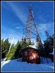
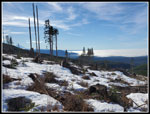
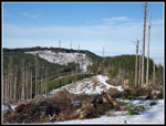
At the next crossing of the road we stopped for food and water break. The two other hikers passed us by. They stopped to and started up before us. The snowy boot path slowed us down as we sank in in places and had solid steps in others. As we slogged along I looked right and noticed we were right under the East Summit tower. The snow did not look to be very deep. I joked that we should go straight up. Gary thought about it and started up. Much to our surprise, the snow held. We quickly reached the tower. At least 3+ feet of snow at the tower. The other guys went farther on the trail then went up to the road. They arrived soon after us. There are no longer any views from the actual summit so wen went down the road to the spot with a bench and views out to the north. The bench was buried by snow.
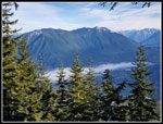
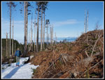
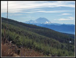
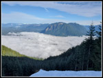
We took a short break in the sunshine. It felt really nice. So far, we had hiked 4.5 miles of the 10.4 total. We were at our highest point. The trail descends as it heads for the West Peak. There were some footprints. In places there were deep post holes. This day it was not that soft. I sank a bit but not too badly. I really did not want make it to the clearcut and start do sink deeply. That would mean climbing back to the summit and then down to the car. As we entered the clear cut the snow depth dropped significantly. Back at the break spot, I managed to sink in to my crotch and had to climb out. Now the snow was not deep enough for that to happen. In fact the snow in the open was firm enough. We did a little post holing but by and large it was not bad. In the clearcut we could see the West Peak and out to the south. Below us was a sea of white. The low clouds/fog filled all the lowlands. Anyone near the surface was in a dank, damp, dark place. We were in bright sunshine.
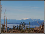
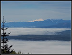
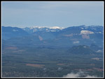
In places the snow was gone and we verified that we were on the actual trail. Near the ridge top we had views north to Mt. Baker and Three Finger. We stopped near hear for a longer stop. Once we went back into forest that would be the end of the bright sunshine. There was no wine all and it was much warmer hear than down in the cities. We stopped at 11:50 am and did not get started again until 12:17 pm. I could have stayed longer but we still had quite a ways to go. We could see footprints below us on the road to the middle tower. The tracks were heading to the forest. We followed them a ways then decided to take a sharp left turn and work our way over to the road. The road had more footprints than the real trail. The road was nicely consolidated making for good footing. More importantly, we were still out in the sunshine where the trail was just inside the edge of the forest.s
Farther down we found the spot where the old road/trail meets the new trail. At that point we left the open sunshine. One hiker we met mentioned a long stretch of post holing but we never saw it. It might have been on the section of trail we bypassed. It was a bit softer going over to Grand Prospect but it was not bad at all.
We arrived at Grand Prospect at 12:58. It took us nearly 4.5 hours to hike 6.4 miles. The first 2.2 miles only took about 50 minutes. We did take a lot of breaks and the snow did snow us down. We also took a lot of photos. Neither of us was in a hurry to get back under the inversion. Last fall the five trees that had grown up from below Grand Prospect to block the view were removed. This trip it looks like even more trees are gone now. We could see from Mt. Baker to the north to North Bend and the peaks around it. The view should outlive me now. We expected the snow to be better packed down below Grand Prospect and that is exactly what happened. We removed quite a few more logs and branches on the section before the road/trail dives into the forest. Our microspikes stayed on a bit longer until the now thinned out. There was more snow near the small bridge over the creek and a little more just above Stan's Overlook. That was the end of it.
We saw some folks heading up but far fewer than I expected. After Rattlesnake Ledges in the first few miles we had a lot of solitude along the route. we reached the car at 3:10 pm. Gary drove back to my car at Rattlesnake to end the trip. Snoqualmie Point was out of the clouds but as I drove home I went back under the low fog/cloud layer. This trip worked out even better than I expected. There were a lot of cars at the start but after the ledges we left crowds. The first roughly 2.5 miles from each end was bare. The middle 5.4 miles was all or mostly on snow. The snow was deep at the East Peak but not too awfully soft. Not bringing snowshoes was the right call. The sunshine was great. The views of peaks with a big white sea of clouds below us was great too. This was the third straight sunny day I have had on the trail in January. That is most unexpected. It will probably another year or two before we do the one way Rattlesnake Traverse again but this day it was almost perfect.
Trips - 2022
Home


