01-29-22
I
needed to get in some mileage and
elevation gain and get home by early afternoon. I had 3 packages and
one book being delivered this day. I had a hard time coming up with a
trip. I decided on a Tiger Mountain hike starting at Sunset Way. This
is a very low start maximizing elevation gain. It also is not High
Point where I have been doing so many day and night hikes this winter.
I had a pretty early start arriving at about 7:40 am. The lot was
already about 2/3 full. I was on my way at 7:43 am. It was a less than
balmy 30 degrees. The quick climb to the Tradition Plateau helped to
warm me up. I chose to take the Adventure Trail to the High School
Trail then get on the Poo Poo Point Trail. It was forecast to be the
last dry day before rain returned. We have had several dry weeks with
low clouds/fog that often did not burn off all day. It was clear and
warmer above the inversion layer. I was getting a little tired of the
dark dank days in the city.
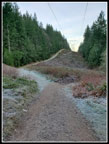
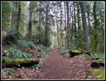
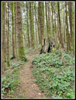
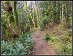
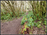
I had considered taking the Section Line Trail but veered right onto the High School Trail. This route is one I have done many times over many decades. It used to be a way to get to Poo Poo Point (PPP) without seeing many folks. Those days are over. It can get crowded though nothing like the Chirico Trail to PPP. With an early start I usually see few if anyone else. Not this day. I started seeing runners coming down and a few going up. We did a headlamp hike on Thursday evening and I was a little unsure how I would feel with only one day of rest. Turns out, I felt pretty good. I kept up a steady pace on the old logging road turned trail. As a road it is set at a very moderate grade. I crossed the big bridge and headed for the end of the road. At that point the trail heads straight up the fall line. The first part is very steep. Except it is not any more. The road ended at a switchback and new trail heading up at a moderate grade. This is new since my last visit a couple years ago.
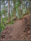
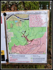
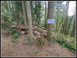
I soon recognized the old trail. The night before I was mystified by the Gaia map online. The PPP Trail continues up to the West Side Railroad Grade. Here grade goes left and right goes to PPP. Straight is the start of the One View Trail. The map showed there is no four way junction. Something was different. I did not spend any time figuring it out. Now I found the answer. A 150' feet below the railroad grade is a new trail. This one goes right and meets the old trail that dropped from the railroad grade. This new trail is shorter and saves about 150' of elevation gain going and returning from PPP. I took the new trail. It is still easy enough to find the junction with the old trail. The last part is on the old road I have long hiked. I reached PPP at 9:13 am. I had hiked 3.90 miles in 90 minutes. Not too bad for tired legs. I took some photos and was quickly back on my way. There were 4 or 5 groups on the high point.
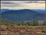
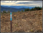
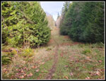
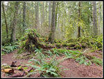
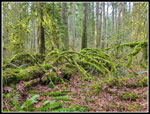
On the way back to the junction of the PPP Trail with the now lower starting One View Trail I debated where to go. I could go up to the railroad grade and follow it to the Section Line and then up Tiger 3. The only problem is the grade does not get much maintenance and we had a big storm a few weeks earlier. Lots of trees were likely down on the route. Did I want to climb over all of them? Not really. Another good option was to hike down the PPP Trail then up the Section Line and down the Nook Trail and out. That would get good mileage and elevation gain. The tops of Tiger 1, 2, and 3 were clearcut in early fall. The top of the Poo Top Trail was obliterated. We saw it from atop Tiger 1 earlier. The trees began not too far below and I was curious how easy it is to hike up to the summit now. I decided to at least head on up the One View a ways and decide if I wanted to go for Tiger 1.
I hiked to the first bump on the One View and decided to continue on. I saw a few runners up here. I was a bit surprised as the Tiger Mountain Trail has been obliterated between the top of the One View and Tom's Crossing on the north side of Tiger 2. That is the main route for runners to get from here to the popular north side trails. At the TMT junction I went right to the Hidden Forest Trail and then up the steep climb to the main road to Tiger 2. At the road I met a lone hiker exiting the Poo Top Trail. I quizzed him and found there is no snow at the top and the scramble through the slash of the clearcut was not too bad. I decided to continue to the top of Tiger 1. At the road I checked the Internet. I was surprised to get a signal. My 3 packages were delivered at 8:04 am. That is about 4 hours earlier than ever before. Amazon usually delivers at my house at about 2:00-5:00 pm. That was not part of the plan. The book was delivered at 10:03 am. That was about 5 hours earlier than usual. To heck with it. I was going to the summit.
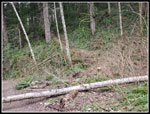
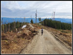
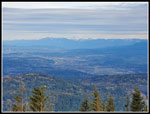
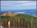
The Poo Top has some very steep sections. It follows right on the ridge top. There is one tree down that I had to go around. Not a big problem. I reached the start of the clearcut to see the summit buildings not that far above. It turned out to be only 115' to the top. I quickly lost the real trail under logs and branches. It was a bit of a pain but not very difficult to reach the top. I arrived to see a runner heading by on the summit road. Clouds were coming in but I had a pretty good view of the Cascade peaks and down to Bellevue and Lake Sammamish. I had a little water, took some photos and headed down. I reached the top at 10:37 am. I had hiked abut 6.7 miles gaining roughly 3100'. Now it was almost all downhill. I slogged back through the clearcut and then picked up the pace going down. From the clearcut I reached the road in 16 minutes. I took my lunch break there. Then it was back down the trail.
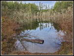
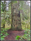
On the way back I did not detour over to PPP again. As expected, once on the PPP Trail I started to see more people. There was a steady stream though with some long gaps in between. I decided to do a loop at the bottom. Rather than retrace my steps, at the bottom of the PPP Trail I turned right onto the Gas Line Trail. Not much of a trail. It is a thin brown line on a grassy pipeline right of way. It is also a lot softer on feet than the gravel road that runs parallel to it. I took it to the Bus Trail and then left, right, and left again in short order to Round Lake. The lake is almost becoming a marshy meadow in the summer. It is a real lake in the winter. I checked my mileage and saw I would be a little short of 12 miles. I decided on a detour to the Big Tree. The tree is 24' 4" in circumference. A big tree indeed. My detour did the trick. I dropped off the plateau and down to my car with a full 12 miles under my belt. Ups and downs on the way back brought the total elevation gain to 3400'.
I was down at 1:07 pm. I was home by 1:45 pm. I thought that would be earlier enough to beat the package deliveries. Instead, they sat on my front steps for nearly 6 hours. They were all there and accounted for. This was a really fun hike. I hiked a short new section and a longer new trail for the first time. I was early enough to miss most of the crowds that showed up later. I was not early enough to miss a number of morning runners however. This was my first hike with over 3000' of gain this year. It was my fourth hike of eight that was 11 or more miles long. The next day I was out on a rainy umbrella hike but this was the last in a strange for January series of dry hikes. A fun day indeed.
Click on thumbnails to get
larger pictures.
Trips - 2022
Home
I had considered taking the Section Line Trail but veered right onto the High School Trail. This route is one I have done many times over many decades. It used to be a way to get to Poo Poo Point (PPP) without seeing many folks. Those days are over. It can get crowded though nothing like the Chirico Trail to PPP. With an early start I usually see few if anyone else. Not this day. I started seeing runners coming down and a few going up. We did a headlamp hike on Thursday evening and I was a little unsure how I would feel with only one day of rest. Turns out, I felt pretty good. I kept up a steady pace on the old logging road turned trail. As a road it is set at a very moderate grade. I crossed the big bridge and headed for the end of the road. At that point the trail heads straight up the fall line. The first part is very steep. Except it is not any more. The road ended at a switchback and new trail heading up at a moderate grade. This is new since my last visit a couple years ago.
I soon recognized the old trail. The night before I was mystified by the Gaia map online. The PPP Trail continues up to the West Side Railroad Grade. Here grade goes left and right goes to PPP. Straight is the start of the One View Trail. The map showed there is no four way junction. Something was different. I did not spend any time figuring it out. Now I found the answer. A 150' feet below the railroad grade is a new trail. This one goes right and meets the old trail that dropped from the railroad grade. This new trail is shorter and saves about 150' of elevation gain going and returning from PPP. I took the new trail. It is still easy enough to find the junction with the old trail. The last part is on the old road I have long hiked. I reached PPP at 9:13 am. I had hiked 3.90 miles in 90 minutes. Not too bad for tired legs. I took some photos and was quickly back on my way. There were 4 or 5 groups on the high point.
On the way back to the junction of the PPP Trail with the now lower starting One View Trail I debated where to go. I could go up to the railroad grade and follow it to the Section Line and then up Tiger 3. The only problem is the grade does not get much maintenance and we had a big storm a few weeks earlier. Lots of trees were likely down on the route. Did I want to climb over all of them? Not really. Another good option was to hike down the PPP Trail then up the Section Line and down the Nook Trail and out. That would get good mileage and elevation gain. The tops of Tiger 1, 2, and 3 were clearcut in early fall. The top of the Poo Top Trail was obliterated. We saw it from atop Tiger 1 earlier. The trees began not too far below and I was curious how easy it is to hike up to the summit now. I decided to at least head on up the One View a ways and decide if I wanted to go for Tiger 1.
I hiked to the first bump on the One View and decided to continue on. I saw a few runners up here. I was a bit surprised as the Tiger Mountain Trail has been obliterated between the top of the One View and Tom's Crossing on the north side of Tiger 2. That is the main route for runners to get from here to the popular north side trails. At the TMT junction I went right to the Hidden Forest Trail and then up the steep climb to the main road to Tiger 2. At the road I met a lone hiker exiting the Poo Top Trail. I quizzed him and found there is no snow at the top and the scramble through the slash of the clearcut was not too bad. I decided to continue to the top of Tiger 1. At the road I checked the Internet. I was surprised to get a signal. My 3 packages were delivered at 8:04 am. That is about 4 hours earlier than ever before. Amazon usually delivers at my house at about 2:00-5:00 pm. That was not part of the plan. The book was delivered at 10:03 am. That was about 5 hours earlier than usual. To heck with it. I was going to the summit.
The Poo Top has some very steep sections. It follows right on the ridge top. There is one tree down that I had to go around. Not a big problem. I reached the start of the clearcut to see the summit buildings not that far above. It turned out to be only 115' to the top. I quickly lost the real trail under logs and branches. It was a bit of a pain but not very difficult to reach the top. I arrived to see a runner heading by on the summit road. Clouds were coming in but I had a pretty good view of the Cascade peaks and down to Bellevue and Lake Sammamish. I had a little water, took some photos and headed down. I reached the top at 10:37 am. I had hiked abut 6.7 miles gaining roughly 3100'. Now it was almost all downhill. I slogged back through the clearcut and then picked up the pace going down. From the clearcut I reached the road in 16 minutes. I took my lunch break there. Then it was back down the trail.
On the way back I did not detour over to PPP again. As expected, once on the PPP Trail I started to see more people. There was a steady stream though with some long gaps in between. I decided to do a loop at the bottom. Rather than retrace my steps, at the bottom of the PPP Trail I turned right onto the Gas Line Trail. Not much of a trail. It is a thin brown line on a grassy pipeline right of way. It is also a lot softer on feet than the gravel road that runs parallel to it. I took it to the Bus Trail and then left, right, and left again in short order to Round Lake. The lake is almost becoming a marshy meadow in the summer. It is a real lake in the winter. I checked my mileage and saw I would be a little short of 12 miles. I decided on a detour to the Big Tree. The tree is 24' 4" in circumference. A big tree indeed. My detour did the trick. I dropped off the plateau and down to my car with a full 12 miles under my belt. Ups and downs on the way back brought the total elevation gain to 3400'.
I was down at 1:07 pm. I was home by 1:45 pm. I thought that would be earlier enough to beat the package deliveries. Instead, they sat on my front steps for nearly 6 hours. They were all there and accounted for. This was a really fun hike. I hiked a short new section and a longer new trail for the first time. I was early enough to miss most of the crowds that showed up later. I was not early enough to miss a number of morning runners however. This was my first hike with over 3000' of gain this year. It was my fourth hike of eight that was 11 or more miles long. The next day I was out on a rainy umbrella hike but this was the last in a strange for January series of dry hikes. A fun day indeed.
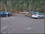 Parking Lot |
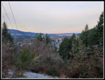 View West |
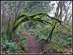 Mossy Arch |
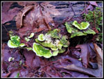 Green Fungi |
 Powerline Corridor |
 Poo Poo Point Trail |
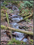 Small Creek |
 New Trail Section |
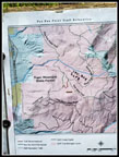 Map Of New Trails |
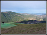 Poo Poo Point |
 Old PPP Trail |
 One View Arch |
 Trails Closure Map |
 Poo Top Trail |
 Tiger 1 Summit |
 Looking East |
 View Northeast |
 Tiger 2 |
 East Tiger |
 Old Poo Top Start |
 Mossy Tree |
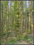 Mossy Tree 2 |
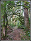 Reverse Arch |
 Blocked Trail |
 PPP Trail |
 Gas Line Trail |
 Round Lake |
 Mossy Again |
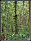
 Big Tree |
 Mossy Log |
 Great Color |
 Hanging Ferns |
Trips - 2022
Home