12-16-23
It
was time for another trip up to Chuckanut Mountain. Passing a gas
station priced $1.40/gallon less that the cheapest station in NW
Seattle was a bonus. I was surprised to see that I had not done this
loop in nearly 2 years. Knowing that I hike the Rock Trail very slowly,
I had to be on my way early to get home before dark. Days are very
short in mid December. I headed north at 6:48 am. It was dark for the
much of my drive. I headed for the North Chuckanut Trailhead on
Chuckanut Drive at the northwest end of Chuckanut Mountain. There were
about 8 or 9 cars in the lot at 8:15 am when I arrived. It was a brisk
35 degrees. It was supposed to reach the upper 40s by afternoon. I
generally do the loop counterclockwise. I debated a change and finally
decided on clockwise. That meant ascending the steep Rock Trail
in the second half of the trip. It was overcast in the morning and was
expected to clear in the afternoon. Going that direction would put on
on the ridge top with a view of Mt. Baker after it hopefully cleared up.
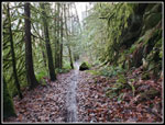
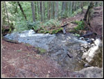
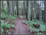
The trail quickly climbs up to the Interurban Trail and turns left. Several years ago the small waterfall overflowed and took out the bridge below and washing out the trail. It is now repaired. I had a nice look at the falls. There are a lot of trails and junctions on Chuckanut Mountain. Most are signed and some have maps showing the current location. I was pretty sure about the junctions but I checked on my phone gps map app to be sure. After an easy start the trail begins to climb. I managed to take a wrong turn and found myself among homes. I was a little too confident that I did not need to check the map. I reached the lost Lake-Chuckanut Ridge junction at 9:13 am. I had one last chance to do the ridge first but chose to head to Lost Lake. The trail follows the ridge route but hundreds of feet lower. With a ridge on both sides, the valley was a cold sink. Cold air sat at the bottom and it was much colder. Bike tires churned up the center of the trail in many spots. I could walk on the edges in most spaces but in narrow spots it was slick.
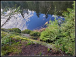
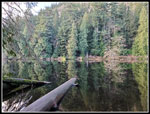
At about 4.7 miles I reached the junction for the lake. I followed the trail a short way and then went straight towards the lake. I was able to push through branches and had a look down the lake. Clouds reflected in the lake. Some of the sky was now blue. Years ago, I tried to go along the left shore of the lake. I made it a ways to where I had a good look at the lake. It did not look like it went all the way down the lake as the slope climbs steeply well above lake level. This time I tried getting onto the low ridge. There is a trail that does go the length of the lake. Bikers take it. I talked to one who did this route and climbed to the ridge south of lost lake and west near saltwater. It is a route I want to take at a later time. Part way down the lake the trail drops to a lake outlet creek. That creek drops quickly over a waterfall. I only saw the top of it. There are two spots with clear views of the lake. I turned around and went back to the main South Lost Lake Trail.
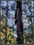
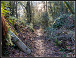
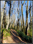
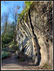
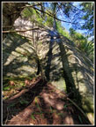
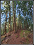
I turned left and headed for the Rock Trail. A few minutes later I heard the sound of a woodpecker. It was very close. I saw it on a tree not far from the trail. Their heads move so fast. I took half a dozen photos and they were all blurry. Then I thought of another idea. How about a video? My video turned out much better. It was a big pileated woodpecker and close enough to a good video. That was an unexpected treat. Two runners with a dog arrived. The woodpecker did not seem to care that we were so close. Soon we were all on our way again. The sign for the Rock Trail is gone. There are just two posts it was connected to. I think it was gone on my last visit too. The Rock Trail is my favorite part of this trip. I expected to take an hour to hike the next .75 miles. I was not disappointed. Sun was now shining down. The colors were lit up. The bare trees had big shadows. The rock is sandstone and it is very cliffy. I hiked up a ways to where I was standing in sunshine. I decided to take my lunch break here. It was 11:03 am. It was a cold morning and the sunshine felt really good. My quick break took 12 minutes. I grudgingly, headed on up the trail.
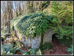
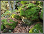
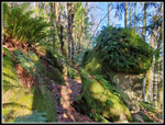
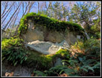
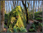
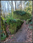
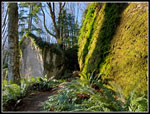
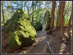
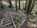
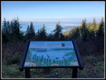
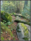
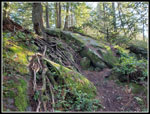
I could now see some peaks to the east through the bare trees. I thought I might be seeing Mt. Baker but I was not sure. I took an awful lot of photos in the next half mile. I have been here in the spring with wildflowers, in the fall with leaf colors, and in the winter with only the bright green moss providing colors. Lots of rocks have broken off and fallen. The trail winds through them. They are mostly covered with moss and ferns. It is very scenic. Mostly I come down the trail. This is only the second or third time I have hiked up it. The views are slightly different going in the opposite direction. The sun and shadows provided some views I have not seen. The top of the trail has a dozen sets of wooden stairs to get up the very steep slope. I was getting a bit tired for the last steep climb. At the top it is just a few minutes to the Cyrus Gates Overlook. I took 56 minutes to hike up that .75 miles. Time well spent. The lot was nearly full as bikers drive to the top then go down steep trails and back up the road. I had a short food and water break. The overlook was completely shaded. It was cold once again.
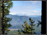
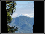
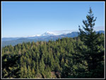
Rather than hike down the road to where it meets the Chuckanut Ridge Trail, I headed uphill to the top of Chuckanut Mountain's Middle Peak. From the top I could just make out Twin Sisters and Mt. Baker. All peaks but Baker were in the clear. The upper half of Baker looked to be in clouds. Oh well... I headed down the ridge. In only a few minutes I reached where the road touches the trail. The ridge is another highlight of this trip. It is right on the ridge top most of the way. The ridge drops nearly vertically on the right down to where I hiked to Lost Lake in the morning. There are a lot of ups and downs. Even though I was going down hill, I had many uphills. One climb is 200' as I counted five 40' contours on the map. The trailhead is at only about 118' and the highest point is about 1923'. That is 1800' net gain and with all the ups and downs about 2700' of gain in total. Much of it is on the ridge. At the junction with the road is a clear view of Mt. Baker and Twin Sisters. Now I could clearly see that the top half of Baker was lost in a thick cloud.
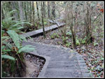
I only saw a few groups on the ridge. I have found it to be less used. As I reached the north end of the ridge open views appeared of Mt. Baker. It was now in the clear. Quite a change from when I started down the ridge. From the last viewpoint, it is a short steep drop to the bottom. The trail traverses to the right and comes out on the trail I came up. My loop was closed. Now I just had about 2.2 miles back to the trailhead. As I descended the sun was now behind me and out of sight. It grew cooler once again. In the last mile I started to see folks out on short hikes. My gloves went on again though it was near the warmest part of the day. I reached the trailhead at 2:18 pm. I spent 5:58 on the trail hiking 12 miles with 2700' of elevation gain. My drive home took 45 minutes longer than the morning drive. Traffic was bad. Still, it was well worth it. I left in the dark in the morning and arrived home right at sunset.
I have enjoyed all my hikes on Chuckanut Mountain. They wave been very different in changing seasons. 12 miles is a good long leg stretcher. The Rock Trail is always fun. The ridge is fun and challenging. Now I have another adventure planned with a leg going around Lost Lake. There is always something to enjoy on these trails. I did fill my tank with cheap gas on the way home. One more plus for this day.
Click on thumbnails to get
larger pictures.
Trips - 2023
Home
The trail quickly climbs up to the Interurban Trail and turns left. Several years ago the small waterfall overflowed and took out the bridge below and washing out the trail. It is now repaired. I had a nice look at the falls. There are a lot of trails and junctions on Chuckanut Mountain. Most are signed and some have maps showing the current location. I was pretty sure about the junctions but I checked on my phone gps map app to be sure. After an easy start the trail begins to climb. I managed to take a wrong turn and found myself among homes. I was a little too confident that I did not need to check the map. I reached the lost Lake-Chuckanut Ridge junction at 9:13 am. I had one last chance to do the ridge first but chose to head to Lost Lake. The trail follows the ridge route but hundreds of feet lower. With a ridge on both sides, the valley was a cold sink. Cold air sat at the bottom and it was much colder. Bike tires churned up the center of the trail in many spots. I could walk on the edges in most spaces but in narrow spots it was slick.
At about 4.7 miles I reached the junction for the lake. I followed the trail a short way and then went straight towards the lake. I was able to push through branches and had a look down the lake. Clouds reflected in the lake. Some of the sky was now blue. Years ago, I tried to go along the left shore of the lake. I made it a ways to where I had a good look at the lake. It did not look like it went all the way down the lake as the slope climbs steeply well above lake level. This time I tried getting onto the low ridge. There is a trail that does go the length of the lake. Bikers take it. I talked to one who did this route and climbed to the ridge south of lost lake and west near saltwater. It is a route I want to take at a later time. Part way down the lake the trail drops to a lake outlet creek. That creek drops quickly over a waterfall. I only saw the top of it. There are two spots with clear views of the lake. I turned around and went back to the main South Lost Lake Trail.
I turned left and headed for the Rock Trail. A few minutes later I heard the sound of a woodpecker. It was very close. I saw it on a tree not far from the trail. Their heads move so fast. I took half a dozen photos and they were all blurry. Then I thought of another idea. How about a video? My video turned out much better. It was a big pileated woodpecker and close enough to a good video. That was an unexpected treat. Two runners with a dog arrived. The woodpecker did not seem to care that we were so close. Soon we were all on our way again. The sign for the Rock Trail is gone. There are just two posts it was connected to. I think it was gone on my last visit too. The Rock Trail is my favorite part of this trip. I expected to take an hour to hike the next .75 miles. I was not disappointed. Sun was now shining down. The colors were lit up. The bare trees had big shadows. The rock is sandstone and it is very cliffy. I hiked up a ways to where I was standing in sunshine. I decided to take my lunch break here. It was 11:03 am. It was a cold morning and the sunshine felt really good. My quick break took 12 minutes. I grudgingly, headed on up the trail.
I could now see some peaks to the east through the bare trees. I thought I might be seeing Mt. Baker but I was not sure. I took an awful lot of photos in the next half mile. I have been here in the spring with wildflowers, in the fall with leaf colors, and in the winter with only the bright green moss providing colors. Lots of rocks have broken off and fallen. The trail winds through them. They are mostly covered with moss and ferns. It is very scenic. Mostly I come down the trail. This is only the second or third time I have hiked up it. The views are slightly different going in the opposite direction. The sun and shadows provided some views I have not seen. The top of the trail has a dozen sets of wooden stairs to get up the very steep slope. I was getting a bit tired for the last steep climb. At the top it is just a few minutes to the Cyrus Gates Overlook. I took 56 minutes to hike up that .75 miles. Time well spent. The lot was nearly full as bikers drive to the top then go down steep trails and back up the road. I had a short food and water break. The overlook was completely shaded. It was cold once again.
Rather than hike down the road to where it meets the Chuckanut Ridge Trail, I headed uphill to the top of Chuckanut Mountain's Middle Peak. From the top I could just make out Twin Sisters and Mt. Baker. All peaks but Baker were in the clear. The upper half of Baker looked to be in clouds. Oh well... I headed down the ridge. In only a few minutes I reached where the road touches the trail. The ridge is another highlight of this trip. It is right on the ridge top most of the way. The ridge drops nearly vertically on the right down to where I hiked to Lost Lake in the morning. There are a lot of ups and downs. Even though I was going down hill, I had many uphills. One climb is 200' as I counted five 40' contours on the map. The trailhead is at only about 118' and the highest point is about 1923'. That is 1800' net gain and with all the ups and downs about 2700' of gain in total. Much of it is on the ridge. At the junction with the road is a clear view of Mt. Baker and Twin Sisters. Now I could clearly see that the top half of Baker was lost in a thick cloud.
I only saw a few groups on the ridge. I have found it to be less used. As I reached the north end of the ridge open views appeared of Mt. Baker. It was now in the clear. Quite a change from when I started down the ridge. From the last viewpoint, it is a short steep drop to the bottom. The trail traverses to the right and comes out on the trail I came up. My loop was closed. Now I just had about 2.2 miles back to the trailhead. As I descended the sun was now behind me and out of sight. It grew cooler once again. In the last mile I started to see folks out on short hikes. My gloves went on again though it was near the warmest part of the day. I reached the trailhead at 2:18 pm. I spent 5:58 on the trail hiking 12 miles with 2700' of elevation gain. My drive home took 45 minutes longer than the morning drive. Traffic was bad. Still, it was well worth it. I left in the dark in the morning and arrived home right at sunset.
I have enjoyed all my hikes on Chuckanut Mountain. They wave been very different in changing seasons. 12 miles is a good long leg stretcher. The Rock Trail is always fun. The ridge is fun and challenging. Now I have another adventure planned with a leg going around Lost Lake. There is always something to enjoy on these trails. I did fill my tank with cheap gas on the way home. One more plus for this day.
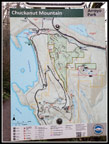 Trailhead Map |
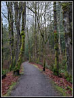 Interurban Trail |
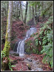 Waterfall |
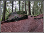 A Big Erratic |
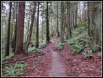 Open Forest |
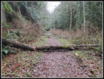 Trees Down |
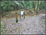 Signed Junction |
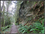 Big Sandstone Wall |
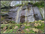 Running Water On Wall |
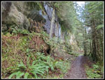 Looking Back To Wall |
 Wet Leaves & Moss |
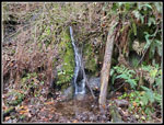 Small Falls |
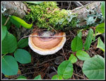
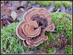 Fresh Fungus |
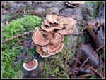 More Fungus |
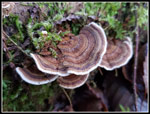 Turkey Tail Fungus |
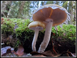 Nice Mushrooms |
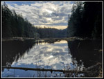 Dark Lost Lake |
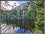 Lighter Lost Lake |
 Reflected Sky |
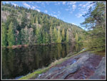 Looking Down Lake |
 Outlet Over The Falls |
 Reflection At Lake Level |
 Pileated Woodpecker |
 Runners On The Trail |
 On The Rock Trail |
 Cave In Rock |
 Great Green Colors |
 Winding Though Rocks |
 Blue, White, & Green |
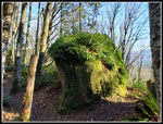 A Lone Boulder |
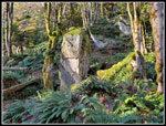 Another Fallen Boulder |
 Sun & Shadows |
 Shadow On Rock |
 And More |
 Lots Of Colors |
 Favorite Rocks |
 More Tree Shadows |
 Lots Of Steps |
 Cyrus Gates Overlook |
 Twin Sisters |
 Cloudy Mt. Baker |
 Chuckanut Ridge Top |
 Rocky Trail |
 Colorful Fungus |
 Trail? |
 Cloudless Mt. Baker |
 No More Sunshine |
 Long Boardwalk |
Trips - 2023
Home