02-19-23
Gary
was free for a hike on Sunday.
We did a 13 mile cross-country ski trip last Sunday that had us in pain
as it was our first ski trip in nearly a year. On Wednesday evening we
did a 9 mile 2500' gain hike. That slowed our recovery. Now it was
Sunday again. Rain on Saturday kept me indoors. Monday is Presidents
Day and it looked to by heavy rain and high winds. Sunday was not
looking great but it would be the only chance for a hike over the three
day weekend. Gary is retired but three day weekends are important to
me. The forecast was for light rain in the morning and heavier rain
later one. It would be less wet near Seattle so we opted for an 8:00 am
start on Cougar Mountain. We could just hike until we were
sufficiently wet.
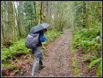
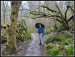
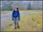
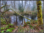
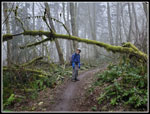
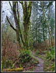
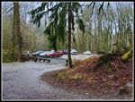
In the morning everything changed. Now it was rain until about 10:00 am and then just showers for several more hours. We chose to hold off our start until 8:30 am. We met at Red Town Trailhead at 8:25 am. It was just lightly drizzling. That was better than expected. On went raincoats and up went our umbrellas. We decided to head uphill first and turn around if the rain started to pick up substantially. I hoped we could get in 8 miles. I expected a little less. One positive of the rain was the parking lot was two thirds empty. We headed up the Military Road just after 8:30 am. Soon I was unzipping my raincoat and after about three quarters of a mile I took down my umbrella. It was just lightly drizzling. We reached the Sky Country Trailhead at the 1 mile mark.
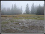
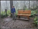
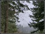
Next, we headed over to the Cave Hole Road. From there we went to Fred's Railroad and crossed the Clay Pit Road. The rain had stopped by then. It's pretty flat easy walking along the Klondike Swamp Trail. The final push took up uphill on the Lost Beagle Trail to the summit of Anti-Aircraft Peak. As we rose the clouds thickened. At the big grass meadow we could just see across to the picnic shelter. We headed on over to it. It was windy here and the shelter was soaking wet inside. We chose to head back over to the other picnic shelter. This one was dry inside. Time for a food and water break. It was 9:54 am. We took 1:24 to hike 3.4 miles. It was misty pea soup but it was not raining. I was now hoping to get in double figure miles.
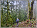
We were on our way at 10:07 am. First we went over to the Million Dollar View. The leaves were off the trees and we would have had some views except for all the clouds. Our next objective was the Clay Pit. the trail drops down to cross Tibbets Creek and then climbs up to the Clay Pit. Down near the creek I saw some trail work beginning a few months ago. Now most of it is done. Some of the new ditches were well overdone but much of the work is helpful. We arrived at the Clay Pit to find views out to Tiger Mountain and Mt. Si beyond to be lost in the clouds. We took the East Fork Trail down to Fred's Railroad. At Jerry's Duck Pond I was surprised to find no algae in the water. It has been covered in green for several years. We even saw two ducks on the pond.
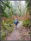
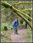
At Fred's Railroad we had a decision to make. At the start I expected the rain to have us heading back to the car by this point. There was no rain so we turned left and headed to Shy Bear Pass. At the pass we took the new trail up Wilderness Peak. It is 1.5 times the length of the old trail but is much gentler. We had not seen many people so far. This trail is busier than the old trail. We saw several groups on this section. We had some more wind and mist at the summit. This is the highest point on Cougar Mountain at 1598'. We dropped the .60 miles back to Shy Bear Pass.
It was time for one more decision. We could turn right and head back to the cars for a 10 mile day. If we went left it would be a 12 mile day. The rain kept holding off so we went left. We dropped and then climbed up to Long View Peak. Next we dropped from Deceiver Ridge to a creek crossing and a short detour to Doughy Falls. On a fall trip to Doughy Falls there was no water at all. The creek was dry dirt without even any mud. The falls were not roaring but there was a steady stream of water going over. We reached the falls at 12:28 pm after 8.7 miles of hiking. We had already hiked more miles than I expected in the morning.
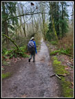
We saw a few runners out this far but not many. We climbed up and over the ridge and dropped to the Shy Bear Trail. This took us over to Far Country Lookout. That would be our last food and water break of the day. No view here as with every other viewpoint we reached. The last 2 miles back to Red Town and our cars was mostly downhill or flat with a few ups and downs thrown in. We saw more people when within a mile of the end. We reached the trailhead right at 2:00 pm. The lot was mostly full but not entirely.
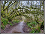
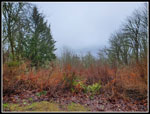
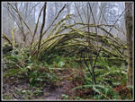
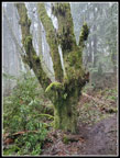
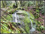
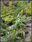
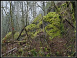
We were very fortunate to have had only a little rain in the first 1+ mile. I expected it too be much worse. The foggy, cloudy day brought out some good colors with all the moss. We saw a few small patches of snow but had none on the trail. All the rain washed it away. The damp day also seemed to keep the usual crowds away most of the day. Our route was never very steep and the highest point was only 1598'. With ups and downs we managed almost 2000' of elevation gain. Less than most hikes but 12 miles did make it a good workout. All in all, it was a much better hike than either of us expected going into it. It was a fun day on the trail.
Click on thumbnails to get
larger pictures.
Trips - 2023
Home
In the morning everything changed. Now it was rain until about 10:00 am and then just showers for several more hours. We chose to hold off our start until 8:30 am. We met at Red Town Trailhead at 8:25 am. It was just lightly drizzling. That was better than expected. On went raincoats and up went our umbrellas. We decided to head uphill first and turn around if the rain started to pick up substantially. I hoped we could get in 8 miles. I expected a little less. One positive of the rain was the parking lot was two thirds empty. We headed up the Military Road just after 8:30 am. Soon I was unzipping my raincoat and after about three quarters of a mile I took down my umbrella. It was just lightly drizzling. We reached the Sky Country Trailhead at the 1 mile mark.
Next, we headed over to the Cave Hole Road. From there we went to Fred's Railroad and crossed the Clay Pit Road. The rain had stopped by then. It's pretty flat easy walking along the Klondike Swamp Trail. The final push took up uphill on the Lost Beagle Trail to the summit of Anti-Aircraft Peak. As we rose the clouds thickened. At the big grass meadow we could just see across to the picnic shelter. We headed on over to it. It was windy here and the shelter was soaking wet inside. We chose to head back over to the other picnic shelter. This one was dry inside. Time for a food and water break. It was 9:54 am. We took 1:24 to hike 3.4 miles. It was misty pea soup but it was not raining. I was now hoping to get in double figure miles.
We were on our way at 10:07 am. First we went over to the Million Dollar View. The leaves were off the trees and we would have had some views except for all the clouds. Our next objective was the Clay Pit. the trail drops down to cross Tibbets Creek and then climbs up to the Clay Pit. Down near the creek I saw some trail work beginning a few months ago. Now most of it is done. Some of the new ditches were well overdone but much of the work is helpful. We arrived at the Clay Pit to find views out to Tiger Mountain and Mt. Si beyond to be lost in the clouds. We took the East Fork Trail down to Fred's Railroad. At Jerry's Duck Pond I was surprised to find no algae in the water. It has been covered in green for several years. We even saw two ducks on the pond.
At Fred's Railroad we had a decision to make. At the start I expected the rain to have us heading back to the car by this point. There was no rain so we turned left and headed to Shy Bear Pass. At the pass we took the new trail up Wilderness Peak. It is 1.5 times the length of the old trail but is much gentler. We had not seen many people so far. This trail is busier than the old trail. We saw several groups on this section. We had some more wind and mist at the summit. This is the highest point on Cougar Mountain at 1598'. We dropped the .60 miles back to Shy Bear Pass.
It was time for one more decision. We could turn right and head back to the cars for a 10 mile day. If we went left it would be a 12 mile day. The rain kept holding off so we went left. We dropped and then climbed up to Long View Peak. Next we dropped from Deceiver Ridge to a creek crossing and a short detour to Doughy Falls. On a fall trip to Doughy Falls there was no water at all. The creek was dry dirt without even any mud. The falls were not roaring but there was a steady stream of water going over. We reached the falls at 12:28 pm after 8.7 miles of hiking. We had already hiked more miles than I expected in the morning.
We saw a few runners out this far but not many. We climbed up and over the ridge and dropped to the Shy Bear Trail. This took us over to Far Country Lookout. That would be our last food and water break of the day. No view here as with every other viewpoint we reached. The last 2 miles back to Red Town and our cars was mostly downhill or flat with a few ups and downs thrown in. We saw more people when within a mile of the end. We reached the trailhead right at 2:00 pm. The lot was mostly full but not entirely.
We were very fortunate to have had only a little rain in the first 1+ mile. I expected it too be much worse. The foggy, cloudy day brought out some good colors with all the moss. We saw a few small patches of snow but had none on the trail. All the rain washed it away. The damp day also seemed to keep the usual crowds away most of the day. Our route was never very steep and the highest point was only 1598'. With ups and downs we managed almost 2000' of elevation gain. Less than most hikes but 12 miles did make it a good workout. All in all, it was a much better hike than either of us expected going into it. It was a fun day on the trail.
 Getting Started |
 Rainy Mossy Hike |
 Mossy Arch |
 Misty Meadow |
 Gary On AA Peak |
 Million Dollar View |
 Gary On Trail |
 The Clay Pit |
 Jerry's Duck Pond |
 East Fork Trail |
 Muddy Trail |
 Wilderness Peak Summit |
 More Moss |
 More Moss & Mist |
 Moss & Ferns On Tree |
 Over The Bridge |
 Doughty Falls |
 Dark Greem All Around |
 Far Country Lookout |
 Far Country Falls |
 Mossy Rocks |
 Another Mossy Arch |
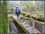
 Coal Creek Bridge |
 Red Town Lot |
Trips - 2023
Home