11-18-23
I
was looking for a close in hike with more miles than elevation gain as
a goal. I decided on another loop around Cougar Mountain. I was set to
leave in the morning when I checked the traffic. Google routed me an
extra six miles all around the Red Town Trailhead. It showed that the
Lakemont Boulevard from Forest Drive to well the other side of Coal
Creek was closed. I found online that the culvert was being replaced
with a new bridge. It would not be done until next June. With that in
mind I headed out for the Sky Country Trailhead. It is a mile above Red
Town. I arrived just after 8:00 am and the lot was 75% full. It seemed
that it was more full because the Red Town lot was closed. I decided to
due the route counterclockwise. This way I would get to Red Town early.
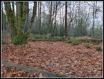
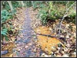
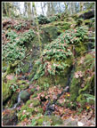
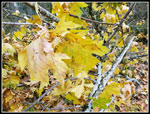
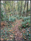
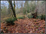
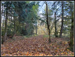
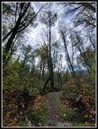
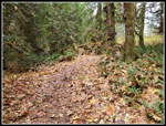
There are a lot of deciduous trees on Cougar Mountain and the area
around the Sky Country Trailhead is really thick. Fallen leaves covered
all of the ground. It is six or more inches deep in many spots. I
headed down the leafy trail. As I descended there were more evergreens
and fewer leaves. Soon I could even see bare ground. In about twenty
minutes I reached Red Town.
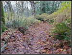
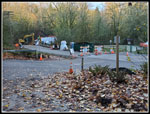
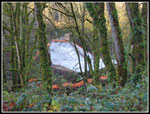
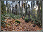
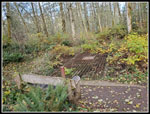
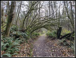
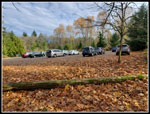
There was heavy equipment in the road. The culvert is gone and there is a big piece of missing road. More surprisingly, there were 12 cars in the parking lot. The road closed sign is right at the entrance. I saw two hikers leaving their car and stopped to talk. It seems that there is a road block at Forest Drive. One lane is open and one closed heading to Red Town. I needed to check it out on my way home. With that done, I headed along Coal Creek for the Wildside Trail. At the creek I passed a group of half a dozen. I took the Wildside and followed it to the Indian Trail. I turned onto it and headed for Far Country Lookout. There were fewer leaves but I still saw them on most of the hike. I took the short detour to Far Country Falls. I could hear it gong by but there was not much water going over the falls.
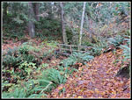
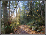
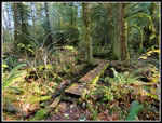
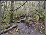
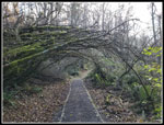
Back on the trail, I quickly turned onto the Far Country Lookout Trail. I stopped at the lookout for a few photos and kept going. Dropping down to cross the small creek all of the ground all around was buried under big piles of leaves. It had been very quiet since Red Town and I finally passed a runner. I turned off on the Deceiver Ridge Trail. I went over the first ridge and dropped down. Time for another short detour. This time it was to Doughy Falls. On my last visit the falls were completely dry. This time there was a small amount of water. Better but not much of a waterfall. Back on the trail I took the bridge across the creek. This mossy spot is one of my favorites. Now the trail begins to climb. It switches back an forth up Deceiver Ridge. I finally topped out and reached the junction with the short trail up to Long View Peak. The views have been long gone for a long time. I headed back to the trail. I had just .40 miles to reach Shy Bear Pass.
The old trail up Wilderness Peak from Shy Bear Pass was mostly straight up. In .40 miles it reached the summit. The new trail has switchbacks and a much gentler grade. It also adds .50 miles going round trip. I saw a few runners on Deceiver Ridge and now I saw several more hikers and runners. The shorter trail from Highway 900 coming up here. Half a dozen hikers were coming down as I went up. I reached the top at 10:29 am. Nobody else was there. Time for a brunch snack. Five minutes later I was on my way down. Wilderness Peak was the highest point on my loop but not the last climb. Back at Shy Bear Pass I turned right and headed downhill. This trail passes the trail coming from Far Country Lookout I was on earlier. I continued straight ahead and the route became Fred's Railroad. I passed the top of the Quarry trail and continued straight. At the East Fork Trail I turned right and headed gently uphill. This route goes to the Clay Pit.
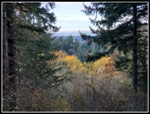
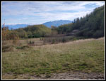
I reached Jerry's Duck Pond to find all the green growth on top of it was gone for the winter. A few minutes later I was on the Clay Pit Road just short of the Clay Pit. When I reached the Pit there was one group there. I had a good view of Tiger Mountain and Mt. Si. I took a few photos and turned around. A short way down the road I turned right on the trail heading for Anti-Aircraft Peak. It's about a mile to AA Peak. Several decades ago I would take a trail that branches off the main route and heads over to the road/Shangrila Trail. The two trails meet near the trailhead at AA Peak. The Shangrila route was a narrow boot path and the main trail was much better. I had been meaning to try the old route and when I reached the junction I took it. It is about .40 miles longer now. They used to be the same distance. For the extra length the old route is now a very nice trail. At the Shangrila Trail I turned left and headed up to the AA Trailhead. There were only 7 or 8 cars in the lot.
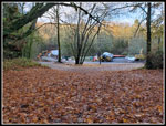
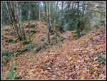
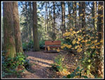
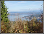
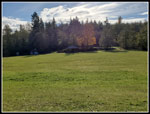
I stopped at the Million Dollar View for a few photos. Most leaves were off the trees and I could see out a little now. Lake Sammamish is right below. I then headed over to the picnic shelter at the far end of the big meadow. The sun was now high enough to shine on the shelter. I sat at a picnic table in the sunshine. It was still cool but felt much warmer in the sunshine. I arrived right at 12:00 pm. It was time to finish my lunch. So far, I had traveled about 10 mile. I only had a couple more to go. Leaving the meadow meant going back into the shade. Well, I had to do it at some point to finish my trip. I crossed the meadow and then climbed to the actual highest point. From there, the Lost Beagle Trail dropped by down to the Klondike Swamp Trail. At some point I will count all of the numerous trails this loop covers. The Klondike Swamp Trail is mostly flat with one climb on a section that climbs above the old swamp. That section was muddy and moved to drier terrain. I reached the Clay Pit Road and crossed over it onto the start of Fred's Railroad. In fifty feet, I turned right onto the Bypass Trail. It crosses a creek that is dry much of the year. It has flow right now.
I soon reached the Cave Hole Road. Right or left goes back to the Sky Country Trailhead. Left is longer and I wanted to be sure I would be over 12 miles. Left it was. One more right turn onto the Nike Horse Trail took me back to the trailhead in .30 miles. I was back at my car at 12:54 pm. The lot was now nearly full. I took 4:46 to cover 12 miles with 2000' of gain with several breaks and a lot of photo stops. I was home several hours before the UW-Oregon St. football game. The Huskies won to go 11-0 on the season.
With the road torn up at Red Town my plans were nearly derailed before I started. Instead, I persevered and had a chance to see the construction up close. This is a pretty easy 12 mile hike but in any season has different things to see. On this trip the huge piles of leaves were the most interesting. The weather was better than expected and most of the route had a lot of solitude. I did see more people near the trailheads but it never seemed to be crowded. It is a fun close in trip with a short drive and much to see. It is one I manage to do once or twice most years and three times this year.
Click on thumbnails to get
larger pictures.
Trips - 2023
Home
There was heavy equipment in the road. The culvert is gone and there is a big piece of missing road. More surprisingly, there were 12 cars in the parking lot. The road closed sign is right at the entrance. I saw two hikers leaving their car and stopped to talk. It seems that there is a road block at Forest Drive. One lane is open and one closed heading to Red Town. I needed to check it out on my way home. With that done, I headed along Coal Creek for the Wildside Trail. At the creek I passed a group of half a dozen. I took the Wildside and followed it to the Indian Trail. I turned onto it and headed for Far Country Lookout. There were fewer leaves but I still saw them on most of the hike. I took the short detour to Far Country Falls. I could hear it gong by but there was not much water going over the falls.
Back on the trail, I quickly turned onto the Far Country Lookout Trail. I stopped at the lookout for a few photos and kept going. Dropping down to cross the small creek all of the ground all around was buried under big piles of leaves. It had been very quiet since Red Town and I finally passed a runner. I turned off on the Deceiver Ridge Trail. I went over the first ridge and dropped down. Time for another short detour. This time it was to Doughy Falls. On my last visit the falls were completely dry. This time there was a small amount of water. Better but not much of a waterfall. Back on the trail I took the bridge across the creek. This mossy spot is one of my favorites. Now the trail begins to climb. It switches back an forth up Deceiver Ridge. I finally topped out and reached the junction with the short trail up to Long View Peak. The views have been long gone for a long time. I headed back to the trail. I had just .40 miles to reach Shy Bear Pass.
The old trail up Wilderness Peak from Shy Bear Pass was mostly straight up. In .40 miles it reached the summit. The new trail has switchbacks and a much gentler grade. It also adds .50 miles going round trip. I saw a few runners on Deceiver Ridge and now I saw several more hikers and runners. The shorter trail from Highway 900 coming up here. Half a dozen hikers were coming down as I went up. I reached the top at 10:29 am. Nobody else was there. Time for a brunch snack. Five minutes later I was on my way down. Wilderness Peak was the highest point on my loop but not the last climb. Back at Shy Bear Pass I turned right and headed downhill. This trail passes the trail coming from Far Country Lookout I was on earlier. I continued straight ahead and the route became Fred's Railroad. I passed the top of the Quarry trail and continued straight. At the East Fork Trail I turned right and headed gently uphill. This route goes to the Clay Pit.
I reached Jerry's Duck Pond to find all the green growth on top of it was gone for the winter. A few minutes later I was on the Clay Pit Road just short of the Clay Pit. When I reached the Pit there was one group there. I had a good view of Tiger Mountain and Mt. Si. I took a few photos and turned around. A short way down the road I turned right on the trail heading for Anti-Aircraft Peak. It's about a mile to AA Peak. Several decades ago I would take a trail that branches off the main route and heads over to the road/Shangrila Trail. The two trails meet near the trailhead at AA Peak. The Shangrila route was a narrow boot path and the main trail was much better. I had been meaning to try the old route and when I reached the junction I took it. It is about .40 miles longer now. They used to be the same distance. For the extra length the old route is now a very nice trail. At the Shangrila Trail I turned left and headed up to the AA Trailhead. There were only 7 or 8 cars in the lot.
I stopped at the Million Dollar View for a few photos. Most leaves were off the trees and I could see out a little now. Lake Sammamish is right below. I then headed over to the picnic shelter at the far end of the big meadow. The sun was now high enough to shine on the shelter. I sat at a picnic table in the sunshine. It was still cool but felt much warmer in the sunshine. I arrived right at 12:00 pm. It was time to finish my lunch. So far, I had traveled about 10 mile. I only had a couple more to go. Leaving the meadow meant going back into the shade. Well, I had to do it at some point to finish my trip. I crossed the meadow and then climbed to the actual highest point. From there, the Lost Beagle Trail dropped by down to the Klondike Swamp Trail. At some point I will count all of the numerous trails this loop covers. The Klondike Swamp Trail is mostly flat with one climb on a section that climbs above the old swamp. That section was muddy and moved to drier terrain. I reached the Clay Pit Road and crossed over it onto the start of Fred's Railroad. In fifty feet, I turned right onto the Bypass Trail. It crosses a creek that is dry much of the year. It has flow right now.
I soon reached the Cave Hole Road. Right or left goes back to the Sky Country Trailhead. Left is longer and I wanted to be sure I would be over 12 miles. Left it was. One more right turn onto the Nike Horse Trail took me back to the trailhead in .30 miles. I was back at my car at 12:54 pm. The lot was now nearly full. I took 4:46 to cover 12 miles with 2000' of gain with several breaks and a lot of photo stops. I was home several hours before the UW-Oregon St. football game. The Huskies won to go 11-0 on the season.
With the road torn up at Red Town my plans were nearly derailed before I started. Instead, I persevered and had a chance to see the construction up close. This is a pretty easy 12 mile hike but in any season has different things to see. On this trip the huge piles of leaves were the most interesting. The weather was better than expected and most of the route had a lot of solitude. I did see more people near the trailheads but it never seemed to be crowded. It is a fun close in trip with a short drive and much to see. It is one I manage to do once or twice most years and three times this year.
 Lots Of Leaves |
 Even More Leaves |
 First Bridge |
 Red Town Lot |
 Construction |
 New Bridge Site |
 Long Lasting Goo |
 Low Sunlight |
 Far Country Falls |
 More Leaves |
 Far Country Lookout |
 The Trail Is Somewhere |
 Leaves On Trees |
 Doughty Falls |
 Mossy Bridge |
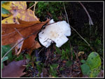 Mushroom |
 Long View Peak |
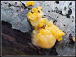 Witches Butter |
 Wilderness Peak |
 Shy Bear Trail |
 Jerry's Duck Pond |
 Mine Vent |
 Clay Pit View |
 Tibbetts Creek Bridge |
 Million Dollar View |
 Anti-Aircraft Meadow |
 AA Peak Summit |
 Mossy Arbor |
 Another Arbor |
 White Sky |
 Lots More Leaves |
 12 Miles Done |
Trips - 2023
Home