04-07-23
Good
Friday is a holiday in my
business. That means I get to do a weekday hike without the weekend
crowds. The forecast was for rain and showers all day. I slept in not
expecting a dry hike. My knee has been sore for several weeks and I
skipped the after-work hike this week to have a full ten days off for
it to heal. The back of my knee felt better but the front seemed to
still be a little sore. I chose a close in hike with limited elevation
gain to test it out. At 7:45 am I checked and it was not raining. That
was not expected. The forecast was for rain all day. but the futurecast
radar showed the rain would hold off until around 11:00 am. I guess it
was past time to go hiking. I was on my way at 8:30 am and arrived at
the Red Town Trailhead at 9:02 am. I was on my way at 9:07 am.
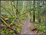
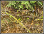
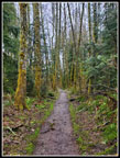
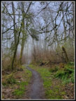
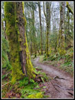
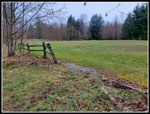
I set out to do a counterclockwise loop. I headed for the Wildside Trail. Once across Coal Creek I came to a bunch of coltsfoot in bloom. For the past 3 or 4 weeks I have been looking for that first wildflower in bloom for the year. Today I finally found it. The next section has a lot of trillium. I was pleased to find four or five of them flowering. Then I saw one lone skunk cabbage in bloom. That was almost the end of the days wildflowers. There were just a couple more on my trip. I turned onto the Indian Trail and soon after headed uphill on the Quarry Trail. I saw three or four groups of runners early and then the solitude set in. My knee was a little sore but it was not bad going uphill. I passed the turnoff for Coal Creek Falls and continued up to Fred's Railroad. With rain coming and my knee a bit of a question mark I chose not to head over to Wilderness Peak. Instead, I turned left on Fred's Railroad. I then took a right turn on the East Fork Trail. I had warmed up enough to pull up my sleeves. I could now feel some mist on my arms but it was not enough to consider rain gear.
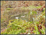
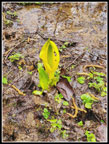
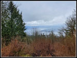
In a big puddle alongside the trail I saw two mallard ducks. There has been enough rain recently to have the puddle bigger than I recall seeing it. At Jerry's Duck Pond I looked over the bank to the right and saw some skunk cabbage blooming. Not much but there it was. The trail climbs then drops to the Clay Pit Road. A minute or so later I was at the Clay Pit. On a clear day you can see Tiger Mountain and Mt. Si. This day I could see white clouds. No views at all. I then headed on to Anti-Aircraft Peak. The trail begins by descending. At the first junction I turned left towards Cougar Pass. The first creek often has early blooming skunk cabbage. Today I saw quite a few blooming skunk cabbage. I stopped for a few photos. Then it was time to retrace my steps back to the junction. I turned left and dropped to Tibbetts Creek. It was still a little misty.
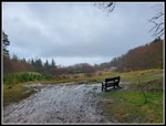
I crossed the creek and began the climb to Anti-Aircraft Peak. I ran into a big group of first grade aged kids with a couple teachers. In the parking lot at AA Peak I saw a van with "Wilderness Awareness School" emblazoned on the side. The kids had a nice damp and muddy day to explore the forest. I topped at the Million Dollar View to find no view. I could see down to Lake Sammamish though. I headed over to the meadow. All the picnic tables in the first picnic shelter full of stuff likely from the kids I had seen. I went across the meadow to the other shelter for a lunch break. It began to rain as I neared the shelter. It was a good time for a break out of the rain. I arrived at 11:05 am. It was right about the time the future radar had predicted rain.
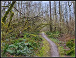
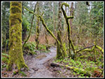
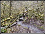
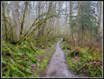
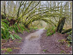
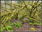
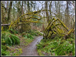
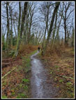
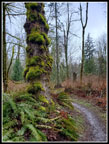
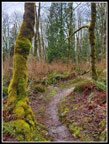
I had a short food and water break and took out my umbrella and put on my pack cover. Hiking downhill in the rain with an umbrella is much easier than uphill. I headed across the meadow to the road and the highest point on AA Peak. I descended on the Lost Beagle Trail. The rain lightened and it was off and on much of the way back. It was more off than on. Other than a few minutes of harder rain it was not bad at all. The mossy colors were really good with the rain and overcast. I had a lot of mossy arches and mossy trees on the next sections. At the junction with the Klondike Swamp Trail I turned left. This route took be back to the Clay Pit Road. I crossed over to Fred's Railroad and quickly turned right. I headed for the Cave Hole Road. Ir looked like I was on pace for an 8 mile day. I followed the Cave Hole Road to the Nike Horse Trail. This took me to the big meadow and the Sky Country Trailhead. The next junction marked exactly one mile to go.
My knee was getting much sorer on the descent. Thankfully, these trails are not very steep so it was not too bad. The last half mile seemed to drag on. I was very pleased to see the trailhead at Red Town. I arrived at 12:33 pm. I hiked for 3:31 covering just over 8 miles with 1200' of gain. I actually saw more people than I was expecting on a rainy Friday morning but it was never crowded. I did have some rain but most of it was after I gained most all of the elevation. Even the rain turned to light shadows farther along. After ten days off the trail I expected my knee to be near 100%. It was not. I hope this heals soon as warmer weather and spring wildflowers are about to arrive.
Click on thumbnails to get
larger pictures.
Trips - 2023
Home
I set out to do a counterclockwise loop. I headed for the Wildside Trail. Once across Coal Creek I came to a bunch of coltsfoot in bloom. For the past 3 or 4 weeks I have been looking for that first wildflower in bloom for the year. Today I finally found it. The next section has a lot of trillium. I was pleased to find four or five of them flowering. Then I saw one lone skunk cabbage in bloom. That was almost the end of the days wildflowers. There were just a couple more on my trip. I turned onto the Indian Trail and soon after headed uphill on the Quarry Trail. I saw three or four groups of runners early and then the solitude set in. My knee was a little sore but it was not bad going uphill. I passed the turnoff for Coal Creek Falls and continued up to Fred's Railroad. With rain coming and my knee a bit of a question mark I chose not to head over to Wilderness Peak. Instead, I turned left on Fred's Railroad. I then took a right turn on the East Fork Trail. I had warmed up enough to pull up my sleeves. I could now feel some mist on my arms but it was not enough to consider rain gear.
In a big puddle alongside the trail I saw two mallard ducks. There has been enough rain recently to have the puddle bigger than I recall seeing it. At Jerry's Duck Pond I looked over the bank to the right and saw some skunk cabbage blooming. Not much but there it was. The trail climbs then drops to the Clay Pit Road. A minute or so later I was at the Clay Pit. On a clear day you can see Tiger Mountain and Mt. Si. This day I could see white clouds. No views at all. I then headed on to Anti-Aircraft Peak. The trail begins by descending. At the first junction I turned left towards Cougar Pass. The first creek often has early blooming skunk cabbage. Today I saw quite a few blooming skunk cabbage. I stopped for a few photos. Then it was time to retrace my steps back to the junction. I turned left and dropped to Tibbetts Creek. It was still a little misty.
I crossed the creek and began the climb to Anti-Aircraft Peak. I ran into a big group of first grade aged kids with a couple teachers. In the parking lot at AA Peak I saw a van with "Wilderness Awareness School" emblazoned on the side. The kids had a nice damp and muddy day to explore the forest. I topped at the Million Dollar View to find no view. I could see down to Lake Sammamish though. I headed over to the meadow. All the picnic tables in the first picnic shelter full of stuff likely from the kids I had seen. I went across the meadow to the other shelter for a lunch break. It began to rain as I neared the shelter. It was a good time for a break out of the rain. I arrived at 11:05 am. It was right about the time the future radar had predicted rain.
I had a short food and water break and took out my umbrella and put on my pack cover. Hiking downhill in the rain with an umbrella is much easier than uphill. I headed across the meadow to the road and the highest point on AA Peak. I descended on the Lost Beagle Trail. The rain lightened and it was off and on much of the way back. It was more off than on. Other than a few minutes of harder rain it was not bad at all. The mossy colors were really good with the rain and overcast. I had a lot of mossy arches and mossy trees on the next sections. At the junction with the Klondike Swamp Trail I turned left. This route took be back to the Clay Pit Road. I crossed over to Fred's Railroad and quickly turned right. I headed for the Cave Hole Road. Ir looked like I was on pace for an 8 mile day. I followed the Cave Hole Road to the Nike Horse Trail. This took me to the big meadow and the Sky Country Trailhead. The next junction marked exactly one mile to go.
My knee was getting much sorer on the descent. Thankfully, these trails are not very steep so it was not too bad. The last half mile seemed to drag on. I was very pleased to see the trailhead at Red Town. I arrived at 12:33 pm. I hiked for 3:31 covering just over 8 miles with 1200' of gain. I actually saw more people than I was expecting on a rainy Friday morning but it was never crowded. I did have some rain but most of it was after I gained most all of the elevation. Even the rain turned to light shadows farther along. After ten days off the trail I expected my knee to be near 100%. It was not. I hope this heals soon as warmer weather and spring wildflowers are about to arrive.
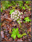 Coltsfoot |
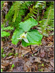 Trillium |
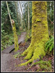 Many Colored Moss |
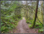
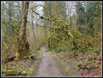 Wildside Trail |
 Quarry TrailS |
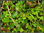 Yellow Violet Almost |
 Ducks On A Pond |
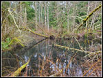 Jerry's Duck Pond |
 Skunk Cabbage |
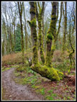
 Arch Ahead |
 The Clay Pit |
 A Skunk Cabbage |
 Mud &I Puddles |
 Tibbetts Creek Bridge |
 Deciduous Trees |
 Not So Great View |
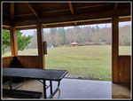 Picnic Shelter |
 Getting Wetter |
 Nice Colors |
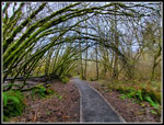 Big Arch |
 Klondike Swamp Trail |
 Another Arch |
 Mossy Arms |
 Broken Arch |
 Big Meadow |
 Another Hiker |
 Mossy Colors |
 Vibrant Colors |
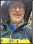 Rare Selfie |
 Into The Home Stretch |
 Final Arch |
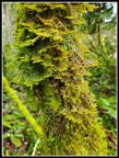 Very Mossy Tree |
Trips - 2023
Home