04-29-23
The
month is almost over and I have
been scrambling to get in miles and elevation gain. With only 24 miles
hiked
with 10 days to go it looked bleak. I did two hikes for 23 miles last
week and 8 miles on Thursday. I needed one more long hike to finish the
month. I did not want to hike on snow. It was in the low then high 70s
the past two days. It was supposed to be in the high 70s again this
day. Avalanche danger was very high. Also, I had few miles early due to
a sore knee. I did not need to tweak it by slipping on snow. I looked
at the three close in trips I could do for 15-17 miles while staying
below the snow. I chose a trip up East Tiger Mountain starting off
Highway 18 north of Tiger Summit. Most of the route is seldom hiked and
not often biked. It provides a lot of solitude. This route is 13.4
miles with 200' of gain to the summit. I planned a little more.
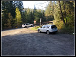
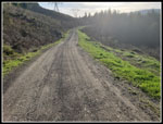
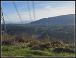
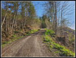
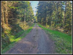
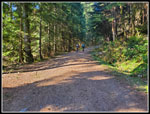
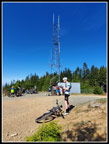
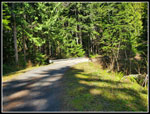
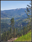
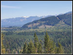
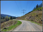
I was on the road at 7:40 am. I turned off Highway 18 and parked at 8:21 am. It was 53 degrees. It was 60 in Issaquah. I started with long sleeves and pant legs zipped on. I did not expect that to last long. At 8:26 am I was on my way. The gated road climbs quickly to the big powerline corridor. The road heads north. The sky was blue and the cool temperature would not last. I soon had a look at the summit of West Rattlesnake Mountain. There was so much glare I could not the upper road well. The top has been recently clearcut and the road is now visible. I could see a little snow. On the way down the view was much clearer and I could see the snow on the road. That is another of my long lonesome road walks at a relatively low elevation. I can get in 17 miles from Highway 18. I was glad I did not go that way. Definitely more snow that I wanted to see this day. The road makes a sharp left turn into forest. The powerlines drop sharply into the valley of the Raging River. Highway 18 can be seen far below.
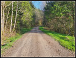
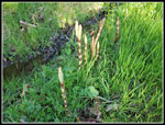
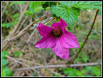
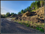
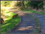
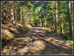
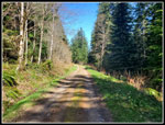
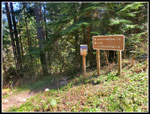
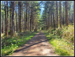
Once in forest I saw a few skunk cabbage plants. There was no yellow colors yet. There were horsetails growing there too. Coltsfoot were in full bloom. Higher up I would see then just beginning to flower. There were a few salmonberry flowers in bloom. Only a few. There are a number of mile markers and signed distances to trail junction. It's easy to guesstimate your position even without a gps track. I have tracks of this route and did not make another one. I passed the 1 mile marker. Soon after I passed the end of the Northwest Timber Trail. For the past few years there was active logging on this road. I hiked only on weekends when they were not working. There are no signs of it now. There is a new quarry alongside the road. The trail drops steeply to a creek crossing. It is not a big drop but is not appreciated when it comes at abut mile 13 on the way back. It is forested and provides shade on a hot day like this one would become. I climbed above the new clearcut. It does provide views out to snow on the Cascade front peaks. I could also look down and see some houses south of Preston. The trail leveled off and I made good time.
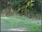
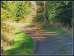
At about 2.2 miles I noticed a little movement in grass along the right side of the road. The road had grass growing on it and thick grass on both sides. It looked like a medium sized animal with no legs. A fat pine marten? Then it stood up and walked onto the road. That was definitely a cat. Not really big but not small. The tail was short. It was a bobcat. I have seen exactly one bobcat in almost 41 years of hiking. That one was on a snowy closed road. It ran across the road and was gone. This one was a lot more interesting. He stopped so I stopped. I took out my camera and took a shot. Unfortunately, I only had my cell phone camera. It is great but has only a 2x optical zoom. That is 52 mm equivalent which is about the same as the human eye. My photos are similar to what I was seeing. I'd guess I was about 40' from the cat. Close but not close enough to spook it. The bobcat started walking and so did I. It then stopped and walked over to the far left side of the road. It was staring intently and crouched a bit. I took a photo. A few seconds later it pounced. It jumped with it's head about six feet off the ground. It crossed the grassy ditch and seemed to land vertically on the sloped brushy ground. Just a few seconds later it walked back to the road with breakfast in it's mouth.
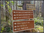
That was a really special moment. Seeing such a seldom viewed animal and seeing it hunt too. It headed down the road at a trot and jumped into the forest on the left. And that was the end of that. Less than ten minutes later I saw a deer on the road but I see them often. The bobcat was a once in a hiker's lifetime event. I picked up my pace and continued along the nearly level road. I did make a stop after 2.5 miles to zip off my pants legs and switch to a short sleeve shirt. It felt like it was in the mid 60s now. I reached the big switchback at 3.1 miles. The road begins a steady ascent from here. I missed the Preston Railroad Grade trail as it goes off right at a reverse angle. It was easy to see coming down. I passed the Silent Swamp Trail on the left. Next was the Bail Out Trail on the right. I crossed the big cement bridge and the grade steepened.
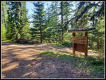
As I passed the Fully Rigid/Joy Ride Trail I was passed by two mountain bikers coming up the road. They were the first people I had seen on my 1:40 hike. I expected to start seeing lots of bikers when I reached the Master Link trail junction. I was correct. When I reached the trail I found more than half a dozen bikers on the road. They would by heading across the road and onto the Quick Link Trail when they continued. The road is shorter than the Quick Link but is much steeper. I was still feeling pretty good. I was a bit concerned about the upper trail after 2800' of gain less than two days earlier. I passed the upper end of the Quick Link. Now I just had a short climb to the top and the road descends a short way to the junction with the East Tiger Summit Spur Road.
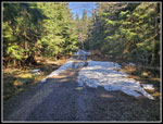
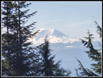
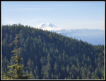
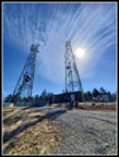
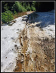
When I reached the junction four bikers zoomed by me and headed for the summit. Now I just had .70 miles with 350' of gain to go. I was 6 miles into my trip. A few weeks earlier there was a trip report mentioning that there was snow the last half mile to the summit. After a few warmer weeks I hoped it was all melted. I did not bring traction devices or poles. At the worst I hoped it would be just a little slush. The first third of the way was bare ground. It was feeling much warmer now even though I was nearing the 3004' summit. Then I reached the last section of snow all the way across the road. It was slushy and short. Bikes had almost worn it down to dirt but not quite. It was no problem. There was snow up higher but it was not all the way across the road. I met another big group of bikers where the East Tiger Summit Trail crosses the road. The last bit is steep but I soon reached the summit. There were about a dozen bikers on top for each of my visits. Some left and other arrived. Mt. Rainier was in the clear.
I sat down in the shade of the only tree I could find. It is maybe 10' tall. It was only 9:50 am. Sadly, I was not the only person to look for shade on a sunny 65 degree morning. Three of us fit in the narrow shade of that small tree. I only spent about 10 minutes on top when I headed down. If I felt good enough I planned to descend the summit spur and climb back to the summit. That would add 1.4 miles with 350' of gain. That would push the day to 14.8 miles with 2400' of gain. The downhill was easy. Coming back up was more of a challenge. I reached the top again at 10:33 am. I went back to my shady spot. I posted photos of my bobcat sighting after the event. I check on the summit and it had 43 likes already. That is near the most I ever get. I am no Instagram star. By the next evening it was up to 146. That is multiple times the most ever. I guess that bobcat is much more popular than I am.
I headed down at 10:52 am. There were only a few short uphills on the way back. I made very good time with a lot less effort than on the ascent. I saw a lot of bikers and four hikers before I reached the Master Link junction. After that I did see more bikes than usual until I reached the Fully Rigid/Joy Ride junction. After that, It was just a couple bikers seen. Below the Master Link there is an old quarry where the road is very wide. A newer trail heads downhill from there. There were half a dozen bikers stopped together and two more a short distance apart. They were all standing at for right in shade while most of the road was in the sunshine. I mentioned to the two that they were true Northwesterners as they were avoiding the sun on one of the first sunny days of the year. They laughed.
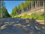
Though much of the route down was in forest the sun seemed to always be directly overhead. I was running out of gas and getting overheated towards the end. The last .75 mile is out in the open in the powerline corridor. That did have a little shade. I was very pleased to reach my car and air conditioning. I arrived back at the car at 1:08 pm. I took 2:16 to come down. I took 2:22 to go up.
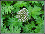
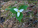
This was a great trip. I maintained a very good pace for almost 15 miles. I had a lot of solitude except near the top of the mountain. I saw wildflowers including coltsfoot, salmonberry, trillium, and yellow violets. I not only had a rare bobcat sighting, I had lots of time to watch and photograph it. I even had a change to see it hunt and succeed. The last 10 days of the month turned a 24 mile month into a 70 mile month. That was quite a finish. I look forward to getting away form Tiger Mountain for wildflower hikes east of the crest and snow scrambles followed by snow free meadows in the high country. For now, this made for a very nice close in hike.
Click on thumbnails to get
larger pictures.
Trips - 2023
Home
I was on the road at 7:40 am. I turned off Highway 18 and parked at 8:21 am. It was 53 degrees. It was 60 in Issaquah. I started with long sleeves and pant legs zipped on. I did not expect that to last long. At 8:26 am I was on my way. The gated road climbs quickly to the big powerline corridor. The road heads north. The sky was blue and the cool temperature would not last. I soon had a look at the summit of West Rattlesnake Mountain. There was so much glare I could not the upper road well. The top has been recently clearcut and the road is now visible. I could see a little snow. On the way down the view was much clearer and I could see the snow on the road. That is another of my long lonesome road walks at a relatively low elevation. I can get in 17 miles from Highway 18. I was glad I did not go that way. Definitely more snow that I wanted to see this day. The road makes a sharp left turn into forest. The powerlines drop sharply into the valley of the Raging River. Highway 18 can be seen far below.
Once in forest I saw a few skunk cabbage plants. There was no yellow colors yet. There were horsetails growing there too. Coltsfoot were in full bloom. Higher up I would see then just beginning to flower. There were a few salmonberry flowers in bloom. Only a few. There are a number of mile markers and signed distances to trail junction. It's easy to guesstimate your position even without a gps track. I have tracks of this route and did not make another one. I passed the 1 mile marker. Soon after I passed the end of the Northwest Timber Trail. For the past few years there was active logging on this road. I hiked only on weekends when they were not working. There are no signs of it now. There is a new quarry alongside the road. The trail drops steeply to a creek crossing. It is not a big drop but is not appreciated when it comes at abut mile 13 on the way back. It is forested and provides shade on a hot day like this one would become. I climbed above the new clearcut. It does provide views out to snow on the Cascade front peaks. I could also look down and see some houses south of Preston. The trail leveled off and I made good time.
At about 2.2 miles I noticed a little movement in grass along the right side of the road. The road had grass growing on it and thick grass on both sides. It looked like a medium sized animal with no legs. A fat pine marten? Then it stood up and walked onto the road. That was definitely a cat. Not really big but not small. The tail was short. It was a bobcat. I have seen exactly one bobcat in almost 41 years of hiking. That one was on a snowy closed road. It ran across the road and was gone. This one was a lot more interesting. He stopped so I stopped. I took out my camera and took a shot. Unfortunately, I only had my cell phone camera. It is great but has only a 2x optical zoom. That is 52 mm equivalent which is about the same as the human eye. My photos are similar to what I was seeing. I'd guess I was about 40' from the cat. Close but not close enough to spook it. The bobcat started walking and so did I. It then stopped and walked over to the far left side of the road. It was staring intently and crouched a bit. I took a photo. A few seconds later it pounced. It jumped with it's head about six feet off the ground. It crossed the grassy ditch and seemed to land vertically on the sloped brushy ground. Just a few seconds later it walked back to the road with breakfast in it's mouth.
That was a really special moment. Seeing such a seldom viewed animal and seeing it hunt too. It headed down the road at a trot and jumped into the forest on the left. And that was the end of that. Less than ten minutes later I saw a deer on the road but I see them often. The bobcat was a once in a hiker's lifetime event. I picked up my pace and continued along the nearly level road. I did make a stop after 2.5 miles to zip off my pants legs and switch to a short sleeve shirt. It felt like it was in the mid 60s now. I reached the big switchback at 3.1 miles. The road begins a steady ascent from here. I missed the Preston Railroad Grade trail as it goes off right at a reverse angle. It was easy to see coming down. I passed the Silent Swamp Trail on the left. Next was the Bail Out Trail on the right. I crossed the big cement bridge and the grade steepened.
As I passed the Fully Rigid/Joy Ride Trail I was passed by two mountain bikers coming up the road. They were the first people I had seen on my 1:40 hike. I expected to start seeing lots of bikers when I reached the Master Link trail junction. I was correct. When I reached the trail I found more than half a dozen bikers on the road. They would by heading across the road and onto the Quick Link Trail when they continued. The road is shorter than the Quick Link but is much steeper. I was still feeling pretty good. I was a bit concerned about the upper trail after 2800' of gain less than two days earlier. I passed the upper end of the Quick Link. Now I just had a short climb to the top and the road descends a short way to the junction with the East Tiger Summit Spur Road.
When I reached the junction four bikers zoomed by me and headed for the summit. Now I just had .70 miles with 350' of gain to go. I was 6 miles into my trip. A few weeks earlier there was a trip report mentioning that there was snow the last half mile to the summit. After a few warmer weeks I hoped it was all melted. I did not bring traction devices or poles. At the worst I hoped it would be just a little slush. The first third of the way was bare ground. It was feeling much warmer now even though I was nearing the 3004' summit. Then I reached the last section of snow all the way across the road. It was slushy and short. Bikes had almost worn it down to dirt but not quite. It was no problem. There was snow up higher but it was not all the way across the road. I met another big group of bikers where the East Tiger Summit Trail crosses the road. The last bit is steep but I soon reached the summit. There were about a dozen bikers on top for each of my visits. Some left and other arrived. Mt. Rainier was in the clear.
I sat down in the shade of the only tree I could find. It is maybe 10' tall. It was only 9:50 am. Sadly, I was not the only person to look for shade on a sunny 65 degree morning. Three of us fit in the narrow shade of that small tree. I only spent about 10 minutes on top when I headed down. If I felt good enough I planned to descend the summit spur and climb back to the summit. That would add 1.4 miles with 350' of gain. That would push the day to 14.8 miles with 2400' of gain. The downhill was easy. Coming back up was more of a challenge. I reached the top again at 10:33 am. I went back to my shady spot. I posted photos of my bobcat sighting after the event. I check on the summit and it had 43 likes already. That is near the most I ever get. I am no Instagram star. By the next evening it was up to 146. That is multiple times the most ever. I guess that bobcat is much more popular than I am.
I headed down at 10:52 am. There were only a few short uphills on the way back. I made very good time with a lot less effort than on the ascent. I saw a lot of bikers and four hikers before I reached the Master Link junction. After that I did see more bikes than usual until I reached the Fully Rigid/Joy Ride junction. After that, It was just a couple bikers seen. Below the Master Link there is an old quarry where the road is very wide. A newer trail heads downhill from there. There were half a dozen bikers stopped together and two more a short distance apart. They were all standing at for right in shade while most of the road was in the sunshine. I mentioned to the two that they were true Northwesterners as they were avoiding the sun on one of the first sunny days of the year. They laughed.
Though much of the route down was in forest the sun seemed to always be directly overhead. I was running out of gas and getting overheated towards the end. The last .75 mile is out in the open in the powerline corridor. That did have a little shade. I was very pleased to reach my car and air conditioning. I arrived back at the car at 1:08 pm. I took 2:16 to come down. I took 2:22 to go up.
This was a great trip. I maintained a very good pace for almost 15 miles. I had a lot of solitude except near the top of the mountain. I saw wildflowers including coltsfoot, salmonberry, trillium, and yellow violets. I not only had a rare bobcat sighting, I had lots of time to watch and photograph it. I even had a change to see it hunt and succeed. The last 10 days of the month turned a 24 mile month into a 70 mile month. That was quite a finish. I look forward to getting away form Tiger Mountain for wildflower hikes east of the crest and snow scrambles followed by snow free meadows in the high country. For now, this made for a very nice close in hike.
 My Car Near Highway 18 |
 Morning Glare |
 In The Powerline Corridor |
 Heading Into Forest |
 Horsetails |
 Blooming Coltsfoot |
 Salmonberry Flower |
 New Quarry |
 Uphill In The Sunshine |
 Something In The Grass |
 It's A Bobcat! |
 It Caught Breakfast |
 One Last Look |
 Grassy Road |
 Lots Of Signs |
 A Trillium |
 Beginning To Bloom |
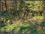 Devil's Club |
 Two Bikers |
 Trail Junction |
 Old Quarry |
 Largest Snow Patch |
 Mt. Rainier - East Tiger |
 Rainier Again |
 Heading Up Again |
 Summit Crowd |
 Twin Towers |
 Melting Snow |
 Green Grass & Coltsfoot |
 Big Bridge |
 Silent Swamp Trail |
 Shady Forest |
 Cascading Creek |
 Rattlesnake Mt. |
 View Northeast |
 Hot Sun Near End |
Trips - 2023
Home