11-12-23
Saturday
was windy and rainy.
Sunday looked to be better. The point forecast for East Tiger Mountain
showed winds of 14 mph gusting to 20 mph. That is not what I want for a
40 degree day. I expected trees and branches down from Saturday's
weather and wanted better conditions. Other forecasts for Issaquah
showed calm winds and a much lower chance of rain. I wanted a longer
hike and I chose the long way up East Tiger hoping the wind was not
likely to happen. In the past year the NWS spot forecasts have been at
odds with other forecasts by showing much more wind and rain than
actually occurred. If there is a big storm it will be rainy and windy.
Otherwise, I am now skeptical. I checked the weather stations all
around Tiger and they all showed 0-3 mph winds at 6:20 am. I was out
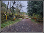
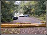
the door early at 6:40 am. I arrived at the gated spur off Highway 18
at 7:22 am. It was just 10 minutes after sunrise. After a drive in the
dark it was fully light as I set out at 7:27 am. It was only 42 degrees
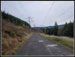
at the start. The spur quickly climbs to the main road beneath the big
powerline towers. I followed this for about half a mile. A cold
headwind caught me attention. Fortunately, this 6 mph wind was the
strongest of the day and it was not steady. I stopped near the turn off
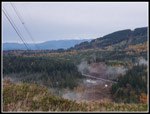
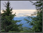
the powerline corridor for photos. Across the way was the summit of
West Rattlesnake Mountain. Peaks along the Cascade front had fresh snow
from the day before. The road turns left and leaves the powerlines for
forest. That was the end of the wind.
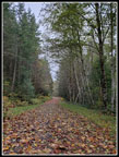
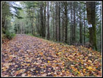
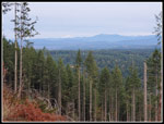
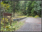
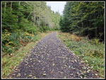
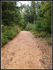
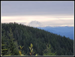
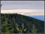
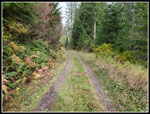
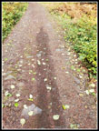
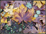
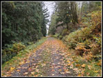
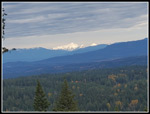
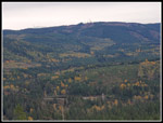
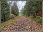
There were deciduous trees along much of the road. At first there were a lot of yellow leaves on the road/trail. I would see a lot of green leaves down and a lot of green leaves still on the trees in mid November. I passed the barbecue. It has been sitting on the side of the road for years. At 1.3 miles I passed the Northwest Timber Trail. It goes back to the Tiger Summit Trailhead. The road drops down to cross a creek and then has a steep climb up the other side. Near the top of this hill I had great views out. The trees were cut down fairly recently. I could see much of the Cascade front from here. Both Mt. Baker and Three Fingers were visible. They had lots of fresh snow. I soon passed the spot where I saw a bobcat last April. There was no cat this time. At 3.1 miles the road switches back and starts to climb. The trailhead is at 1090' and the switchback is at 1475'. That is only a net of 385' gained in 3.1 miles. I had 3.6 miles and 1575' to go.
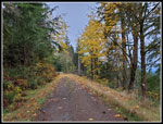
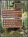
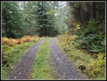
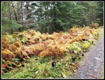
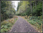
There are about half a dozen bike trails that reach or cross the road. After the first few it gets more likely that I will see some bikers. I kept hiking and I did not see anyone. I noticed at 3.1 miles that I was keeping up a 3.1 mph pace. There was not much elevation gain but that is still pretty fast for me. The first part of the road has seen recent logging and is a bit rocky. After the clearcut it is much nicer. Grass down the center is softer than the rocky tire tracks. I kept up a pretty good pace as the uphill is at a mostly steady grade. Higher up there are some steeper sections. Where the Off The Grid trail crosses the road and becomes the Fully Rigid Trail there are two picnic tables. Several times I have seen bikers there. Not this day. While the tree leaves are largely green higher up the ferns were very brown. I stopped occasionally for photos. The next bike trail crossing is where the Master Link crosses and becomes the Quick Link. This is my usual hiking route up from Tiger Summit. I stayed on the road and kept climbing.
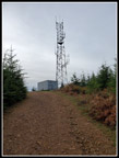
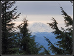
At the six mile mark I reached the spur road up to the summit of East Tiger. Here I saw a bike rider coming up the road from Tiger Summit. He was the first person I saw in those 6 miles. Now that is pretty good solitude for East Tiger Mountain. I checked the gps and I was still at 3.1 mph. I decided to see how fast I could knock of the last .70 miles and 350' of gain. I did pretty well. I reached the summit at 9:35 am. I hiked up 6.7 miles with 2000' of gain in 2:08. That is a 3.1 mph pace. It was strange to have the grade get steeper farther in and each time I checked I was at 3.1 mph. I was afraid that near the 3004' summit the wind might start to blow hard. It never did. It was fully overcast on top but the cloud level was very high. I saw above 10,786' Mt. Baker early on and I could see above 14,411' Mt. Rainier from the summit. Rainier was in the clear. I did not expect that. The biker I saw earlier was on the summit. He was the only person seen over 6.7 miles. I talked with the biker. He saw nobody coming up. That is strange for such a popular place. I took a few photos and headed down at 9:47 am.
I had been debating going straight down or dropping down the spur road and then coming back up to the summit a second time. On the positive side, it turns 13.4 miles into 14.8 miles and brings the elevation gain up to 2400'. On the negative side, It is another climb after 6.7 miles. Near the bottom of the spur I went over to the lower viewpoint. It has an unobstructed view of Mt. Rainier. You can see it from the summit but not completely unobstructed. I then dropped to the bottom of the road and decided to head back uphill. I was a bit slower this time. By now, the bikers started to arrive. I saw several groups heading up. At the summit I finally had brunch. It was still only 10:17 am and I had 8.1 miles done. I started down at 10:25 am.
The descent was easier but the miles piled up. 10 miles is a good day. At that point I still had 5 miles to go. To make things more interesting, I was trying out a new pair of boots. Downhill was a bit painful after miles of descent. Not too bad but noticeable. The NWS showed the chance of rain going from 12% to 47% at noon. I sped along to try to get down before any rain arrived. I had a few sprinkles on the drive home but the hike was totally dry. At the Northwest Timber Trail I spoke with two women hikers. I had not seen anyone in an hour. The powerline corridor was not windy. Easy hiking the last part down. With about a quarter mile to go I was passed by five trucks and SUVs on the road. They had a key to the gate. I have no idea what they were doing. I reached the gate at 12:41 pm. I took 2:15 coming down. I added .25 miles be repeating a short section to be sure I would be at or above 15 miles. Even accounting for that, I took a few minutes longer coming down that going up. I guess I was just getting tired near the end.
This turned out to be a great hike. 15 miles was only one mile less than my longest day hike of the year. With an early start, a fast pace, and short breaks, I finished well before 1:00 pm. My fear of high winds was not a problem. I had very little wind. The rain held off too. I saw some people while coming down from East Tiger but over 15 miles I saw far fewer people than expected. On my drive home I reached Seattle just as the Seahawks were kicking off. I passed the stadium with no backups. That was great timing. This trip puts me at 851 miles. Barring injury, a second 900+ mile year is a near certainty. The temperature was in the low to mid 40s most all day. It is not yet winter but it is getting colder. That coolness had a major impact on my fast pace. I won't have to worry about too hot days for another six months or so.
Click on thumbnails to get
larger pictures.
Trips - 2023
Home
There were deciduous trees along much of the road. At first there were a lot of yellow leaves on the road/trail. I would see a lot of green leaves down and a lot of green leaves still on the trees in mid November. I passed the barbecue. It has been sitting on the side of the road for years. At 1.3 miles I passed the Northwest Timber Trail. It goes back to the Tiger Summit Trailhead. The road drops down to cross a creek and then has a steep climb up the other side. Near the top of this hill I had great views out. The trees were cut down fairly recently. I could see much of the Cascade front from here. Both Mt. Baker and Three Fingers were visible. They had lots of fresh snow. I soon passed the spot where I saw a bobcat last April. There was no cat this time. At 3.1 miles the road switches back and starts to climb. The trailhead is at 1090' and the switchback is at 1475'. That is only a net of 385' gained in 3.1 miles. I had 3.6 miles and 1575' to go.
There are about half a dozen bike trails that reach or cross the road. After the first few it gets more likely that I will see some bikers. I kept hiking and I did not see anyone. I noticed at 3.1 miles that I was keeping up a 3.1 mph pace. There was not much elevation gain but that is still pretty fast for me. The first part of the road has seen recent logging and is a bit rocky. After the clearcut it is much nicer. Grass down the center is softer than the rocky tire tracks. I kept up a pretty good pace as the uphill is at a mostly steady grade. Higher up there are some steeper sections. Where the Off The Grid trail crosses the road and becomes the Fully Rigid Trail there are two picnic tables. Several times I have seen bikers there. Not this day. While the tree leaves are largely green higher up the ferns were very brown. I stopped occasionally for photos. The next bike trail crossing is where the Master Link crosses and becomes the Quick Link. This is my usual hiking route up from Tiger Summit. I stayed on the road and kept climbing.
At the six mile mark I reached the spur road up to the summit of East Tiger. Here I saw a bike rider coming up the road from Tiger Summit. He was the first person I saw in those 6 miles. Now that is pretty good solitude for East Tiger Mountain. I checked the gps and I was still at 3.1 mph. I decided to see how fast I could knock of the last .70 miles and 350' of gain. I did pretty well. I reached the summit at 9:35 am. I hiked up 6.7 miles with 2000' of gain in 2:08. That is a 3.1 mph pace. It was strange to have the grade get steeper farther in and each time I checked I was at 3.1 mph. I was afraid that near the 3004' summit the wind might start to blow hard. It never did. It was fully overcast on top but the cloud level was very high. I saw above 10,786' Mt. Baker early on and I could see above 14,411' Mt. Rainier from the summit. Rainier was in the clear. I did not expect that. The biker I saw earlier was on the summit. He was the only person seen over 6.7 miles. I talked with the biker. He saw nobody coming up. That is strange for such a popular place. I took a few photos and headed down at 9:47 am.
I had been debating going straight down or dropping down the spur road and then coming back up to the summit a second time. On the positive side, it turns 13.4 miles into 14.8 miles and brings the elevation gain up to 2400'. On the negative side, It is another climb after 6.7 miles. Near the bottom of the spur I went over to the lower viewpoint. It has an unobstructed view of Mt. Rainier. You can see it from the summit but not completely unobstructed. I then dropped to the bottom of the road and decided to head back uphill. I was a bit slower this time. By now, the bikers started to arrive. I saw several groups heading up. At the summit I finally had brunch. It was still only 10:17 am and I had 8.1 miles done. I started down at 10:25 am.
The descent was easier but the miles piled up. 10 miles is a good day. At that point I still had 5 miles to go. To make things more interesting, I was trying out a new pair of boots. Downhill was a bit painful after miles of descent. Not too bad but noticeable. The NWS showed the chance of rain going from 12% to 47% at noon. I sped along to try to get down before any rain arrived. I had a few sprinkles on the drive home but the hike was totally dry. At the Northwest Timber Trail I spoke with two women hikers. I had not seen anyone in an hour. The powerline corridor was not windy. Easy hiking the last part down. With about a quarter mile to go I was passed by five trucks and SUVs on the road. They had a key to the gate. I have no idea what they were doing. I reached the gate at 12:41 pm. I took 2:15 coming down. I added .25 miles be repeating a short section to be sure I would be at or above 15 miles. Even accounting for that, I took a few minutes longer coming down that going up. I guess I was just getting tired near the end.
This turned out to be a great hike. 15 miles was only one mile less than my longest day hike of the year. With an early start, a fast pace, and short breaks, I finished well before 1:00 pm. My fear of high winds was not a problem. I had very little wind. The rain held off too. I saw some people while coming down from East Tiger but over 15 miles I saw far fewer people than expected. On my drive home I reached Seattle just as the Seahawks were kicking off. I passed the stadium with no backups. That was great timing. This trip puts me at 851 miles. Barring injury, a second 900+ mile year is a near certainty. The temperature was in the low to mid 40s most all day. It is not yet winter but it is getting colder. That coolness had a major impact on my fast pace. I won't have to worry about too hot days for another six months or so.
 Starting Out |
 Under Powerlines |
 West Rattlesnake Mt. |
 Cascades & Highway |
 Lots Of Leaves |
 One Mile Done |
 Bake & 3 Fingers |
 More Fall Color |
 Cascading Creek |
 Many Signs |
 Big Bridge |
 Grassy Trail |
 Brown Ferns |
 Trail Crossing |
 Old Quarry |
 Continuing Uphill |
 Predator Trail |
 Summit Spur Road |
 Almost To Summit |
 Mt. Rainier From Summit |
 Rainier From Viewpoint |
 Back On Summit |
 Summit Towers |
 Lower Viewpoint Again |
 Heading Down |
 Softer Tread |
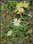 Wildflower! |
 My Shadow |
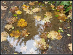 Submerged Leaves |
 Maple Leaves |
 Leafy Road |
 Lit Up Three Fingers |
 Rattlesnake Mountain |
 Powerlines Ahead |
 Busy Highway 18 |
Trips - 2023
Home