01-14-23
I
wanted to get in a morning hike. Recently we have had strong winds. The
forecast was for gust ranging from 10-40 mph.That is quite a
difference. The wind was calm early morning. I was tired of hikes on
the north side of West Tiger Mountain to avoid the southerly winds. I
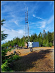
chose to take a chance on a hike up East Tiger from Tiger Summit. I was
slow to get going and did not arrive at the inner parking lot until
8:45 am. By 8:49 I was on my way. This is primarily a mountain bikers
trailhead. I usually start by 8:15 am to get out ahead of the bikers.
Four bikers zoomed by me on the connector trail. I crossed the road
onto the NW Timber Trail. A few minutes later I turned off on the
Master Link. Since this is an uphill only trail for bikes I don't have
to worry about fast bikes coming down. Hikers can be in both directions.
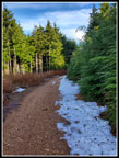
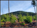
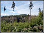
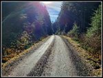
So far there was no wind at all. Though I was in forest there was a little sun shining through. We had not seen much of that so far this year. I set out at a good but not fast pace. I expected the first bikers to catch up with me soon. I was not aware of snow conditions at the 3007' summit. The West Tiger Peaks had a good snow cover in December but recent rains had melted nearly all of it away. I through in light YakTrax but did not pack microspikes. About half way up a group of four or five bikers passed me. That was it on the Master Link. It was much less crowded than I expected. I popped out on the road at 9:55 am. I went across and took the Quick Link Trail. This route follows the road uphill but is at a gentler grade with switchbacks. This day I was out for the most miles. That is the Quick Link. Near the top a lone biker almost caught up with me. I kept waiting for him to catch up so I would step off the trail. I just stayed behind me until I reached the road once again.
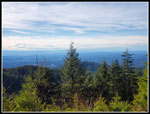
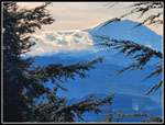
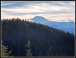
The biker than passed by and took off. I walk up the road finding no snow at all. At the high point it drops slightly to the junction with the East Tiger Summit spur road. This is just .70 miles from the top. I was passed by a couple groups of bikers on this part of the route. The road was mostly snow free. There is one big log angling down across the road. I could walk under one end. The other is laying on the road. In several spots near the top the snow covered about half of the road. It was no problem at all. On the steep stretch just below the summit a few bikes went by then slowed to my speed. I almost caught up to them again. I reached the top at 10:29 am. I was not alone at the summit. The sky had cleared on my way up. I had a clear view out to Mt. Rainier. I took some photos and then headed down. This trip does not have much elevation gain so I occasionally drop down the spur road and climb back up. That adds 1.4 miles and 360' of elevation gain to the trip. The spur road has some flat sections and some steep ones. The second time up is a bit tougher. I detoured to the lower viewpoint going down.
I reached the summit for the second time at 11:01 am. There were fewer people on top this time. I took some more photos and walked over to a hiker with a ham radio setup at the picnic tables. The only person I know of who hikes to summits and checks out who hear him is Tim Nair. He had back to back to back conversations but I finally was able to talk to him. Yes, it was Tim. I knew of him and he knew of my website and trip reports. We had a short conversation before his radio was buzzing again. I am amazed it took this long to see him on a summit.
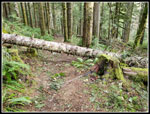
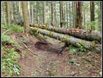
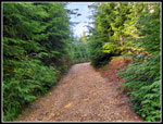
I packed up and headed down at 11:11 am. The usual loop is just over 8 miles. My double summit would up that to about 9.7 miles. I needed another short detour to bring it up to 10 mile. I dropped down the summit spur and turned right at the bottom. This is the road route back to the Connector Trail and the inner parking lot. The wind had picked up on my first time up the summit spur. It was windy but not too bad on the summit. The same occurred on my second trip up. The second time down the wind sounded much louder and trees were bending a lot over my head. I jogged a short way until the wind slowed down. I do fear falling trees and branches. The Master Link had four trees down across it and the summit spur had the one big one. They all fell in the very recent wind storms we had. The road down form the summit spur junction was largely our of the wind. At a low spot the road turns left and drops down to Highway 18. That would be my route down.
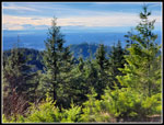
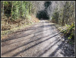
I still needed some extra mileage so I went straight at that junction. The road climbs as it starts to circle East Tiger Mountain. I added not just the .30 miles needed to get to 10, I continued another half mile to get my total up to 11 miles. I passed the East Tiger Trail and the new Side Hustle Trail. Where I turned around I had a view to Middle Tiger Mountain. I headed back to the junction and turned right. Now I just had bout 2.7 mile of road and the short Connector Trail to go. I saw more bikers coming up as I descended. It still was not as crowded as usual. One reason might be that the Seahawks had a 1:30 pm playoff game with San Francisco. I was back to my car radio before it began. The road seems to go on a lot farther than the mileage states. I was glad to reach the Connector Trail.
After one third of a mile, I was back in the parking lot. It was 12:58 pm. I took 4:09 to hike 11 miles with 2100' of gain. The wind did blow hard at times near the top of East Tiger but was not much of a problem. I brought an umbrella since there was a chance of rain but I ended up with a lot of sunshine. I hiked in the low to high 40s. Seattle reached the high 50s. It was much warmer than an average January 14. It was nice to get away from the north side of West Tiger Mountain. With the December snow nearly entirely gone at 3000' the hiking was easy. The Seahawks were big underdogs. They led at halftime. They lost by 20 points. The hike was the high point of my day.
Click on thumbnails to get
larger pictures.
Trips - 2023
Home
So far there was no wind at all. Though I was in forest there was a little sun shining through. We had not seen much of that so far this year. I set out at a good but not fast pace. I expected the first bikers to catch up with me soon. I was not aware of snow conditions at the 3007' summit. The West Tiger Peaks had a good snow cover in December but recent rains had melted nearly all of it away. I through in light YakTrax but did not pack microspikes. About half way up a group of four or five bikers passed me. That was it on the Master Link. It was much less crowded than I expected. I popped out on the road at 9:55 am. I went across and took the Quick Link Trail. This route follows the road uphill but is at a gentler grade with switchbacks. This day I was out for the most miles. That is the Quick Link. Near the top a lone biker almost caught up with me. I kept waiting for him to catch up so I would step off the trail. I just stayed behind me until I reached the road once again.
The biker than passed by and took off. I walk up the road finding no snow at all. At the high point it drops slightly to the junction with the East Tiger Summit spur road. This is just .70 miles from the top. I was passed by a couple groups of bikers on this part of the route. The road was mostly snow free. There is one big log angling down across the road. I could walk under one end. The other is laying on the road. In several spots near the top the snow covered about half of the road. It was no problem at all. On the steep stretch just below the summit a few bikes went by then slowed to my speed. I almost caught up to them again. I reached the top at 10:29 am. I was not alone at the summit. The sky had cleared on my way up. I had a clear view out to Mt. Rainier. I took some photos and then headed down. This trip does not have much elevation gain so I occasionally drop down the spur road and climb back up. That adds 1.4 miles and 360' of elevation gain to the trip. The spur road has some flat sections and some steep ones. The second time up is a bit tougher. I detoured to the lower viewpoint going down.
I reached the summit for the second time at 11:01 am. There were fewer people on top this time. I took some more photos and walked over to a hiker with a ham radio setup at the picnic tables. The only person I know of who hikes to summits and checks out who hear him is Tim Nair. He had back to back to back conversations but I finally was able to talk to him. Yes, it was Tim. I knew of him and he knew of my website and trip reports. We had a short conversation before his radio was buzzing again. I am amazed it took this long to see him on a summit.
I packed up and headed down at 11:11 am. The usual loop is just over 8 miles. My double summit would up that to about 9.7 miles. I needed another short detour to bring it up to 10 mile. I dropped down the summit spur and turned right at the bottom. This is the road route back to the Connector Trail and the inner parking lot. The wind had picked up on my first time up the summit spur. It was windy but not too bad on the summit. The same occurred on my second trip up. The second time down the wind sounded much louder and trees were bending a lot over my head. I jogged a short way until the wind slowed down. I do fear falling trees and branches. The Master Link had four trees down across it and the summit spur had the one big one. They all fell in the very recent wind storms we had. The road down form the summit spur junction was largely our of the wind. At a low spot the road turns left and drops down to Highway 18. That would be my route down.
I still needed some extra mileage so I went straight at that junction. The road climbs as it starts to circle East Tiger Mountain. I added not just the .30 miles needed to get to 10, I continued another half mile to get my total up to 11 miles. I passed the East Tiger Trail and the new Side Hustle Trail. Where I turned around I had a view to Middle Tiger Mountain. I headed back to the junction and turned right. Now I just had bout 2.7 mile of road and the short Connector Trail to go. I saw more bikers coming up as I descended. It still was not as crowded as usual. One reason might be that the Seahawks had a 1:30 pm playoff game with San Francisco. I was back to my car radio before it began. The road seems to go on a lot farther than the mileage states. I was glad to reach the Connector Trail.
After one third of a mile, I was back in the parking lot. It was 12:58 pm. I took 4:09 to hike 11 miles with 2100' of gain. The wind did blow hard at times near the top of East Tiger but was not much of a problem. I brought an umbrella since there was a chance of rain but I ended up with a lot of sunshine. I hiked in the low to high 40s. Seattle reached the high 50s. It was much warmer than an average January 14. It was nice to get away from the north side of West Tiger Mountain. With the December snow nearly entirely gone at 3000' the hiking was easy. The Seahawks were big underdogs. They led at halftime. They lost by 20 points. The hike was the high point of my day.
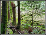 Light In The Forest |
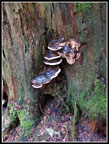 Fungi |
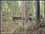 Big Bridge |
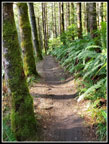
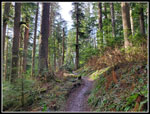 Nice Forest |
 Log Down |
 Two Logs Down |
 Mossy Erratic |
 Another Bridge |
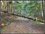 Largest Log Down |
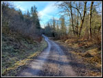
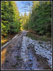 Snow On Road |
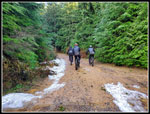 Biker Pass By |
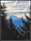 Mt. Rainier From Summit |
 People On Top |
 Heading Down |
 Lower Viewpoint |
 Heading Up Again |
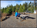 Tim Nair Is On The Air |
 Big Clouds |
 South Tiger Mountain |
 Rainier From Viewpoint Rainier From Viewpoint |
 East Tiger Again |
 Middle Tiger Mountain |
 Sunshine On Road |
 Bikes Coming Up |
 Shade Ahead |
 Trees Aligned |
Trips - 2023
Home