01-29-22
Gary
and John were free for a trip.
We discussed a ski or snowshoe trip. It would be extremely cold with a
possibility of 10+ mph winds. 15 degrees with a lower wind chill did
not appeal to us. Gary came up with a good idea. Last spring he and I
did a trip on Chuckanut Mountain with a lake, viewpoints, and the Rock
Trail. We decided to do it backwards this time. John had been on the
Rock Trail but no other part of this route. We met in Lynnwood at 7:45
am and headed north. We took Chuckanut Drive and arrived at the Two
Dollar Trailhead at 8:52 am. There were only about 5 cars there. We
were packed and on our way by 8:58 am. The temperature was near 30
which was much warmer than in the mountains. The trail starts with
smooth switchbacks climbing up the slope. It helped to warm us up.
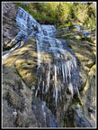
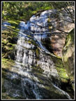
The grade flattens and our pace picked up. It is 1.7 miles to Fragrance Lake. We kept up a 2.8 mph pace and reached the lake in 39 minutes at 9:37 am. Along the way we stopped at the waterfall for some photos. There was a steady flow though not as much as after steady rain. At the lake we chose to go around the left side. We had a little wind but not much coming in. The ridge blocked it. The lake had wind lines and less than a perfect reflection. We did have blue sky most all day. I expected to see hikers who came up the Fragrance Lake Trail from Chuckanut Drive but we did not see anyone. We continued beyond the lake and passed the Fragrance Lake Trail. We then reached the old road. Usually, I turn left and climb up to the Cyrus Gates Overlook. This time we chose to go right. We quickly turned onto the South Lost Lake Trail. The route is on an old road. It is gently graded like most of our route.
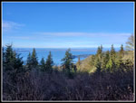
We saw a couple mountain bikers on the way. Hikers were few and far between. The next junction has a map. South Lost Lake Trail continues to the left. We took the other trail. This route leaves Larrabee State Park and enters a clear cut. We first went to the east looking viewpoint. We had a good look at Mt. Baker. One then another group of hikers arrived. It seems this place is getting crowded. After a short break we headed up the road to Burnout Knob. We were out of the forest and into the sunshine. That was a good thing because it was still very cold. A light breeze with the temperature in the low 30s was cold. I had a glove off to take photos and my hand was chilled through. We had good views out to the San Juan Islands. Farther south was Anacortes and Washington Park. Mt. Baker was back in sight. The January blue sky was unusual but welcome. We had lunch while I put on a jacket.
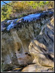
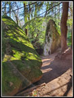
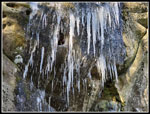
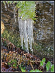
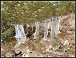
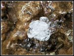
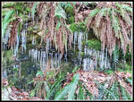
We arrived at Burnout at 11:15 am. We stayed until 12:08 pm. We headed back the way we came. Sunshine gave way to shaded forest. At the junction we turned right on the South Lost Lake Trail. It was all downhill. Along the way we saw one display of hair ice. It melts fast above freezing. It was cold in the forest. We also saw a cascading creek with a series of icicles. We stopped for photos at each opportunity. This route would provide the first time hiking the Rock Trail uphill. This would be the steepest part of the entire hike. The trail has several sets of wooden stairways. The first was down near the bottom. Instead of staring with the great sandstone walls up high, we started in forest and climbed up to the rocks. On the way we saw some small icicle patches and then some big and even bigger ones. The rocks are worth a lot of photo stops. The icicle display was even better this day.
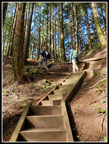
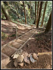
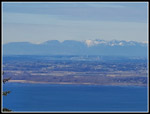
The upper rock walls are so steep that the icicles were right overhead in places. We did not linger beneath them. The bright icicles with some sun shining on them in places were really beautiful. We did see hikers coming down but fewer than I expected. I'm not sure if the NFL Conference Championship Games were the reason but the crowds were less than expected all day. The top of the Rock Trail has a series of very steep steps that were a bit easier to go up than down. At the top, we had a short walk over to the Cyrus Gates Overlook. We took another short break at the viewpoint. I looked north trying to figure out where thinks were. Google Maps helped. Gary saw Vancouver. I also saw faint tall buildings. I was the only one who brought a super zoom camera. It stated acting up at Burnout Knob. I tried it again but could not get a shot to work.
Our next step was to close our loop. We headed down the road. Suddenly, there were cars and trucks coming up and going down. The road was a lot busier than the trails had been. Soon enough, we reached the old road coming in from the left. The old road back down to Fragrance Lake is pretty easy walking. We reached the next junction and turned right for the short walk to the lake. Rather than hike around the lake we decided to take a detour seen on maps. Next to the top of the Fragrance Lake Trail is another unmarked trail. It climbs up to the top of the step wall on the west side of the lake. It has ups and downs. In a few spots, we could look down and see bits of the lake. The trail then descended to meet the Two Dollar Trail just before the lake.
Now we just had about 1.5 miles to go. I still had on my jacket. It was still cool at the time of the heat of the day. We saw a few groups still coming in but not many. We reached the trailhead at 3:27 pm. For the day we hiked about 10.6 miles with 2400' of gain. With all our breaks and photo stops we were on the trail for 6:29. The lack of crowds also pertained to the drive home. There was only a very short slowdown in Everett.
For a last minute choice, this one turned out great. Instead of near zero wind chill temperatures in the mountain passes, we had sunshine and temperatures below then above freezing. The sunshine made it even better. Our route included a lake, two great viewpoints, and the Rock Trail complete with a terrific icicle show. The lack of crowds most of the day made it even better. I look forward to more snowshoe and ski trips this winter. For this day, a hike on Chuckanut Mountain was exactly what we needed.
Trips - 2023
Home


