01-01-23
After
an 11 mile hike with 3000' of
gain on New Year's Eve, I managed to get out again on New Year's Day.
After completing a 1,000 mile year in 2022 it is tough to start all
over again. Best to get a fast start to the new year. I was not fast
our of my house. I reached the trailhead off the High Point exit on
I-90 at 8:25 am. I was on my way at 8:29 am. There was only one car in
the lot and with one window duck taped with plastic and the fender duck
taped on I don't think it was a morning hiker. The car was still there
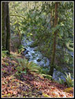
when I returned 4 hours later. Issaquah Creek was flowing strong and I
stopped for photos from the bridge. I did not know what my route would
be. I was tired from the day before NYE Tiger hike that covered 11
miles with 3000' of gain. I figured about 8 miles would be good.
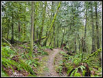
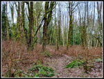
Within one minute four bikers passed my heading uphill. I would not see another person for over an hour. The gentle downhill grade of the old railroad grade makes for fast hiking. The waterfall along the way had more water than I had seen in some time. At the junction with the trail heading uphill off the grade, I checked my phone GPS app. It showed I had traveled 10.5 miles. Say what? I saved the track and started a new one. I have no idea how Gaia started recording a track 10 miles down the freeway while my phone was in my pocket. On the way back I found the distance was .60 miles. I just added that to the track I did have. I cheated a bit and switched back to my summer backpack for the day. I will go back to my normal bigger and heavier winter daypack. I had plenty of room for my needs but there would be no microspikes or umbrella or saw this day. I had winter boots on but the light pack helped after the tougher trip the day before.
I made good though not great time. I reached the one road crossing about 2.2 miles in at 9:17 am. I was feeling good and thinking about doing a bit longer trip. Rather than just the Water Tower Loop I decided to continue on the main trail to the WTA Bridge. That would get me about 9 miles with 1500' of gain. About an hour in I met the first person since the bikers right at the start. I hoped that most folks stayed up past midnight and would be late to the trail. That seems to be what happened. I reached the low spot and climbed back uphill. I noted the turnoff to the Mitchell Hill Connector Trail. I have done it a few times to add some elevation to a trip. On the descent to the WTA Bridge I saw a couple more bikers. I reached the bridge at 10:05 am. That was just over 4 miles. I wanted to get to 4.5 so I continued past the erratic next to the trail. At 4.5 miles I turned around.
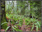
I passed the WTA Bridge and then climbed back uphill. When I reached the Mitchell Hill Connector I decided to take it. It is a step trail and I was getting a bit tired. My pace slowed down. The day was very misty but it now began to clear a bit. Where the deciduous trees had no leaves I could see through them to Tiger Mountain. I continued uphill and the grade eases.I decided to go all the way to the road. There is a sign warning not to enter the private road. I did not do so. On my way back I stopped and retraced .15 miles then turned around. I calculated that would get me up to 11 miles. I miscalculated and had bout 11.3 miles for the day. I did stop for my only food and water break. Within 5 minutes I was back on my way. I reached the main trail and turned left. Now I just had about 3.4 miles to go. I did start to see more people. I saw very few people for the first 8 miles.
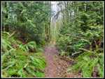
The route back is easy but a second 11 mile day in a row was slowing me down. When I turned off the main route and began to drop down to the railroad grade I had solitude back. I was really glad to reach the old grade. Now I just had a gentle uphill climb of .60 miles back to my car. On the descent I had a little sun shining through the forest. It felt pretty warm on a mid 40 degree day. Soon it was nearly all blue sky. That was not in any weather forecast. It was not sunny in Seattle either but it was very nice on the east side of Lake Washington. Unfortunately, when I reached the grade it was in shade. The hillside right above me was bathed in sunlight. I was in cold shade. The last part did not take long. I was back at my car at 12:50 pm. I took 4:21 to hike 11.3 miles.
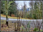
My timing was excellent. A Seahawks game would be starting at 1:10 pm. I missed all the traffic. In fact, the traffic was surprisingly light on the drive home. I did not set out to do a 11 mile hike with 1900' of elevation gain but I was glad to have done it. I rested on the third day of the holiday weekend but I did get in a whole lot of hiking on the first two days. This weekend I finished off a really good hiking year and set the new year off to a good start.
Click on thumbnails to get
larger pictures.
Trips - 2023
Home
Within one minute four bikers passed my heading uphill. I would not see another person for over an hour. The gentle downhill grade of the old railroad grade makes for fast hiking. The waterfall along the way had more water than I had seen in some time. At the junction with the trail heading uphill off the grade, I checked my phone GPS app. It showed I had traveled 10.5 miles. Say what? I saved the track and started a new one. I have no idea how Gaia started recording a track 10 miles down the freeway while my phone was in my pocket. On the way back I found the distance was .60 miles. I just added that to the track I did have. I cheated a bit and switched back to my summer backpack for the day. I will go back to my normal bigger and heavier winter daypack. I had plenty of room for my needs but there would be no microspikes or umbrella or saw this day. I had winter boots on but the light pack helped after the tougher trip the day before.
I made good though not great time. I reached the one road crossing about 2.2 miles in at 9:17 am. I was feeling good and thinking about doing a bit longer trip. Rather than just the Water Tower Loop I decided to continue on the main trail to the WTA Bridge. That would get me about 9 miles with 1500' of gain. About an hour in I met the first person since the bikers right at the start. I hoped that most folks stayed up past midnight and would be late to the trail. That seems to be what happened. I reached the low spot and climbed back uphill. I noted the turnoff to the Mitchell Hill Connector Trail. I have done it a few times to add some elevation to a trip. On the descent to the WTA Bridge I saw a couple more bikers. I reached the bridge at 10:05 am. That was just over 4 miles. I wanted to get to 4.5 so I continued past the erratic next to the trail. At 4.5 miles I turned around.
I passed the WTA Bridge and then climbed back uphill. When I reached the Mitchell Hill Connector I decided to take it. It is a step trail and I was getting a bit tired. My pace slowed down. The day was very misty but it now began to clear a bit. Where the deciduous trees had no leaves I could see through them to Tiger Mountain. I continued uphill and the grade eases.I decided to go all the way to the road. There is a sign warning not to enter the private road. I did not do so. On my way back I stopped and retraced .15 miles then turned around. I calculated that would get me up to 11 miles. I miscalculated and had bout 11.3 miles for the day. I did stop for my only food and water break. Within 5 minutes I was back on my way. I reached the main trail and turned left. Now I just had about 3.4 miles to go. I did start to see more people. I saw very few people for the first 8 miles.
The route back is easy but a second 11 mile day in a row was slowing me down. When I turned off the main route and began to drop down to the railroad grade I had solitude back. I was really glad to reach the old grade. Now I just had a gentle uphill climb of .60 miles back to my car. On the descent I had a little sun shining through the forest. It felt pretty warm on a mid 40 degree day. Soon it was nearly all blue sky. That was not in any weather forecast. It was not sunny in Seattle either but it was very nice on the east side of Lake Washington. Unfortunately, when I reached the grade it was in shade. The hillside right above me was bathed in sunlight. I was in cold shade. The last part did not take long. I was back at my car at 12:50 pm. I took 4:21 to hike 11.3 miles.
My timing was excellent. A Seahawks game would be starting at 1:10 pm. I missed all the traffic. In fact, the traffic was surprisingly light on the drive home. I did not set out to do a 11 mile hike with 1900' of elevation gain but I was glad to have done it. I rested on the third day of the holiday weekend but I did get in a whole lot of hiking on the first two days. This weekend I finished off a really good hiking year and set the new year off to a good start.
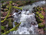 Roaring Issaquah Creek |
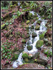 Cascading Falls |
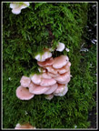 Mushrooms |
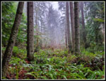
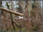
 Misty Overcast Colors |
 Mist In The Air |
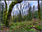
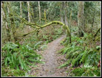 Arch Over Trail |
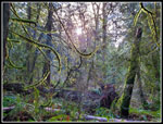
 Mist & Moss |
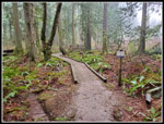
 First Bridge |
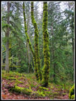
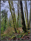
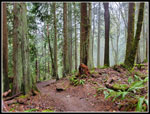 Cedar Trees |
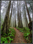 Tall Trees |
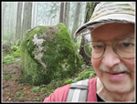 Me & My Erratic |
 WTA Bridge |
 Mossy Forest |
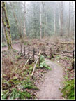
 Ferns On Mitchell Hill |
 Near The End |
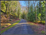
 Road & Tiger Mt. |
 Leafless Bushes |
 Raindrop |
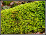 Really Green |
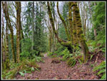 Leaf Covered Trail |
 More Good Colors |
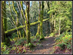
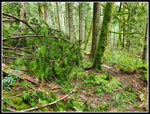 Tree Across Trail |
 Slow |
 Sunshine |
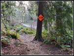
 Curved Trail |
 Moss & Sunshine |
 Suspended Tree |
 On The Grad Again |
 Creek Below |
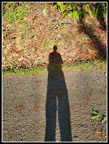 Me & My Shadow |
Trips - 2023
Home