11-24-23
This
would be a rare cold sunny
late November day. I was home late from a Thanksgiving dinner the night
before and decided on a trip up Mt. Si on a less traveled route. I
wanted to get in a longer than average hike with good elevation gain.
First, I had to scrape ice on my car. It was just below
freezing
almost everywhere. It seemed few people were heading to work on Friday
morning. I had an easy drive through Seattle. Past Mercer Island I went
into fog. It as off and on for much of the drive. I hoped it would be
gone by the time I reached North Bend. In fact, it was. I pulled into
the Mt. Teneriffe parking lot at 8:27 am. For most of my trips here I
arrive at about 8:00 am. The lot usually has 6-10 cars in it. This day
there were closer to 25 or more cars. It was clear and 29 degrees. I
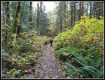
packed up and was on the trail at 8:33 am. The first half mile of the
new trail went by fast. I turned left onto the old road/trail and at
.87 miles I reached the junction with the Teneriffe Falls Trail. I
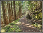
continued left as the trail grade was gentle. There are a couple
bridges and several rock hop creeks. After a very dry summer and fall,
the creeks were flowing. It was easy to hop rocks to get across. I
reached the second bridge at the end of the flats. The waterfall had
plenty of water. Now the grade steepens.
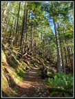
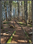
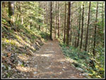
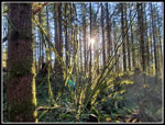
The first 1.5 miles gained 460'. It is a steady grade up that was steep for a car when it was a road. I definitely slowed down. I just switched from my summer day pack to my winter one. It is much heavier. The Mt. Si trail was reported to be snow free. The route up via the Mt. Teneriffe Road often has snow near the top when the Mt. Si trail has none. I carried microspikes just in case. There was no snow at all. I short way up the steeper road, a lone runner passed me coming down. The temperature rose a little but stayed in the mid 30s. I stayed warm hiking uphill. In places a little sun shone through the forest. Mostly the forest kept me in the shade.
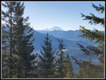
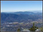
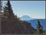
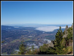
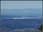
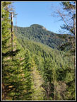
I took a very short break just after the last switchback to the left at 3.5 miles in. This spot has a view out to Mt. Rainier. It was in the clear. A slightly steeper section ends when the road grade becomes flat. It's a chance to speed up and still work less. The road turns uphill again for the last bit to the Mt. Si junction. The junction is at the 4.2 mile mark. I just had .80 miles more to go. Right after turning onto the Mt. Si spur I saw the only hair ice of the day. It was starting to melt but still in pretty good shape. I reached the highest point on my route at 4050'. Then it was downhill to the Haystack and then down into Haystack Basin. I saw one other runner coming down high on the route and at the North Bend overlook I saw two other hikers. They left soon after I arrived. The sky was still blue and there was almost no wind. That was good at it was still in the mid 30s. With a cap and gloves on plus a windbreaker it was not too cold. Mt. Rainier was in sight and from North Bend to Seattle and the Olympic Mountains. In places the morning fog was still blocking out all the sunshine.
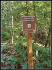
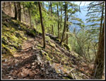
I spent a full 40 minutes in Haystack Basin. I arrived at 10:54 am and left at 10:34 am. I took one more stop at the bench next to the Haystack in bright sunshine. I would not see much more on the rest of the hike. I hiked back to the high point and then it was all downhill. Near the Si junction I passed a hiker coming uphill. She was only the fifth hiker I passed up and part way down. I made steady progress coming down. The road can be a bit rocky in places so it is not as nice as a soft dirt trail. With about 2 miles to go I reached the trail over to Teneriffe Falls. In the old days there was a boot path alongside the creek that went by the falls and then on to the top of Mt. Teneriffe. Since then, a trail was built over to the falls. It is much longer than the old straight up the fall line path. It has been nearly a decade since I have hiked that route. The new Falls trail is very popular. A minimal unsigned boot path showed up along the Mt. Teneriffe Road several years ago. Recently, it is improved and sports a sign. I have passed by it many times. I never tried it.
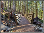
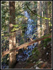
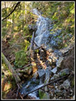
At the junction two hikers were coming out of the Falls Connector trail. I wondered if it was easy to cross the creek below the falls so I asked. They said there was a new bridge. My curiosity was engaged. I was finishing a 10 mile 3300' gain hike. Did I want to go exploring this new to me trail? Well, yes I did. The Connector Trail drops a little and climbs a bit. There is not much elevation change. I reached the new bridge to find very little water flowing beneath it. Recent photos of the waterfall showed a lot of water. Just after the bridge, the Connector Trail meets the Teneriffe Falls Trail. There were hikers at the junction. And plenty more up above. The trail is narrow and rocky. I went up several switchbacks and there were more above. The trail finally came close to the creek and the volume went way up. I was very near the falls. I had a glimpse between the trees. A path went downhill and I took it in an attempt to see more of the falls. A path left the ridge and cut across the slope to a pretty good look at the falls. My memory was of being at the base of a big falls. This was not right. I did get some good views of falls though.
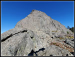
I climbed back up to the main trail. Was there another falls above. I figured I would be up to 3800' of gain if I headed down. I decided that was enough. I had more groups to pass on the descent. When I reached the Connector junction I decided solitude beats passing so many folks on a narrow trail. I short order I was back on the Teneriffe Road/Trail and descending once again. I dropped down to the flats and crossed the bridge with the small waterfall. Now I just had 1.5 miles to go. With .87 miles left I reached the bottom of the Teneriffe Falls Trail. I left the road for the new trail down to the trailhead with .50 miles to go. I reached the parking lot at 2:33 pm. I took exactly 6 hours to hike 12 miles with 3800' of gain. I took a nice long break atop Mt. Si in bright sunshine. An unexpected plus getting to hike a new trail on a mountain I have hiked for more than three decades. The lot may have been less filled than it was early in the morning. All in all, it was a great day on the trail.
Click on thumbnails to get
larger pictures.
Trips - 2023
Home
The first 1.5 miles gained 460'. It is a steady grade up that was steep for a car when it was a road. I definitely slowed down. I just switched from my summer day pack to my winter one. It is much heavier. The Mt. Si trail was reported to be snow free. The route up via the Mt. Teneriffe Road often has snow near the top when the Mt. Si trail has none. I carried microspikes just in case. There was no snow at all. I short way up the steeper road, a lone runner passed me coming down. The temperature rose a little but stayed in the mid 30s. I stayed warm hiking uphill. In places a little sun shone through the forest. Mostly the forest kept me in the shade.
I took a very short break just after the last switchback to the left at 3.5 miles in. This spot has a view out to Mt. Rainier. It was in the clear. A slightly steeper section ends when the road grade becomes flat. It's a chance to speed up and still work less. The road turns uphill again for the last bit to the Mt. Si junction. The junction is at the 4.2 mile mark. I just had .80 miles more to go. Right after turning onto the Mt. Si spur I saw the only hair ice of the day. It was starting to melt but still in pretty good shape. I reached the highest point on my route at 4050'. Then it was downhill to the Haystack and then down into Haystack Basin. I saw one other runner coming down high on the route and at the North Bend overlook I saw two other hikers. They left soon after I arrived. The sky was still blue and there was almost no wind. That was good at it was still in the mid 30s. With a cap and gloves on plus a windbreaker it was not too cold. Mt. Rainier was in sight and from North Bend to Seattle and the Olympic Mountains. In places the morning fog was still blocking out all the sunshine.
I spent a full 40 minutes in Haystack Basin. I arrived at 10:54 am and left at 10:34 am. I took one more stop at the bench next to the Haystack in bright sunshine. I would not see much more on the rest of the hike. I hiked back to the high point and then it was all downhill. Near the Si junction I passed a hiker coming uphill. She was only the fifth hiker I passed up and part way down. I made steady progress coming down. The road can be a bit rocky in places so it is not as nice as a soft dirt trail. With about 2 miles to go I reached the trail over to Teneriffe Falls. In the old days there was a boot path alongside the creek that went by the falls and then on to the top of Mt. Teneriffe. Since then, a trail was built over to the falls. It is much longer than the old straight up the fall line path. It has been nearly a decade since I have hiked that route. The new Falls trail is very popular. A minimal unsigned boot path showed up along the Mt. Teneriffe Road several years ago. Recently, it is improved and sports a sign. I have passed by it many times. I never tried it.
At the junction two hikers were coming out of the Falls Connector trail. I wondered if it was easy to cross the creek below the falls so I asked. They said there was a new bridge. My curiosity was engaged. I was finishing a 10 mile 3300' gain hike. Did I want to go exploring this new to me trail? Well, yes I did. The Connector Trail drops a little and climbs a bit. There is not much elevation change. I reached the new bridge to find very little water flowing beneath it. Recent photos of the waterfall showed a lot of water. Just after the bridge, the Connector Trail meets the Teneriffe Falls Trail. There were hikers at the junction. And plenty more up above. The trail is narrow and rocky. I went up several switchbacks and there were more above. The trail finally came close to the creek and the volume went way up. I was very near the falls. I had a glimpse between the trees. A path went downhill and I took it in an attempt to see more of the falls. A path left the ridge and cut across the slope to a pretty good look at the falls. My memory was of being at the base of a big falls. This was not right. I did get some good views of falls though.
I climbed back up to the main trail. Was there another falls above. I figured I would be up to 3800' of gain if I headed down. I decided that was enough. I had more groups to pass on the descent. When I reached the Connector junction I decided solitude beats passing so many folks on a narrow trail. I short order I was back on the Teneriffe Road/Trail and descending once again. I dropped down to the flats and crossed the bridge with the small waterfall. Now I just had 1.5 miles to go. With .87 miles left I reached the bottom of the Teneriffe Falls Trail. I left the road for the new trail down to the trailhead with .50 miles to go. I reached the parking lot at 2:33 pm. I took exactly 6 hours to hike 12 miles with 3800' of gain. I took a nice long break atop Mt. Si in bright sunshine. An unexpected plus getting to hike a new trail on a mountain I have hiked for more than three decades. The lot may have been less filled than it was early in the morning. All in all, it was a great day on the trail.
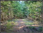
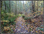 Leafy Trail |
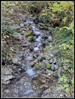 Creek Is Running |
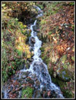 Colorful Waterfall |
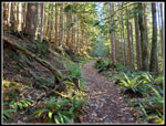 Road To Trail |
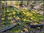 Mossy Hillside |
 Sunshine & Shadows |
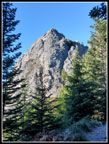
 Teneriffe Summit |
 Mt. Rainier In Sight |
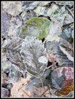 Icy Leaves |
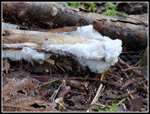 Hair Ice |
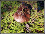
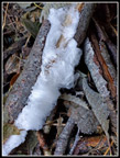
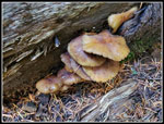 Mushrooms |
 Nearing High Point |
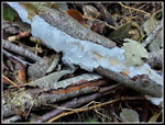
 Another Mushroom |
 Haystack In Sight |
 View West From Si |
 Mt.Rainier From Mt. Si |
 Fog Below |
 Camp Robber Jay |
 Seattle & Olympics |
 Haystack Above |
 Trail Border |
 Another Hair Ice Shot |
 Last Hair Ice |
 Mt. Teneriffe Summit |
 Descending |
 Falls Connector Trail |
 New Bridge |
 Framed Falls |
 Lower Teneriffe Falls |
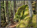 Mossy Rocks |
 Sunshine |
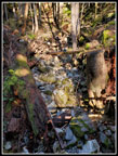 Dry Creek? |
 Another Person! |
 Final Half Mile |
 Lit Up Moss |
Trips - 2023
Home