09-09-23
I
wanted to get in a high elevation
gain hike without a long drive. The day looked to have a high
temperature of about 80 degrees. I needed an early start. I chose a
trip up Mt. Teneriffe via the old road/trail. This would give me plenty
of miles too. I did the hike last year. Checking earlier trip reports
then I noted that my two previous trips took 3:00 and 3:00 to summit.
Quite a coincidence. I then hiked up in... 2:59. That is even more of a
coincidence. A 6.5 mile hike gaining 4100' with a one minute variation
in three consecutive trips. Now that I am another year older, how long
would it take this time? I was on the road at 6:37 am. I reached the
trailhead at 6:23 am. I was on the trail at 7:27 am. There were only
three other cars in the lot. It was sunny but only 50 degrees. I had on
long pants and a long sleeve shirt. It would be much warmer when I
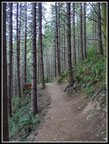
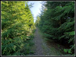
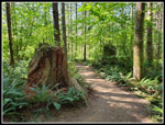
returned. The first half mile is on the new trail up to the old road.
It gains elevation but is well graded. I was moving pretty fast. At the
road I turned left and continued.
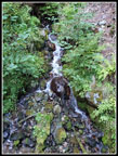
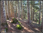
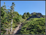
Soon the Teneriffe Falls Trail heads off right. It is signed. The long trail to Mt. Teneriffe is not. Several of the creeks on the next nearly flat section were still running. I stopped at the one waterfall for a few photos and just after that it the first of three routes over to the Mt. Si Trail. I zipped off my pants legs and put on a short sleeve shirt. It was warming up quickly. I took 29 minutes to hike the first 1.5 miles. With 5 miles to go, the trail begins the steady climb with only a few flat sections to the end of the road/trail. I set a steady pace I would maintain. I was moving pretty fast though that is all relative. A lone hiker caught up quickly and zoomed by. When I was his age, about 35 years ago, I used to do that too. While checking out my hiking log the night before, I noted that my first trip up Teneriffe was in March 1994. That as 29 1/2 years ago. I did it on snow and came back in May 1994 for a snow free ascent. There was very little information about it back then. Now there are two trails with plenty of signs and gps tracks on the Internet. It is much less an adventure but still a long hike.
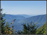
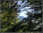
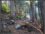
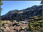
The upper turnoff for Teneriffe Falls used to be hard to find. Now it has a sign. There are half a dozen or more sets of switchbacks as the trail climbs up the slope. Some sections are very steep for a road. My pace was slowing a bit but still pretty steady. I soon saw a hiker coming down. A hiker with a dog passed by going up. Another hiker passed going down. After the last leftward switchback before the Mt. Si junction I always take a break. Time for food and water and the first good views. Mt. Rainier is in sight as are Rattlesnake Lake and Ledges. Trees are growing fast and the views will not exist in a few years. After the steepest section the route flattens. This is a good spot for a walking rest before the uphill starts once again. A few short switchbacks took me to the junction with the trail over to the Mt. Si summit basin. There is a sign with map here. I was 4.2 miles up with 2.3 miles to go. Above the road used to enter a big clear cut. The view was great but it was completely in the open. The trees have grown back. Now there is no view and it is much cooler on a hot day.
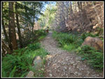
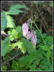
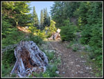
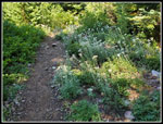
Although there is a lot of elevation gain, the forest kept me cool enough. The climbing ends and the route starts a very gentle descent. I saw a few wildflowers along this section. Not many, but a few are hanging on. The route begins to climb once again. I looked hard and noticed the spot where a cabin used to stand. I recall several conversations with the owners. Now it is hard to spot the small flat spot above the road/trail. The tread is rocky for a while. This was not much fun on the descent though it is now that long. I reached the end of the road at the ridge top saddle. There is another map there. It used to be about .75 miles to the summit along the ridge top boot path. Now there is a switchbacking trail that is less steep but longer. I thought about the 3:00 times I have been logging and picked up my pace for the rest of the way to the summit. I was pleased that I could pick up my pace a little. I passed one more runner coming down. That bought the count up to three going up and three coming down in nearly six miles.
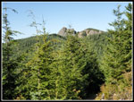
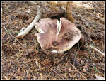
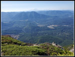
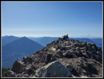
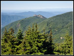
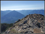
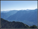
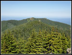
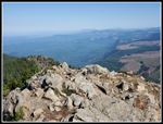
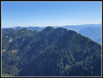
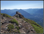
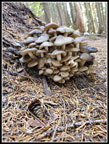
The trail climbs up to just below the false summit and then drops to another saddle. I saw a lot of big mushrooms that were just coming out of the ground. A little recent rain seems to have set their growth. I reached the junction with the much shorter ridge trail from Teneriffe Falls and a viewpoint right after. I had seven minutes left before I had taken 3 hours. I sped up the last climb and scramble to the top, arriving after 2:56. That is my best time in the last four ascents though only 4 minutes less than the worst time. There was almost no wind and the sky was mostly blue. There was some haze and it was worse to the north. Mt. Baker was barely visible. Mt. Rainier was clearer to the south. I arrived at 10:23 am to find two other groups on the summit. Shortly, one group headed down. Ten minutes later so did the other group. I had the summit to myself. It is surprising that Teneriffe is not more crowded on a sunny Saturday morning. I'm sure that Mt. Si and Mailbox Peak were very crowded. They always are.
I took lots of photos and had brunch. Seattle and Bellevue were in the clear but my 2x zoom lens was not up to the challenge. I single hikers came up and almost immediately headed down. I left the summit at 10:58 am. I stopped at the lower viewpoint where the trail turns sharply right. A lone runner passed by as I started down and passed me again at the lower viewpoint. I took a few more photos and headed back at 11:10 am. It as much easier hiking down the soft tread of the new trail. I stopped at a big pile of mushrooms that I completely missed on the way up. I dropped down to the saddle on the ridge and took a closer look at all the big mushrooms I passed on the way up. Some were just barely above ground. The mushroom show up high was pretty good. On the other hand, it was the first weekend in quite a while that I did not see a single saprophyte. The climb up from the saddle was probably the biggest ascent on the way down. From there it was easy walking back to the old road end.
The first section down from the road end has the loose rocks in the trail. I did not slip but I was careful. After that it was just a few sections of loose crap on the road/trail. Most of the way down was still in shade. The few open sections showed just how warm it was becoming. I liked the shade. I took a break at the Mt. Si junction. A little more down to the flat section then the fairly steep switchbacks began. I like the opportunity to get in a 13 mile hike but the old road is not soft and my feet began to feel the pounding. I saw only a half dozen or so hikers and runners on the way down. I was pleased to reach the bottom of the steady descent. I passed the waterfall had sped up on the flats. I passed the Teneriffe Falls lower junction and finally left the road with just a half mile of trail to go. I reached the trailhead at 1:54 pm. There were about 35 cars in the lot which is half of the 70 spaces. My car registered 80 degrees on my way out. I-405 was closed south of I-90 for construction and from there to Seattle was a mess. It took my one hour to drive just less than 6 miles across Mercer Island and to I-5. It as faster than my hiking speed but not by much.
This turned out to be a great hike. I covered 13 miles with 4400' of gain. I have had two days gaining over 5000' this year but only two more over 4000' including this trip. There is still time to get in a few more this year. The weather was excellent. Cool at first and hot at the end but nearly all in the shade except for the summit. The trail was not crowded. Neither was the summit after my first 10 minute on top. I have managed a little total solitude on most of my summit visits. My feet were a little sore but not enough to keep me from another hike Sunday morning. Only the drive home was a pain. The day on the trail was terrific.
Click on thumbnails to get
larger pictures.
Trips - 2023
Home
Soon the Teneriffe Falls Trail heads off right. It is signed. The long trail to Mt. Teneriffe is not. Several of the creeks on the next nearly flat section were still running. I stopped at the one waterfall for a few photos and just after that it the first of three routes over to the Mt. Si Trail. I zipped off my pants legs and put on a short sleeve shirt. It was warming up quickly. I took 29 minutes to hike the first 1.5 miles. With 5 miles to go, the trail begins the steady climb with only a few flat sections to the end of the road/trail. I set a steady pace I would maintain. I was moving pretty fast though that is all relative. A lone hiker caught up quickly and zoomed by. When I was his age, about 35 years ago, I used to do that too. While checking out my hiking log the night before, I noted that my first trip up Teneriffe was in March 1994. That as 29 1/2 years ago. I did it on snow and came back in May 1994 for a snow free ascent. There was very little information about it back then. Now there are two trails with plenty of signs and gps tracks on the Internet. It is much less an adventure but still a long hike.
The upper turnoff for Teneriffe Falls used to be hard to find. Now it has a sign. There are half a dozen or more sets of switchbacks as the trail climbs up the slope. Some sections are very steep for a road. My pace was slowing a bit but still pretty steady. I soon saw a hiker coming down. A hiker with a dog passed by going up. Another hiker passed going down. After the last leftward switchback before the Mt. Si junction I always take a break. Time for food and water and the first good views. Mt. Rainier is in sight as are Rattlesnake Lake and Ledges. Trees are growing fast and the views will not exist in a few years. After the steepest section the route flattens. This is a good spot for a walking rest before the uphill starts once again. A few short switchbacks took me to the junction with the trail over to the Mt. Si summit basin. There is a sign with map here. I was 4.2 miles up with 2.3 miles to go. Above the road used to enter a big clear cut. The view was great but it was completely in the open. The trees have grown back. Now there is no view and it is much cooler on a hot day.
Although there is a lot of elevation gain, the forest kept me cool enough. The climbing ends and the route starts a very gentle descent. I saw a few wildflowers along this section. Not many, but a few are hanging on. The route begins to climb once again. I looked hard and noticed the spot where a cabin used to stand. I recall several conversations with the owners. Now it is hard to spot the small flat spot above the road/trail. The tread is rocky for a while. This was not much fun on the descent though it is now that long. I reached the end of the road at the ridge top saddle. There is another map there. It used to be about .75 miles to the summit along the ridge top boot path. Now there is a switchbacking trail that is less steep but longer. I thought about the 3:00 times I have been logging and picked up my pace for the rest of the way to the summit. I was pleased that I could pick up my pace a little. I passed one more runner coming down. That bought the count up to three going up and three coming down in nearly six miles.
The trail climbs up to just below the false summit and then drops to another saddle. I saw a lot of big mushrooms that were just coming out of the ground. A little recent rain seems to have set their growth. I reached the junction with the much shorter ridge trail from Teneriffe Falls and a viewpoint right after. I had seven minutes left before I had taken 3 hours. I sped up the last climb and scramble to the top, arriving after 2:56. That is my best time in the last four ascents though only 4 minutes less than the worst time. There was almost no wind and the sky was mostly blue. There was some haze and it was worse to the north. Mt. Baker was barely visible. Mt. Rainier was clearer to the south. I arrived at 10:23 am to find two other groups on the summit. Shortly, one group headed down. Ten minutes later so did the other group. I had the summit to myself. It is surprising that Teneriffe is not more crowded on a sunny Saturday morning. I'm sure that Mt. Si and Mailbox Peak were very crowded. They always are.
I took lots of photos and had brunch. Seattle and Bellevue were in the clear but my 2x zoom lens was not up to the challenge. I single hikers came up and almost immediately headed down. I left the summit at 10:58 am. I stopped at the lower viewpoint where the trail turns sharply right. A lone runner passed by as I started down and passed me again at the lower viewpoint. I took a few more photos and headed back at 11:10 am. It as much easier hiking down the soft tread of the new trail. I stopped at a big pile of mushrooms that I completely missed on the way up. I dropped down to the saddle on the ridge and took a closer look at all the big mushrooms I passed on the way up. Some were just barely above ground. The mushroom show up high was pretty good. On the other hand, it was the first weekend in quite a while that I did not see a single saprophyte. The climb up from the saddle was probably the biggest ascent on the way down. From there it was easy walking back to the old road end.
The first section down from the road end has the loose rocks in the trail. I did not slip but I was careful. After that it was just a few sections of loose crap on the road/trail. Most of the way down was still in shade. The few open sections showed just how warm it was becoming. I liked the shade. I took a break at the Mt. Si junction. A little more down to the flat section then the fairly steep switchbacks began. I like the opportunity to get in a 13 mile hike but the old road is not soft and my feet began to feel the pounding. I saw only a half dozen or so hikers and runners on the way down. I was pleased to reach the bottom of the steady descent. I passed the waterfall had sped up on the flats. I passed the Teneriffe Falls lower junction and finally left the road with just a half mile of trail to go. I reached the trailhead at 1:54 pm. There were about 35 cars in the lot which is half of the 70 spaces. My car registered 80 degrees on my way out. I-405 was closed south of I-90 for construction and from there to Seattle was a mess. It took my one hour to drive just less than 6 miles across Mercer Island and to I-5. It as faster than my hiking speed but not by much.
This turned out to be a great hike. I covered 13 miles with 4400' of gain. I have had two days gaining over 5000' this year but only two more over 4000' including this trip. There is still time to get in a few more this year. The weather was excellent. Cool at first and hot at the end but nearly all in the shade except for the summit. The trail was not crowded. Neither was the summit after my first 10 minute on top. I have managed a little total solitude on most of my summit visits. My feet were a little sore but not enough to keep me from another hike Sunday morning. Only the drive home was a pain. The day on the trail was terrific.
 Starting Up Trail |
 Waterfall |
 Hiker Passed Me |
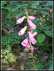
 Bleeding Hearts |
 Narrow Trail |
 Mt. Si Summit |
 Rattlesnake Lake |
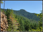
 View Of Teneriffe Summit |
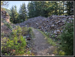 Blasted Road |
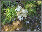 Blooming Pearly Everlasting |
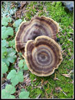 Neat Fungi |
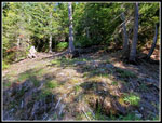 Old Cabin Site |
 Colorful Moss |
 New Mushroom |
 Nearing The Summit |
 Lower Viewpoint |
 Summit Is Above |
 Last Short Scramble |
 Hikers On Summit |
 Rattlesnake Lake & Ledge |
 Mt. Si Haystack |
 Benchmark |
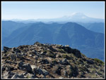 Rainier & Washington |
 Mailbox Peak |
 Russian Butte |
 Dixie Peak |
 North To Mt. Baker |
 Green Mountain |
 Heading Down |
 Pile Of Mushrooms |
 Back On Old Road |
 Many Pearly Everlasting |
 Ferns Everywhere |
 Foxglove |
 Teneriffe Summit |
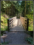 Waterfall Bridge |
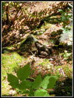 Big Toad |
 Almost Back |
Trips - 2023
Home