06-03-23
Janet
was free to join me for a
hike. I suggested a trip I had not done in 10 years and Janet had never
done. After long drives east last weekend we were both ready for a
shorter drive. We left my place at 7:15 am heading east. We headed up
the Middle Fork Snoqualmie Road. The usual crowds at the Mailbox Peak
Trail were seen. People were walking back along the road from a mile
away just past the Mine Creek area. We were expecting a lot less people
on our route. We arrived at the Middle Fork Trailhead at 8:17 am. I did
not see a parking permit noted so I checked windshields. Three NW
Forest Passes, three Discover Passes, two cars with neither and two
with both. That was not helpful. At the trail sign it did note that the
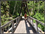
NW Forest Pass is needed. We hit the trail at 8:24 am. We crossed the
bridge over the MF and turned right on the Pratt Connector Trail.
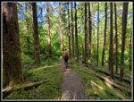
On my two 2013 visits to the Big Tree the trail was brand new. The road was not yet paved. The trail has a number of ups and downs but no big climbs as it follows the river downstream. The river is seen at first and again near the Pratt River but not much in between. Most early wildflowers were finished. We saw some trillium leaves but no flowers. Bleeding hearts were mostly past prime but a few were near prime still. False lily of the valley was the flower of the day. It began immediately and never really stopped. We saw it in profusion for most of the hike. Even with our later than usual start, we did not see many hikers. On the hike to the Pratt River we saw two hikers coming back and two at the viewpoint above the MF River.
The trail was mostly in shade and it was cool in the morning. I kept on my zip off pants legs and a long sleeve shirt. We had a view of Mt. Garfield early. Bunchberries were in bloom. They were the first ones I have seen this year. Janet noticed two lone coralroot saprophytes. I saw some last week too. This is a really green trail with moss, ferns, and lots of trees. Most of the way was in forest and I never bothered to put on sunscreen. Early on, the open sunny sections were appreciated. We reached the viewpoint of the MF River at 3.3 miles after 1:39. It was still only 10:03 am. Two people were at the overlook so I took a photo and turned around. Now the route turned 90 degrees and headed up the Pratt River Valley. The blooming false lily of the valley kept on lining the trail. We kept an eye out for wild ginger but saw none. I often see it with false lily of the valley.
At 4.5 miles we reached the sign. It points left to continue up the valley on the old logging railroad grade. I came down that route on a one way 16 mile trip from I-90 to the MF Road in 2013. We went right on the route to the Big Tree. On my 2013 trips to the Big Tree the route from the sign was very hard to follow. It was a very faint boot path. Now it is a trail. It is well enough traveled to be easy to follow. As we neared the Big Tree I looked up and spotted it. We arrived at 11:01 after hiking 4.5 miles. 2:44 minutes was not too bad with lots of photo stops. We took photos of the tree and had an early lunch. After that, I went looking for the sign. It read: Diameter 9' 6" Height Approx 250'. I took a photo of smaller trees near the Big Tree and at home I was able to identify the tree. It is still standing but the sign is gone.
After lunch we headed back at 11:15 am. There was a step to drop on the trail and as I bent down I noticed a big wild ginger leaf. There was a flower under the leaf. We poked around and found a number of flowers here. We saw no other ones on the trail back. About a mile along the trail we met a family out for a hike. They were looking for Dingford Creek but took a right instead of a left after crossing the bridge over the MF. I think the route they took is more interesting than the more popular trail up the river. We took another break at the point the Pratt Trail turns into the Pratt Connector Trail. There is a big campsite there and it makes a good spot to stop. The trail goes downriver on the way in and upriver coming back. Therefore, it has more elevation gain on the return. Most trails we hike but uphill on the way in. Though there is not much elevation change along the way the ups and downs add up. We ended with a bout 2000' of gain for the day.
Though it was never crowded we did see groups coming in periodically. One family was heading in for an overnight camping trip. We set a comfortable pace though neither of us was in a hurry to get back. I stopped for some photos at the bridge over Rainy Creek and then we climbed up the only switchbacks of the day. We arrived back at the trailhead at 3:01 pm. That was 6:37 after we started. for the day we hiked 9 miles with 2000' of gain.
It was an excellent day on the trail. More blooming false lily of the valley than I have seen on one hike. So many shades of green. Not very many other hikers seen. And the Big Tree. It was worth the effort. We managed to avoid snow higher up and bright sunshine in most places. Instead, we had easy walking in a deep dark forest. That is not a bad way to spend a spring day.
Click on thumbnails to get
larger pictures.
Trips - 2023
Home
On my two 2013 visits to the Big Tree the trail was brand new. The road was not yet paved. The trail has a number of ups and downs but no big climbs as it follows the river downstream. The river is seen at first and again near the Pratt River but not much in between. Most early wildflowers were finished. We saw some trillium leaves but no flowers. Bleeding hearts were mostly past prime but a few were near prime still. False lily of the valley was the flower of the day. It began immediately and never really stopped. We saw it in profusion for most of the hike. Even with our later than usual start, we did not see many hikers. On the hike to the Pratt River we saw two hikers coming back and two at the viewpoint above the MF River.
The trail was mostly in shade and it was cool in the morning. I kept on my zip off pants legs and a long sleeve shirt. We had a view of Mt. Garfield early. Bunchberries were in bloom. They were the first ones I have seen this year. Janet noticed two lone coralroot saprophytes. I saw some last week too. This is a really green trail with moss, ferns, and lots of trees. Most of the way was in forest and I never bothered to put on sunscreen. Early on, the open sunny sections were appreciated. We reached the viewpoint of the MF River at 3.3 miles after 1:39. It was still only 10:03 am. Two people were at the overlook so I took a photo and turned around. Now the route turned 90 degrees and headed up the Pratt River Valley. The blooming false lily of the valley kept on lining the trail. We kept an eye out for wild ginger but saw none. I often see it with false lily of the valley.
At 4.5 miles we reached the sign. It points left to continue up the valley on the old logging railroad grade. I came down that route on a one way 16 mile trip from I-90 to the MF Road in 2013. We went right on the route to the Big Tree. On my 2013 trips to the Big Tree the route from the sign was very hard to follow. It was a very faint boot path. Now it is a trail. It is well enough traveled to be easy to follow. As we neared the Big Tree I looked up and spotted it. We arrived at 11:01 after hiking 4.5 miles. 2:44 minutes was not too bad with lots of photo stops. We took photos of the tree and had an early lunch. After that, I went looking for the sign. It read: Diameter 9' 6" Height Approx 250'. I took a photo of smaller trees near the Big Tree and at home I was able to identify the tree. It is still standing but the sign is gone.
After lunch we headed back at 11:15 am. There was a step to drop on the trail and as I bent down I noticed a big wild ginger leaf. There was a flower under the leaf. We poked around and found a number of flowers here. We saw no other ones on the trail back. About a mile along the trail we met a family out for a hike. They were looking for Dingford Creek but took a right instead of a left after crossing the bridge over the MF. I think the route they took is more interesting than the more popular trail up the river. We took another break at the point the Pratt Trail turns into the Pratt Connector Trail. There is a big campsite there and it makes a good spot to stop. The trail goes downriver on the way in and upriver coming back. Therefore, it has more elevation gain on the return. Most trails we hike but uphill on the way in. Though there is not much elevation change along the way the ups and downs add up. We ended with a bout 2000' of gain for the day.
Though it was never crowded we did see groups coming in periodically. One family was heading in for an overnight camping trip. We set a comfortable pace though neither of us was in a hurry to get back. I stopped for some photos at the bridge over Rainy Creek and then we climbed up the only switchbacks of the day. We arrived back at the trailhead at 3:01 pm. That was 6:37 after we started. for the day we hiked 9 miles with 2000' of gain.
It was an excellent day on the trail. More blooming false lily of the valley than I have seen on one hike. So many shades of green. Not very many other hikers seen. And the Big Tree. It was worth the effort. We managed to avoid snow higher up and bright sunshine in most places. Instead, we had easy walking in a deep dark forest. That is not a bad way to spend a spring day.
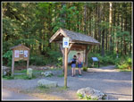 Trailhead Signboard |
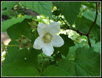
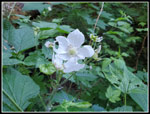 Thimbleberry |
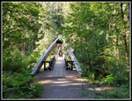 Gateway Bridge |
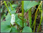
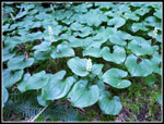 False Lily Of The Valley |
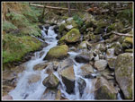 Rainy Creek |
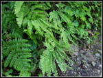 Maidenhair Ferns |
 More FLOTValley |
 Neat Mix |
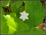 Starflower |
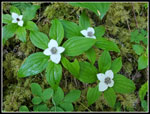 Bunchberries |
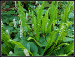
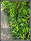
 FLOTV & FernS |
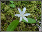 Queen's Cup |
 Guttation |
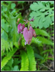 Bleeding Hearts |
 Neat Color |
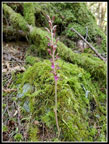 Saprophyte |
 Mossy Ground |
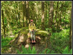 Janet & Big Stump |
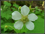 Big Flower |
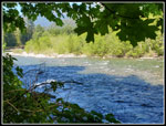 By The River |
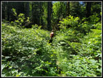 Brushy |
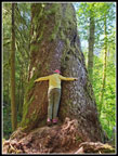 Tree Hugger |
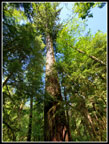 250' Tall |
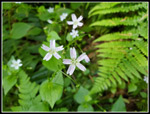 Spring Beauty |
 Wild Ginger |
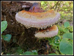
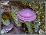
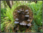 Fabulous Fungi |
 More Spring Beauty |
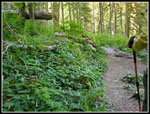
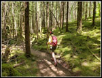 Open Forest |
 Flower & Berry |
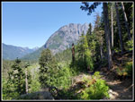 Garfield Mountain |
 Good Lighting |
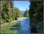 MF River |
 Almost Back |
Trips - 2023
Home