09-16-23
Kim
was free for a hike. We
kicked around a few ideas and I came up with Wallace Lake. A good
distance and a little below average elevation gain but nearly all in
forest. For another 80 degree day that sounded good. Kim was interested
in including the Falls. That is the way we have done it before. It
includes a logging road walk that is in the open. We would be hiking
that early in the day. It would likely be fine. The falls and lake it
would be. I picked up Kim in Shoreline at 6:45 am. We headed east and
arrived at Wallace Falls State Park at about 7:35 am. The
parking near the cabins was about full. The rest of the lot was less
than half full. It was only about 50 degrees when we were on our way at
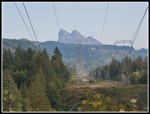
7:45 am. We stopped at the viewpoint under the powerlines. Mt. Baring,
Index, and Persis were in sight though the sky was a bit white. Some
smoke from the Airplane Lake fire was to the east. Overhead it was blue.
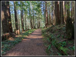
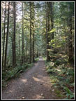
The route then headed into the forest. We quickly reached the first junction and turned right on the Woody Trail. The route drops down to the Wallace River. The water level is very low. I was not expecting much water over the falls and this confirmed it. I usually take the Railroad Grade Trail but this route is shorter. We would be in double digits even with the shortest possible route. The sun was still very low and we could see it shining through the trees. There are a few ups and downs. We passed one trail coming down from the Railroad Grade. This would be where we would complete our loop. We climbed up to a high point where the second trail drops from the RR Grade. Then we dropped back down to the river where the North Fork from Wallace Lake comes in. Once across the bridge the steepest climb of the day starts. By now other hikers were catching up with us.
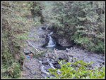
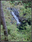
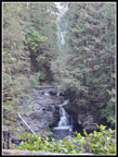
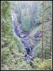
At the top of the climb is the roofed picnic shelter and the first views of the falls. As always, I dropped to view the lower falls and came back up. There were hikers down on the rocks by the river. One had been been in the pool in the river. We could also see up to a larger falls. The water flower was very small over the falls. I stopped to zip off my pants legs and switch to a short sleeve shirt. It was already warmed up considerably. The trail climbs in switchbacks to viewpoints of the Middle and Upper Falls. At the Upper Falls we took some photos and headed for the route up to the road above. There were several groups at the viewpoint and just higher. We continued part way up to a spot for a brunch break. I had breakfast at 6:10 am and it was now 9:50 am. We had hiked just short of one fourth of the trip. Kim noticed a pretzel tree. One smaller tree had grown in circle around the larger tree. There is a Pretzel Tree Trail on Squak Mountain and this one looks very similar.
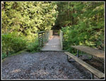
After our break we climbed up to the road and turned right. A short hike brought us to the newish bridge over the Wallace River. The falls is just below around a corner. In the not too distant future, a trail from the Reiter Trail System will reach the bridge. Until then, it is a dead end with just overgrown logging roads on the other side. We headed back. At the top of the Falls Trail, we continued straight ahead on the road heading for Wallace Lake. It is 2.5 miles to the lake. We left the state part and forest gave way to recent logging. I went off the road to a landing and viewpoint of the Skykomish River Valley. The view was pretty good though father away the Olympics were lost in haze. The road used to be an old grassy logging road that was easy on the feet. Now it is an active logging road with hard packed dirt and gravel. It is not what it was but is still a way to make a nice loop of the falls and lakes. A few faster groups went by us on the road. There is one new road and more logging than on my last visit in 2021.
The spot near Wallace Lake where the road/trail is underwater much of the year was completely dry. At the sign for camping we took a right to the old car camping area. There is now a metal food storage box to avoid animals. There is also a new outhouse. We took a break at what looks like the one and only campsite complete with a raised tent space, picnic table, and metal fire grate. It was 11:50 am and time for lunch. A couple other groups wandered through the area. After lunch, we took a path over to the Wallace Lake shore. Kim noticed a neat big fungus on a stump. Many photos were taken. We finally headed to the lake outlet. I took another of many photos from the outlet bridge. Were at five miles now and nearly half way around out route. We next headed for the lake inlet. It was now getting quite warm but out route stayed in the shade. Even the earlier logging road from the falls was mostly in shade. As expected, the inlet creek was dry. I was here just a month ago. We found one other group of two at Pebble Beach. We sat down in the sunshine for a very nice break.
I would not have minded an hour there. It was plenty warm but we would be in shade most of the way back. A little heat was just fine. We arrived at 1:05 pm and stayed until 1:22 pm. We still had 4.6 miles to go and it was time to start back. We went back to the inlet and then took the route to the main logging road. They have put down even more sharp rocks on the old road/trail making it even more uncomfortable to walk on. The main logging road was much easier on my feet. We only took the main road for a tenth of a mile or two and reached the top of the Greg Ball Trail. This would be our route down. I had hoped for a good mushroom display here. We had seen some on many spots so far. Unfortunately, I think we were just two early. I had a really great display in early October a few years ago. We saw almost none. We did take a final break at a bench set facing the NF Wallace River. After that it was back on the trail.
The GBT always seems to be a lot longer than 1.9 miles. This time was no exception. My gps agrees with the distance but it still seems to be much longer. We finally popped out on the old Railroad Grade. We walked the grade passed the first trail down to the Woody Trail. At the second one, we turned left and downhill. In less than a tenth of a mile we were closed our loop. Now we just had a short hike on the Woody Trail and then the powerline road to the trailhead. I took one short side trip to get a photo of Baring, Index, and Persis in the afternoon sun. Not great but a little clearer than in the morning. We arrived back at the parking lot at 4:27 pm. We managed to use most of the day on the trail. A lot of time was just taking long breaks. We did not see many wildflowers or as many mushrooms as hoped. We did have great weather, the falls and Wallace Lake. For the day we hiked about 10.5 miles with 1800' of elevation gain. It was not a strenuous hike but 10+ miles and 1800' is still a good workout and a great day on the trail.
Click on thumbnails to get
larger pictures.
Trips - 2023
Home
The route then headed into the forest. We quickly reached the first junction and turned right on the Woody Trail. The route drops down to the Wallace River. The water level is very low. I was not expecting much water over the falls and this confirmed it. I usually take the Railroad Grade Trail but this route is shorter. We would be in double digits even with the shortest possible route. The sun was still very low and we could see it shining through the trees. There are a few ups and downs. We passed one trail coming down from the Railroad Grade. This would be where we would complete our loop. We climbed up to a high point where the second trail drops from the RR Grade. Then we dropped back down to the river where the North Fork from Wallace Lake comes in. Once across the bridge the steepest climb of the day starts. By now other hikers were catching up with us.
At the top of the climb is the roofed picnic shelter and the first views of the falls. As always, I dropped to view the lower falls and came back up. There were hikers down on the rocks by the river. One had been been in the pool in the river. We could also see up to a larger falls. The water flower was very small over the falls. I stopped to zip off my pants legs and switch to a short sleeve shirt. It was already warmed up considerably. The trail climbs in switchbacks to viewpoints of the Middle and Upper Falls. At the Upper Falls we took some photos and headed for the route up to the road above. There were several groups at the viewpoint and just higher. We continued part way up to a spot for a brunch break. I had breakfast at 6:10 am and it was now 9:50 am. We had hiked just short of one fourth of the trip. Kim noticed a pretzel tree. One smaller tree had grown in circle around the larger tree. There is a Pretzel Tree Trail on Squak Mountain and this one looks very similar.
After our break we climbed up to the road and turned right. A short hike brought us to the newish bridge over the Wallace River. The falls is just below around a corner. In the not too distant future, a trail from the Reiter Trail System will reach the bridge. Until then, it is a dead end with just overgrown logging roads on the other side. We headed back. At the top of the Falls Trail, we continued straight ahead on the road heading for Wallace Lake. It is 2.5 miles to the lake. We left the state part and forest gave way to recent logging. I went off the road to a landing and viewpoint of the Skykomish River Valley. The view was pretty good though father away the Olympics were lost in haze. The road used to be an old grassy logging road that was easy on the feet. Now it is an active logging road with hard packed dirt and gravel. It is not what it was but is still a way to make a nice loop of the falls and lakes. A few faster groups went by us on the road. There is one new road and more logging than on my last visit in 2021.
The spot near Wallace Lake where the road/trail is underwater much of the year was completely dry. At the sign for camping we took a right to the old car camping area. There is now a metal food storage box to avoid animals. There is also a new outhouse. We took a break at what looks like the one and only campsite complete with a raised tent space, picnic table, and metal fire grate. It was 11:50 am and time for lunch. A couple other groups wandered through the area. After lunch, we took a path over to the Wallace Lake shore. Kim noticed a neat big fungus on a stump. Many photos were taken. We finally headed to the lake outlet. I took another of many photos from the outlet bridge. Were at five miles now and nearly half way around out route. We next headed for the lake inlet. It was now getting quite warm but out route stayed in the shade. Even the earlier logging road from the falls was mostly in shade. As expected, the inlet creek was dry. I was here just a month ago. We found one other group of two at Pebble Beach. We sat down in the sunshine for a very nice break.
I would not have minded an hour there. It was plenty warm but we would be in shade most of the way back. A little heat was just fine. We arrived at 1:05 pm and stayed until 1:22 pm. We still had 4.6 miles to go and it was time to start back. We went back to the inlet and then took the route to the main logging road. They have put down even more sharp rocks on the old road/trail making it even more uncomfortable to walk on. The main logging road was much easier on my feet. We only took the main road for a tenth of a mile or two and reached the top of the Greg Ball Trail. This would be our route down. I had hoped for a good mushroom display here. We had seen some on many spots so far. Unfortunately, I think we were just two early. I had a really great display in early October a few years ago. We saw almost none. We did take a final break at a bench set facing the NF Wallace River. After that it was back on the trail.
The GBT always seems to be a lot longer than 1.9 miles. This time was no exception. My gps agrees with the distance but it still seems to be much longer. We finally popped out on the old Railroad Grade. We walked the grade passed the first trail down to the Woody Trail. At the second one, we turned left and downhill. In less than a tenth of a mile we were closed our loop. Now we just had a short hike on the Woody Trail and then the powerline road to the trailhead. I took one short side trip to get a photo of Baring, Index, and Persis in the afternoon sun. Not great but a little clearer than in the morning. We arrived back at the parking lot at 4:27 pm. We managed to use most of the day on the trail. A lot of time was just taking long breaks. We did not see many wildflowers or as many mushrooms as hoped. We did have great weather, the falls and Wallace Lake. For the day we hiked about 10.5 miles with 1800' of elevation gain. It was not a strenuous hike but 10+ miles and 1800' is still a good workout and a great day on the trail.
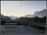 Hazy Peaks |
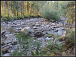 Mighty Wallace River |
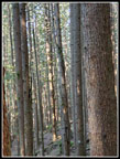
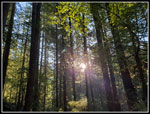 Sun Through Trees |
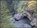
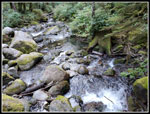 NF Wallace River |
 First Falls |
 Lower Falls |
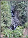
 Two Falls |
 Middle Falls |
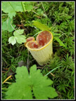
 Fungus |
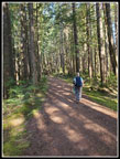
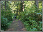
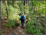
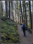 Kim On Trail |
 Upper Falls |
 Pretzel Tree |
 Top Of Falls |
 Old Road In Park |
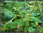
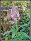 Fireweed |
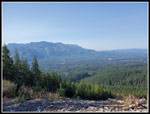 Skykomish Valley View |
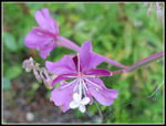 Fireweed Close Up |
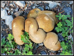 Bunch Of Mushrooms |
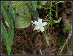
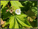 Flowering? |
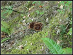
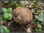
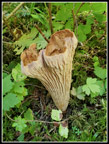 Unusual Mushroom |
 Another Mushroom |
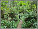
 Nearing The Lake |
 Skunk Cabbage |
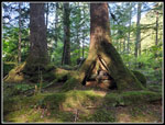 Nurse Log |
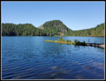 Wallace Lake |
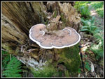 Big Fungus |
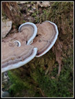 Closer Look |
 Wallace Lake Outlet |
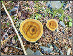 Colorful Mushrooms |
 Big Mushroom |
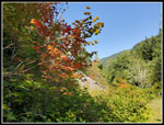 Fall Color |
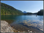 Pebble Beach View |
 Leaving Lake |
 Greg Ball Trail |
 Spring Beauty |
 Green Leaves Above |
 Railroad Grade |
 Mt. Baring |
Trips - 2023
Home