09-21-24
Gary
was free for a weekend hike.
We had hoped for an overnight backpacking trip but Sunday was looking
wet. Saturday was looking great. He suggested a trip he had not done in
24 years an I had not done in 22 years. We had each hiked up Davis Peak
four times. My 2002 trip was just a few months after I started Hiking
Northwest and it did not have any photos. That needed to be rectified.
We met in Seattle at 6:00 am and I drove east. Two weeks in a row we
have started driving in the dark. This would be the last day of summer.
Traffic was heavy in Seattle but light as we drove over Snoqualmie
Pass. We drove through Roslyn and up the road to Salmon La Sac. The
turn off is just 1.5 miles up the main dirt road. Passing Lake Cle Elum
we noticed it was almost empty. It was lower than I can ever recall
seeing. The side road to the trailhead is rocky but was fine in my SUV.
We parked in a new to me lot just a few minutes walk from the old
trailhead lot. It was a cool 36F when we arrived at 7:55 am. We were on
our way at 8:02 am. The downhill start did not help us to warm up. It
as mostly clear at the start.
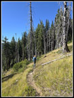
In several minutes we reached the old lot where there were two vehicles parked. The trail starts with a drop down to the bridge over the Cle Elum River. One of the four cement posts holding up the bridge looks very weathered. There is no water on this trail after the river. It was not a hot day and I was fine with two quarts. The trail starts with minimal elevation gain. That did not last long. There were small and medium sized logs across the trail. I was a little surprised that since most were near the start they were not cut out this year. We started to warm up as the trail steepened. The first half of the route is almost all in forest. There was not much to see. Flowers have been done for some time. We saw one patch of blooming pearly everlasting. There were few mushrooms. I have been seeing them east and west of the crest the last few weeks. What I did notice is that the grade is very smooth. We gained 4200' but it was never overly steep. Just a steady uphill grade.
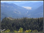
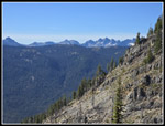
Our first views out of the forest were to the south. We cold see the big empty reservoir of Lake Cle Elum. It was almost all brown dirt except for some water at the far south end. Red Mountain was also in sight. After a short break with views, we headed back into forest. Another forest break is where the trail goes mostly straight up the ridge in a brushy section. The brush was not narrow enough that it encroached on the trail. The route goes into and out of the Alpine Lakes Wilderness at one point. The route turns left of the ridge and enters a rocky section. We took another break where we had clear views of peaks on the Cascade Crest north of Snoqualmie Pass. It was 10:14 am and we were 3.2 miles up the trail having gained 2775'. I noted that we saw Four Brothers, Chikamin, Hibox, Alta, Three Queens, Lemah, and Chimney Rock. To the south Mt. Adams and Mt. Rainier were peaking over the ridges. Two young women passed by at this point. They were the first two of seven hikers seen all day long.
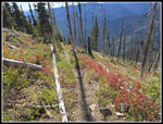
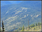
From here to the ridge top we were in the burn of a big wildfire some dozen or more years ago. It this elevation the largest seedlings were only waist high. There were some berry bushes with leaves starting to turn color. We did not have the sun in position to light them up. A series of switchbacks took up up the ridge top. The views only grew better as we ascended. On my last visit in 2002 on a Mountaineer trip, we had hard snow on the north side of the ridge. We needed our ice axes to descent into the basin on our way to the lookout site. It was a lot easier this day. The ridge top is at about 5760'. We now had views to the east. Mt. Stuart and Hawkins Mountain. This ridge is one side of a horseshoe shape. The old lookout site is on the other end of the horseshoe. We dropped down a short way to the high end of a basin and began to climb up to the lookout site. The basin has granite rocks and is pretty scenic. We then went into forest for the first part of the ascent.
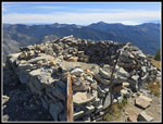
The trail maintains its steady smooth grade with lots of switchbacks. We were feeling the elevation gain as we neared the top. We passed two hikers who were coming down. I arrived at the lookout site at 11:27 am. The lookout is at 6426'. We now had views to the north. Sloan Peak was at far left. Glacier Peak was mostly behind a closer peak. The Cradle was the largest appearing mountain as it was much closer than higher ones. It is 7472' high. We took time for our lunch break. A nice trail with about 4000' of gain to great views and we had seen four hikers so far. We found solitude once again. We decided to go further along the ridge. On my first three visits I went to the summit of what is now called Davis Central Peak. On the last one with snow we did not. The ridge walk is easy enough to follow. It is a bit scrambly but not hard much of the way. There is one spot with a couple big steps up and considerable exposure. I had no trouble before but did not feel comfortable coming down it. We turned around.
Back at the lookout spot we had another break. It was sunny and warm but not hot. Views remained very good. Who wanted to go home? We did have 4000' to lose in 4.45 miles plus a 107 miles drive so we packed up and headed down at 1:36 pm. The upper part as a bit rocky but the lower section is smooth dirt trail. Just what we needed. On the way down we met a lone hiker coming up and a couple heading up. That finished the total of seven people seen. I'm sure there were 500 people at Mt. Si and hundreds more at Mailbox peak. We had better views, a lot of elevation gain, and very few other people. That was nice trade off. We reached the bridge at 4:24 pm. By 4:31 pm we were back at the car. It was a comfortable 70F at the end of the hike.
This was a great hike. It's hard to believe Gary and I had waited so long to redo this hike. I liked it before and I like it again. This was only my third trip of more than 4000' of elevation gain this year. It is nice to get in that much gain. I was expecting much more fire damage than we saw. The lower half of the trail was untouched. The last mile was in great condition. Even the burn is coming back well. This would not be great for me on a hot summer day but this time of year it was almost perfect. The lack of hikers was puzzling. I plan to put this back on my radar for the next decade.
The drive home was another story. We had light traffic for the first 97 miles. The last 10 miles was amazingly bad. With I-405 closed NB at Bothell, the floating bridges were overwhelmed. Google sent us via Highway 520 to save 15 minutes over I-90. It was stop and go just before the bridge. Google said w could save a lot of time exiting at Montlake. One minute later it said the mainline would be much faster. Then we checked and a Husky football game was just letting out. Then the newly opened HOV lane under the new Montlake Lid had no traffic light. That led to 45 minutes to get down the exit. We had gridlock all around the University. We took two hours to get home those last 10 miles. That was longer than the first 97 miles. Even that was a small price to pay for a great day on the trail.
Trips - 2024
Home


