11-06-24
Gary
joined me for a hike up north
near Bellingham. The weekend was looking like two days of rain and
Wednesday would be dry. The blue sky forecast a day earlier did not
come to pass but it was dry. It was the day after the presidential
election and I could use the day off from all the hullabaloo. A day off
work it would be. With daylight saving time now over, sunset would be
at 4:41 pm. We needed an early start. I met Gary at Ash Way Park
&
Ridge and drove north. We met at 6:30 am. Traffic was not bad as we
maintained at least the speed limit all the way. We took the Chuckanut
Drive exit from I-5 and continued north. The Two Dollar Trailhead is
just off Chuckanut. We arrived at 7:37 am to find one car already
there. The trail starts with switchbacks up the slope. It then levels
off with some ups and downs on the way to Fragrance Lake. There were a
lot of leaves on the trail down low then mostly evergreen trees higher
up. It was 42F at the start. That is much warmer than recent hikes.
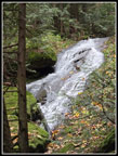
With no wind it was pleasant. The trail reaches a waterfall coming from
the lake. It is a trickle in the summer but had a good flow this day.
Summer and fall were pretty dry but recent rains have raised the lake
enough to provide a good outflow. From the falls the trail climbs again
up to the lake.
The last bit goes along a sandstone wall. We would see a lot more sandstone on the Rock Trail later in the day. We reached the lake after 1.7 miles at 8:28 am. We passed one hiker coming out near the start and saw nobody else up to and around the lake. Midweek solitude is nice. We went left and around the lake. With no wind the lake was perfect for some reflection photos. The sky was white but we had a few small patches of blue that lit up the lake a bit. We stopped on the far side for more reflection photos and then headed on. We planned to do the loop counterclockwise. The overcast was supposed to thicken so we took the short way to the viewpoints. We left the lake and quickly reached the old road. Left goes up to Cleator Road and then the Cyrus Gates Overlook. That would be our route coming back. We turned right and headed for another old road that goes south to the viewpoints. We had done the loop clockwise more often. The turn left onto the correct road is easy to see. I have always seen it. This day we were distracted and did not notice it.
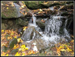
Our road turned to the south. There are a few ups and downs. We noticed more down than up. A bike trail came down from the left. A minute later a bike trail dropped down tot he right. Gee, we were on this trail earlier this year and did not see any bike trails. Were they very brand new? A short way later there was a lot wall of red crisscrossed plastic tape blocking the edge of the road. It had slid down the hillside. Wow! That occurred since our last visit? The dirt looked very settled with grass growing in it. All that in seven months since we were last here? We puzzled over these strange sightings. The final straw was the waterfall dropping down the hillside. How could we have missed that on previous trips? The bike trails and waterfall were on the Gaia app map. We finally realized we were not on the correct road/trail. It was now very obvious we mess up. I can blame it on talk about the election the day before. This road would take us down to Chuckanut Drive. That was not what we planned. We turned around and headed back gaining about 200' of elevation.
We did not have to go all the way back as we took the bike trail that climbed up to the road/trail we were supposed to be on. After a mile of extra distance we were back on route. We have made a few wrong turns over the years but seldom continued for half a mile before we realized it. Well, I did get in an extra mile for my annual trip log. Once back on track, we made good time. We reached the junction and took a food and water break. It was now 10:08 and we had covered 5.1 miles. We went right and continued south. We took the spur to the left on the way out. This provides a view our to Mt. Baker and Twin Sisters Mountain. It also looks down on Lake Samish. We arrived to see the bottom of Mt. Baker and most of the Twin Sisters. They had fresh snow low down. On the other side of I-5 the close in peaks had some snow on top. We took some photos and returned to the main trail. We went left and soon reached Burnout Knob. The sky was mostly white but we could see all the lower elevation sights. There are islands to the west and Anacortes is to the southwest. Gary even made out part of Mt. Rainier. There was a little breeze but it was a nice place for a break.
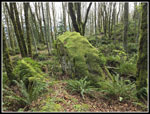
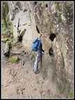
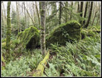
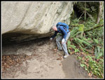
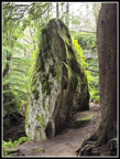
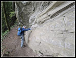
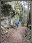
We arrived at the knob at 10:44 am. The area was clearcut a decade or so ago and views are excellent in all directions. We could even see Mt. Baker once again. It was 11:10 am when we started back. We retraced our steps back to our earlier break spot. We turned right on the South Lost Lake Trail. It drops steadily. There were a lot of leaves on the trail again. Half a mile later, we reached the bottom of the Rock Trail. This trail has become one of my favorites. I make up here several times most years. The trail opened in 2014 and my first visit was in 2015. The trail is very green down low. Moss grows on all the boulders and sword ferns cover the hillside. We ascended the trail with switchbacks and stairs. Part way up we reached the sandstone walls and bigger boulders that have broken off and fallen down the slope. Everything is covered with moss and ferns. This section is always slow. The sandstone is so unlike most everywhere else we hike. On most weekend hikes I now see at least a few groups on the Rock Trail. This day it was very quiet.
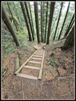
The top of the trail ascends a very steep slope on half a dozen steep staircases. We reached the top and hiked a short distance to the Cyrus Gates Overlook. The parking lot was empty. That was not expected. Hikers drive up for easy access to the Rock Trail. Bicyclers come up and do a one way downhill ride to Chuckanut Drive. This day it was just us. We took a last food and water break. The lower Cleator Road gate is near the Two Dollar Trailhead. It was closed when we arrived. The sign said it was open from 8:00 am to dusk. Where were all the cars? Are weekdays this uncrowded? We headed down Cleator Road and saw a couple hikers coming up but no cars. At our junction we took the old road/trail that drops down to near Fragrance Lake. We turned off the route to close our loop, We headed to the lake. We took the trail that goes around the left side of the lake. That was opposite the lakeshore trail we took in the morning. The trail drops from the lake and we quickly reached the waterfall for some more photos.
On the hike back to the trailhead we saw a few groups coming in and going out. We went from about 7 people seen on most of the trip to a total of 14. That was still not many over nearly 12 miles. The uphills in the 1.5 miles were not appreciated but not very long either. We finally reached the switchbacks that took us down to the trailhead. There were more cars that we expected. I don't know why we did not see more people. The gate was still closed. It was well before dusk so it seems that it was never open. That explains seeing no cars at Cyrus Gates Overlook and on our road walk section. It was 2:37 pm at the finish. This seemed to be very early but it was only 2:04 before sunset. I was afraid we would see a lot of rush hours traffic on the way home. That was not the case. It was mostly at the speed limit until after I dropped Gary off at Ash Way. Lynnwood was slow then it was full speed to my exit south of Northgate.
I do not take a lot of days off work. This one was much enjoyed. We escaped all the election news for a day and had a dry November hike. The lack of crowds was a nice bonus. I am starting to look forward to midweek hikes after I retire. We ended up with 11.7 miles and 2600' of elevation gain. Views were not perfect but they were not a bust either. All the leaves on the trail and fresh mushrooms added to our sights and photo opportunities. All in all, it was a very nice day on the trail.
Trips - 2024
Home


