02-10-24
I
was on my own this weekend. I
kicked around several ideas before settling on another trip to Granite
Lakes. Reports from just two days earlier mentioned that it was snow
free to the lakes. That is very unusual in early February. I saw a
report the night before showing thin new snow on 2757' Tiger 2. I took
poles and threw in microspikes at the last minute. I also took high top
leather boots and gaiters. I expected to see some snow but not much as
the upper lake is at about 3060'. I arrived at the Granite Creek
Trailhead at 7:40 am to find only three cars in the lot. One car had
someone inside. I was also surprised to see a couple open parking spots
at Mailbox Peak's lower lot. By this time of day I usually see many
more cars. I packed up quickly and was on my way at 7:47 am. The trail
is a little steeper than I recalled. It is also very smooth and easy to
hike. I often do this hike with spring flowers or fall leaf colors.
This day I had only green moss for color.
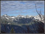
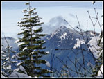
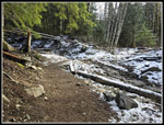
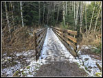
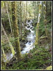
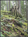
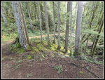
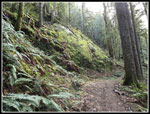
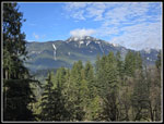
The day was supposed to have 70% overcast dropping a little by late morning. Instead I had some blue sky, I stopped for some photos through breaks in the forest out to peaks on the other side of the MF Snoqualmie River. I reached the junction with the old Granite Creek Road/Trail at 8:21 am. I had hiked 1.3 miles in 34 minutes gaining 850'. So far, it was snow free. The road/trail is looking more like a trail. The grade is never very steep. Granite Creek is now below in a canyon. In places I had a pretty good view of it. It took the very short spur to the best view. Just before reaching the bridge over Granite Creek, there was a little bit of fresh snow on the sides of the trail. The bridge had some crusty ice on it. After the bridge snow continued on the sides but not on the trail. The bridge is at about 1870'. I did not expect to see fresh snow this low. It is 2.2 miles from the bridge to the Thompson Lake/Granite Lakes junction. It always seems longer on the trail. It was 30F at the parking lot and was still chilly but above freezing on the trail now.
So far I had total solitude. I did not expect that to continue all day. There are a dozen or so creeks that flow across the trail. The big bridge over Granite Creek is the only one with a bridge. They were all flowing well but not very high. I could rock hop them all. I was glad to have high top waterproof boots as I had dry feet all day long. With the creek and snow higher up, I doubt many people in trail runners could say the same. About a half mile after the bridge snow and ice was on the trail. There were some bare spots but the trail was mostly covered. I took out my poles when that happened. With poles I had enough traction to keep my microspikes in my pack. The snow was fresh so there was still some snow on the sides of the trail where it was especially icy. The snow provided traction. I caught and passed two hikers heading for the upper lake. Now I just had one car load ahead of me. Heading up the trail in the cold shade the forest thinned and I had views across the valley to sunshine. I'm sure it was a lot warmer over there. Nearing the junction, I stopped for another photo and a lone woman hiker caught up and passed me.
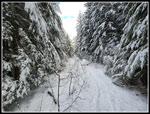
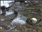
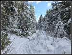
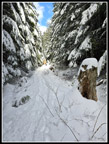
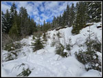
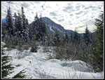
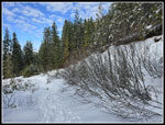
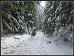
At the junction I saw tracks on both trails. I turned right heading for Upper Granite Lake. Now I was in a winter wonderland. I had the best of all worlds. The fresh snow was about 3-4 inches deep. It covered everything. The trees and bushes were heavily flocked. The sky was blue and travel was still easy going. I had great scenery and the snow hardly slowed me down. The biggest creek to cross did not prove to be a problem. It is wide but was not deep. It was another easy rock hop. The poles did help with balance. The lone woman was now out of sight. I was moving slowly and taking lots of photos. The poor snow season has not provided many good scenic snow hikes. Nearing the lakes two more fast hikers passed by. Now I had three potential groups ahead. There are not a lot of good spots on the lakeshore, especially with fresh snow. I reached the outlet to find a little more snow. Footprints crossed the log that was snow covered. That was no problem with poles. The path alongside the creek was under snow. The tracks jumped from rock to rock in the creek. I followed them. The last crossing was the most interesting. Crossing requires big steps on small rocks. One pole sand in several feet deep. I did not want to go knee deep in very cold water. When bare, boulders go around the water. They were covered in snow. I went straight and made it fine.
I was on a small peninsula sticking out into the lake. At the end is the best spot and I could hear several voiced. I decided to go left to another spot. The snow was now 6"+ deep. I headed over some buried brush and lots to the shore. Now that I had gone through the deeper snow I put on gaiters. I should have done that first. My feet were dry but not my pants legs. I arrived at 9:56 am. I had traveled about 4.25 miles in 2:09. That was a very slow pace. Some icy trail and a lot of snowy photos explained much of my pace. It was still early in the day. A little food and water and photos of the lake did not take long. At 10:09 am I was on my way back. I still had two detours in my plans. The first one is mandatory. The upper lake gets very crowded. The lower lake is almost unknown. I once snowshoed along the creek between the two lakes on six feet of snow. That is the only reasonable time to do it. Without snow it is a marshy mess with lots of devil's club bushes. Some years back I bashed around and found a strip of forest that was not clearcut near the spot the trail comes closest to the lower lake. I now use this spot to avoid all the devil's club and get to a talus pile right above the lower lake. That was my goal again this day.
Between my lunch spot and where I leave the trail I passed 3 or 4 groups of 2 to 5 hikers. My timing was excellent. I left the trail and within 5 minutes I was in sunshine looking down on Lower Granite Lake. The upper lake was in shade but I was in much warmer sunshine. Above were many small white clouds with blue in between. Both the lakes were covered with thin ice. Right above me was Dirty Harry's Peak. I first summited that peak in 1986, almost 38 years ago. I arrived at 10:28 am. I had lunch and just enjoyed the views. I started back at 10:41 am. Heading straight back would give me 8.6 miles with 2400' of gain. I wanted more. I headed back uphill to the Thompson/Granite junction. Along the way I passed 4 or 5 more groups of 4-6 hikers. It would be crowded at the upper lake. At the junction I met two more hikers taking a break before heading to the upper lake. I turned right and headed up the trail to Thompson Point or Thompson Lake.
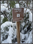
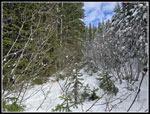
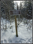
Twenty years ago I did a Mountaineer snowshoe trip to Thompson Point from the old Granite Creek Road gate near the present Mailbox Peak Trailhead. That trip was 14 miles with 4400' of gain. We had snow from the cars. This day I was planning to hike up towards the old Defiance Trailhead where the trail to Thompson Lake starts. That would bring the trip up to 11 miles with 3300' of gain. That would depend on snow conditions. Heading up the trail there were a few bare spots at first. Soon, the trail was all on slightly packed fresh snow. The conditions were excellent. I made steady progress. Part way up I met one hiker coming down from Thompson Point. He may have been the person from one of the two cars in the lot. I had not seen that person/group at Upper Granite Lake. The shaded walk gave way to some sunshine as I neared the Defiance Trailhead. I reached the Thompson Lake sign at 11:43 am. From the junction below, I had hiked 1.18 miles with 900' of gain. Per the other hiker, the road above the Defiance Trail to the ridge top is a little overgrown. I needed a little more distance to round up to 11 miles so I went ahead. It is overgrown but not enough to make it too unpleasant. I was about 1.3 miles from the ridge top near Thompson Point but also 1000'. I chose not to go on.
I did reach the 4000' level. I dropped back to the Defiance Trail and had another food and water break. I had some partial views out towards Green Mt. and Mt. Teneriffe. I packed up and headed down at 12:01 pm. The going was so much easier. I made very good time even with more photo stops. I stopped just before reaching the Granite Lakes junction to put on microspikes. I knew that many people had hiked on the trail since I came up in the morning. It was likely even slicker now. That was a good call. I reached the junction and continued down. I soon met more groups coming up. I also began to catch up to groups heading down. For some reason I was hiking faster than most of them. I kept catching up with more and more groups. Many were 3-6 people. The trail is narrow and passing requires some help. It took a while to get around some of the groups. When passed, they were quickly out of sight. I probably passed 18-20 people in a mile. The lake must have been pretty crowded.
I finally found myself in a spot with nobody else around. When the trail head some longer bare stretches I stopped to take off spikes and gaiters. Of course, I soon hit a last long slick stretch. I was glad when the icy trail part was finished. I crossed the bridge and met another ascending hiker. The rest of the way down was much easier on bare dirt. I reached the trailhead at 1:55 pm. I came all the way down in 1:54. The lot was nearly full. Traffic on the drive home was moderately light. A good finish to a very good day on the trail.
For the day I hiked 11 miles with 3300' of gain. I had nearly total solitude hiking up to Upper Granite Lake. I had total solitude at the lower lake. Up and down the road to the Defiance Trail I saw only one other person. The trail down was much more crowded. The scenery up near the lakes and the trail above that was very scenic. The blue and clouded sky was very nice. The frozen lakes were great. Microspikes were really helpful on the way down. I went twice as fast as I would have with just boots. This turned out to be a great trip. I did not have a high summit but two lakes and 3300' of gain in 11 miles is a good workout. It was very unusual to do this trip in February with no snowshoes. It was also a lot easier without six feet of snow.
Trips - 2024
Home


