08-10-24
Gary
joined me for a hike in the North Cascades. It was going to be a hazy
but not smoky day. I had done the Scott Paul Trail twice. Gary had not
yet done it. He had also not been to Park Butte Lookout in 29 years.
That needed to be changed. It is a buy trail and a long drive so we met
in Lynnwood at 5:55 am. I drove north to Highway 20 and then up the
Baker Lake Road. We ended up right behind two other vehicles on the
dusty logging roads. All the spaces in the 3360' lot were taken but we
found a parallel park spot in the lot. We arrived at about 7:45 am. I
guess that is not early. It was hazy on the drive up. The sky was
mostly clear at the start. We packed up and were on the trail at 7:54
am. The start of the trail is on gravel. That is now since my last
visit. We crossed the creek on a bridge and headed up Schriebers
Meadow. We immediately saw ripe huckleberries. We were amazed that they
were ripe and still there. Hikers seem to have all avoided picking nay.
We did sample a few.
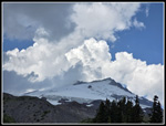
We quickly found we would not be alone on the trail. One hiker was ahead of us. A big group was behind. We soon passed that group. It was not long until we had views up to the summit of Mt. Baker through the trees. The meadow walk gains very little elevation. The trail meanders through forest until it reaches the rocky swath of Rocky Creek. The metal bridge sits on a board on each side. It is not permanent. The high snow melt flow would wash it out every year. Once across we looked a bit and found the trail once again. We did have some good views up to Mt. Baker from the creek swath. The trail is in forest as it switchbacks up the steep slope to Morovitz Meadow at the top. As forecast, the humidity was very high. I started with long sleeves and pants legs on. That did not last long. I hoped to keep them on to avoid big bites. That did not last long. Once across the creek, I had to put on a short sleeve shirt and zip off my pant legs. I still was soaked most of the hike uphill.
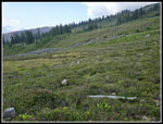
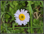
We reached the junction with the upper ind of the Scott Paul Trail at 8:57 am. We had covered 2.1 miles. With berries and photo stops, our pace was moderate. A food and water break was in order. We would be taking the much longer Scott Paul Trail on the way down. The lower junction is right near the trailhead. A little more forest and gentle ascent took us out into the meadow. Now we had great views up to Mt. Baker. It was still very clearly in sight. The trail grew much busier. We saw some groups coming down already. We saw climbers heading down. More groups were now behind us coming up. It is only about 7.8 miles round trip with about 2100' of gain to spectacular views. The trail is deservedly crowded in the summer. The wildflower show was good but not great. We saw pink Lewis monkey flowers, lupine, Valerian, yellow daisy-like flowers, and a few others. We crossed the meadow and then had one more sizable climb to the lookout. We could see the lookout from much of the meadow.
The climb is moderately graded. Views behind us of Mt. Baker grew better as we ascended. In other directions it was quite hazy. Mt. Shuksan should have been easily seen but we saw nothing. Below us we could see the trail over Bell Pass and several tents. We checked out the pass on our way back. The trail climbed to a flat area with some tarns and then climbed again. We could then see Pocked Lake below. The lookout did not seen to be getting much closer. Another climb and we reached the ridge top just below the lookout. We stopped for a break to take in the views. On a clear day we would have been able to see many peaks to the south including Glacier Peak. We saw only haze. To the north Mt. Baker was even more spectacular. With my 10x zoom I was able to pick out 3 climbers descending from the top of Mt. Baker. It looked like everyone else was already down. We finally headed up to the lookout. The last bit was steeper. We arrived at the base at 10:05 am. I had forgotten that there was a last short easy scramble to the ladder. I hiked up Park Butte in 1988, 1989, 1995, 2007 looping on the brand new Scott Paul Trail, 2010 all the way on snow. It had been 17 years since I was there with out snow. My 2010 photos showed a flat walk on snow to the ladder.
We spent some time on the walkway taking in the views. A big group was going to spend the night in the lookout. We went inside for a short visit. It was crowded inside and out so we headed down. A trail went below on the west side. We went there for a shaded spot for brunch. It was still well before lunch time. It was hazy to the west but we could clearly see the Twin Sisters peaks. To the east the sky was now white. To the west it was still blue. The dividing line was above Mt. Baker and the lookout. At 10:31 am we headed down. Back on the ridge top just below, we had another break to enjoy the views without the lookout crowd. We could have enjoyed a few more hours there but we had over 7 miles to go. At 11:27 am we finally headed down.
The crowds coming up were much larger now. We stopped and waited for groups of 6-9 to go by on the narrow trail. Down to the meadow we went. We were aware of another trail that come up from the west to Bell Pass. We went over to the pass to check it out. I could see the trail where it drops down a talus field in a series of switchbacks. After that, we continued to cross Morovitz Meadow. We reached the Scott Paul Trail (SPT) junction at 12:25 pm. We were about 5.8 miles into our hike. That was just about half way. I had done the SPT two times before with Kim Brown. Both times we did it counterclockwise. This would be the first time doing it in this direction. It starts in forest and then drops into a big moraine.We crossed a series of moraines. They all have steep dirt and rock walls. That means climbing up and over a series of walls. The day was getting quite warm and there is not much shade in the moraines. The first one is the most interesting. Hiking down we saw quite a few wildflowers. Fireweed was the most prevalent.
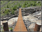
We could see the suspension bridge well before we reached it. The far end is higher than the near end. The bridge is not flat. It drops then climbs to the far end. The hand rails move quite a bit. It was an interesting crossing. The creek below is chocolate brown, fast moving, and loud. After crossing I could not talk to Gary on the other side. We crossed with no problem though the movement and noise made it a bit challenging. We crossed over the next moraine wall and dropped again. The other creeks were small enough to rock hop across. I was really glad when we finished crossing the moraines and were back on smoother trail with some shade. In addition to the moraines the trail crossed quite a few small streams. All the water courses had blooming wildflowers at the crossings. The display of monkey flower was great. We also saw huge patches of partridge foot. Asters were also seen in many places.
Unlike the Park Butte Trail, the SPT was not crowded. We occasionally saw a few groups but there was a lot of solitude. We also had views up to Mt. Baker on the first half of the trail. The route turns into a basin, crosses a running or dry watercourse, then heads out of the basin. Rinse and repeat many times. This sub-alpine terrain with big meadows and some stands of evergreen trees is really beautiful. At times it seems like it will never end. We took one last food and water break in a shady spot. Our "quick break" ended up taking 25 minutes. We spent quite a while in the 5000' to 5200' level. Some views, wildflowers, and huge meadows. We were not in a hurry to drop into the forest. After the last break, we headed non-stop to the trailhead. I was surprised to see several groups heading up later in the afternoon. The trail in the forest was in good shape. We made better time. At long last we reached the Park Butte Trail and just a couple minutes later we were back at the trailhead. The lot was still mostly full with a few open spots from recently departed cars. My car was in the shade which was nice. We reached the trailhead at 4:13 pm. The GPS recored abut 11.7 miles with 3000' of elevation gain.
We had a hard time deciding on where to hike. The east side was too hot. There were some smoky places. The far north looked best and this was a great choice. Gary had not hiked the main trail in 29 years and never on the SPT. I had not hiked to the lookout in 14 years and not without snow in 17 years. This is a trail I should visit at least every five years. Traffic was not bad at all for a sunny August Saturday. We zipped all the way back to Lynnwood. We did miss out on the longer range mountain views because of the haze but we had great view of Mt. Baker and mostly sunshine. The wildflowers were good if not great and half the hike even had solitude in a popular area. All in all, it was a great day on the trail.
Click on thumbnails to get
larger pictures.
Trips - 2024
Home
We quickly found we would not be alone on the trail. One hiker was ahead of us. A big group was behind. We soon passed that group. It was not long until we had views up to the summit of Mt. Baker through the trees. The meadow walk gains very little elevation. The trail meanders through forest until it reaches the rocky swath of Rocky Creek. The metal bridge sits on a board on each side. It is not permanent. The high snow melt flow would wash it out every year. Once across we looked a bit and found the trail once again. We did have some good views up to Mt. Baker from the creek swath. The trail is in forest as it switchbacks up the steep slope to Morovitz Meadow at the top. As forecast, the humidity was very high. I started with long sleeves and pants legs on. That did not last long. I hoped to keep them on to avoid big bites. That did not last long. Once across the creek, I had to put on a short sleeve shirt and zip off my pant legs. I still was soaked most of the hike uphill.
We reached the junction with the upper ind of the Scott Paul Trail at 8:57 am. We had covered 2.1 miles. With berries and photo stops, our pace was moderate. A food and water break was in order. We would be taking the much longer Scott Paul Trail on the way down. The lower junction is right near the trailhead. A little more forest and gentle ascent took us out into the meadow. Now we had great views up to Mt. Baker. It was still very clearly in sight. The trail grew much busier. We saw some groups coming down already. We saw climbers heading down. More groups were now behind us coming up. It is only about 7.8 miles round trip with about 2100' of gain to spectacular views. The trail is deservedly crowded in the summer. The wildflower show was good but not great. We saw pink Lewis monkey flowers, lupine, Valerian, yellow daisy-like flowers, and a few others. We crossed the meadow and then had one more sizable climb to the lookout. We could see the lookout from much of the meadow.
The climb is moderately graded. Views behind us of Mt. Baker grew better as we ascended. In other directions it was quite hazy. Mt. Shuksan should have been easily seen but we saw nothing. Below us we could see the trail over Bell Pass and several tents. We checked out the pass on our way back. The trail climbed to a flat area with some tarns and then climbed again. We could then see Pocked Lake below. The lookout did not seen to be getting much closer. Another climb and we reached the ridge top just below the lookout. We stopped for a break to take in the views. On a clear day we would have been able to see many peaks to the south including Glacier Peak. We saw only haze. To the north Mt. Baker was even more spectacular. With my 10x zoom I was able to pick out 3 climbers descending from the top of Mt. Baker. It looked like everyone else was already down. We finally headed up to the lookout. The last bit was steeper. We arrived at the base at 10:05 am. I had forgotten that there was a last short easy scramble to the ladder. I hiked up Park Butte in 1988, 1989, 1995, 2007 looping on the brand new Scott Paul Trail, 2010 all the way on snow. It had been 17 years since I was there with out snow. My 2010 photos showed a flat walk on snow to the ladder.
We spent some time on the walkway taking in the views. A big group was going to spend the night in the lookout. We went inside for a short visit. It was crowded inside and out so we headed down. A trail went below on the west side. We went there for a shaded spot for brunch. It was still well before lunch time. It was hazy to the west but we could clearly see the Twin Sisters peaks. To the east the sky was now white. To the west it was still blue. The dividing line was above Mt. Baker and the lookout. At 10:31 am we headed down. Back on the ridge top just below, we had another break to enjoy the views without the lookout crowd. We could have enjoyed a few more hours there but we had over 7 miles to go. At 11:27 am we finally headed down.
The crowds coming up were much larger now. We stopped and waited for groups of 6-9 to go by on the narrow trail. Down to the meadow we went. We were aware of another trail that come up from the west to Bell Pass. We went over to the pass to check it out. I could see the trail where it drops down a talus field in a series of switchbacks. After that, we continued to cross Morovitz Meadow. We reached the Scott Paul Trail (SPT) junction at 12:25 pm. We were about 5.8 miles into our hike. That was just about half way. I had done the SPT two times before with Kim Brown. Both times we did it counterclockwise. This would be the first time doing it in this direction. It starts in forest and then drops into a big moraine.We crossed a series of moraines. They all have steep dirt and rock walls. That means climbing up and over a series of walls. The day was getting quite warm and there is not much shade in the moraines. The first one is the most interesting. Hiking down we saw quite a few wildflowers. Fireweed was the most prevalent.
We could see the suspension bridge well before we reached it. The far end is higher than the near end. The bridge is not flat. It drops then climbs to the far end. The hand rails move quite a bit. It was an interesting crossing. The creek below is chocolate brown, fast moving, and loud. After crossing I could not talk to Gary on the other side. We crossed with no problem though the movement and noise made it a bit challenging. We crossed over the next moraine wall and dropped again. The other creeks were small enough to rock hop across. I was really glad when we finished crossing the moraines and were back on smoother trail with some shade. In addition to the moraines the trail crossed quite a few small streams. All the water courses had blooming wildflowers at the crossings. The display of monkey flower was great. We also saw huge patches of partridge foot. Asters were also seen in many places.
Unlike the Park Butte Trail, the SPT was not crowded. We occasionally saw a few groups but there was a lot of solitude. We also had views up to Mt. Baker on the first half of the trail. The route turns into a basin, crosses a running or dry watercourse, then heads out of the basin. Rinse and repeat many times. This sub-alpine terrain with big meadows and some stands of evergreen trees is really beautiful. At times it seems like it will never end. We took one last food and water break in a shady spot. Our "quick break" ended up taking 25 minutes. We spent quite a while in the 5000' to 5200' level. Some views, wildflowers, and huge meadows. We were not in a hurry to drop into the forest. After the last break, we headed non-stop to the trailhead. I was surprised to see several groups heading up later in the afternoon. The trail in the forest was in good shape. We made better time. At long last we reached the Park Butte Trail and just a couple minutes later we were back at the trailhead. The lot was still mostly full with a few open spots from recently departed cars. My car was in the shade which was nice. We reached the trailhead at 4:13 pm. The GPS recored abut 11.7 miles with 3000' of elevation gain.
We had a hard time deciding on where to hike. The east side was too hot. There were some smoky places. The far north looked best and this was a great choice. Gary had not hiked the main trail in 29 years and never on the SPT. I had not hiked to the lookout in 14 years and not without snow in 17 years. This is a trail I should visit at least every five years. Traffic was not bad at all for a sunny August Saturday. We zipped all the way back to Lynnwood. We did miss out on the longer range mountain views because of the haze but we had great view of Mt. Baker and mostly sunshine. The wildflowers were good if not great and half the hike even had solitude in a popular area. All in all, it was a great day on the trail.
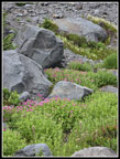 Flower Show |
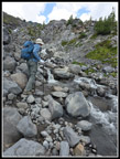 Another Creek Crossing |
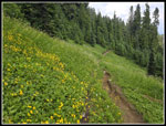 Yellow Daisies |
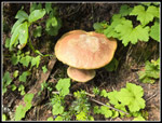 Mushrooms |
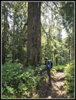 Gary & Big Tree |
Trips - 2024
Home


