07-27-24
Gary
was free for a hike and we
each came up with several ideas. Surprisingly, we had one in common. It
was a hike up Rock Mountain via Snowy Creek. I had only done that route
one time 17 years earlier. We had never done it together. Smoke was an
unknown as there are several fires burning but the smoke has not been
much of a problem so far. We hoped the wind would continue to send it
away from us. This is a long drive so we met very early. We were at the
Bothell Park & Ride at 6:10 am. We zoomed over Stevens Pass and
turned left onto Smith Brook Road. The small lot for the Lake
Valhalla/PCT Trail was almost full. The road over Rainy Pass to the
Snowy Creek Trailhead was in pretty good shape. A little rocky after
the pass but not brushy at all. We had two deer in the road who ran
ahead rather than jump off the road. They finally ran up a steep slope
to get away. We arrived at about 7:50 am and found two cars. It was
clear but still a little cool. I had a vague recollection of the route.
I recalled a meadow and open switchbacks up to the ridge top near the
summit of Rock Mountain.
It is only 4.1 miles to the top with about 3300' of gain. Those are almost exactly the same as on the main Mt. Si trail. This trail starts at a gentle grade and makes up for it near the end. It is nowhere as smooth as Mt. Si and the trail ending elevation is about 1900' higher. We did not maintain a Mt. Si hike pace. There were some good wildflower displays along the way. Some were at peak but many were past. The peak was probably one to two weeks ago. There were some impressive displays to see. Rock Mountain is not a highly popular destination but it has two trailheads for day hikers and one is right off Highway 2. We hoped with only two cars at the start, we would have some solitude on the summit. We had that part right.
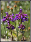
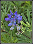
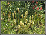
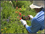
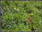
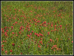
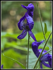
There are creeks to cross and the most have become easy rock hops by late July. We saw coralroot right near the start. This saprophyte is a reddish pink color that is very hard to auto-focus a photograph. I took half a dozen blurry photos and gave up. It was the only saprophyte we saw all day. Monkshood were in bloom in the first half mile. After mostly a forest walk we reached the meadow to find a variety of wildflowers in bloom. There were a lot of elephanthead lousewort but nearly all of them had lost their color. Instead of pink they were just green. I saw my first bistort of the year. Lots of Indian paintbrush were in bloom. Red predominated with some orange ones too. By small streams we saw pink Lewis monkey flower blooming. The rest of the way up lupine varied from full bloom to totally gone to seed. It was much warmer in the open meadows. The sky was mostly white but more from high smoke than clouds. The forecast had a 30% chance of rain by early afternoon but that did not occur.
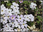
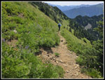
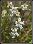
After the meadow the trail began to climb. Now it was time to get in most of that 3300' of gain. It was mostly moderately graded trail with lots of switchbacks though in a few spots it goes straight up the fall line. There were a few trees down but none proved to be much of a problem. T:he trail went into and out of forest for a while before raising above most trees. The wildflower show continued where we were out of the forest. One bright white flower was unfamiliar to me. It seems that it is Parry's catchfly. I don't think I have seen it previously. Another unknown occurrence was a non-sap sap. Early on, we noticed a sticky substance on our hands. Gary noticed that most of the leaves were wet though there was low humidity and no recent rain. Touching the leaves left a sticky not watery substance on my hand. The trail was not overly brushy but our poles brushed up against the leaves. Our poles were covered with the sticky stuff from top to bottom. On the way down we washed our poles in a stream and it all came off. I have no idea what it was. I do not recall every having this problem. It was along most of the trail until the final climb to the ridge top.
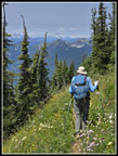
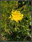
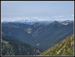
Western anemone were in their tousled head stage. They are so different than when they are flowering. There were some asters in bloom but most were just about finished. Soon we could see the big meadow far below us. The ridge was still a ways higher. The flower show improved as we ascended. Buckwheat appeared and some yellow hawksbeard. Indian paintbrush returned along with lupine. It was not a hillside of thick wildflowers but there was still a good show overall. Views began to appear as well. Mts. Daniel and Hinman appeared to the south. To the north we could now see Sloan Peak. At last we reached the summit ridge. To the left is the trail to the summit of Rock Mountain. To the right the trail heads a short way along the ridge then drops toward Rock Lake. It continues along Nason Ridge, or drops to Highway 2. We took a short break to take in the views and wildflowers on the ridge top. Other than the summit of Rock we had a 360 degree view. Soon we headed up the last short way to the summit.
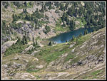
We arrived on top at 11:06 am. Nobody else was there. We did see two tents just above Rock Lake but no people. This really is a great viewpoint at 6852'. Glacier Peak did not come into view until the last few steps. With a map or peakfinder software you can identify a whole lot of peaks. Gary picked out Mt. David, a long but favorite hike of ours. 7 Fingered Jack and Mt. Maude were visible. To the east it was quite hazy with smoke. Glacier had haze near the summit. Farther west the sky was much clearer. We could even make out Three Fingers and Whitehorse to the north west. There were some bugs and a gentle breeze. The bugs were not bad enough to break out the bug juice. I was a little surprised to find a stronger cell signal than I get at home. We were on top for about 45 minute when two women arrived. The first people we had seen all day. We headed over to the lower point below the summit. We had more good views. When we headed back the other hikers had left. At 12:38 it was time to head down. If not for the long hike and drive, I would have spent another hour on top,
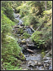
We saw a couple hikers and a dog below where the Snowy Creek Trail reaches the ridge. They were long gone when we reached that spot. We took fewer photos going down but still stopped whenever we saw something interesting. The mountain views began to disappear. It was windy enough up high to make it difficult to photograph long stemmed flowers bouncing in the wind. I tried some with moderate success. The trail is a bit narrow and rocky but the grade is mostly moderate enough to make it easy on my knees. We passed one hikers with a dog heading up. He was the third and last person we saw up close all day long. Not bad solitude for a trail to great summit views with two routes with one starting on a main highway. The lighting was different in the big meadow and some photos turned out better than in the morning. After that it was back into the forest. With half a mile to go we crossed a creek. We stopped to see the waterfall above and tried washing the sticky goo off our hands and poles. I was surprised to find it came off so easily. I have no idea what it is but it comes off quickly.
We reached the car at 3:34 pm. The two cars there in the morning were still there. That was it. We were left with a mystery as to where the hiker with a dog started his hike. It is 8.6 miles from Highway 2. Did he start at Rainy Pass and take the old non-maintained Nason Ridge Trail? Did he park farther up the road and walk to the trailhead. Back at home Gary found an old map that shows the Snowy Creek Trail started down on the Rainy Creek road some 400'+ below. Did the hiker start down there? That old trail might deserve a check on a future hike.
All in all, it was a great day hike. There was some haze but views were still pretty clear. The summit is such a great viewpoint. We had far fewer hikers seen than expected. The wildflower show was a little past peak but still very good. We hoped that Saturday on Highway 2 would not be too bad for traffic. It was also the first full day of the Paris Olympics on television. We did great until reaching Startup then it was very slow all the way through Sultan. It added about 30 minutes to our driving time in the morning. A small price to pay for a really great day on the trail to a high summit.
Trips - 2024
Home


