06-29-24
Gary
was free for a Saturday hike.
It looked to be totally overcast with some afternoon rain. We chose a
short drive and a loop over Squak Mountain. In the morning the forecast
changed radically. Now, we were looking at a clear morning then rapidly
building total overcast. With that in mind, we changed the hike. We
drove a little farther to the south Tiger Mountain Trail (TMT)
trailhead for a trip to South and Middle Tiger Mountains. This would
give us great views to Mt. Rainier in the morning, hopefully before the
clouds came it. We met at 7:30 am and reached the trailhead at 8:18 am.
There were about half a dozen cars parked alongside the road. We were
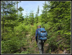
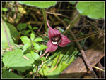
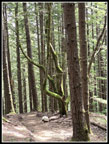
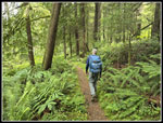
on our way at 8:20 am. The first things I saw on the trail were big
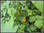
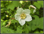
leaved trillium with the flower long since done. Next were some big but
not ripe salmonberry berries. The trail climbs steadily from the 560'
trailhead. I do the loop around South Tiger Mountain once or twice most
years. I have added more mileage but I do not recall going to Middle
Tiger and back.
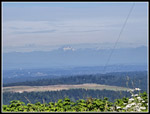
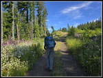
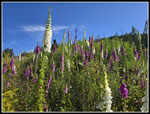
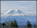
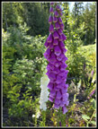
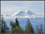
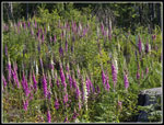
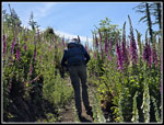
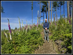
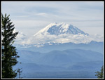
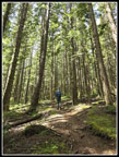
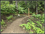
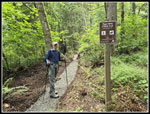
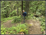
We saw two people coming down as we ascended. We did not see many other people all day long. Less than a mile up the trail we saw the first blooming foxglove. They would not be the last ones we were to see. At the first junction we took the hiker trail instead of the horse trail. We took the horse trail on the way back. A short hike brought the two trails back together. The TMT turned right. That would be our route on the way back. We turned left then right again and began to climb steeply up an old road. In short order, we reached the big powerline corridor. We could see out to the west to The Brothers in the Olympics. Years back the trail above the powerlines was in forest. Since it was clearcut, it is now a gravel road with few trees left. Both sides of the road were lined with white and pink foxgloves. Not just a few but hundreds or thousands. Gary mentioned seeing more foxglove flowers than he ever had. We took a lot of photos here. As we ascended I looked back and Mt. Rainier had come into view. There were a few clouds near the bottom but most of the mountain was in the clear. Higher up the powerlines were out of the picture.
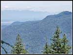
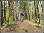
We turned off the road and back onto trail. It as mostly in clearcut but with some glades of old forest. At the next junction, the old trail goes off left as the South Tiger Traverse Trail. We went right on the new South Tiger Summit Trail. This trail is almost entirely in the open. As we ascended, Mt. Rainier came back into view. This is one of the best views of Rainier I have seen. The trail climbs higher and passed right by the top of the southern South Tiger summit. It drops down to a logging spur and then continues up the northern South Tiger Summit. That summit was clearcut years earlier. Immediately, a boot path appeared. It went almost straight up to the bare summit. I could see East Tiger and Mt. Si from the top. In the last couple years a new gentler trail switchbacks up to a completely forested summit. The south peak is not clearcut with views. The north peak is a forest of 30' tall trees. We had a brunch break on top. It was 10:11 am. At 10:25 we headed on. Down the short trail and onto the logging spur. That road goes all the way down to the TMT north of South Tiger. We took the road a ways and turn left on another road. Quickly we reached where the South Tiger Traverse Trail crosses the road. We went right on this old trail. It was deeply graveled on my last visit but the gravel had consolidated and is now much easier walking.
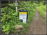
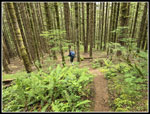
The South Tiger Traverse is parallel to the logging road and soon runs into it. The road drops and meets the TMT. To the right would be our route on the way back. We turned left. This old road/trail quickly reaches the main road from Tiger Summit to Poo Poo Point. We saw two runners here. There is a sign at the TMT across the road mentioning logging on Middle Tiger. We had hoped to get there. We decided to check out the trail to see if logging has actually closed the route near Middle Tiger. We hiked to the junction with the TMT Connector trail. This route from the Iverson Railroad Trail to here is hikers only. I have hiked it several times since it has opened. Gary and I hiked through the trail crash area and across the new bridge. We turned around. I noticed on the sign that the crash occurred nearly 100 years ago on 2/23/25. We met another hiker here. He was the last person we saw for nearly four hours. The old TMT corkscrewed around a bump. A new trail goes straight up on this side of the bump. It makes this trip shorter than by the old trail. So far we saw no signs of any logging.
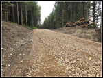
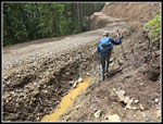
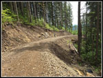
We continued up the TMT until we reached a new logging road. The road is right over the old TMT. With gps we managed to figure where the trail was. Where the TMT and the Middle Tiger Trails meet we saw the junction just below the road. A cut bank is above. We headed up the cut bank and found the trail. Until logging is done, I would recommend just avoiding this spot. I won't be back. We followed the trail up. There were a whole lot of wild ginger along the trail. More than I think I have seen in one place. We passed a new trail junction and continued to the top. It still has its trees but not for long. The edge of the cut is over the top and down a short way on the north side. The whole south side will be cut. We took a break for lunch. It was 12:08 pm when we reached the summit. About 100' below we saw a new gravel road about where the old logging spur was located. After lunch we packed up and headed back at 12:41 pm. It was 6 miles to the top and though we had a long way to return, we decided to check out the new trail. I expected it would turn right and descend just outside the logging area to the TMT before it reaches the new road.
I was wrong. The new trail follows a ridge and then turns left and meets the old spur to Middle Tiger right where the spur reaches the main Tiger Mountain Road on its way to Tiger 1 and 2. The old grassy road was now wider and paved with rocks and gravel. We hoped this would be the road we were on earlier. We traveled to the old trail up to the top of Middle Tiger. It is not visible from the road. At about that spot another road headed steeply downhill. We stay on the higher road. It was not descending. We had quite a ways to go down. Then it ended. The slope here was very steep. Thought the Middle Tiger Trail was not too far away it was not a good idea to go cross country. Instead, we headed uphill and in about 92 vertical feet we reached the summit of Middle Tiger again. Now we headed down the old trail back to the new road. Walking down the road our earlier track was very useful. The TMT is hard to see from the road. We checked the gps and that got us off the road and onto the trail. Now we just has about 5 miles of trail to get back to the car.
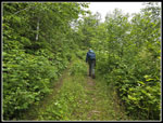
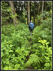
The TMT is gently graded and made for pretty easy walking. It is overgrown in places above the trail crash site. We crossed the road to Tiger Summit and met the South Tiger Traverse again. this time we turned left and hiked between Holder Creek and the very steep slope of South Tiger Mountain. This was pretty easy hiking. At the end of this section the TMT turned left on a road and quickly reached the big powerline corridor. It turned right and went under the powerlines until turning left on trail. Now at the end of the previous section a new trail goes almost straight ahead paralleling the powerlines but remaining in trees. The trail has been dug deep in a trench with lots of gravel on top. Not great for hiking but better than the powerline corridor. The trail turned left and crossed over the powerline road directly onto the old TMT. We hiked on and finally saw another person. As mentioned earlier, it had been about 4 hours of total solitude. We were now just a couple miles from the end.
This time we took the horse trail and it soon met up with the hiker trail we took in the morning. We had just over a mile to go. As usual, the last mile seemed to drag on. We finally reached the trailhead at 4:00 pm exactly. The clouds did come in around noon and it was almost totally overcast. We were fortunate to have the clear morning views of Mt. Rainier. It was fun to check out the coming logging. With the TMT obliterated for a short distance and major logging about to start I will not be returning to Middle Tiger until it is finished. For the day we hiked about 12.4 miles with 3100' of gain. The gain was steady over a long distance and did not seem like that much. Only the half mile up Middle Tiger was steep. The lack of other hikers was surprising. South Tiger is not close to the coming logging. We just had a close in hike on a popular trail without many other hikers.
Click on thumbnails to get
larger pictures.
Trips - 2024
Home
We saw two people coming down as we ascended. We did not see many other people all day long. Less than a mile up the trail we saw the first blooming foxglove. They would not be the last ones we were to see. At the first junction we took the hiker trail instead of the horse trail. We took the horse trail on the way back. A short hike brought the two trails back together. The TMT turned right. That would be our route on the way back. We turned left then right again and began to climb steeply up an old road. In short order, we reached the big powerline corridor. We could see out to the west to The Brothers in the Olympics. Years back the trail above the powerlines was in forest. Since it was clearcut, it is now a gravel road with few trees left. Both sides of the road were lined with white and pink foxgloves. Not just a few but hundreds or thousands. Gary mentioned seeing more foxglove flowers than he ever had. We took a lot of photos here. As we ascended I looked back and Mt. Rainier had come into view. There were a few clouds near the bottom but most of the mountain was in the clear. Higher up the powerlines were out of the picture.
We turned off the road and back onto trail. It as mostly in clearcut but with some glades of old forest. At the next junction, the old trail goes off left as the South Tiger Traverse Trail. We went right on the new South Tiger Summit Trail. This trail is almost entirely in the open. As we ascended, Mt. Rainier came back into view. This is one of the best views of Rainier I have seen. The trail climbs higher and passed right by the top of the southern South Tiger summit. It drops down to a logging spur and then continues up the northern South Tiger Summit. That summit was clearcut years earlier. Immediately, a boot path appeared. It went almost straight up to the bare summit. I could see East Tiger and Mt. Si from the top. In the last couple years a new gentler trail switchbacks up to a completely forested summit. The south peak is not clearcut with views. The north peak is a forest of 30' tall trees. We had a brunch break on top. It was 10:11 am. At 10:25 we headed on. Down the short trail and onto the logging spur. That road goes all the way down to the TMT north of South Tiger. We took the road a ways and turn left on another road. Quickly we reached where the South Tiger Traverse Trail crosses the road. We went right on this old trail. It was deeply graveled on my last visit but the gravel had consolidated and is now much easier walking.
The South Tiger Traverse is parallel to the logging road and soon runs into it. The road drops and meets the TMT. To the right would be our route on the way back. We turned left. This old road/trail quickly reaches the main road from Tiger Summit to Poo Poo Point. We saw two runners here. There is a sign at the TMT across the road mentioning logging on Middle Tiger. We had hoped to get there. We decided to check out the trail to see if logging has actually closed the route near Middle Tiger. We hiked to the junction with the TMT Connector trail. This route from the Iverson Railroad Trail to here is hikers only. I have hiked it several times since it has opened. Gary and I hiked through the trail crash area and across the new bridge. We turned around. I noticed on the sign that the crash occurred nearly 100 years ago on 2/23/25. We met another hiker here. He was the last person we saw for nearly four hours. The old TMT corkscrewed around a bump. A new trail goes straight up on this side of the bump. It makes this trip shorter than by the old trail. So far we saw no signs of any logging.
We continued up the TMT until we reached a new logging road. The road is right over the old TMT. With gps we managed to figure where the trail was. Where the TMT and the Middle Tiger Trails meet we saw the junction just below the road. A cut bank is above. We headed up the cut bank and found the trail. Until logging is done, I would recommend just avoiding this spot. I won't be back. We followed the trail up. There were a whole lot of wild ginger along the trail. More than I think I have seen in one place. We passed a new trail junction and continued to the top. It still has its trees but not for long. The edge of the cut is over the top and down a short way on the north side. The whole south side will be cut. We took a break for lunch. It was 12:08 pm when we reached the summit. About 100' below we saw a new gravel road about where the old logging spur was located. After lunch we packed up and headed back at 12:41 pm. It was 6 miles to the top and though we had a long way to return, we decided to check out the new trail. I expected it would turn right and descend just outside the logging area to the TMT before it reaches the new road.
I was wrong. The new trail follows a ridge and then turns left and meets the old spur to Middle Tiger right where the spur reaches the main Tiger Mountain Road on its way to Tiger 1 and 2. The old grassy road was now wider and paved with rocks and gravel. We hoped this would be the road we were on earlier. We traveled to the old trail up to the top of Middle Tiger. It is not visible from the road. At about that spot another road headed steeply downhill. We stay on the higher road. It was not descending. We had quite a ways to go down. Then it ended. The slope here was very steep. Thought the Middle Tiger Trail was not too far away it was not a good idea to go cross country. Instead, we headed uphill and in about 92 vertical feet we reached the summit of Middle Tiger again. Now we headed down the old trail back to the new road. Walking down the road our earlier track was very useful. The TMT is hard to see from the road. We checked the gps and that got us off the road and onto the trail. Now we just has about 5 miles of trail to get back to the car.
The TMT is gently graded and made for pretty easy walking. It is overgrown in places above the trail crash site. We crossed the road to Tiger Summit and met the South Tiger Traverse again. this time we turned left and hiked between Holder Creek and the very steep slope of South Tiger Mountain. This was pretty easy hiking. At the end of this section the TMT turned left on a road and quickly reached the big powerline corridor. It turned right and went under the powerlines until turning left on trail. Now at the end of the previous section a new trail goes almost straight ahead paralleling the powerlines but remaining in trees. The trail has been dug deep in a trench with lots of gravel on top. Not great for hiking but better than the powerline corridor. The trail turned left and crossed over the powerline road directly onto the old TMT. We hiked on and finally saw another person. As mentioned earlier, it had been about 4 hours of total solitude. We were now just a couple miles from the end.
This time we took the horse trail and it soon met up with the hiker trail we took in the morning. We had just over a mile to go. As usual, the last mile seemed to drag on. We finally reached the trailhead at 4:00 pm exactly. The clouds did come in around noon and it was almost totally overcast. We were fortunate to have the clear morning views of Mt. Rainier. It was fun to check out the coming logging. With the TMT obliterated for a short distance and major logging about to start I will not be returning to Middle Tiger until it is finished. For the day we hiked about 12.4 miles with 3100' of gain. The gain was steady over a long distance and did not seem like that much. Only the half mile up Middle Tiger was steep. The lack of other hikers was surprising. South Tiger is not close to the coming logging. We just had a close in hike on a popular trail without many other hikers.
 Salmonberries |
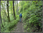
 On The Trail |
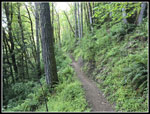 Narrow Hiker Trail |
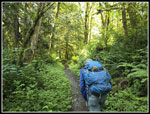
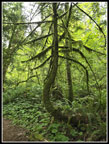
 Gary Leads The Way |
 Powerline Viewpoint |
 On The Road |
 Native Berry |
 Foxglove Everywhere! |
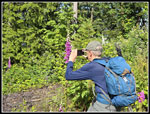 Gary At Work |
 First Mt. Rainier View |
 Pink & White Foxglove |
 Wireless Rainier View |
 Many Foxgloves |
 Buttercups |
 Foxglove Valley |
 Gary & Foxgloves |
 Clouds Forming Low |
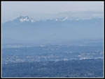
 Downtown Seattle |
 The Brothers |
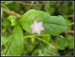 Starflower |
 Spring Beauty |
 Thimbleberry Flower |
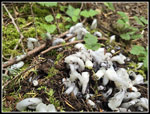
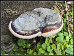 Droplets On Shelf Fungus |
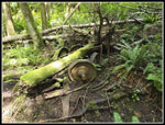 Train Wreck Site |
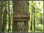 2/23/25 Date |
 Brushy TMT |
 Wild Ginger |
 Steep MT Trail |
 Middle Tiger Summit |
 Mossy Snag On New Trail |
 Start Of New Trail |
 Logging Closure |
 Old Grassy Road |
 New Logging Spur |
 Descending From MT |
 Getting Onto Road |
 Start Of MT Trail |
 Descending Road |
 Bunchberry |
 Logging Map |
 More Brushy TMT |
 TMT Below South Tiger |
 New TMT Section |
 Orange Berries |
 Gary On Wiggle |
 Indian Pipe |
 Bent Tree |
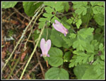 Bleeding Hearts |
Trips - 2024
Home