01-12-25
I
was free for a Sunday hike. It
was a very overcast day in western Washington. I decided to head north
to Blanchard Hill near Bellingham for a snow free hike. I was on the
road by 6:55 am. Doppler radar showed no rain for the drive. As I
entered Everett I turned my wipers on. The rain was hard enough that
light traffic was moving at 55 mph. Dark and heavy rain are not my
favorite driving conditions. It rained more lightly most of the rest of
the drive. What was I getting myself into? It stopped a couple miles
from the Alger exit. Driving in, I could see the top of Blanchard Hill
was in the clouds. I arrived at the Upper Blanchard Trailhead to find
three cars in the lot. Last year I did a figure eight course with a
couple extra detours and I planned to repeat it this day. I started up
the gated road at 8:16 am. The first mile is on the road. At the quarry
I noticed piles of gravel for road use. I checked out the view of Mt.
Baker and found no views of anything. That was not a surprise. It was
supposed to partly clear up later in the day.
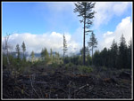
At one mile, I reached the start of the Alternate Incline Trail. On my first visit almost exactly 20 years ago, the Incline and Alternate Incline Trails were in use. Just a couple years later the Incline Trail was shut down. I never did hike it. I noticed the start and end of the trail during this hike. Now we have only the Alternate Incline Trail but no alternative. The lower trail was really muddy. Mountain Bikes have churned it up. Soon the mud virtually disappeared. There were some evidence of the recent bomb cyclone wind storm but less than around Tiger Mountain. All the logs have been cut out on my route. It was 36F at the start but began to warm a bit as I ascended. I still had gloves on much of the day. Right before reaching the junction with the Pacific Northwest Trail I took the Caddis Fly bike trail. In one third mile it climbs to a new clearcut. Last year I found great views of Mt. Baker and some Canadian peaks. This day I found thick fog our of the forest. At .40 miles the trail reaches a logging road. I turned around here.
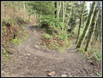
I dropped back to the junction and took the left trail which is the Lily Lizard Trail. This section is one I would repeat later. This old railroad grade/road has narrowed to a trail. I reached the junction with the Lily Lake Trail which would be my last leg of the day. I continued straight ahead. At the junction with the trail to Lily Lake, North Butte, and Lizard Lake I met a group of 6 or 7 hikers. They headed to the lake and I kept going straight on my way to Oyster Dome. I knew that my early morning trip to the Dome was likely to end with few views. At least it might be a little less crowded in the morning. The trail drops to meet the main Oyster Dome Trail coming up from Chuckanut Drive. This is where the crowds come from. I did see three or four groups going up or down on the last bit to Oyster Dome. There is a creek crossing but it has stepping stones that make it easy to cross with dry feet. The last part up used to be very steep but a switchbacking trail has been built. It is a bit longer but now much wider with a gentler grade. I reached the viewpoints at 10:04 am. I was about 4.4 miles into my hike.
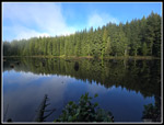
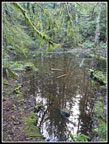
Two other guys were there. That is small crowd at Oyster Dome. I could see bit of the ridge with Burnout Knob through the clouds. At times I could also see where Cyrus Gates Overlook is located. A few islands went into and out of the clouds. That was about it for views. I had a quick brunch and took photos anyway. I went over to the actual summit as usual. There were no views north or over to North Butte. As I was leaving several big groups were arriving. I headed down at 10:21 am. It was still mid morning and I had most of the elevation gain done. I retraced my route back to the Lily Lake junction. I headed towards the lake. About 15 years ago there was a beaver dam that turned the meadow into a lake. Chainsaws took it out and the lake drained. Just below that spot a new dam is in. The old beaver lake is back. In just a few minutes I reached Lily Lake. The lake level is high. A new log bridge leads to the end of the lake and a campsite. I went to the usual viewpoint of the lake. There is a log that has been sticking out of the water for as long as I have visited. Now it is underwater. I could not tell if it had been moved or if the water was that much higher. My visit was short and I headed on.
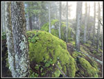
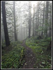
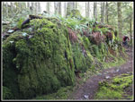
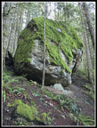
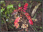
The trail continues along the shore then begins to climb. It is often very muddy where it ascends. A hiker ahead of me went that way. I went up to the camping area and picked up the trail. The other hiker and I met where the trails come together. I let her get out ahead. This tiny boot path 15 years ago is now a constructed and well signed trail. The days of finding the path to North Butte and having complete solitude are gone. At that junction I turned left and uphill to North Butte. While I did not have any sunshine in the morning the misty forest was great. The wet moss on trees and rocks was very colorful. The other hiker went to a rock with few views and I went over and scrambled up the main high viewpoint. On a clear day I could see San Juan Islands and Oyster Dome. This day I could see clouds. I arrived at 10:58 am. It was time for lunch. A windshirt was sufficient. There was almost zero wind all day. As I was about to leave a little blue sky appeared overhead. Overhead but not lower down. I still had no views.
On the way down I stopped at the Mt. Baker viewpoint and as expected there were no views. I saw runner coming from the opposite direction and decided to see if I may have missed something. In past years I did look around the forest on this flat spot just below the top of North Butte. This time I found an obvious boot path. I followed it and reached a spot with rock slab just out side the forest. There would be a great view on a clear day. There is also a metal bench with inscription bolted to the rock. It's a good thing as there is a huge drop right in front of the bench. Poke around a familiar place and sometimes you find something new. Now I headed down. At the Lily Lake junction I went left towards Lizard Lake. The path climbs over the lip of one basin into the next one. The trail drops down to Lizard Lake. I arrived and went over to the campsites at the end of the lake. I saw one biker on the trail down but nobody at the lake. The wind was calm enough to provide some nice reflection shots in the lake. I arrived at 11:39 and left at 11:43. It was just a short walk to the Alternate Incline-Lily Lizard junction. My second visit of the day. I took a chance that the clouds had burned off enough and headed backup the Caddis Fly Trail. At the clearcut I could now see the trees clearly and out a bit. There still was no view of Mt. Baker.
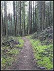
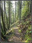
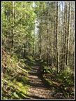
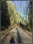
I returned to the junction and took the Lily Lizard Trail for the second time on the hike. In .60 miles I reached the top of the Lily Lake Trail. Now I just had about 2.8 miles to go. This is a popular trail with hikers and bikers. I expected to see people along here. I probably saw 7 or 8 people. Busy by non-Oyster Dome standards this day but still pretty quiet. This section always seems to take a long time to hike and it was no different on this hike. It is a pretty trail and a good way to end my trip. I reached the car at 1:19 pm. The lot was nearly full and a few more cars were parked along the road. In the last mile coming down I saw sunlight on the trail in places. The forest is pretty thick but sunlight and shadows decorated the trail. It was 46 degrees at the trailhead. Almost balmy compared to most of the morning.
I had my doubts about this trip when the non-existent rain blasted me on most of my drive but it turned out great. Unlike a week before, when I had my umbrella up for the entire hike, I never needed it. Those reaching Oyster Dome at 1:00 pm or later probably had some good views out. I had some solitude and some great colors on the misty trail. The early finish allowed me to be home hours before dark. An added bonus was filling my gas tank at a price $.84/gallon less than in NW Seattle. For the day I hiked about 10.5 miles with 2200' of gain. It as a good workout without being a difficult hike. It was a nice day away from so many winter hikes along I-90.
Trips - 2025
Home


