12-06-25
An
atmosphere river with heavy rain was on the way. I wanted to get in a
trip while the rain was light. The night before it looked like light
rain most of the day. In the morning that changed to mostly dry before
noon. The 12-15 mph winds were still in the forecast. I settled on
Cougar Mountain as I could get in lots of miles with multiple ways to
cut the distance and bail out if the rain really picked up. I was a
little late getting started and reached the Red Town trailhead at 8:20
am. I was on my way at 8:23 am. My knee has been sore so less elevation
gain was okay. I headed out on the Wildside Trail as I would be doing
this loop counterclockwise. The lot was less than half full though
several groups were getting started. It was in the mid 40s as we have
been having higher than normal temperatures lately. I expected it to
reach the mid 50s later. Near the Ford Slope, the big pond was back.
Coal Creek had plenty of water too. I continued around to the Indian
Trail and headed for the Quarry Trail. The QT is nicely graded as it
climbs to the upper mountain.
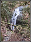
At the junction with the Coal Creek Falls Trail I turned left and dropped to the falls. It is just a trickle in the summer but had a pretty good flow this day. After a few photos I retraced my route. I passed a big group along here. At the top of the Quarry Trail I turned right on Fred's Railroad. So far there was not a drop of moisture. My loop trip had an out and back leg going to the top of Wilderness Peak. At Shy Bear Pass I went left up the fairly new trail to the summit. The longer gentler grade was fine this day as it was much easier on my knee. Several groups of runners zoomed by. I saw many more runners than hikers, some of them coming and going. I reached the summit at 9:48 am. I was on my way down about a minute later. Where the new trail comes within about 15 feet of the old one, I spotted a trail. A few steps later I was on the old route. Going uphill it was still quite visible. Going downhill it has been completely lost in thick brush. I retraced my route back to the top of the Quarry Trail and kept going on Fred's Railroad.
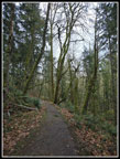
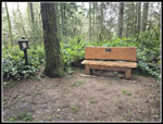
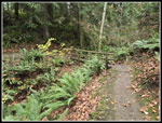
It only took a few minutes to reach the bottom of the East Fork Trail. The grade was more gentle uphill and I headed for the Clay Pit. We have had some windy days recently and it showed. There were at least a dozen logs down across the trails. Some of them broke into pieces and I was able to move them off the trail. There were lots of branches down too and I was able to move many of them. The rest will have to wait for someone with a big saw. None of them were very difficult to get over. I reached the Clat Pit at 10:41 am. Two people were on the bench. The top of the peaks of West Tiger Mountain were lost in the clouds. The sky was very white. Near the top of Wilderness Peak I could here the wind howling above. The trees were moving but not much. The noise was worse than the danger of falling branches or trees. There was some wind at the Clay Pit. Once back on trail descending to Tibbetts Creek the noise abated.
The creek was dry in the summer but it was running pretty good once again. I was past 6 miles on the climb to Anti-Aircraft Peak. I was tempted to shorted the route but with all the rain coming, I wanted to get in miles now when it was dry. My knee was not in agreement. Uphill was less uncomfortable but I still had most of the elevtaton loss to go. At the Million Dollar View there were several groups. The views were minimal and the wind was very noticeable. I headed over to the first picnic shelter. This was my only break of the day. I arrived at 11:11 am. I was back on the move at 11:18 am. It is almost all downhill back to Red Town so I was feeling pretty good about the weather. Twelve hours earlier it looked like a wet day and now it looked like it might be totally dry. I went over the top of AA Peak and down the Lost Beagle Trail to what is now called the Harvey Manning Trail. I had one set of several logs to get over. This took me down to Cougar Pass and then the Klondike Swamp Trail. I took my usual route back via the Bypass and Cave Hole trails to the Nike Horse Trail. I took the latter trail over to the big meadow and the Sky Country Trailhead. On my last visit a covered picnic spot was under construction. It was still blocked by construction tape but the roof was on and picnic tables were inside.
From the parking lot it is just one mile back to Red Town. My knee was now getting sore as I reached nearly 10 miles. I slowed down for the steeper descent and avoided mud where possible. Some recent work has improved the traction considerably. I reached my car at 12:40 pm. My GPS usually reads high and it recorded 11.15 miles. I think it was more likely about 10.6. With all the ups and downs it is hard to know the elevation gain. I think it was about 1700'. There was not a drop of rain the whole day. Doppler showed it was raining east of Preston most of the day. By staying closer to Seattle I had pretty nice conditions. This trip brought me up to 853 miles. I have a very good chance of another 900 mile year if my knee holds up. This turned out to be a very nice day for a close in double digit mile hike.
Click on thumbnails to get
larger pictures.
Trips - 2025
Home
At the junction with the Coal Creek Falls Trail I turned left and dropped to the falls. It is just a trickle in the summer but had a pretty good flow this day. After a few photos I retraced my route. I passed a big group along here. At the top of the Quarry Trail I turned right on Fred's Railroad. So far there was not a drop of moisture. My loop trip had an out and back leg going to the top of Wilderness Peak. At Shy Bear Pass I went left up the fairly new trail to the summit. The longer gentler grade was fine this day as it was much easier on my knee. Several groups of runners zoomed by. I saw many more runners than hikers, some of them coming and going. I reached the summit at 9:48 am. I was on my way down about a minute later. Where the new trail comes within about 15 feet of the old one, I spotted a trail. A few steps later I was on the old route. Going uphill it was still quite visible. Going downhill it has been completely lost in thick brush. I retraced my route back to the top of the Quarry Trail and kept going on Fred's Railroad.
It only took a few minutes to reach the bottom of the East Fork Trail. The grade was more gentle uphill and I headed for the Clay Pit. We have had some windy days recently and it showed. There were at least a dozen logs down across the trails. Some of them broke into pieces and I was able to move them off the trail. There were lots of branches down too and I was able to move many of them. The rest will have to wait for someone with a big saw. None of them were very difficult to get over. I reached the Clat Pit at 10:41 am. Two people were on the bench. The top of the peaks of West Tiger Mountain were lost in the clouds. The sky was very white. Near the top of Wilderness Peak I could here the wind howling above. The trees were moving but not much. The noise was worse than the danger of falling branches or trees. There was some wind at the Clay Pit. Once back on trail descending to Tibbetts Creek the noise abated.
The creek was dry in the summer but it was running pretty good once again. I was past 6 miles on the climb to Anti-Aircraft Peak. I was tempted to shorted the route but with all the rain coming, I wanted to get in miles now when it was dry. My knee was not in agreement. Uphill was less uncomfortable but I still had most of the elevtaton loss to go. At the Million Dollar View there were several groups. The views were minimal and the wind was very noticeable. I headed over to the first picnic shelter. This was my only break of the day. I arrived at 11:11 am. I was back on the move at 11:18 am. It is almost all downhill back to Red Town so I was feeling pretty good about the weather. Twelve hours earlier it looked like a wet day and now it looked like it might be totally dry. I went over the top of AA Peak and down the Lost Beagle Trail to what is now called the Harvey Manning Trail. I had one set of several logs to get over. This took me down to Cougar Pass and then the Klondike Swamp Trail. I took my usual route back via the Bypass and Cave Hole trails to the Nike Horse Trail. I took the latter trail over to the big meadow and the Sky Country Trailhead. On my last visit a covered picnic spot was under construction. It was still blocked by construction tape but the roof was on and picnic tables were inside.
From the parking lot it is just one mile back to Red Town. My knee was now getting sore as I reached nearly 10 miles. I slowed down for the steeper descent and avoided mud where possible. Some recent work has improved the traction considerably. I reached my car at 12:40 pm. My GPS usually reads high and it recorded 11.15 miles. I think it was more likely about 10.6. With all the ups and downs it is hard to know the elevation gain. I think it was about 1700'. There was not a drop of rain the whole day. Doppler showed it was raining east of Preston most of the day. By staying closer to Seattle I had pretty nice conditions. This trip brought me up to 853 miles. I have a very good chance of another 900 mile year if my knee holds up. This turned out to be a very nice day for a close in double digit mile hike.
 Reflection Pond |
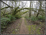
 Mossy Arbor #1 |
 Coal Creek Falls |
 Fred's Railroad |
 Fungus |
 Wilderness Peak Summit |
 Old Trail Up |
 Old Trail Down |
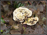 Mushrooms |
 East Fork Trail |
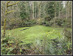 Jerry's Duck Pond |
 Another Mossy Arbor |
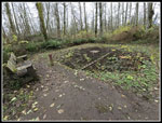 Mine Airshaft |
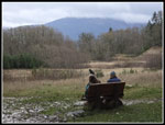 Clay Pit Bench |
 Tiger Mt. From Clay Pit |
 Tibbetts Creek Bridge |
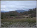
 Million Dollar View |
 Heading Down |
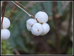 White Berries |
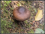 Brown Mushroom |
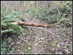 Log Across Trail |
 Arbor #3 |
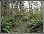
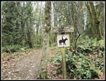 Nike Horse Trail |
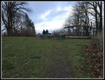
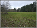 Big Meadow |
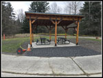 Neww Picnic Shelter |
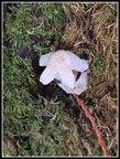 Mini-Mushroom |
 Another Bridge |
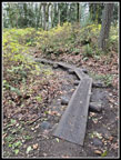 Mud Crossing Boardwalk |
Trips - 2025
Home