01-05-25
It
was time for my first hike of the year. I did a Seattle waterfront walk
on Saturday before the rain arrived. Sunday looked awful. Rain and
showers all day long was the forecast when I went to bed. At 6:00 am on
Sunday the forecast changed radically. Instead of 50% chance
of rain all day, it was now 9% until 1:00 pm at Cougar Mountain. It was
nearly as good at Tiger. I decided to take advantage of the situation
and get in a longer hike at Cougar Mountain. I was on my way at 7:20 am
and arrived at Red Town at 7:51 am. For the first time I can recall, I
was the first car in the lot. Another two cars arrived soon after me.
On the drive over, I had a little mist in Seattle then light rain for
the rest of the drive. The Doppler showed zero rain in the entire area.
I put on a jacket and pulled out my umbrella to start. Ironically, I
had decided not to hike in these conditions then headed out with a
completely dry morning forecast and it was lightly raining. Oh well..
if I only hiked on dry days I would not get out about twice a week. I
decided to go for an 8 mile loop with the option to add Wilderness Peak
and another two miles. I was on my way at 7:51 am.
I headed off on the Wildside Trail. Coal Creek was dry in late fall but had plenty of water this day. I crossed the road near the Ford Slope and continued on. With ups and downs the trail heads over to the Indian Trail. The pitter patter of rain on my umbrella stayed light but continuous. I turned right on the Indian Trail and quickly reached the Quarry Trail. This would be by route to the upper mountain. The old Quarry Trail was a road to the left and along Coal Creek. The last part of the trail is back on the old trail. The steady climb is at a moderate grade. I had my jacket unzipped and the easy climbing kept me from overheating. My jacket sleeves were wet all day though the rest of my body stayed dry. When I saw all the water in the creek near the start I decided to take the detour down to Coal Creek Falls. Besides, I could use all the elevation gain I could get. This route does not have a lot. At the junction I turned left and dropped to the falls. As hoped, there was nobody else there yet.
I have seen the falls with more water just after big storms but the flow was very good. There is one log that fell across the base a couple years ago and it is still there. There are no longer perfect photos but they are still pretty good. After photos it was time to head back uphill. Back on the Quarry Trail I hiked on to Fred's Railroad. My 8 mile loop turns left here. Turning right takes you to the top of Wilderness Peak, the highest point on Cougar Mountain, at 1595'. It adds one mile each way. About now the rain was turning to light misty drizzle. The trees were so wet that they would continue to drip even when the rain ended. The umbrella stayed up. The new trail from Shy Bear Pass to the summit is .60 miles vs. the old straight up trail at .40 miles. It is longer but no longer steep. I reached the summit to find that it was now a lake. In all my years going up Cougar in the winter I have never seen so much water on top. I turned around and headed down. It was 9:19 am when I arrived. I covered about 3.7 miles in 1:24. I also had about 2/3 of the days elevation gain finished. A short way down I met two hikers coming up. They were the first people I had seen on the trail.
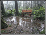
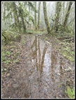
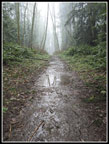
I retraced my steps back to Shy Bear Pass and then over to Fred's Railroad. I crossed over the Wilderness Fork of Coal Creek and continued to the East Fork Trail. Here I turned right. This trail heads up to the Clay Pit. Along the way, I looked for and found the where the short lived trail to Wilderness Peak heads off. I only find it on a minority of my trips along here. I saved a waypoint for possible future use. Last time I passed by Jerry's Duck Pond it was completely covered in algae. As happens in the winter it was rapidly going away. I could mostly see water again. I rounded the pond, climbed, and dropped to the old mine airshaft that has a grate over it. A minute or two later I was at the Clay Pit Road. I had passed a couple more groups since seeing the hikers below Wilderness Peak. The fine moist weather was keeping most people away. I headed up to the Clay Pit wondering if I would be able to see any part of Tiger Mountain. That would be negative. I could not even see the end of the Clay Pit. The puddles on the ground and thick mist did make for a neat photo anyway.
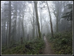
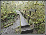
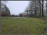
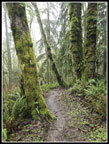
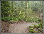
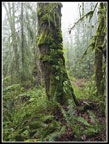
It was now 10:14 am and I had traveled about 5.8 miles. The drizzle was getting a bit lighter. I took the trail heading for Anti-Aircraft Peak (AA). It drops to the log bridge over Tibbetts Creek and then climbs up to AA. All the rain really lit of the mossy trees. The green moss was oozing water. Tibbetts Creek also had a good flow. It was dry in the fall. I climb up the trail to AA and detoured over to the Million Dollar View. It as about a 45 cent view this morning. I could not even see down to Lake Sammamish. I quickly headed over to the closer of the two picnic shelters. There were two picnic tables inside. This is a good spot on a rainy day for lunch. A few minutes later a group of senior hikers (my age) arrived. There was plenty of room for all of us inside. I just had a little over 3 miles to go and nearly all of it was downhill.
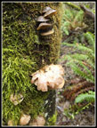
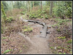
After lunch, I headed up to the top of AA Peak and onto the Lost Beagle Trail. This drops down to the Klondike Swamp Trail. I saw some mushrooms here and lots of mossy trees. At the junction I turned left and headed towards the Clay Pit Road. This trail is mostly flat and though I was nearing 8 mile son the day I sped up. I crossed the Clay Pit Road and immediately turned right on the Connector Trail. This led to the Cave Hole Road/Trail. On a fall trip all the trails meeting the Cave Hole and Clay Pit Road were closed officially. It looked like some of the cave holes were being lined and/or filled in. I forgot to check them out this day. I finally reached the Nike Trail over to the Sky Country Trailhead. This was my route. I met a young woman and we talked until reaching the trailhead. She was done for the day and I had exactly 1 mile to go. I headed over to the Military Road and down it to the Red Town Parking lot. I arrived back at my car at 12:05 pm. I almost had a morning hike but just made it into the afternoon.
I was a little surprised to see that the parking lot was about 90+% full. There were a few spots open but not many. Even steady rain can't keep people away from Cougar Mountain on a weekend. I had a surprisingly easy drive home. The light drizzle continued until I crossed Mercer Island. On Lake Washington and west it was completely dry. I decided not to hike on a wet Sunday, changed my mind when the forecast and Doppler showed no rain, and had a fun rainy hike anyway. Back home it was dry in the morning and looks like it stayed that way.
It is always a let down to complete a big mileage year and have to start at zero miles January first. It was nice to get in a full 10 mile trip to start the year. I gained only 1600' which is well below my average but at least I was out on the trail. The wet weather did give me even more solitude than I could have expected on Cougar Mountain. Every now and then a rainy hike can be fun. I have good scenery and no wind which allowed for use of the umbrella most of the day. That kept me drier than the best Gore-Tex rain gear. I am not looking for a bunch of wet hikes this winter but a few of them are okay. Hopefully, I will be out on some snowshoe trips soon. Falling snow beats falling rain every time.
Trips - 2025
Home


