04-29-26
John
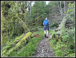
joined me for an afternoon/evening hike on Squak Mountain. I took off
from work at 1:15 pm and headed east. We met at the Squak Mountain
State Park trailhead on the south side of the mountain at 2:00 pm.We
have been doing recent hikes on Rattlesnake, Tiger, and Cougar but not
on Squak. Gary and I had done a Margaret's Way and a Sunrise start trip
this year but not from the state park. It was 68F at the start. This
was my first trip this year with shorts and a short sleeve shirt. We
were on our way at 2:02 pm. Just a a couple minutes into the trip I
noticed a small patch of blooming forget-me-nots. I seldom
see them. We crossed the road and headed uphill. The trail is gently
graded which was good because it felt very warm at the start. We
started seeing the usual spring wildflowers. First was spring beauty
and then Oregon grape. We went left at the first junction. The trail at
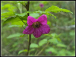
right would be our return route. Higher up, John noticed one big
colorful blooming columbine right of the trail. We were surprised to
see one in bloom in late April. It was the only one we saw all day.
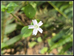
Nearby was a starflower. That was the first one I have seen this year.
We did not see any more of them either. After that we started seeing
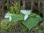
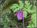
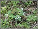
trillium, bleeding hearts, and yellow violets. It was already looking
to be a very good wildflower hike.
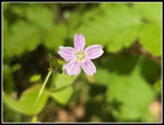
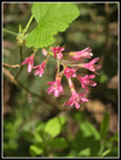
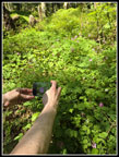
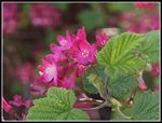
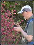
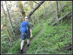
The next wildflower was red currant. I have been seeing a lot of it recently and we saw it in many places around our loop. At the next junction we went left on the Perimeter Trail. This brought us up to the short spur to Debbie's View. We arrived at 3:27 pm. We covered just under 3 miles in 1:25. That is not a great pace but we did stop for a lot of photos. Mt. Rainier was in clouds even on this sunny day. We took a short food and water break. A hiker arrived as we were leaving. Back at the Perimeter Trail, we turned left once again. The trail took us over to the top of Margaret's Way Trail. On the other side of the trail, to the north, is the fairly new Chybinski Trail. It took us down the north side of Squak on a smooth gently graded trail. It was much cooler here. Less sun shines on the north side of the mountain. We saw fewer wildflowers on the north side. At the bottom junction we went right. That trail brought us to the Bullitt Fireplace Trail. It is a gravel road that at one time accessed the Bullitt Cabin above. Now it is a narrower gravel trail. Unlike the Chybinski Trail, it goes straight up the slope. Part way up, we turned left onto the Central Peak Trail. That would be our next objective and the highest point on Squak Mountain.
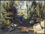
We were in shade but climbing uphill warmed me back up. Flowers remained minimal along here. There was a recent tree that fell across the trail. we were able to duck under it. The trail reaches another junction. Right goes to the Fireplace and left continues to the top of Central Peak. If I am after more distance and elevation gain, I go right to the Fireplace then along the ridge to Central Peak. We were going plenty far for an after work hike so we took the shorter route. It gets steeper at the top and I was starting to feel it. We arrived at the 2019' top of Central Peak at 4:46 pm. We had covered 5.5 miles in 2:44. We were now past the half way point and had gained most of the elevation. There was a narrow view of downtown Seattle as recently as 4 or 5 years ago. There is zero view now. Our break was short and we were on our way at 4:58 pm.
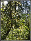
We retraced our steps a short way down to the top of the Old Griz Trail. This used to be our favorite Squak trail as it went through dark forest with moss and wildflowers in season. The Bomb Cyclone storm of November 2024 turned forest into a sea of fallen trees. It took most of a year to saw out the trail. It is much different now but still has its charms. There is now some sunshine and partial views to the east and Tiger Mountain. With all the big logs down and rootballs pulled out of the ground, the trail is back to being pretty smooth. We descended to Phil's Creek Trail. Along the way we saw more wildflowers. It was the usual suspects with more trillium, spring beauty, and bleeding hearts. Phil's Creek Trail was also hit hard by the Bomb Cyclone. Many trees had to be cut out before the trail could open. It was also dark forest that now has views to the east. We saw lots of blooming trillium along there. We passed the Summit Trial and the East Ridge Trail and continued down on Phil's Creek Trail. One boggy spot where water ran over and down the trail has had a turnpike built since my last visit. The trail is now completely dry. John noticed all the stinging nettles along the trail. Since were wearing shorts, we had to be careful not to brush up against it.
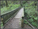
We left the trail and cross the a bridge over the creek on the Equestrian Loop Trail. The trail turns south again and with a few ups and downs descends. We saw the only mushroom display of the trip along here on a log. I laid down to get a photo of the underside of the mushrooms and rubbed against a nettle stalk. That was not a good idea. We made good time on the descent. The trail seems to go on and on along here. It finally flattens out a bit and comes to another junction. Right is a short trail down to the bridge over Phil's Creek. Left is a longer trail to the bridge. I wanted to be sure we reached 10 miles so we took the longer route. The bridge has been hit by falling trees regularly and the repairs show difference in appearance in places. It now has more repairs and differences are gone. It looks much better now. After crossing the bridge we had the last climb of the day. The trail meanders in forest before reaching the road up Central Peak. We crossed back into forest. In a short time we completed our loop. The last bit down was on our uphill route.
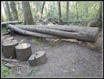
At the bottom of the trail it crosses the road one last time. Here we took the short Pretzel Tree Loop. The Pretzel Tree fell in a recent storm (Bomb Cyclone?). John recalled that it fell across the trail. we found it easy enough. The pretzel part is where the tree split in thirds and the parts wrapped around each other like a pretzel. That part is seen laying on the ground now. A part of the tree was cut out to open up the trail. We then headed back the last minute or two to the trailhead. we arrived at 6:47 pm. We hiked right about 10 miles with 2400' of gain in 4:45. Our average moving speed improved by several tenths of a mile per hour on our descent. I was surprised to see the parking lot more than half full at that hour. We were done late enough that my drive home was pretty open.
This turned out to be a very nice trip. With gas now at 5.25 at the lowest, a shorter drive was appreciated. We had surprising solitude as we did see hikers but they were few and far between. The wildflower display was good and the columbine and starflower were unexpected treats so early in the year. There were a couple new trees down but they were easy to get over and under. Putting in most of a day of work and still getting in a 10 mile hike is a treat. At 68F at the start this was one of the warmest hikes of the year. Even with that it was chilly higher up in places were we had a cool breeze. All in all, it was an excellent mid-week hike.
Click on thumbnails to get
larger pictures.
Trips - 2026
Home
The next wildflower was red currant. I have been seeing a lot of it recently and we saw it in many places around our loop. At the next junction we went left on the Perimeter Trail. This brought us up to the short spur to Debbie's View. We arrived at 3:27 pm. We covered just under 3 miles in 1:25. That is not a great pace but we did stop for a lot of photos. Mt. Rainier was in clouds even on this sunny day. We took a short food and water break. A hiker arrived as we were leaving. Back at the Perimeter Trail, we turned left once again. The trail took us over to the top of Margaret's Way Trail. On the other side of the trail, to the north, is the fairly new Chybinski Trail. It took us down the north side of Squak on a smooth gently graded trail. It was much cooler here. Less sun shines on the north side of the mountain. We saw fewer wildflowers on the north side. At the bottom junction we went right. That trail brought us to the Bullitt Fireplace Trail. It is a gravel road that at one time accessed the Bullitt Cabin above. Now it is a narrower gravel trail. Unlike the Chybinski Trail, it goes straight up the slope. Part way up, we turned left onto the Central Peak Trail. That would be our next objective and the highest point on Squak Mountain.
We were in shade but climbing uphill warmed me back up. Flowers remained minimal along here. There was a recent tree that fell across the trail. we were able to duck under it. The trail reaches another junction. Right goes to the Fireplace and left continues to the top of Central Peak. If I am after more distance and elevation gain, I go right to the Fireplace then along the ridge to Central Peak. We were going plenty far for an after work hike so we took the shorter route. It gets steeper at the top and I was starting to feel it. We arrived at the 2019' top of Central Peak at 4:46 pm. We had covered 5.5 miles in 2:44. We were now past the half way point and had gained most of the elevation. There was a narrow view of downtown Seattle as recently as 4 or 5 years ago. There is zero view now. Our break was short and we were on our way at 4:58 pm.
We retraced our steps a short way down to the top of the Old Griz Trail. This used to be our favorite Squak trail as it went through dark forest with moss and wildflowers in season. The Bomb Cyclone storm of November 2024 turned forest into a sea of fallen trees. It took most of a year to saw out the trail. It is much different now but still has its charms. There is now some sunshine and partial views to the east and Tiger Mountain. With all the big logs down and rootballs pulled out of the ground, the trail is back to being pretty smooth. We descended to Phil's Creek Trail. Along the way we saw more wildflowers. It was the usual suspects with more trillium, spring beauty, and bleeding hearts. Phil's Creek Trail was also hit hard by the Bomb Cyclone. Many trees had to be cut out before the trail could open. It was also dark forest that now has views to the east. We saw lots of blooming trillium along there. We passed the Summit Trial and the East Ridge Trail and continued down on Phil's Creek Trail. One boggy spot where water ran over and down the trail has had a turnpike built since my last visit. The trail is now completely dry. John noticed all the stinging nettles along the trail. Since were wearing shorts, we had to be careful not to brush up against it.
We left the trail and cross the a bridge over the creek on the Equestrian Loop Trail. The trail turns south again and with a few ups and downs descends. We saw the only mushroom display of the trip along here on a log. I laid down to get a photo of the underside of the mushrooms and rubbed against a nettle stalk. That was not a good idea. We made good time on the descent. The trail seems to go on and on along here. It finally flattens out a bit and comes to another junction. Right is a short trail down to the bridge over Phil's Creek. Left is a longer trail to the bridge. I wanted to be sure we reached 10 miles so we took the longer route. The bridge has been hit by falling trees regularly and the repairs show difference in appearance in places. It now has more repairs and differences are gone. It looks much better now. After crossing the bridge we had the last climb of the day. The trail meanders in forest before reaching the road up Central Peak. We crossed back into forest. In a short time we completed our loop. The last bit down was on our uphill route.
At the bottom of the trail it crosses the road one last time. Here we took the short Pretzel Tree Loop. The Pretzel Tree fell in a recent storm (Bomb Cyclone?). John recalled that it fell across the trail. we found it easy enough. The pretzel part is where the tree split in thirds and the parts wrapped around each other like a pretzel. That part is seen laying on the ground now. A part of the tree was cut out to open up the trail. We then headed back the last minute or two to the trailhead. we arrived at 6:47 pm. We hiked right about 10 miles with 2400' of gain in 4:45. Our average moving speed improved by several tenths of a mile per hour on our descent. I was surprised to see the parking lot more than half full at that hour. We were done late enough that my drive home was pretty open.
This turned out to be a very nice trip. With gas now at 5.25 at the lowest, a shorter drive was appreciated. We had surprising solitude as we did see hikers but they were few and far between. The wildflower display was good and the columbine and starflower were unexpected treats so early in the year. There were a couple new trees down but they were easy to get over and under. Putting in most of a day of work and still getting in a 10 mile hike is a treat. At 68F at the start this was one of the warmest hikes of the year. Even with that it was chilly higher up in places were we had a cool breeze. All in all, it was an excellent mid-week hike.
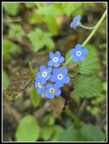 Forget-Me-Nots |
 Spring Beauty |
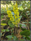 Oregon Grape |
 Colorful Spring Beauty |
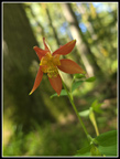 Columbine |
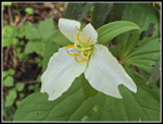 Bug Eaten Trillium |
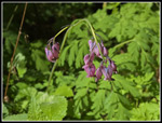 Bleeding Hearts |
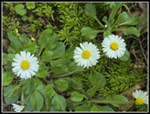 Daisies |
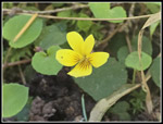 Yellow Violets |
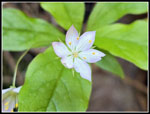 Starflower |
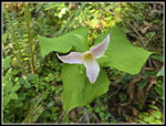 Fading Trillium |
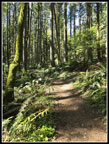 Sunshine On The Trail |
 First Red Currant |
 White & Yellow Flower |
 Steep Trail |
 Lots Of Bleeding Hearts |
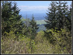 Debbie's View |
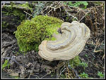 Shelf Fungus |
 Twin Trilliums |
 Lit Up Moss |
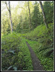
 Central Peak Trail |
 Narrow Brown Trail |
 Salmonberry Flower |
 Central Peak |
 Red Currant Close Up |
 John & Red Currant |
 Many Yellow Violets |
 Great Bleeding Hearts |
 Old Griz Trail |
 Phil's Creek Trail |
 Five Trillium |
 Old Trail Sign |
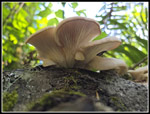 Mushroom Gills |
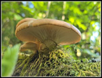 Nice Mushroom |
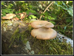 Last Mushroom View |
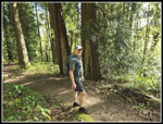 John & Two Cedars |
 Unique Bridge |
 Pretzel Tree Remains |
Trips - 2026
Home