05-24-26
After
a hike up Mt. Si via the
Teneriffe Road on the first day of Memorial Day Weekend I wanted an
easier trip for day two. I decided on a trip from the Sunset trailhead
to Poo Poo Point and back. It would be a short drive and a medium hike
for distance and elevation gain. I had things to get done at home and I
could be back pretty early. I arrived at the Sunset Way Trailhead at
7:40 am and I was on my way at 7:44 am. I was surprised that the lot
was already half full. Poo Poo Point is a very popular destination but
not a lot of folks come up the Poo Poo Point Trail. The shorter Chirico
Trail is very busy. The trail starts with a steep climb up to the
Tradition Lake Plateau. My legs felt like lead right from the start.
This was not a good thing. I hiked 8 miles with 2500' of gain on
Wednesday then 10 miles with 3300' of gain on Saturday. A day later I
was at it again. The trail levels off on the plateau. I looked for
honeysuckle that blooms along the trail in the spring. I had
not timed it right for several years. This time I found lots of bright
orange, yellow, and red honeysuckle flowers. I also saw starflowers,
bleeding hearts, vanilla leaf, and foamflower. At the junction of the
Wetlands Trail and the Adventure Trail I turned right on the AT. There
were some more flowers and lots of green ground cover. The trail climbs
up and then drops 125' to meet the High School Trail. A right turn
brought me to the star of the Poo Poo Point Trail. This used
to be a road turned trail. About 8-10 years ago it was rebuilt to be
more like a trail. Some straight up the hill sections were rerouted on
more gently graded switchbacks.
The first part is reconfigured road and climbs at a moderate grade. There were some false Solomon's seal and foxglove alongside the trail. I passed a couple of groups heading up and a few groups went by on their way down. I crossed the big bridge and soon the old road ended and the trail began to switchback up higher. After the first half mile my lead legs began to feel better and I did much better after that. I was getting a bit worn out as I neared the spot where the new trail turns right and heads for Poo Poo Point. The old trail continued up to the railroad grade, turned right, and then steeply dropped to the route to Poo Poo Point That cut off half a mile and 220' of gain and loss in each direction. To get this trip up to 2100' of gain I needed to do the Adventure trail with its additional gain and hike up to the railroad grade. The trail up to the grade is now part of the One View Trail. It starts out very steep before turning to switchbacks. I decided that I would rather go up to the railroad grade after the Point. I turned right. I passed one group and then was passed by one speedy hiker. I arrived at Upper Poo Poo Point at 9:16 am.
The picnic table was taken but the Bob Rivers Bench was not. I took a break there. The sky was mostly white with a little blue. Thee were no parasailors in sight. I could see down to Issaquah and Lake Sammamish but Bellevue was barely visible. Mt. Baker was not close to being seen. My break was only 11 minutes. At 9:27 I headed down. The take-off spot below the top was filled with hikers. I hiked back to the Poo Poo Point and One View Trail intersection. I headed steeply uphill to the railroad grade. I really felt the steepness. I was pretty slow until the switchbacks started. I reached the grade and turned around. I hiked down and started seeing people once below Poo Poo Point. This trail was never crowded even six or seven years ago. It still isn't compared to the Chirico Trail. It now does have steady traffic on a weekend day. I made better time heading down. When I reached the bottom of the Poo Poo Point Trail I took the boot path along the Pipeline Trail. It is easier on my feet than the gravel Powerline road/trail just to the west.
At the next junction I turned left to the Powerline Trail then right then left again to quickly reach Round Lake. The lake is still mostly full though about five feet lower than it was in early spring. In another three or so months it will be mostly a grassy meadow. I took the meandering Wetlands Trail back. This route is longer than the Adventure Trail I took earlier but has less elevation gain and loss. The Wetlands Trail crosses the At to close my loop. Then I passed the honeysuckles again and just had the steep drop off the plateau to the Sunset Trailhead. I arrived there at 11:11 am. I would be home well before noon. For the day I hiked 8 miles with 2100' of elevation gain. That gave me 18 miles with 5400' of gain for the first two days of the holiday weekend. I had another easier hike planned for Monday. Since Wednesday I had 26 miles with 7900' of gain. It was a great morning for a hike to some views on a well graded trail. There wee some wildflowers in bloom including all the honeysuckles. All that and I as home early to get things done so I could get out on another hike the next day.
Click on thumbnails to get
larger pictures.
Trips - 2026
Home
The first part is reconfigured road and climbs at a moderate grade. There were some false Solomon's seal and foxglove alongside the trail. I passed a couple of groups heading up and a few groups went by on their way down. I crossed the big bridge and soon the old road ended and the trail began to switchback up higher. After the first half mile my lead legs began to feel better and I did much better after that. I was getting a bit worn out as I neared the spot where the new trail turns right and heads for Poo Poo Point. The old trail continued up to the railroad grade, turned right, and then steeply dropped to the route to Poo Poo Point That cut off half a mile and 220' of gain and loss in each direction. To get this trip up to 2100' of gain I needed to do the Adventure trail with its additional gain and hike up to the railroad grade. The trail up to the grade is now part of the One View Trail. It starts out very steep before turning to switchbacks. I decided that I would rather go up to the railroad grade after the Point. I turned right. I passed one group and then was passed by one speedy hiker. I arrived at Upper Poo Poo Point at 9:16 am.
The picnic table was taken but the Bob Rivers Bench was not. I took a break there. The sky was mostly white with a little blue. Thee were no parasailors in sight. I could see down to Issaquah and Lake Sammamish but Bellevue was barely visible. Mt. Baker was not close to being seen. My break was only 11 minutes. At 9:27 I headed down. The take-off spot below the top was filled with hikers. I hiked back to the Poo Poo Point and One View Trail intersection. I headed steeply uphill to the railroad grade. I really felt the steepness. I was pretty slow until the switchbacks started. I reached the grade and turned around. I hiked down and started seeing people once below Poo Poo Point. This trail was never crowded even six or seven years ago. It still isn't compared to the Chirico Trail. It now does have steady traffic on a weekend day. I made better time heading down. When I reached the bottom of the Poo Poo Point Trail I took the boot path along the Pipeline Trail. It is easier on my feet than the gravel Powerline road/trail just to the west.
At the next junction I turned left to the Powerline Trail then right then left again to quickly reach Round Lake. The lake is still mostly full though about five feet lower than it was in early spring. In another three or so months it will be mostly a grassy meadow. I took the meandering Wetlands Trail back. This route is longer than the Adventure Trail I took earlier but has less elevation gain and loss. The Wetlands Trail crosses the At to close my loop. Then I passed the honeysuckles again and just had the steep drop off the plateau to the Sunset Trailhead. I arrived there at 11:11 am. I would be home well before noon. For the day I hiked 8 miles with 2100' of elevation gain. That gave me 18 miles with 5400' of gain for the first two days of the holiday weekend. I had another easier hike planned for Monday. Since Wednesday I had 26 miles with 7900' of gain. It was a great morning for a hike to some views on a well graded trail. There wee some wildflowers in bloom including all the honeysuckles. All that and I as home early to get things done so I could get out on another hike the next day.
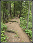 Narrow Ridge |
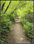 Enclosed Trail |
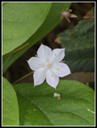 Starflower |
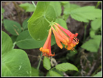 Honeysuckle |
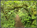 Mossy Arch |
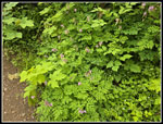 Bunch Of Bleeding Hearts |
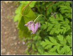 Close Up Bleeding Hearts |
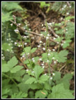 Foamflower |
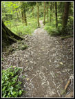 Descending AT |
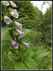 Foxglove |
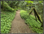 Really Green Trail |
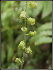 Small Buds |
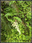 False Solomon's Seal |
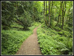 Many Creek Valley |
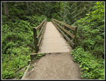 Big Bridge |
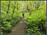 Speedy Hiker |
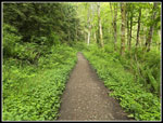 Nearing Poo Poo Point |
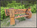 Bob Rivers Bench |
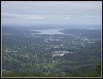 View Northwest |
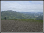 Squak Mountain |
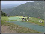 The Crowd Arrives |
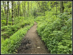 On My Way Back |
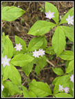 Many Starflowers |
 Spring Beauty |
 Pipeline Trail |
 Grassy Route |
 Powerline Trail |
 Roses At Round Lake |
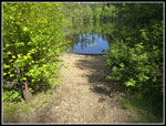 Round Lake |
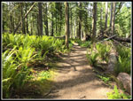 Sunshine & Sword Ferns |
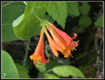 Honeysuckle Again |
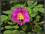 Rose & Bee |
Trips - 2026
Home