9/01-03/18
I
did not get out on even a single backpacking trip before Labor Day.
Gary and John were free so we put together four ideas for a trip. Our
favorite option had some real questions. I last hiked the Huckleberry
Mountain trail in 1990. Gary did the trail and added on the old
Huckleberry Mountain summit and lookout site plus a scramble of Boulder
Peak. The lookout burned down in 1962. There was little maintenance
after that. The trail is known to be very brushy in places. There is
little info about water above Fred Bugner Camp at 3.75 miles. Gary
found water off the trail on his 1992 backpacking trip. That was in
July. Would we find water at the start of September? How much had the
trail beyond the 5460' meadow deteriorated? Most trip reports ended at
that high viewpoint. A few reports available mentioned that it
disappeared. Lastly, the weather was due to deteriorate on Monday.
Going east of the crest likely would have good weather and plenty of
water. On the last evening we chose to go on the backpacking trip with
all the questions.
Day 1
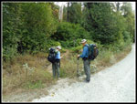
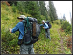
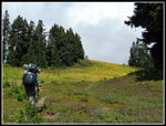
John picked up Gary then me and we headed north on Saturday morning. We arrived at the minimally marked trailhead right on the Suiattle River Road at 8:50 am. By 9:02 am we were on the trail. Due to several road relocations the start is now slightly different than on our earlier trips. It was no surprise that there were no other cars in the small lot. The trail has never been very popular. Our first good surprise was that brushy sections down low had been brushed out. Thanks to the workers who cleaned it out. There were some nettles but we had long pants on and had no trouble. The trail starts at about 1000' and gains a net of 4460' to the high meadow viewpoint where it starts down and most folks turn around. It gains that elevation over 6.3 miles. The grade is pretty steady as it climbs the mountain.
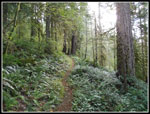
After a few thousand feet the underbrush gives way to more open forest. There are few breaks in the forest to allow sunshine or views out. It does keep the climb cooler. We stopped at Fred Bugner Camp for a break at 11:28 am. A slow steady pace brought us 4 miles and 2800' up the trail. The camp is in thick forest and has room for a tent or two. I did not see if it want farther along. There was running water this late in the year. The old 100 Hikes in the Glacier Peak Region guide book mentioned a campsite one mile and 1000' beyond Fred Bugner. It stated that there was "enough water - usually". We hoped it might be a backup spot if we did not find water farther along. A few trip reports also mentioned it. Going up and down we looked all over at the 4800' to 4900' level. The hillside is far from level. We found nothing at all. If there is a site, with or without water, I'd like to see it.
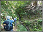
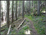
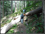
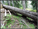
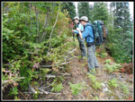
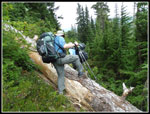
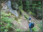
Nearing 5000' the trail nearly touches the ridge top. The grade eases significantly. There are a few downhill spots and a few small meadows. On the way up we climbed or stepped over a few dozen trees. Some were a stretch but none too difficult. There were three duck under trees. High up it was clear that the trail was very brushy recently. some crew had cleared more trail. The route is narrow in places and with brush it would be tough travel. We had it much easier. This was very unexpected and very much appreciated. A little tread was widened and flattened too. Overall, the trail was in much better condition than reports stated. Of course, there are very few trip reports for this trail.
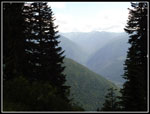
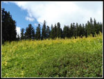
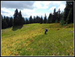
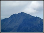
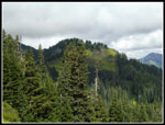
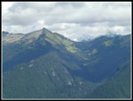
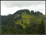
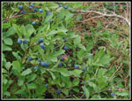
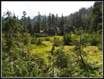
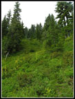
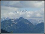
The trail now really lived up to its name. There were multiple types of huckleberries and they were almost all ripe. Ripe and sweet. Our pace ground to a near halt. All those berries and no people or even piles of bear scat. We had all we could possibly eat. We continued on to the big meadows. The trail petered out and we used the map to figure where to go. Across the meadow on a rising route we found it again. At the 5460' high point we had a view over to the summit of Huckleberry Mountain. To the left of it was Boulder Peak. They were close by but not all that easy to get too. We would learn that the next day. We had views north to Buckindy and close by to Green Mountain. Glacier Peak and other big peaks were lost in clouds.
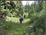
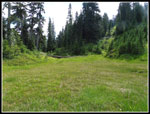
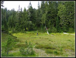
The trail began to slowly drop though more berry patches. We continued our eating. The trail was easy to follow as it descended. We dropped to a meadow where the trail disappeared. My Gaia GAPS on my phone had a trail that was pretty close to what we found. We had a paper map and Gary and John had GPs units with maps. Gary recalled trail he could follow in 1992. It was much worse now. We found the only piece of plastic red tape seen on the route. It directed us down out of the meadow. We found and lost the trail several times. The route continued dropping then traversed under steep walls. There was a meadow well below us. I hoped that was not where the water was. We needed to find water to make this trip successful. Now back on the old trail we climbed a bit to see a meadow below us. A meadow with a meandering small creek running through it.
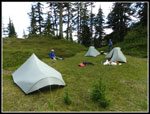
The old trail does not drop into the meadow. It turns left and starts up a grassy meadow heading for the summit of Huckleberry Mountain. We continued on a boot path/trail that dropped right to the meadow. We found a nice grassy spot for camp and a spot to collect water for our water bags. Lots of brush cut out and now we found plenty of water. This trip was looking better and better. We set up camp and had our dinner. Gary went wandering and found a rusty old metal dinner plate along the trail. In an effort to stay out of our tents until dark we chose to play Frisbee with a metal plate. Not something I have ever done on a backpacking trip. It did keep us warm as the temperature dropped into the mid 40s. After a rousing game of "Pass the Plate" we headed to bed.
Click on thumbnails to get
larger pictures.
Day 2
Trips - 2018
Home
Day 1
John picked up Gary then me and we headed north on Saturday morning. We arrived at the minimally marked trailhead right on the Suiattle River Road at 8:50 am. By 9:02 am we were on the trail. Due to several road relocations the start is now slightly different than on our earlier trips. It was no surprise that there were no other cars in the small lot. The trail has never been very popular. Our first good surprise was that brushy sections down low had been brushed out. Thanks to the workers who cleaned it out. There were some nettles but we had long pants on and had no trouble. The trail starts at about 1000' and gains a net of 4460' to the high meadow viewpoint where it starts down and most folks turn around. It gains that elevation over 6.3 miles. The grade is pretty steady as it climbs the mountain.
After a few thousand feet the underbrush gives way to more open forest. There are few breaks in the forest to allow sunshine or views out. It does keep the climb cooler. We stopped at Fred Bugner Camp for a break at 11:28 am. A slow steady pace brought us 4 miles and 2800' up the trail. The camp is in thick forest and has room for a tent or two. I did not see if it want farther along. There was running water this late in the year. The old 100 Hikes in the Glacier Peak Region guide book mentioned a campsite one mile and 1000' beyond Fred Bugner. It stated that there was "enough water - usually". We hoped it might be a backup spot if we did not find water farther along. A few trip reports also mentioned it. Going up and down we looked all over at the 4800' to 4900' level. The hillside is far from level. We found nothing at all. If there is a site, with or without water, I'd like to see it.
Nearing 5000' the trail nearly touches the ridge top. The grade eases significantly. There are a few downhill spots and a few small meadows. On the way up we climbed or stepped over a few dozen trees. Some were a stretch but none too difficult. There were three duck under trees. High up it was clear that the trail was very brushy recently. some crew had cleared more trail. The route is narrow in places and with brush it would be tough travel. We had it much easier. This was very unexpected and very much appreciated. A little tread was widened and flattened too. Overall, the trail was in much better condition than reports stated. Of course, there are very few trip reports for this trail.
The trail now really lived up to its name. There were multiple types of huckleberries and they were almost all ripe. Ripe and sweet. Our pace ground to a near halt. All those berries and no people or even piles of bear scat. We had all we could possibly eat. We continued on to the big meadows. The trail petered out and we used the map to figure where to go. Across the meadow on a rising route we found it again. At the 5460' high point we had a view over to the summit of Huckleberry Mountain. To the left of it was Boulder Peak. They were close by but not all that easy to get too. We would learn that the next day. We had views north to Buckindy and close by to Green Mountain. Glacier Peak and other big peaks were lost in clouds.
The trail began to slowly drop though more berry patches. We continued our eating. The trail was easy to follow as it descended. We dropped to a meadow where the trail disappeared. My Gaia GAPS on my phone had a trail that was pretty close to what we found. We had a paper map and Gary and John had GPs units with maps. Gary recalled trail he could follow in 1992. It was much worse now. We found the only piece of plastic red tape seen on the route. It directed us down out of the meadow. We found and lost the trail several times. The route continued dropping then traversed under steep walls. There was a meadow well below us. I hoped that was not where the water was. We needed to find water to make this trip successful. Now back on the old trail we climbed a bit to see a meadow below us. A meadow with a meandering small creek running through it.
The old trail does not drop into the meadow. It turns left and starts up a grassy meadow heading for the summit of Huckleberry Mountain. We continued on a boot path/trail that dropped right to the meadow. We found a nice grassy spot for camp and a spot to collect water for our water bags. Lots of brush cut out and now we found plenty of water. This trip was looking better and better. We set up camp and had our dinner. Gary went wandering and found a rusty old metal dinner plate along the trail. In an effort to stay out of our tents until dark we chose to play Frisbee with a metal plate. Not something I have ever done on a backpacking trip. It did keep us warm as the temperature dropped into the mid 40s. After a rousing game of "Pass the Plate" we headed to bed.
 Start Of Trail |
 Green Along Trail |
 Small Waterfall |
 Open Forest |
 Logs Across Trail |
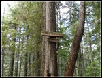 Fred Bugner Camp |
 Wilderness Sign |
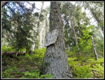
 Log & Insulator |
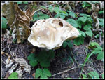 Mushroom |
 Berry Picking Time |
 View Out |
 More Berries |
 Colorful Hellebore |
 Big Meadow |
 Gary In Big Meadow |
 Green Mountain |
 Huckleberry Mt. Summit |
 Nice View |
 Summit Route |
 Over Another Log |
 Big Ripe Berries |
 Berries On The Trail |
 Trail Disappearing Spot |
 Route To Campsite |
 Three Tarptents |
 John In Meadow |
 Pipe In Meadow |
 Color In Meadow |
 Summit Route Start |
 Cloudy Glacier Peak |
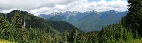 Panorama Looking North to East. |
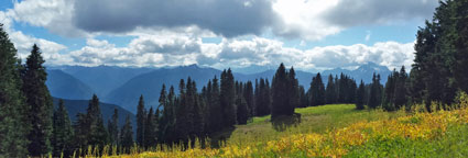 Panorama Looking South Through The Big Meadow. |
Day 2
Trips - 2018
Home